|
The
bordermarkers of the Pyrenees : the GRPdesBF
 |
||||||||||||||||||||||||||||||||||||||||||||||||||||||||||
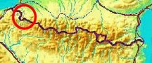
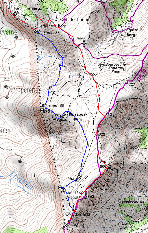
| - stage 5 - Bidarray - Col d'Ispéguy (bm086-091) |
 |
|||||||||||||||||||||||||||||||||||||||||||||||||||||||||
 |
||||||||||||||||||||||||||||||||||||||||||||||||||||||||||
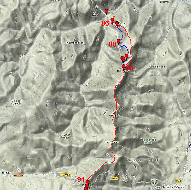
| Only
the bordermarkers along this stage are shown (and some adjoining ones).
The main route is red,
the variants are blue. The main route provides a smooth
on-going route along most bordermarkers, the variants give access to
the remaining bordermarkers. See the GRPdesBF-principles. Click here for an fullscreen interactive map. In short In general, this stage involves a long but stunning hike over de famous ridge of Crêtes d'Iparla. The variant via bm088-089 requires a bit more wayfinding but brings you also to a mysterious unnumbered bordermarker lying on the ground and a puzzling bordercross. Considerations As you might expect: there's no water available on the ridge. I once camped on Col d'Harrieta, getting water from a stream downhill in Spain. At Col d'Ispeguy there are 'venta's': shops and restaurants but a bivouac-spot should be found further on. For example near bm098 where we see - on the map - a stream starting just NE of bm099. Factsheet
Gps-files needed
Useful You might check the relevant webpages in the 'All markers'-section. They provide more pictures of the bordermarkers and additional information on them. Version 01 February 2013. If you have any correction, suggestion etcetera -> please email me: eefberns@grenspalen.nl MAPS AND DIRECTIONS Print your own maps It's easy to print your own - custom made - maps with the GRPdesBF-route and the bordermarkers on them. See: Print your own maps |
||||||||||||||||||||||||||||||||||||||||||||||||||||||||||
 |
||||||||||||||||||||||||||||||||||||||||||||||||||||||||||
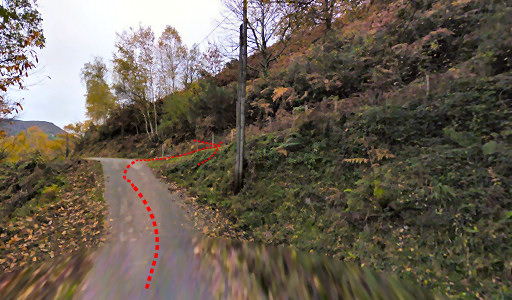 |
The spot where the previous stage ends and the next one starts. Leave the tarmac here and turn right, climbing on a dirtroad. |
|||||||||||||||||||||||||||||||||||||||||||||||||||||||||
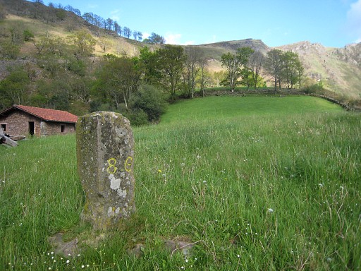 |
After 600m, there's a gate to the meadow left. Bm086 is in the middle of the meadow, 70m NW of the gate. Continue on the dirtroad for 250m until the bend to the left. |
|||||||||||||||||||||||||||||||||||||||||||||||||||||||||
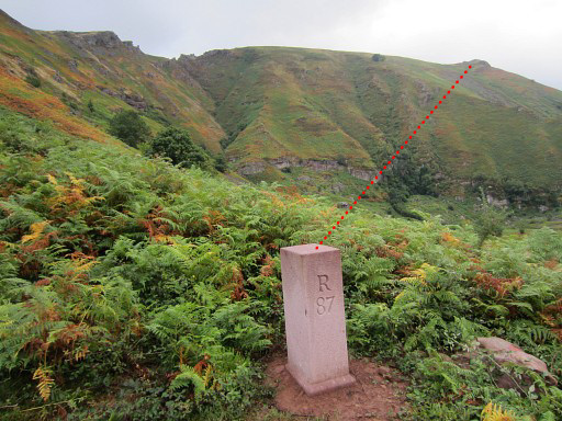 |
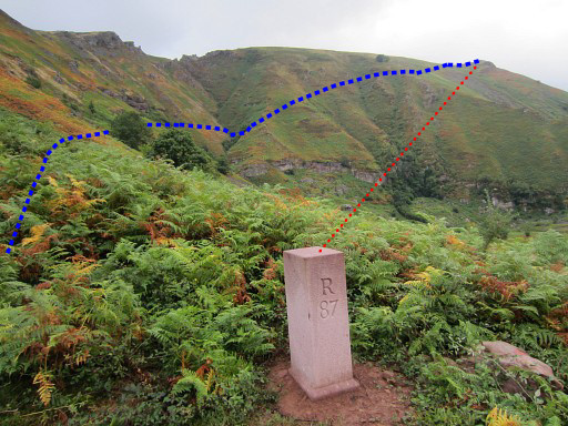
That's where you will find bm087. From here the border is a straight line to bm088 on the hillside far away. The variant traverses along the hillside to bm088. |
|||||||||||||||||||||||||||||||||||||||||||||||||||||||||
|
The main route continues on the dirtroad, climbing zigzag further on. It then continues SE on a yellow waymarked path. After 350m the yellow trail bends to the left to a ruin ("Rnes"). Leave the yellow trail here and go straight on (= SSE) following trails that will unite - after ± 1km - with the GR10-trail. Continue S along the GR10 for ± 1,5km to reach bm090. |
|||||||||||||||||||||||||||||||||||||||||||||||||||||||||
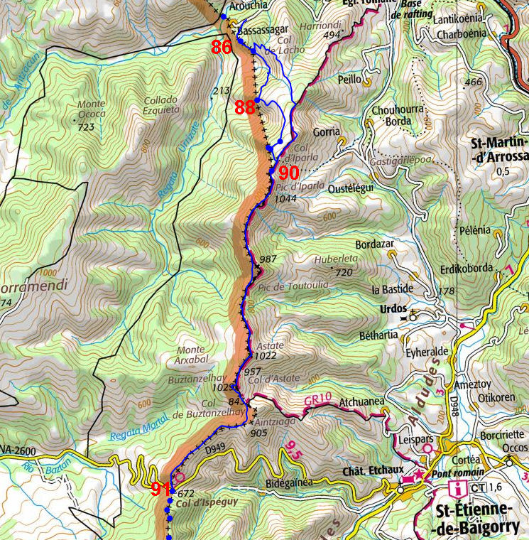
| Variant 1 via bm088-089 |
||||||||||||||||||||||||||||||||||||||||||||||||||||||||||
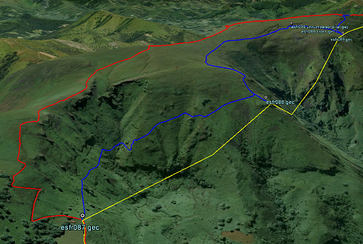 |
An aerial view of this variant. |
|||||||||||||||||||||||||||||||||||||||||||||||||||||||||
 |
From bm087 to bm088, the border is a straight line. You have to traverse along the hilside to get there. From bm087, take a trail SE along the hillside. It's sometimes a vague track but overall clear enough. |
|||||||||||||||||||||||||||||||||||||||||||||||||||||||||
 |
This picture: the trail in its beginning, looking back. When getting close to the hillridge, you will reach a stone-walled field. |
|||||||||||||||||||||||||||||||||||||||||||||||||||||||||
 |
On
the west-side of
that stone-walled field, bm088 is engraved on a horizontal rock. This picture: looking back (= NE). |
|||||||||||||||||||||||||||||||||||||||||||||||||||||||||
 |
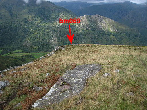
From bm088 looking towards bm089 and 090. The border is a straight line between them. We have to traverse in a half-circle to bm089. |
|||||||||||||||||||||||||||||||||||||||||||||||||||||||||
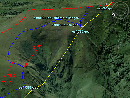 |
You can see that half-circle well on this Google Earth-image (view=SE) From the stone-walled field, continue your climb SE along the hillside. After 200m you wil reach a sort of summit or cliff. |
|||||||||||||||||||||||||||||||||||||||||||||||||||||||||
 |
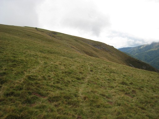
At that cliff, another view in the direction of Col d'Iparla with the approximate location of bm089. From this cliff, go left (= NE), climbing on and passing a ruined barn on the right hand after 100m. Then bend to the right (there's no real trail, perhaps some cattle trails), going SE-SSE, |
|||||||||||||||||||||||||||||||||||||||||||||||||||||||||
 |
still climbing but more gentle
now - to a series of 3 ruined barns. But where are they, those ruined barns? Well: at the W-side of a sort of groove. |
|||||||||||||||||||||||||||||||||||||||||||||||||||||||||
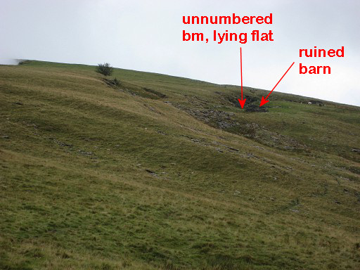 |
Zoom-in of the previous picture. This zoom-in to shows the groove where you can find a mysterious unnumbered borderpillar, lying flat. |
|||||||||||||||||||||||||||||||||||||||||||||||||||||||||
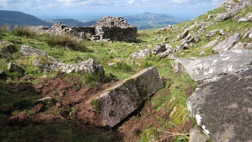 |
It's a mystery: definitely the make of a borderstone but ± 250
meters away from the border and containing no number. Perhaps meant as replacement for bm089 but never been able to make his way to its location and destination. But there's yet another mysterious bordermarker around here: a cross on a horizontal rock. |
|||||||||||||||||||||||||||||||||||||||||||||||||||||||||
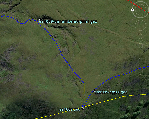 |
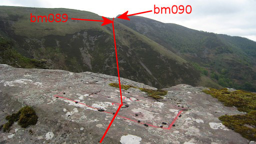
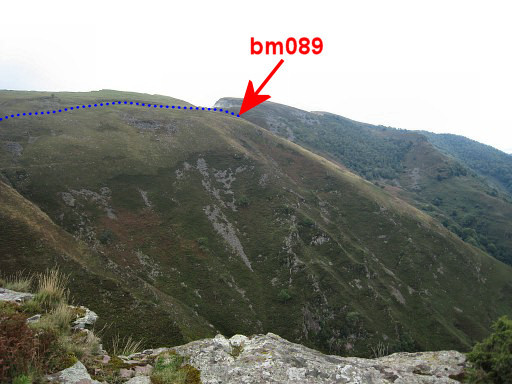
But first to bm089. Its position is shown on this Google Earth-screenshot (note: up = E). Bm089 is 250m SW of the unnumbered pillar. |
|||||||||||||||||||||||||||||||||||||||||||||||||||||||||
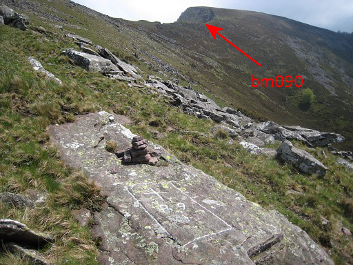
 |
Bm089 is not easy to find. There might be a cairn to help you as on this picture. Note the stone wall to the left. |
|||||||||||||||||||||||||||||||||||||||||||||||||||||||||
 |
Bm089 lies unsuspiciously
between a bunch of rocks, 5-10m N of the stone wall. Now climb SEE uphill. |
|||||||||||||||||||||||||||||||||||||||||||||||||||||||||
 |
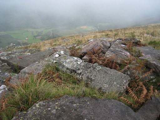
Then
- 50m SE uphill from bm089- there's this flat rock with a cross and a
number believed to be 89 (the number 8 however faded away). This picture: looking back towards bm089. It lies ± 15m downhill beyond the rim, visible on this picture. The rectangular 'cadre' and the position of the cross within is typical for the official bordercrosses around here, like bm088. But why was it engraved? |
|||||||||||||||||||||||||||||||||||||||||||||||||||||||||
 |
From here it's obvious which overall direction to go. First climb parallel of the stone slabs wall uphill SSE. |
|||||||||||||||||||||||||||||||||||||||||||||||||||||||||
 |
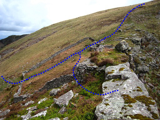
At a certain point the stone
slabs wall changes in a 'normal' wall (this picture). Further on you can pass the wall through a sort of gate. Then - after climbing 50m S - you will join the GR10. Then you are back on the main route. |
|||||||||||||||||||||||||||||||||||||||||||||||||||||||||
| End of variant 1 |
||||||||||||||||||||||||||||||||||||||||||||||||||||||||||
 |
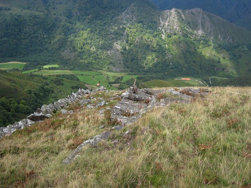
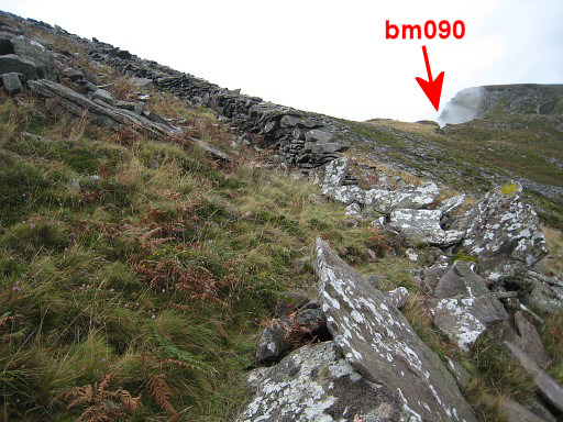
Bm090 at Col d'Iparla. Now navigation becomes easy. Just continue S on the GR10-trail for ± 5km until the GR10 leaves the ridge to descend E to Saint-Étienne-de-Baïgorry. |
|||||||||||||||||||||||||||||||||||||||||||||||||||||||||
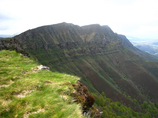 |
Further on and looking back at the famous ridge of 'Crêtes d'Iparla' which is the borderline. | |||||||||||||||||||||||||||||||||||||||||||||||||||||||||
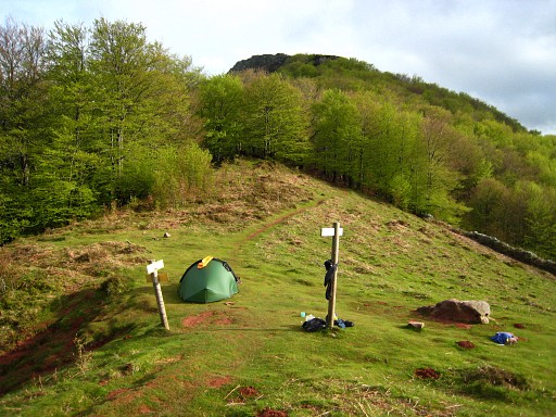 |
Coll
d'Harrieta, 2,5 km beyond bm090, which could suit you for a bivouac. About 10 minutes down the Spanish side, there's a stream. |
|||||||||||||||||||||||||||||||||||||||||||||||||||||||||
 |
Further on - at Col de Buztanzelhuy - the GR10 descends E into the
valley. Continue S on a trail for 300m - leaving the summit of Aintziaga to your left and pick up the ridge again. Then - after a short while on the S-side of the ridge - the trail switches to N-side and continues SW underneath the ridge. |
|||||||||||||||||||||||||||||||||||||||||||||||||||||||||
 |
Finally it descends to Col d'Ispeguy with bm091. |
|||||||||||||||||||||||||||||||||||||||||||||||||||||||||
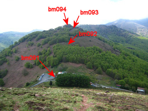
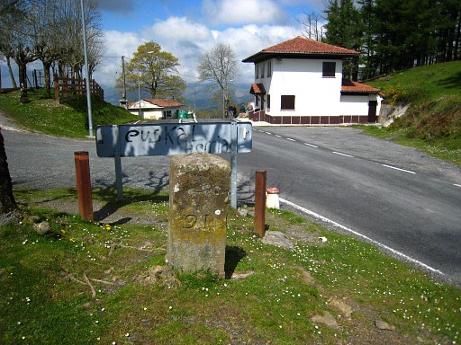 |
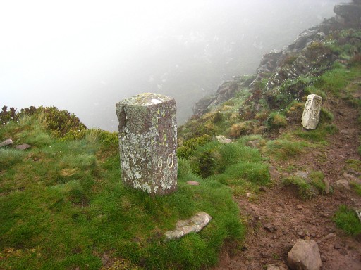
Col d'Ispegy with bm091. End of this stage. Here are one or two restaurants cq ventas. |
|||||||||||||||||||||||||||||||||||||||||||||||||||||||||