|
The
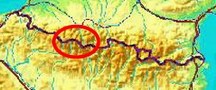
bordermarkers of the Pyrenees : the GRPdesBF
 |
|||||||||||||||||||||||||||||||||||||||||||||||||||||||||||||||||||
| - stage 19 - Embalsa de Respomuso - Valle del Ara (bm312-314) |
 |
||||||||||||||||||||||||||||||||||||||||||||||||||||||||||||||||||
 |
|||||||||||||||||||||||||||||||||||||||||||||||||||||||||||||||||||
| Only
the bordermarkers along this stage are shown (and some adjoining ones).
The main route is red,
the variants have other colors. The main route provides a smooth
on-going route along most bordermarkers, the variants give access to
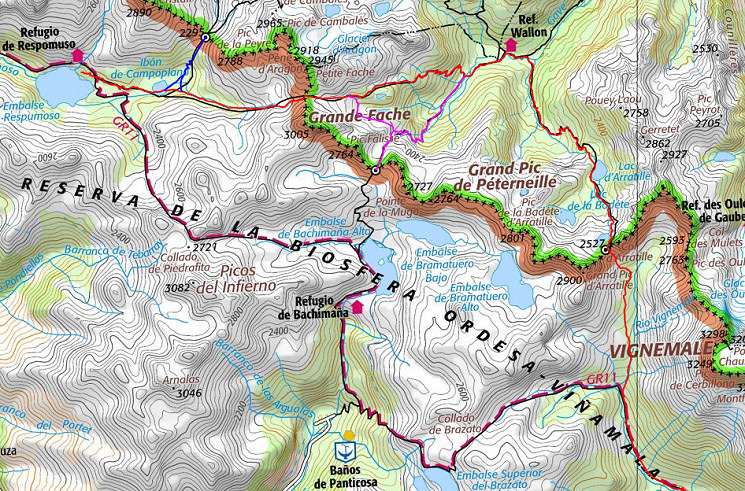
the remaining bordermarkers. See the GRPdesBF-principles. Click here for an fullscreen interactive map. In short In this stage the main route crosses two high mountain passes and descends twice to lovely valleys. Wayfinding is no problem. Variant 1 is an easy hence & forth trip to Port de la Peyre St-Martin (bm312). The second variant visiting bm313 takes a bit more care in navigating from the main route to Port du Marcadeau. Considerations You start in a valley, pass through a valley and end up in a valley where there's plenty of water and bivouac opportunities. The stage ends at a simple cabin (refugio labaza). Factsheet
Gps-files needed
Version 02 July 2014. If you have any correction, suggestion etcetera -> please email me: eefberns@grenspalen.nl MAPS AND DIRECTIONS You might check the relevant webpages in the 'All markers'-section and 'All my trips'-section for more pictures of the bordermarkers and wayfinding-issues. Print your own maps It's easy to print your own - custom made - maps with the GRPdesBF-route and the bordermarkers on them. See: Print your own maps |
|||||||||||||||||||||||||||||||||||||||||||||||||||||||||||||||||||
 |
|||||||||||||||||||||||||||||||||||||||||||||||||||||||||||||||||||
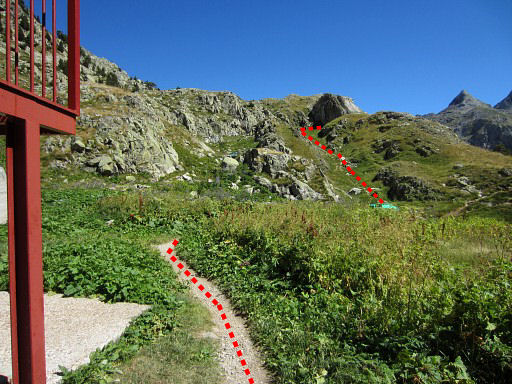 |
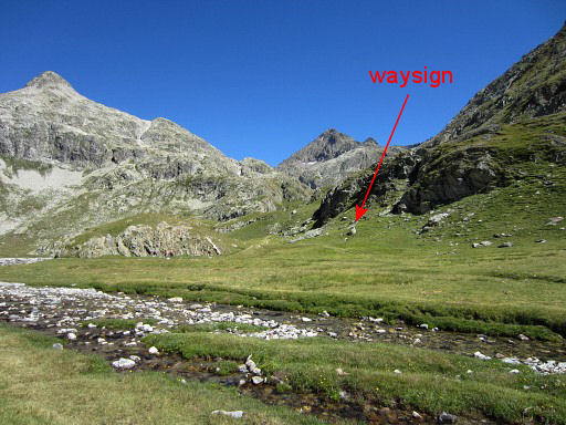
The Refugio de Respomuso is our starting point. The refugio is a bit off the GR11-trail. There's a shortcut from the refuge to the GR11 as shown on this picture: continue past the refuge for ±75m and climb E along a tiny stream to the GR11. |
||||||||||||||||||||||||||||||||||||||||||||||||||||||||||||||||||
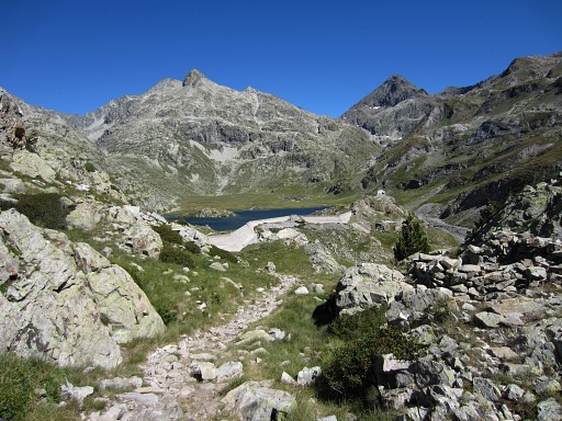 |
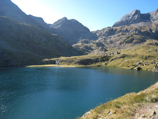
The GR11 will bring you smoothly to the lake of Embalse de Campo Plano. |
||||||||||||||||||||||||||||||||||||||||||||||||||||||||||||||||||
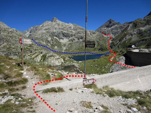 |
Having arrived at a concrete wall, looking forward to the Embalse
de
Campo Plane. We leave the GR11 at this point. The red trail is the main route of the GRPdesBF continuing to Col de la Fache. The blue trail is the hence & forth variant to bm312, |
||||||||||||||||||||||||||||||||||||||||||||||||||||||||||||||||||
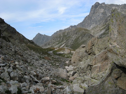
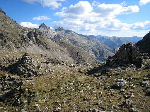
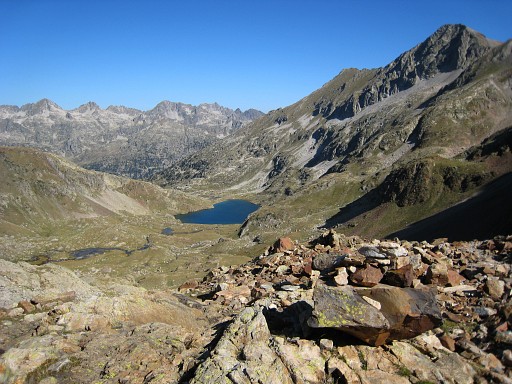
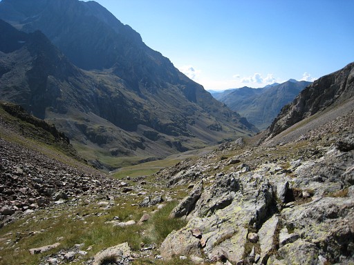
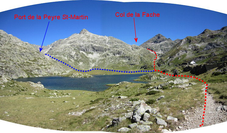 On this panoram we can see very well the GRPdesBF-routes to be taken. The main route (red) will climb to Col de la Fache, the blue route (variant) climbs hence and forth to Port de la Peyre St-Martin to cover bm312. |
|||||||||||||||||||||||||||||||||||||||||||||||||||||||||||||||||||
 |
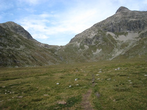
The Campo Plano makes a perfect place for a bivouac including a stream for fresh water. This picture: looking ahead towards the trail to Col de la Fache. There's a waysign pointing to it. |
||||||||||||||||||||||||||||||||||||||||||||||||||||||||||||||||||
| Variant 1 via bm312 |
|||||||||||||||||||||||||||||||||||||||||||||||||||||||||||||||||||
 |
From that grass plain it's an easy stroll to the Port de la Peyre St. Martin. |
||||||||||||||||||||||||||||||||||||||||||||||||||||||||||||||||||
 |
After a short climb, the pass is long stretched with at the end: |
||||||||||||||||||||||||||||||||||||||||||||||||||||||||||||||||||
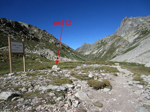 |
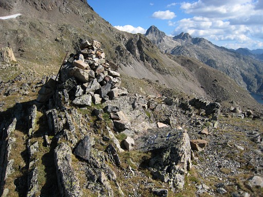
the green borderpass itself with bm312. | ||||||||||||||||||||||||||||||||||||||||||||||||||||||||||||||||||
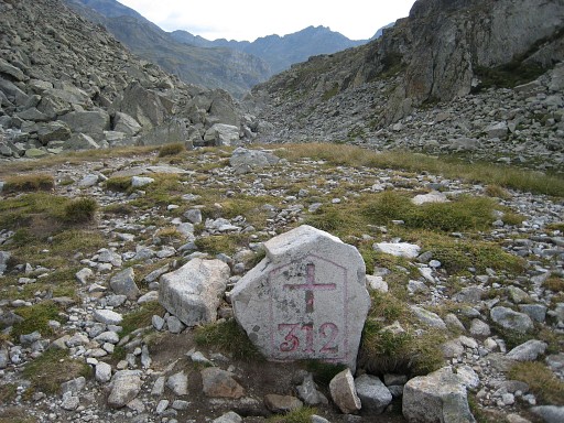 |
Bm312 |
||||||||||||||||||||||||||||||||||||||||||||||||||||||||||||||||||
 |
Descending back to the grassy plains near the lake. Near a distinct rounded hill, there's a sign pointing to Col de la Fache. |
||||||||||||||||||||||||||||||||||||||||||||||||||||||||||||||||||
| End of variant 1 |
|||||||||||||||||||||||||||||||||||||||||||||||||||||||||||||||||||
 |
It's a long and nice climb towards Col de la Fache. |
||||||||||||||||||||||||||||||||||||||||||||||||||||||||||||||||||
 |
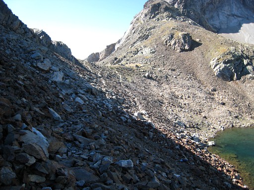
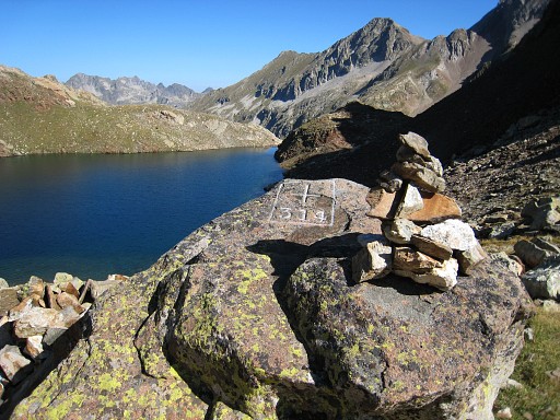
Finally, I arrive at this lake, just underneath the Col de la Fache. From bm312 to this Col takes about 2¼ hours. |
||||||||||||||||||||||||||||||||||||||||||||||||||||||||||||||||||
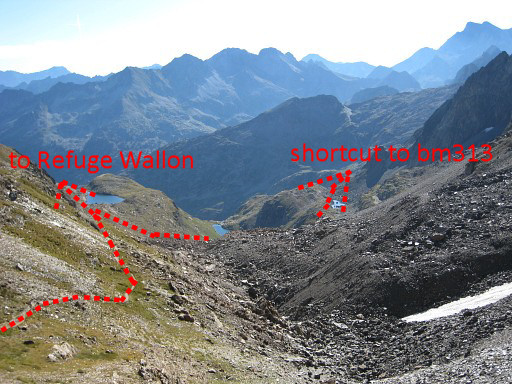 |
When descending from Col de la Fache you'll
reach a grassy part after the first rocky descent. To the right you'll
see a lake below. The main route is straight to Refuge Wallon, to the right you can traverse (variant 2) to bm313. The two routes part at a small hill. |
||||||||||||||||||||||||||||||||||||||||||||||||||||||||||||||||||
 |
A bit further, the trail reaches this hillock. The main trail - to Refuge Wallon - goes left along this hillock, |
||||||||||||||||||||||||||||||||||||||||||||||||||||||||||||||||||
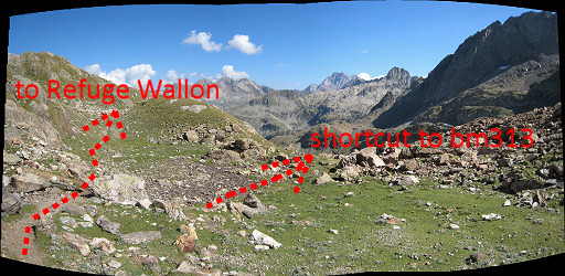 |
while variant 2 (the shortcut) leads you to the right. The main route descends untill a little bridge, 15 minutes away from the Refuge Wallon. |
||||||||||||||||||||||||||||||||||||||||||||||||||||||||||||||||||
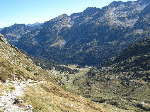 |
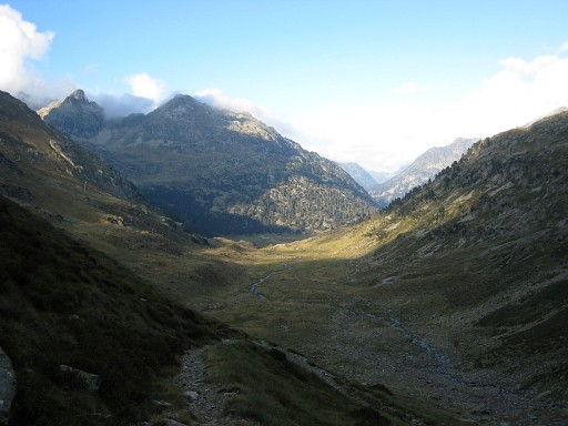
The descent from Col de la Fache to the Refuge takes ± 1½ hours according
to a sign. This picture: the Refuge Wallon already visible in the valley. |
||||||||||||||||||||||||||||||||||||||||||||||||||||||||||||||||||
| Variant 2 via bm313 |
|||||||||||||||||||||||||||||||||||||||||||||||||||||||||||||||||||
|
The spot where variant 2 (shortcut) branches off the main route. |
||||||||||||||||||||||||||||||||||||||||||||||||||||||||||||||||||
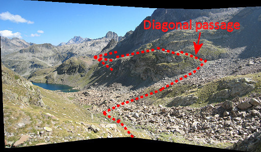 |
So: just before that hillock, leave the main trail and go right along that hillock. Then descend along a little stream (streaming to the lake) untill ± halfway that stream. Then you are more or less at the same level as the 'diagonal passage' at the othere side. Now head to that diagonal passage, passing some rock-slides and climbing to it. |
||||||||||||||||||||||||||||||||||||||||||||||||||||||||||||||||||
 |
After
that diagonal passage, pick up a cairns-trail which will lead you to
the distinct trail from Refuge Wallon to Port de Marcadau This shortcut between the two trails takes approximately ½ hour. The start and end of this shortcut are indicated on the IGN-25k maps. When having arrived at the trail coming from the valley, go right and climb to Port de Marcadau. |
||||||||||||||||||||||||||||||||||||||||||||||||||||||||||||||||||
 |
Bm313 from some distance (the rockpile at the left) | ||||||||||||||||||||||||||||||||||||||||||||||||||||||||||||||||||
 |
Bm313 From Col de la Fache to Port de Marcadau is ± 1¼ hour. |
||||||||||||||||||||||||||||||||||||||||||||||||||||||||||||||||||
 |
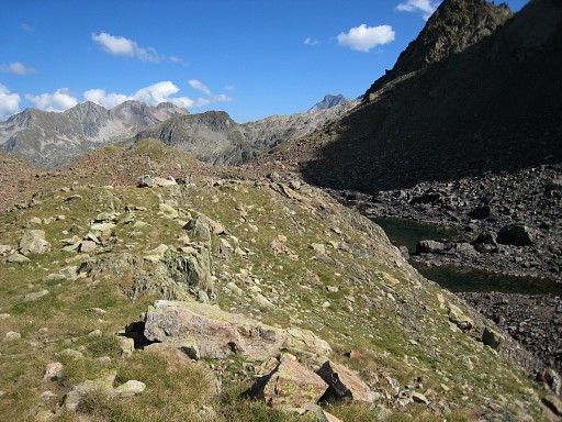
Then descend towards Refuge Wallon and join the main route. |
||||||||||||||||||||||||||||||||||||||||||||||||||||||||||||||||||
| End of variant 2 |
|||||||||||||||||||||||||||||||||||||||||||||||||||||||||||||||||||
 |
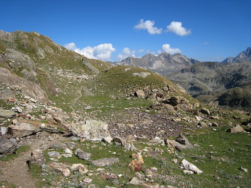
From Refuge Wallon, it
will take you ± 2.30h climbing to Port d’Arretille. On this picture in the distance somewhere on the ridge. Overall, the trail is well waymarked by cairns + in the last part from the lake onwards white and white/red/white waymarks. |
||||||||||||||||||||||||||||||||||||||||||||||||||||||||||||||||||
 |
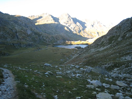
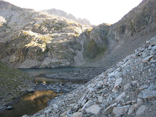
You will pass this beautiful lake (Lac d'Arratille). |
||||||||||||||||||||||||||||||||||||||||||||||||||||||||||||||||||
 |
The last part is well waymarked (white-red). This picture: looking back at Lac d'Arratille. | ||||||||||||||||||||||||||||||||||||||||||||||||||||||||||||||||||
 |
Almost at the Col | ||||||||||||||||||||||||||||||||||||||||||||||||||||||||||||||||||
 |
Bm314 Located a bit to the west of the trail. |
||||||||||||||||||||||||||||||||||||||||||||||||||||||||||||||||||
 |
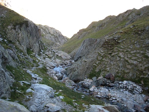
From the Col looking into Spain. Then descending into Spain, the white/red/white-waymarking bends however to the left. So – when descending southwards into the vally – there’s mostly no trail besides an occasional cairn. However, that’s no problem. Keep to the right side of the stream but not too close. |
||||||||||||||||||||||||||||||||||||||||||||||||||||||||||||||||||
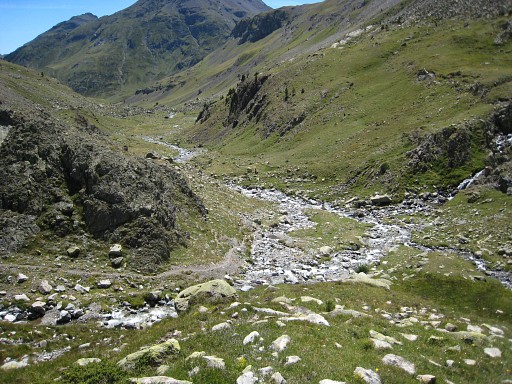 |
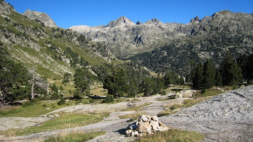
Later on there’s a valley coming from the right. At the confluence of both streams from both valleys, you will join the GR11 coming from that valley from the right. |
||||||||||||||||||||||||||||||||||||||||||||||||||||||||||||||||||
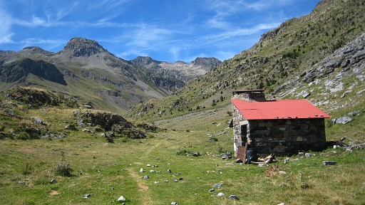 |
Follow the GR11 downstream until this cabin (refugio labaza). | ||||||||||||||||||||||||||||||||||||||||||||||||||||||||||||||||||