|
The
bordermarkers of the Pyrenees : the GRPdesBF
 |
||||||||||||||||||||||||||||||||||||||||||||||||||||||||||
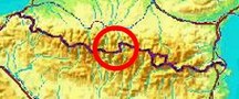
| - stage 26 - Valle de Añes Cruces - Val de Benasque (bm330-330bis) |
 |
|||||||||||||||||||||||||||||||||||||||||||||||||||||||||
 |
||||||||||||||||||||||||||||||||||||||||||||||||||||||||||
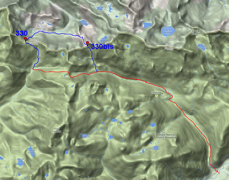
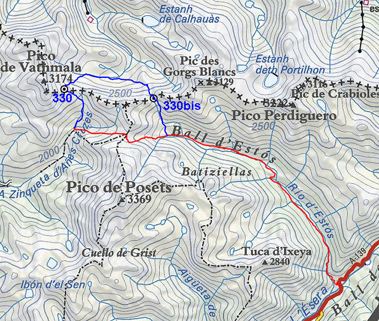
| Only
the bordermarkers along this stage are shown (and some adjoining ones).
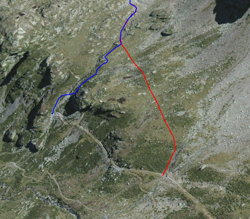
The main route is red,
the variants have other colors. The main route provides a smooth
on-going route along most bordermarkers, the variants give access to
the remaining bordermarkers. See the GRPdesBF-principles. Click here for an fullscreen interactive map. In short The main route can't be easier in navigating: follow the GR11 to the E/SE. First over the pass of Puerto de Chistau, then a long way down the valley along the stream until its confluence with the Rio Esera. The variant is one of the toughest and most interesting parts of the GRPdesBF. It climbs steeply to two mountain passes with two versions of the bm330: the Port d'Aygues Tortes and Port de Clarabide. Considerations The main route is requires no special attention: well waymarked and enough water and bivouac spots (and Refugio de Estós in the middle) . The variant gives in general no wayfinding problems but the second climb (to Port de Clarabide) is - though waymarked for a great deal - on rough terrain. In the variant, water & bivouac are limited to the valley in between the two passes. At the end, there are campings. When continuing on the next stage, you will come along two other campings (after ± 1h a semi-free camping space and after ± 2h - 0,5km off the route - 'camping de los baños'. And a bivouac shouldn't be difficult somewhere along this valley. Factsheet
Gps-files needed
Version 02 July 2014. If you have any correction, suggestion etcetera -> please email me: eefberns@grenspalen.nl MAPS AND DIRECTIONS You might check the relevant webpages in the 'All markers'-section and 'All my trips'-section for more pictures of the bordermarkers and wayfinding-issues. Print your own maps It's easy to print your own - custom made - maps with the GRPdesBF-route and the bordermarkers on them. See: Print your own maps |
||||||||||||||||||||||||||||||||||||||||||||||||||||||||||
 |
||||||||||||||||||||||||||||||||||||||||||||||||||||||||||
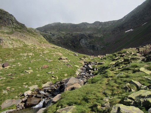
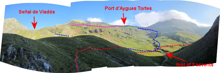 First, this orientation-panorama. The start of the stage is at the "foot of 3 ascents": - left (=W) leading up to Señal de Viadós (the blue line) - right (=E) where the GR11 continues (GR11 = the red line = the main route) - in front (=N) towards Port d’Aigues Tortes (alias “Puerto de Añes Cruces” on Spanish signposts) (the continuation of the blue line = variant 1) The pink line is the approximate shortcut from Señal de Viadós to Port d'Aygues Tortes (see previous stage, now not relevant anymore) |
||||||||||||||||||||||||||||||||||||||||||||||||||||||||||
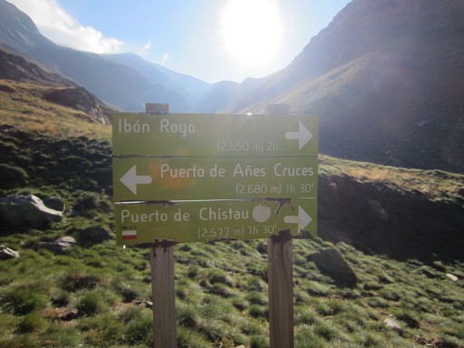 |
The waymarking is perfect here but the different names in Spanish can be confusing. Puerto de Añes Cruces = Port d'Aygues-Tortes (bm330). The main route heads for the Puerto de Chistau, following the GR11 |
|||||||||||||||||||||||||||||||||||||||||||||||||||||||||
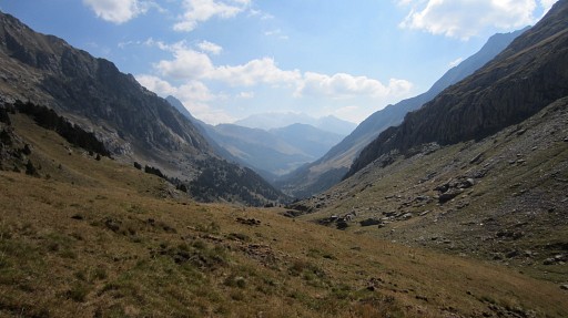 |
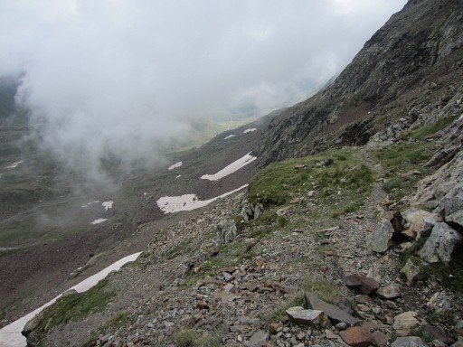
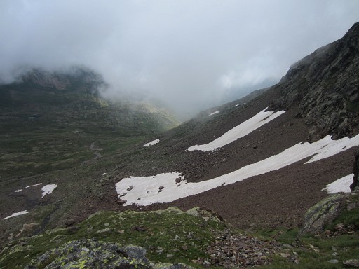
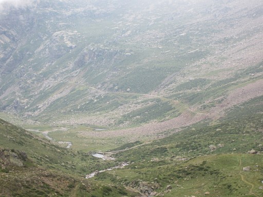
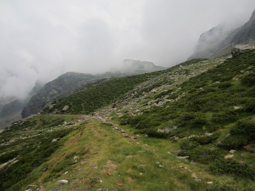
Then - beyond Puerto de Chistau - a long way down
the valley. |
|||||||||||||||||||||||||||||||||||||||||||||||||||||||||
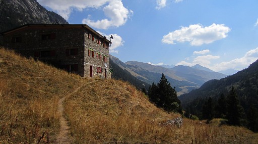 |
You will pass Refugio de Estos. Finally you will arrive at the confluence of the stream with the Rio Esera at the A-139 road. |
|||||||||||||||||||||||||||||||||||||||||||||||||||||||||
| Variant 1 via bm330-330bis |
||||||||||||||||||||||||||||||||||||||||||||||||||||||||||
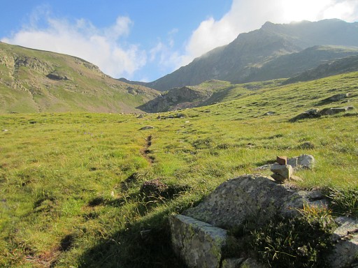 |
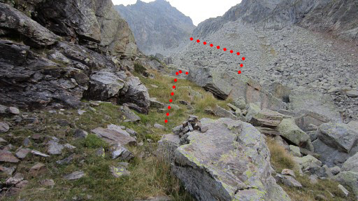
From the "foot of 3 ascents", there’s a cairn-waymarked trail up to the Port d'Agues Tortes (or Puerto de Añes Cruces) and that will take you ± 1.45h. | |||||||||||||||||||||||||||||||||||||||||||||||||||||||||
 |
The trail crosses a rockfall and it climbs further along this stream | |||||||||||||||||||||||||||||||||||||||||||||||||||||||||
 |
and the last part of the climb is quite steep up a ravine but overall, there are no problems. | |||||||||||||||||||||||||||||||||||||||||||||||||||||||||
 |
Now the Port d'Aygues Tortes comes in sight. |
|||||||||||||||||||||||||||||||||||||||||||||||||||||||||
 |
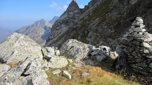
This is a zoom-in of the previous picture. There are two information posts on the pass. | |||||||||||||||||||||||||||||||||||||||||||||||||||||||||
 |
Bm330 It’s located 20m NW of the information post surrounded by a small stone wall. This bm - the original bm330 - was lost for many years but re-discovered in september 2012 by Jean-Paul Laborie. Read this amazing story at the curiosities-page Bm330 was considered lost for many years because the names of the borderpasses have changed on the maps in the course of time. |
|||||||||||||||||||||||||||||||||||||||||||||||||||||||||
 |
Port d’Aygues Tortes used to be Port de Clarabide and that's where the
Treaty of Bayonne of 1862 prescribed a bordercross. On the current Port de Clarabide - 3,5km to the E - a new bordercross 330 was engraved in 2003 because the original cross couldn’t be found there. This picture: note the second information post. |
|||||||||||||||||||||||||||||||||||||||||||||||||||||||||
 |
Then descending along a well and cairns-waymarked path | |||||||||||||||||||||||||||||||||||||||||||||||||||||||||
 |
through an extended rockfall. | |||||||||||||||||||||||||||||||||||||||||||||||||||||||||
 |
At the bottom of the valley | |||||||||||||||||||||||||||||||||||||||||||||||||||||||||
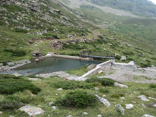 |
at a small barrage |
|||||||||||||||||||||||||||||||||||||||||||||||||||||||||
 |
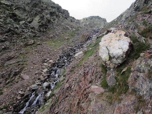
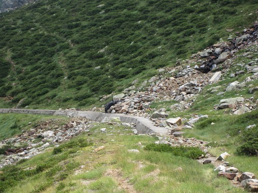
starts a concrete ridge covering a
huge waterpipe. That ridge extends to the E, keeping more or less the same altitude. It’s easy to walk on or besides it, you can't miss it. |
|||||||||||||||||||||||||||||||||||||||||||||||||||||||||
 |
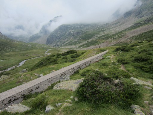
The trail itself crosses the concrete ridge
and descends further. But we have to follow the ridge because that's a direct access to the ascent to Port de Clarabide (bm330bis) |
|||||||||||||||||||||||||||||||||||||||||||||||||||||||||
 |
There are two places where you can leave the concrete ridge to climb
towards Port de Clarabide. The first is where two steel pipes enter the concrete ridge and a stream comes from above. That the one we will take. The second one is where the concrete ridge ends. |
|||||||||||||||||||||||||||||||||||||||||||||||||||||||||
 |
This is the first spot: you can see a black metal pipe entering the concrete ridge. | |||||||||||||||||||||||||||||||||||||||||||||||||||||||||
 |
And now these 2 options shown on Google Earth. Coming from bm330, the red route is the most obvious. So: where the black metal pipes enter the concrete ridge -> climb the hill in eastern direction for ± 400m untill you reach a stream. Then follow the stream uphill, picking up the cairns which will lead you to Port de Clarabide. |
|||||||||||||||||||||||||||||||||||||||||||||||||||||||||
 |
A lot higher, you will approach a sort of pass, south of a rounded green hilltop. | |||||||||||||||||||||||||||||||||||||||||||||||||||||||||
 |
That’s probably where the trail coming
from Lac de Pouchergues arrives on its way to Port de Clarabide.
Around here pick up the cairns-trail which first brings you SSE to the other side of the rockfall-valley. The red line is a rough indication of the trail. |
|||||||||||||||||||||||||||||||||||||||||||||||||||||||||
 |
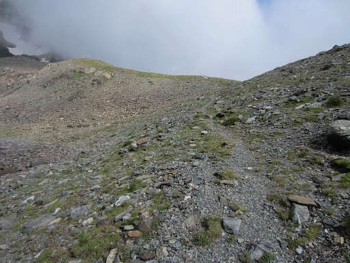
Then the trail climbs further S on grass-strips between rockwall and rockfall. | |||||||||||||||||||||||||||||||||||||||||||||||||||||||||
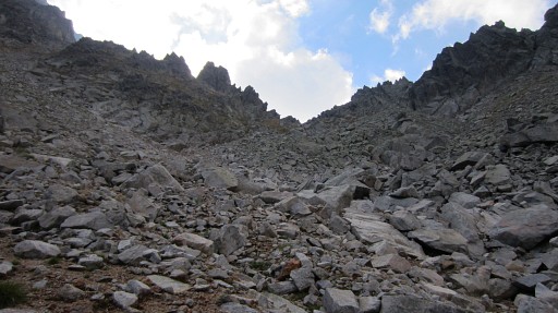 |
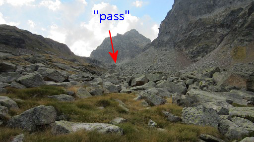
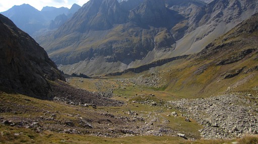
You’ll arrive at this sandy bottom of the upper valley. That’s where the final ascent starts. BUT don’t climb to the ‘pass’ to the right (SSW) which seems the obvious pass but isn’t. It’s the next one (SE), more or less straight on from that sandy bottom. There are cairns (partly) to help you. |
|||||||||||||||||||||||||||||||||||||||||||||||||||||||||
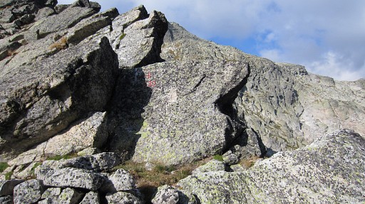 |
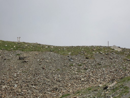
At Port de Clarabide, at it’s W-side, bm330bis is very visible. This bordercross was engraved in 2003. It was decided upon in a meeting of the Commision Mixte d'Arbornement (read the proceedings here) in 2002. The delegation of Huesca stated that the exact location of the old cross was unknown. |
|||||||||||||||||||||||||||||||||||||||||||||||||||||||||
 |
But
they didn't know that the original bm330 is located at the current Port
d'Aygues Tortes, 3,5km to the west. That Port was named Port de
Clarabide on older maps. In september 2012 Jean-Paul Laborie found the
original bm330 there. See the curiosities-page Henceforth, this bm has to be considered as bm330bis, as Jean-Paul himself proposes. |
|||||||||||||||||||||||||||||||||||||||||||||||||||||||||
 |
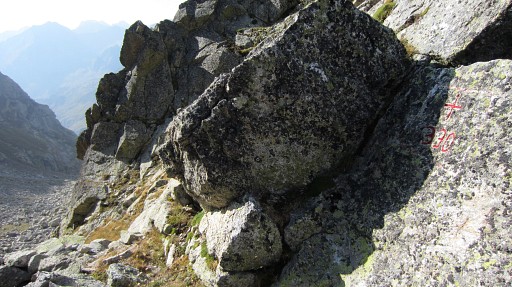
On this pass, there's a square - and partly walled - enclosure. You could even bivouac here - I think - if you bring water. |
|||||||||||||||||||||||||||||||||||||||||||||||||||||||||
 |
Then descending into Spain: first on the grass slope, then across the rockfall and then picking up the cairns-trail which leads you downwards through the E-side of the rockfall. | |||||||||||||||||||||||||||||||||||||||||||||||||||||||||
 |
The rest of the descent is straightforward, cairns or not. At the bottom, you will meet the GR10 again. |
|||||||||||||||||||||||||||||||||||||||||||||||||||||||||