|
The
bordermarkers of the Pyrenees : the GRPdesBF
 |
||||||||||||||||||||||||||||||||||||||||||||||||||||||||||
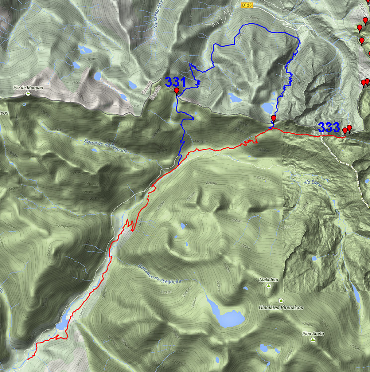
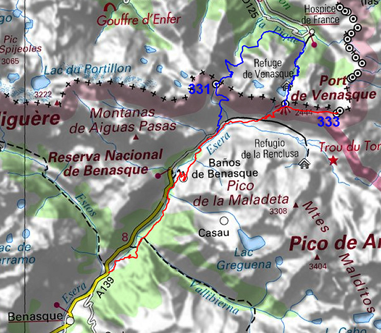
| - stage 27 - Val de Benasque - Pas de l'Escalette (bm331-333) |
 |
|||||||||||||||||||||||||||||||||||||||||||||||||||||||||
 |
||||||||||||||||||||||||||||||||||||||||||||||||||||||||||
| Only
the bordermarkers along this stage are shown (and some adjoining ones).
The main route is red,
the variants have other colors. The main route provides a smooth
on-going route along most bordermarkers, the variants give access to
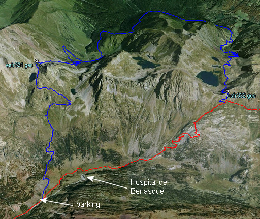
the remaining bordermarkers. See the GRPdesBF-principles. Click here for an fullscreen interactive map. In short This stage starts easy with a long part on (dirt)roads on the E-side of the Rio Esera up to Hospital de Benasque. The main route continues NEE and climbs (passing beneath Col de Venasque) to Pas de l'Escalette (bm333). The only variant leaves the main route just before the Hospital de Benasque and climbs to Port de la Glère (bm331). On a long loop via the forest trail of the Chemin de la Impératrice, it heads to the Col de Venasque (bm332) and links up with the main route. Considerations  If
you include the variant, you will need two days for this stage.
Alternatively, you could descend back from bm331 towards Hospital de
Benasque and continue on the main route. Bm332 is a short detour from
the main route. That will save you some time. If
you include the variant, you will need two days for this stage.
Alternatively, you could descend back from bm331 towards Hospital de
Benasque and continue on the main route. Bm332 is a short detour from
the main route. That will save you some time. There's another option: a shortcut via Lac de la Montagnette found on the internet on various webpages but not tried yet by myself. On Google Earth we can spot the trails involved and I made this kml-route of it (click to open it in GE). NB: I tried this shortcut at 15-9-2016 but found it too steep when getting higher. Unfit for the average GRPdesBF-walker with his full backpack. The second part of this stage will bring you into the high mountains. So take care. Running water is not that abundantly available up there. When you stick to the main route, then you'd better bring water from the stream beyond Hospital de Benasque. When doing the variant, there are more streams available. At the end of this stage - at Pas de l'Escalette (bm333) - a bivouac is hard to do. Either you stop a bit earlier (200m SW of the Pas, there's a flat space) or continue considerably (1,5-2,5h) on the next stage until the valley of Roumingou. |
||||||||||||||||||||||||||||||||||||||||||||||||||||||||||
Factsheet
Gps-files needed
Version 03 December 2014. If you have any correction, suggestion etcetera -> please email me: eefberns@grenspalen.nl MAPS AND DIRECTIONS You might check the relevant webpages in the 'All markers'-section and 'All my trips'-section for more pictures of the bordermarkers and wayfinding-issues. Print your own maps It's easy to print your own - custom made - maps with the GRPdesBF-route and the bordermarkers on them. See: Print your own maps |
||||||||||||||||||||||||||||||||||||||||||||||||||||||||||
 |
||||||||||||||||||||||||||||||||||||||||||||||||||||||||||
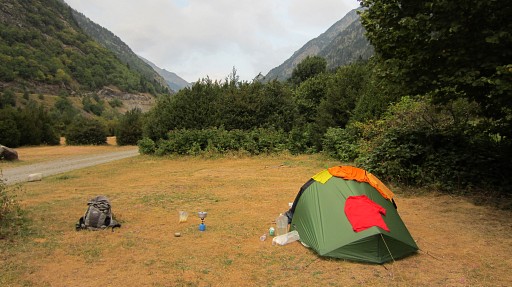 |
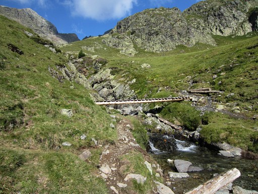
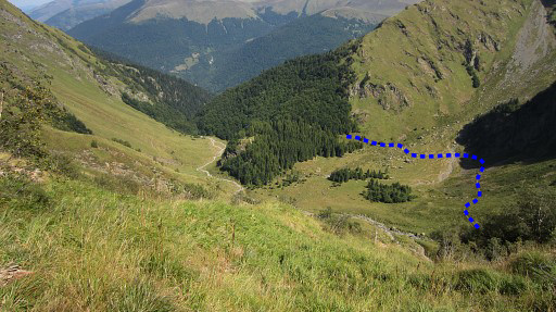
From the start of this stage, a (dirt)road will lead you parallel to the Rio Esera and along a barrage-lake to the N. It passes this campingsite. Further on - at Plan de Turpi - take a zigzag-road uphill and then proceed N on a dirtroad through the forest until its junction with a concrete road. Go right and |
|||||||||||||||||||||||||||||||||||||||||||||||||||||||||
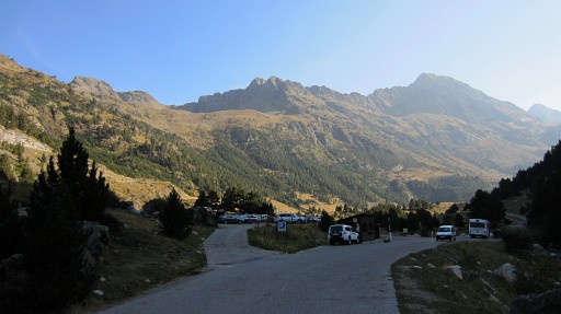 |
that concrete road will bring you to a large parking to the left, 700m before Hotel Hospital de Benasque. That's where variant 1 branches off to the left. The main route also leaves the road here and takes a trail at the left side of the stream leading towards the hotel, passing it at its left side. |
|||||||||||||||||||||||||||||||||||||||||||||||||||||||||
 |
Then the main route follows the trail towards Port de Venasque (bm332). It will not climb entirely to Port de Venasque but bends - at ± 150m distance and ± 100m lower - to the right on a branch towards Port dera Picada. |
|||||||||||||||||||||||||||||||||||||||||||||||||||||||||
| Variant 1 via bm331-332 |
||||||||||||||||||||||||||||||||||||||||||||||||||||||||||
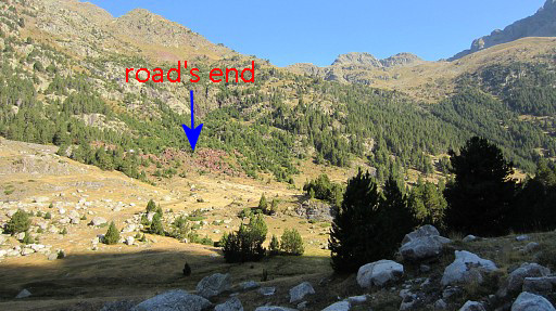 |
From the far end of the parking, climb N along a trail to the road higher up. A bit further, the road ends. |
|||||||||||||||||||||||||||||||||||||||||||||||||||||||||
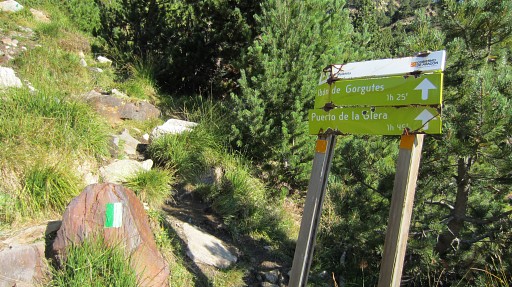 |
From there a green/white trail brings you to Port de la Glère. | |||||||||||||||||||||||||||||||||||||||||||||||||||||||||
 |
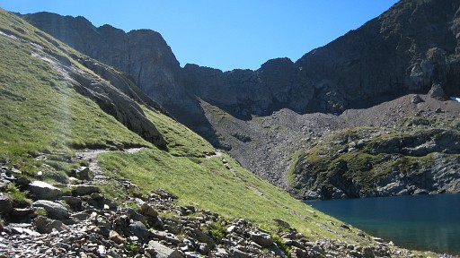
It crosses a streamin between and climbs more gently to the |
|||||||||||||||||||||||||||||||||||||||||||||||||||||||||
 |
Lac des Gourgoutes. The Port de la Glère is now close. |
|||||||||||||||||||||||||||||||||||||||||||||||||||||||||
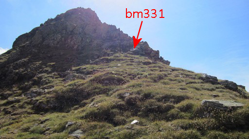 |
At the port itself, bm331 is uphill to the E. |
|||||||||||||||||||||||||||||||||||||||||||||||||||||||||
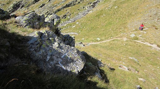 |
From bm33 looking down at the Port. |
|||||||||||||||||||||||||||||||||||||||||||||||||||||||||
|
Then a long descent to the bottom of the Cirque de la Glère. At the bottom take the trail which enters the forest. That trail is called "le chemin de la Impératrice". |
|||||||||||||||||||||||||||||||||||||||||||||||||||||||||
|
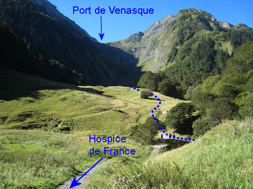
This picture shows where the Chemin de la Impératrice leaves the forest and bends right to start climbing to Port de Venasque. Hospice de France is nearby: a hotel-restaurant annex refuge. |
|||||||||||||||||||||||||||||||||||||||||||||||||||||||||
|
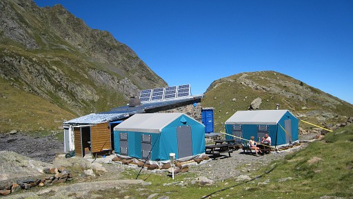
The climb to Port de Venasque is easy with its countless lacelets. You will pass Refuge de Venasque |
|||||||||||||||||||||||||||||||||||||||||||||||||||||||||
 |
and continue for the last part to Port de Venasque. | |||||||||||||||||||||||||||||||||||||||||||||||||||||||||
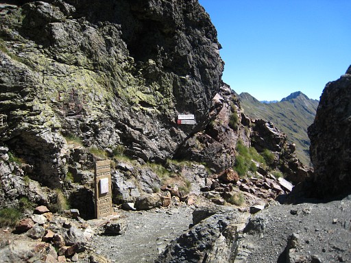 |
Bm332 Above the monument, there’s a cross with F and E and number 332. |
|||||||||||||||||||||||||||||||||||||||||||||||||||||||||
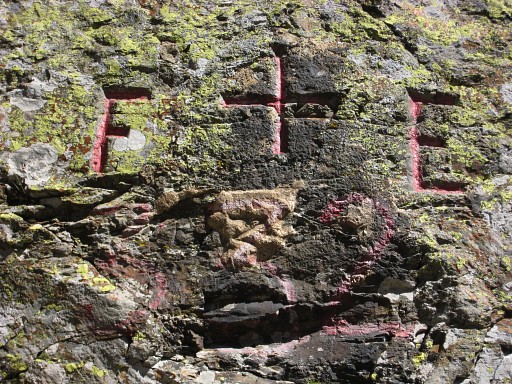 |
Bm332 |
|||||||||||||||||||||||||||||||||||||||||||||||||||||||||
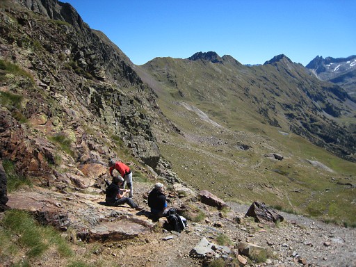 |
Having descended a while (150m distance, 100m lower), you can take a branch to the left leading to Port dera Picada. That is the trail you can spot on this picture and there you are already back at the main route. |
|||||||||||||||||||||||||||||||||||||||||||||||||||||||||
| End of variant 1 |
||||||||||||||||||||||||||||||||||||||||||||||||||||||||||
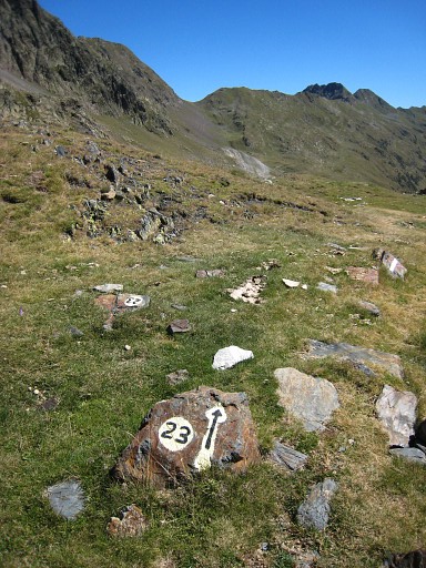 |
We are on the main route again. The Port dera Picada getting nearer, following a trail called nr.23. |
|||||||||||||||||||||||||||||||||||||||||||||||||||||||||
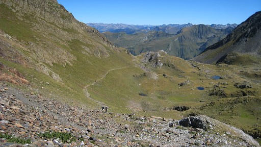 |
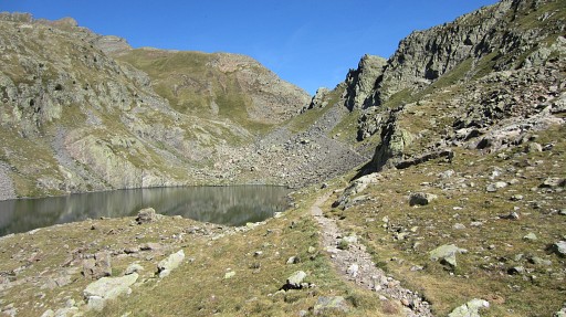
From
Port
dera Picada, the next pass - Pas de
l’Escalette - is already visible. You can see the tiny lakes and flat spots where a bivouac is possible. Alas: no running water. But ± 300m to the SE there's a larger lake and perhaps source of a stream. |
|||||||||||||||||||||||||||||||||||||||||||||||||||||||||
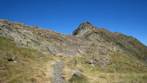 |
Approaching the Pas de l’Escalette | |||||||||||||||||||||||||||||||||||||||||||||||||||||||||
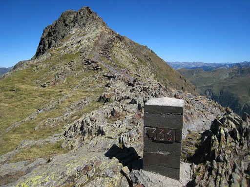 |
At Pas de l'Escalette we find bm333, a few meters off the path. On the summit in the background is bm334 but that's for the next stage. |
|||||||||||||||||||||||||||||||||||||||||||||||||||||||||