|
The
bordermarkers of the Pyrenees : the GRPdesBF
 |
|||||||||||||||||||||||||||||||||||||||||||||||||
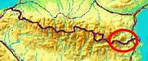
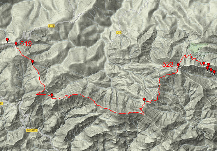
| - stage 47 - Col d'Ares - Coll de les Maçanes (bm519-523) |
 |
||||||||||||||||||||||||||||||||||||||||||||||||
 Only
the bordermarkers along this stage are shown (and some adjoining ones).
The main route is red,
the variants have other colors. The main route provides a smooth
on-going route along most bordermarkers, the variants give access to
the remaining bordermarkers. See the GRPdesBF-principles. Only
the bordermarkers along this stage are shown (and some adjoining ones).
The main route is red,
the variants have other colors. The main route provides a smooth
on-going route along most bordermarkers, the variants give access to
the remaining bordermarkers. See the GRPdesBF-principles.Click here for an fullscreen interactive map. In short Another stage with a large part on the borderridge. From bm519 a dirtroad brings us to the borderridge where a trail along a fence decends to bm520. Then - after 1,5km - our route goes SW for 1km and then descends E to Col de Malrems with bm521. Then -from bm521 - you have to follow the borderridge to the E including a tough climb over the summit of Comanegra. From that summit, it's another 1,5 km until the border leaves the main ridge and turns N. At that point, a trail descends NW->NE through the forest to a dirtroad. That dirtroad will lead you in 150m to close to bm522 which stands along a faint trail between two open grassy spaces. From the second open field a winding trail will bring you in 4km - mainly on the Spanish hillside - towards Pla de la Muga, source of the Muga. Bm523 is a 50m detour to the E. Then a waymarked trail leads N and provides a shortcut to a dirtroad below. That dirtroad will bring you in 2 winding kilometers to Col de les Maçanes. Considerations Water is a problem, take enough with you before you start. At Pla de la Muga, the Muga-stream might contain enough water to refuel. At the dirtroad in the last kilometers towards Col de les Maçanes, you will cross a few stream(bed)s. Col de les Maçanes makes a nice bivouac-spot but there's no water. Factsheet
Gps-files needed
Useful You might check the relevant webpages in the 'All markers'-section and 'All my trips'-section. They provide pictures of the bordermarkers and additional information. Version 02 May 2014. If you have any correction, suggestion etcetera -> please email me: eefberns@grenspalen.nl MAPS AND DIRECTIONS March 2014. Maps and directions yet to be worked out in more detail. You might check the relevant webpages in the 'All markers'-section and 'All my trips'-section for pictures of the bordermarkers and wayfinding-issues. Print your own maps It's easy to print your own - custom made - maps with the GRPdesBF-route and the bordermarkers on them. See: Print your own maps |
|||||||||||||||||||||||||||||||||||||||||||||||||
 |
|||||||||||||||||||||||||||||||||||||||||||||||||
|
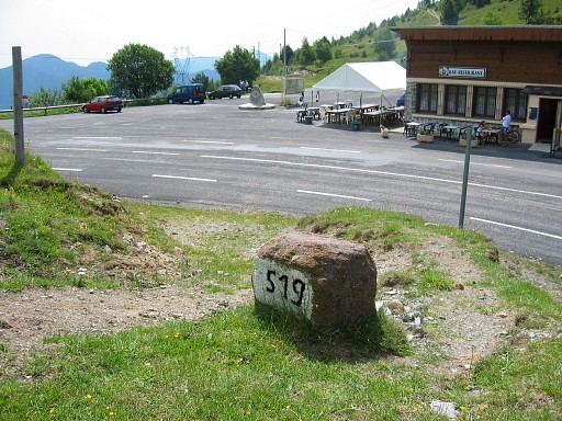
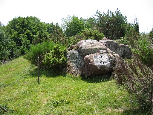
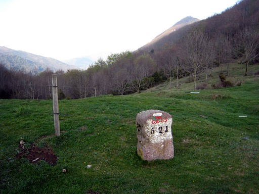
Bm519, overlooking Col d'Ares. The restaurant was out of business in 2011. Left of the restaurant, you have to enter a dirtroad. |
||||||||||||||||||||||||||||||||||||||||||||||||
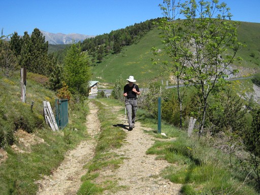 |
Take the
dirtroad climbing SE (not the private road, leading to a house) and pass through this open
gate (This picture: looking back to Col d'Ares) |
||||||||||||||||||||||||||||||||||||||||||||||||
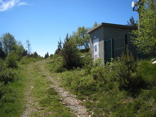 |
and pass later this small building |
||||||||||||||||||||||||||||||||||||||||||||||||
 |
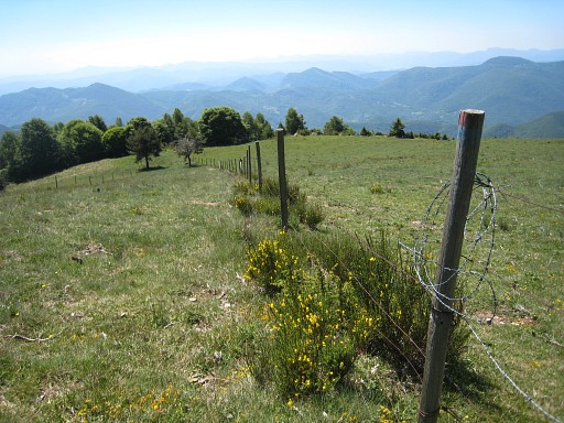
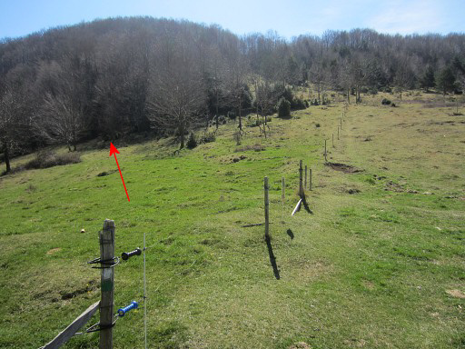
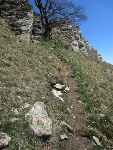
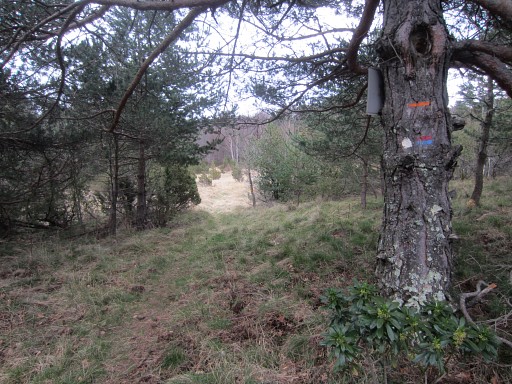
and
you will arrive at the border-ridge with two parallel fences. In between these fences, descend on a trail. The red-blue waymarking will bring you past bm520 and finally as far as bm521. |
||||||||||||||||||||||||||||||||||||||||||||||||
 |
Bm520 already visible. | ||||||||||||||||||||||||||||||||||||||||||||||||
 |
Bm520 Continue along the trail |
||||||||||||||||||||||||||||||||||||||||||||||||
 |
At the forest-ridge at the far end, the trail bends to the right. | ||||||||||||||||||||||||||||||||||||||||||||||||
 |
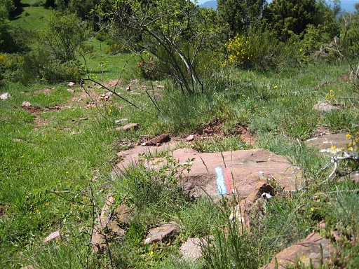
The
red-blue waymarks are accompagnied by orange ones until a point where
the orange trail branches off at right angles and descends steeply, zigzagging in the direction of Col del Malrems. However: the red-blue trail is more attractive and probably not much longer then the zigzagging orange one. My advice: stick to the red/blue trail. This picture: looking down SE at Col del Malrems, taken a bit beyond the branching off of the orange trail. |
||||||||||||||||||||||||||||||||||||||||||||||||
 |
The red-blue trail continues SW and passes Roc del Tabal and then bends to the east to descend to the Col. In the far distance, you can already see the summit of Comanegra. |
||||||||||||||||||||||||||||||||||||||||||||||||
|
At Col de Malrems: bm521 |
||||||||||||||||||||||||||||||||||||||||||||||||
 |
From Col de Malrems, the trail along the borderridge eastwards starts at the French side, SE from bm521 | ||||||||||||||||||||||||||||||||||||||||||||||||
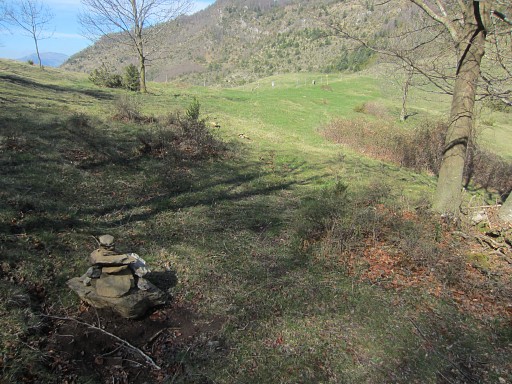 |
Soon you'll reach this cairn. This picture: looking back with in the distance Col de Malrems and bm521 where you come from. | ||||||||||||||||||||||||||||||||||||||||||||||||
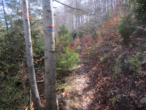 |
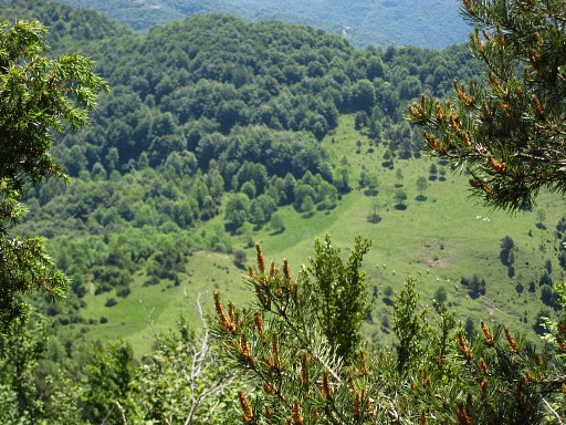
Now
and then, the trail is waymarked with red/blue waymarks and cairns. In general, wayfinding is no problem. A large part of the trail before the Comanegra is underneath the ridge on the French side. |
||||||||||||||||||||||||||||||||||||||||||||||||
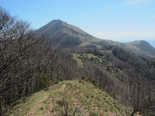 |
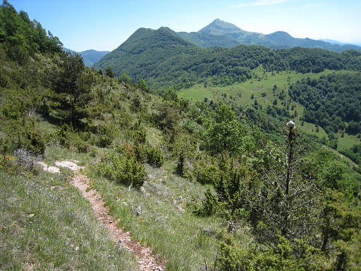
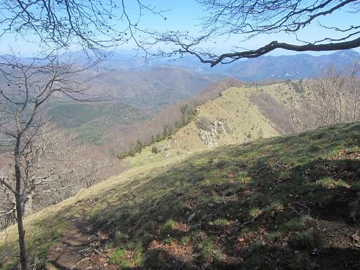
Then the hilltop of Comanegra comes in sight as a peak with grassy hillsides at the S and forests at the N-side. | ||||||||||||||||||||||||||||||||||||||||||||||||
 |
When coming closer to the Comanegra, the
waymarked trail crosses the ridge and enters into Spain. It seems as if it will traverse underneath the Comanegra. In fact it descends to the road down below. |
||||||||||||||||||||||||||||||||||||||||||||||||
 |
Well, don't do that. Keep to the ridge and climb directly along the ridge towards the Comanegra. New trails will appear and lead you along and underneath the subpeaks of the Comanegra |
||||||||||||||||||||||||||||||||||||||||||||||||
 |
until the final climb to the real summit of Comanegra. | ||||||||||||||||||||||||||||||||||||||||||||||||
 |
A green/orange-waymarked trail appears and takes you to the ridge | ||||||||||||||||||||||||||||||||||||||||||||||||
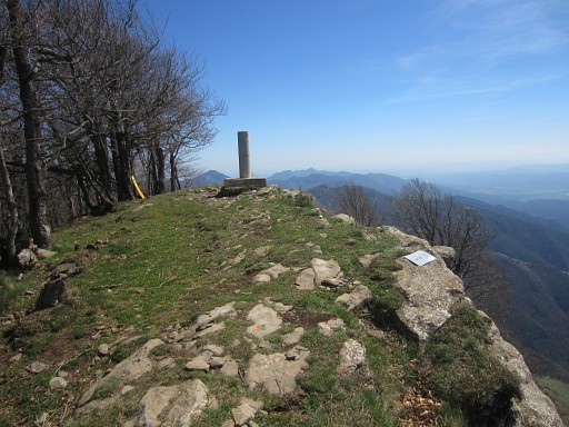 |
and brings you further on to the real Comanegra with its geodesic pillar. | ||||||||||||||||||||||||||||||||||||||||||||||||
 |
Then continuing on the green/orange trail which passes underneath | ||||||||||||||||||||||||||||||||||||||||||||||||
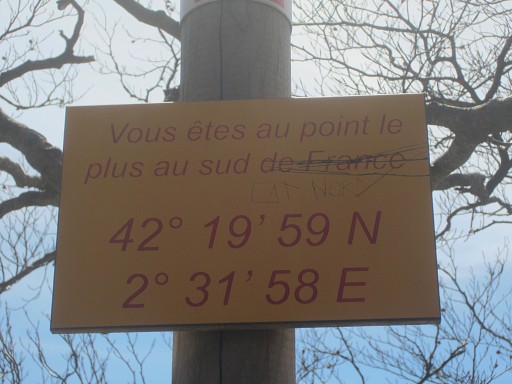 |
this information post which tells you that this is the most southern point of France! | ||||||||||||||||||||||||||||||||||||||||||||||||
 |
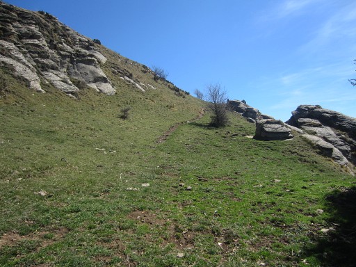
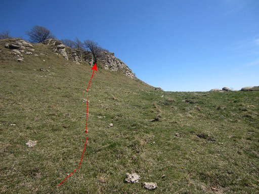
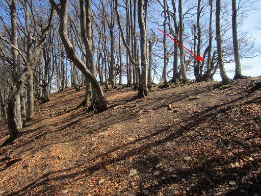
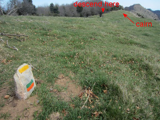
Then the trail descends considerably to a lower level of the ridge. At a certain point on the lower ridge, you have to bend left and decend to the N. But where? |
||||||||||||||||||||||||||||||||||||||||||||||||
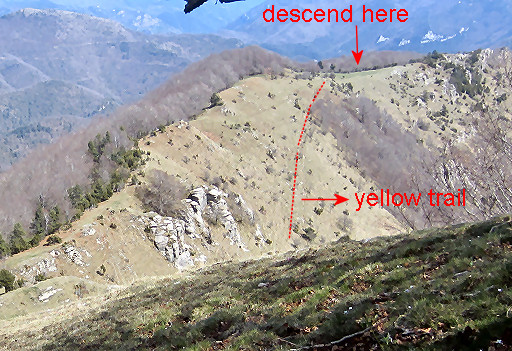 |
Well: there. |
||||||||||||||||||||||||||||||||||||||||||||||||
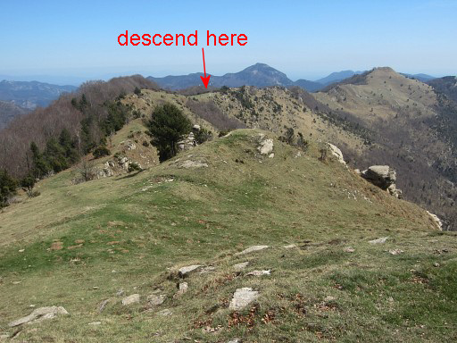 |
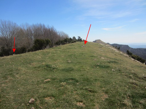
We are now at the lower ridge. | ||||||||||||||||||||||||||||||||||||||||||||||||
 |
Finding the spot where to bend to the N is not difficult. |
||||||||||||||||||||||||||||||||||||||||||||||||
 |
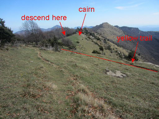
Suddenly yellow waymarks appear. They are from a trail, coming from the W which merges with our green/orange trail |
||||||||||||||||||||||||||||||||||||||||||||||||
 |
Then, some 75m further on, cairns direct you to the left side of the ridge | ||||||||||||||||||||||||||||||||||||||||||||||||
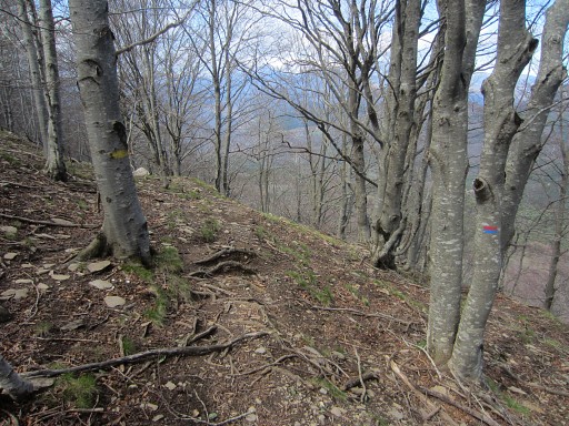 |
where
the yellow trail descends in the forest. Soon also red/blue waymarks appear and become dominant. |
||||||||||||||||||||||||||||||||||||||||||||||||
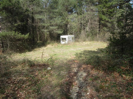 |
The trail descends NNW along the forested hillside, then descends further in some large lacelets, becomes broader and ends at a dirtroad with this caravan. | ||||||||||||||||||||||||||||||||||||||||||||||||
 |
Go
right and after 150m, there's a grassy open space to your right. You have to enter it (as the yellow and red/blue waymarks do). |
||||||||||||||||||||||||||||||||||||||||||||||||
 |
Then - on the open space - go left on a path entering the forest which brings you in 40m to |
||||||||||||||||||||||||||||||||||||||||||||||||
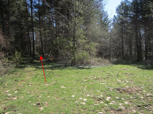
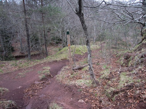
|
bm522. |
||||||||||||||||||||||||||||||||||||||||||||||||
 |
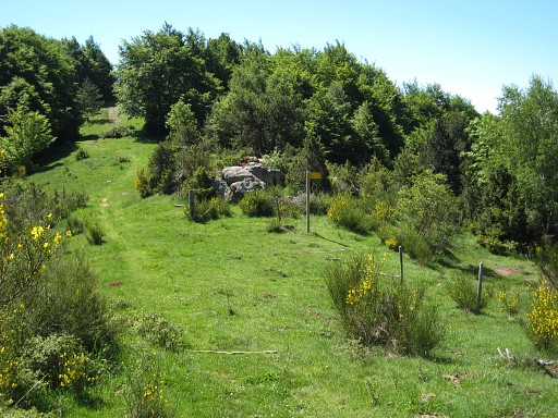
Then continue on the path and reach in ± 40m a second (larger and now rectangular) open grassy space. | ||||||||||||||||||||||||||||||||||||||||||||||||
 |
Go right and walk to
the end of it. There - at the left side - enter the forest where various waymarks reappear: orange and red/blue. |
||||||||||||||||||||||||||||||||||||||||||||||||
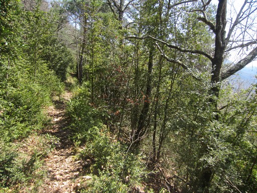 |
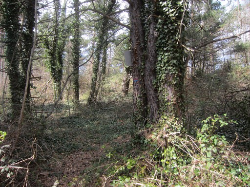
Then it's one hour of pleasant walking - well waymarked - to Pla de la Muga. | ||||||||||||||||||||||||||||||||||||||||||||||||
 |
These signs indicate | ||||||||||||||||||||||||||||||||||||||||||||||||
 |
that you have to go left | ||||||||||||||||||||||||||||||||||||||||||||||||
 |
and go across this grass plain to reach the brown earth of the Pla de la Muga. |
||||||||||||||||||||||||||||||||||||||||||||||||
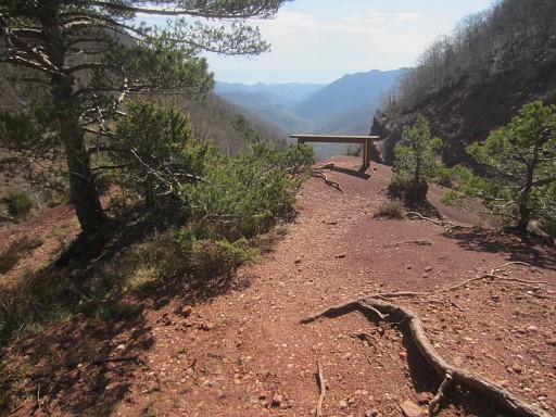 |
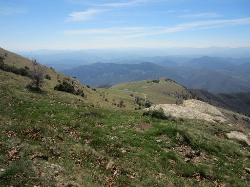
Don't miss this short branch to this viewpoint. It gives a marvellous view on the Muga-valley. |
||||||||||||||||||||||||||||||||||||||||||||||||
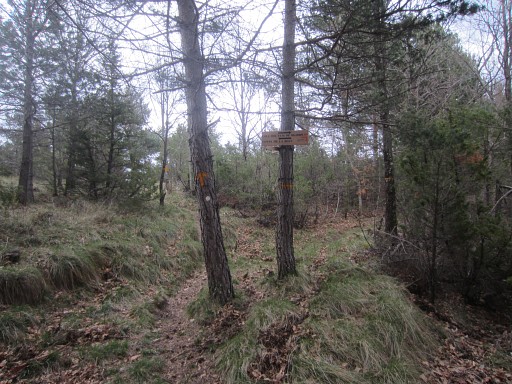
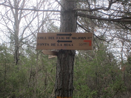
 |
A bit further is the junction of the orange (+ red/blue) trail with the yellow/red trail of the Tour de Vallespir. Go right here and now follow the yellow/red waymarks. |
||||||||||||||||||||||||||||||||||||||||||||||||
 |
This spot is the beginning of the Muga. In fact it's source is a few hundred meters to the W. This might be your only watersource in this stage. A bit further, the Muga drops in a small cascade and collecting water there can be easier than here. Around here, the yellow/red trail bends to the left. That where you can make a little detour E (5om) to |
||||||||||||||||||||||||||||||||||||||||||||||||
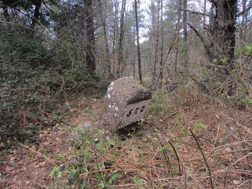
|
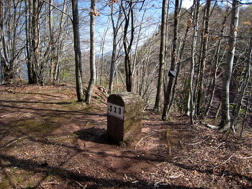
bm523. |
||||||||||||||||||||||||||||||||||||||||||||||||
 |
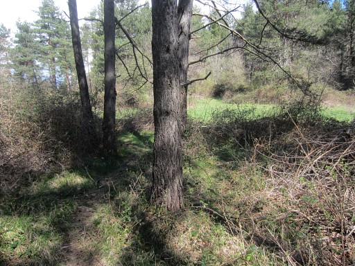
Back to the trail and continue N |
||||||||||||||||||||||||||||||||||||||||||||||||
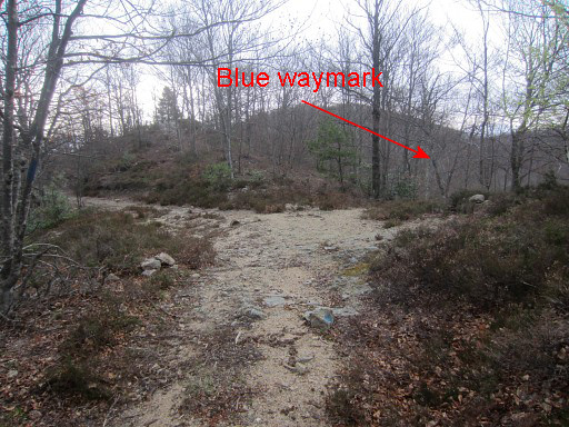 |
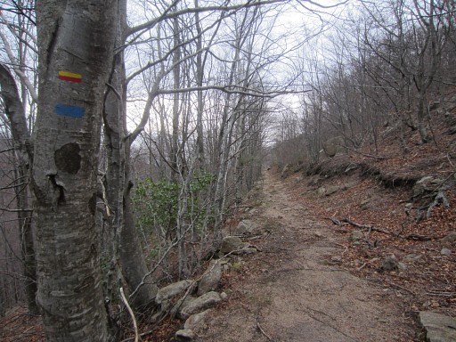
On this trail from Pla de la Muga NNE to the dirtroad, there's at one point a shortcut to the right (blue waymarked) descending directly through the forest to | ||||||||||||||||||||||||||||||||||||||||||||||||
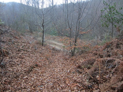 |
the
dirtroad. If you miss it, no problem. You will end up at a sandy dirtroad where you have to turn right. This shortcut will save you a few hundred meters. |
||||||||||||||||||||||||||||||||||||||||||||||||
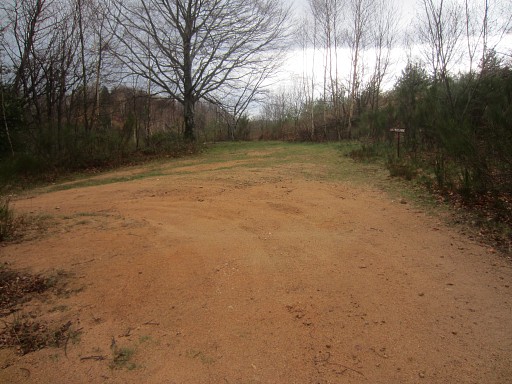 |
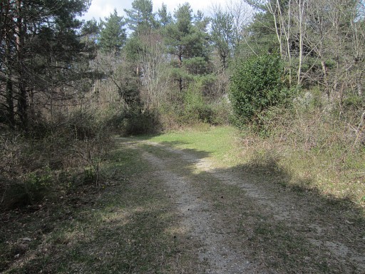
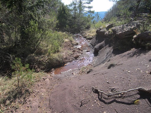
Then it's approximately a half hour along the winding dirtroad to Col de les Maçanes. That's here. You will pass some streams (or perhaps dry streambeds later in the season). That's another chance to collect water. |
||||||||||||||||||||||||||||||||||||||||||||||||
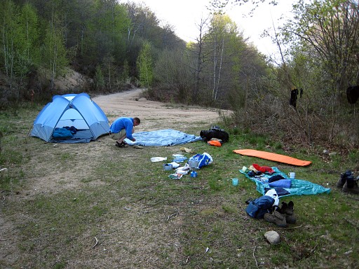 |
Col de les Maçanes is a nice spot for a bivouac. |
||||||||||||||||||||||||||||||||||||||||||||||||
| previous
stage next stage |
|||||||||||||||||||||||||||||||||||||||||||||||||