|
The
bordermarkers of the Pyrenees : all my trips
 |
|
| -
4 may
2009 - Crêtes d'Iparla |
 |
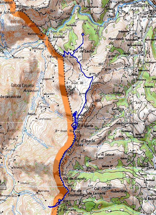 |
esfr-trip-track-20090504.kml (click to open in Google Earth or copy link to Google Maps; click right on this link to download gpx-version) |
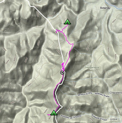 |
For explanation of
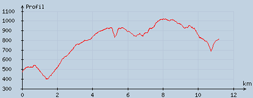
the gps-coordinates and other cartographic backgrounds: see my cartography page According to my watch: - duration: 09 - 18.15; 9.15 hours - up: 1324 m - down: 1008 m - total elevation: 2332 m - highest point: 1055 m - lowest point: 399 m |
 |
According
to visugpx - distance : 11.45 km - cum. elevation gain : 1045 m - cum. elevation loss : 713 m - total elevation: 1758 m - altitude maxi : 1023 m - altitude mini : 397 m - altitude average : 774 m |
 |
The
previous day I arrived by train in Bidarray and camped on Col
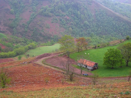
d'Harrieta: N43 12 39.0 W1 23 03.4 First to the assumed place of bm087. I've been here before on 10 april 2009 and 12 april 2009. We're looking on the barn from the north-east. There has been a cleaning-up since my last visit of the terrain in front of and besides the barn. The loose stones have been removed and piled up along the road. Once again I look around and search in vain for bm087. |
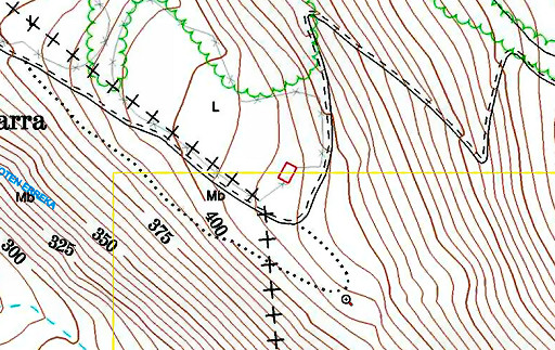 |
The maps I have show different
place. The most precise is the one from the Sitna
(Navarra) mapsite . |
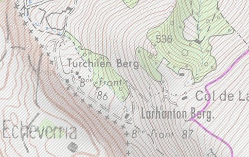 |
The French IGN-maps (online
available on the Geoportail-site)
are less precise and show the borderline a bit more to the south. However: bm086 is actually standing in the meadow north of the borderline indicated on this map. That suggests that this map is wrong. I climb back on the zigzag country road and then continue on a yellow waymarked path untill it bends to the left to ruin. I go straight on following a path that unites with the GR10-trail. |
 |
Going further on the GR10
(including taking a branch to the right which unites further on again
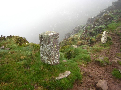
with the GR10). It's foggy (low clouds) and orientation is very difficult. Further on along the GR10, there's bm090. But before making the picture, I descend steeply using my compass (through low heath-bushes) searching for bm089 and climb back in a circle - to my surprise - to the GR10. With this bad sight, such a search makes hardly any sense. So time to make a picture of Bm090 |
 |
But then the sky clears and the
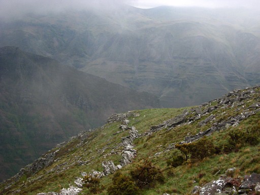
scene becomes visible. Down again and now zigzag exploreing a sort of ridge which is between bm088 and bm090. See picture. But all to no avail. I can't find a borderstone or bordercross 089. But this deserves another trial in the future with the map-coordinates of bm089 (and possibly checked on the sitna-mapsite) |
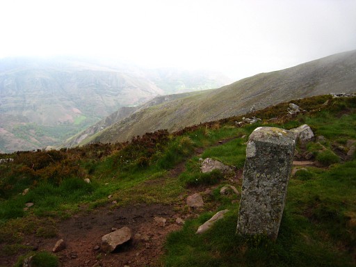 |
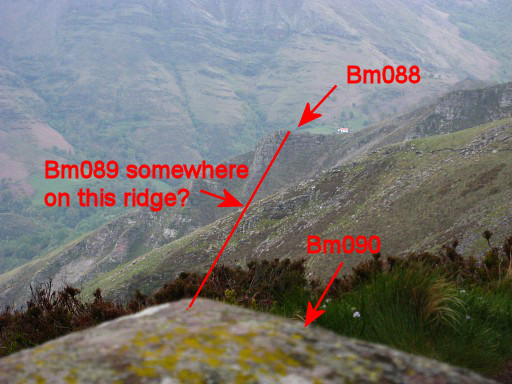
I'm
back at bm090 and make this picture in the direction of bm089 and bm088. |
|
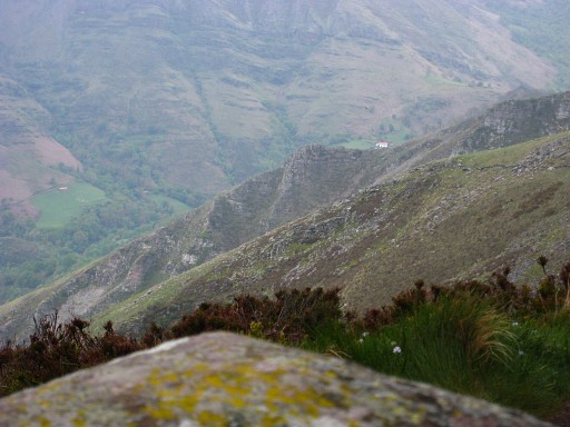
And this is a zoom-in taken from
the topside of bm090. Now we can easily spot two ridges. At the far end the one with bm088, in between the one where bm089 should be. Move the cursor over the picture to see the borderline. |
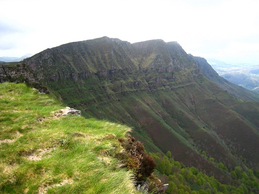 |
Continuing on the GR10, here looking back at the Crêtes d'Iparla. This ridge is the borderline. |
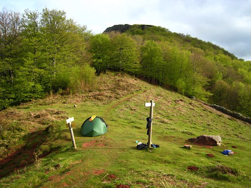 |
Stopping and camping at Coll
d'Harrieta. About 10 minutes down below, I found a stream for my water-supply. |