|
The
bordermarkers of the Pyrenees : all my trips
 |
|
| -
5 june
2009 - A border in the water |
 |
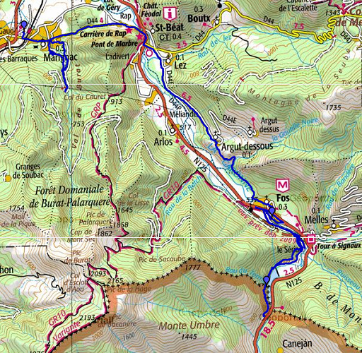 |
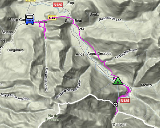
esfr-trip-track-20090605.kml (click to open in Google Earth or copy link to Google Maps; click right on this link to download gpx-version) Part of a 16-days trip, using day 1-10 to cover bm154 to 264 in the eastern Pyrenees and day 11-16 for bm416 to 365 near Bagnères-de-Luchon. Day 11: mainly a transfer day from Lourdes to Fos, walking from Marignac to the camping in Fos and doing a short trip to bm409 and some of its submarkers. Weather: cloudy, finishing the day with a thunderstorm. |
 |
For explanation of
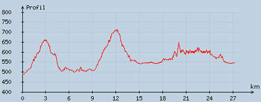
the gps-coordinates and other cartographic backgrounds: see my cartography page According to my watch: Duration: 12-19.45, in total 7.45 hours, ½ hour break for pitching the tent. Up: 707 m Down: 658m Total elevation 1365 m Highest point: 725m Lowest point: 514 m |
 |
According
to visugpx - distance : 27.37 km - cum. elevation gain : 607 m - cum. elevation loss : 549 m - total elevation: 1156 - altitude maxi : 713 m - altitude mini : 488 m - altitude average : 579 m |
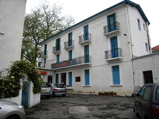 |
My hotel in Lourdes. From Lourdes I took a train to Montréjeau and changed for the bus to Marignac. |
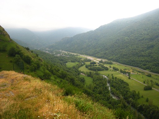 |
Then
walking from Marignac-station to Fos from 12 to 16 pm (including a one
hour deviation into the 'Val de Burat', trying to find a trail
over the hills to the N125, that one was too overgrown). On this picture: between Argout-Dessous and Fos, looking into the river-valley with Fos in the distance. |
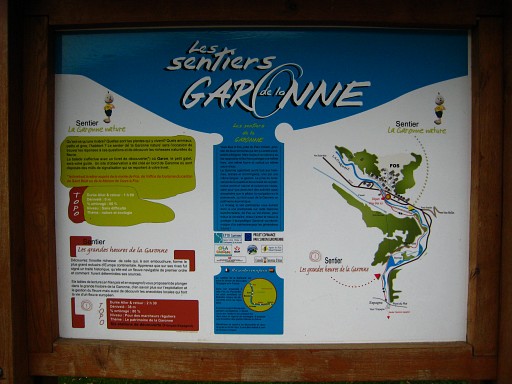 |
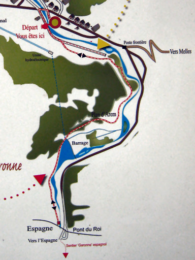
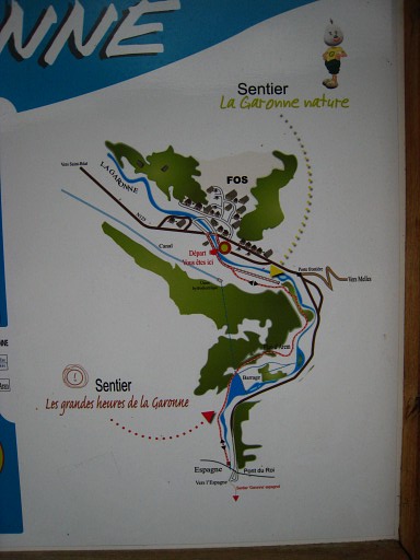
In Fos I pitched my tent on the camping municipal (N42 52 15.9 W0 44 10.6 H539m) and did some shopping. Besides the camping I've seen this board. A nature-trail is starting here, crossing the bridge and leading along the westside of the Garonne and the reservoir-lake until the border. My target: to check if the trail continues from the border until Pont du Roi. |
|
The
nature-trail crosses a new road in construction (bypassing the
village of Fos) and continues on the other side. It starts to climb. If the new road opens, there will be a slightly other route of the trail in order to cross the road. It's all well way-marked. Move the cursor over the picture to zoom in. |
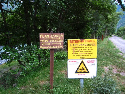 |
This picture: I haven't yet crossed the new road, to the left the Garonne. The left sign interests me although I have no idea where Plan d'Arem is. Anyway, the actual trail to it starts at the electricity plant of the reservoir. Later I will learn that Plan d'Arem is the location of a cabin (Cabane d'Herechet) high up in the mountains. In fact it's not far from bm408 and perhaps this trail provides a short-cut bm408 to bm409. See esfr-html-trips-20090608.html when I searched for bm407 and bm408. See also this link for information and maps of that cabin. |
|
After
the road in construction the nature-trail climbs on a nice trail above
the country road down to the left. They unite again at the
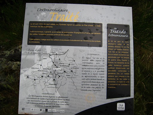
reservoir. This educational panel, somewhere along the nature-trail, is very interesting. It tell's that in 1513 a treaty was signed at Plan d'Arem ( "les lies et passeries") between 19 valley's on both sides of the border. Among others it allows the continuation of commerce between the valleys in time of war and the mutual compensation for damages and losses. Click here to see the picture in large. See this wikipedia-page on Lies et Passeries. |
 |
The nature-trail continues on the
west-side of the reservoir until bm409, besides a footbridge over the
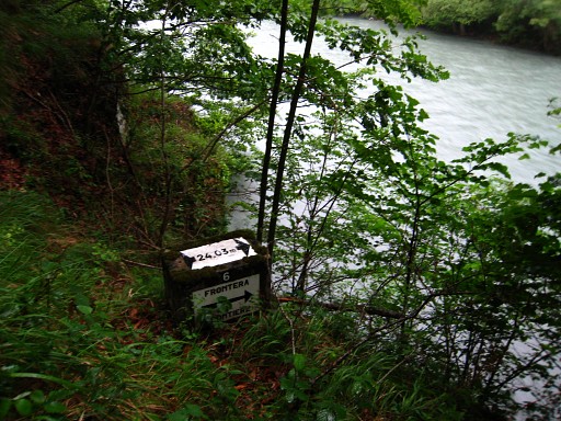
border-stream which ends in the reservoir. Meanwhile it has started to rain and thunder and I walk straight on. The trail is no longer way-marked and indeed ends at the tarmac road in Spain, just beyond Pont du Roi. I return and spot this submarker (nr. 6), indicating that the actual borderline is 24,03 m further, thus in the reservoir. |
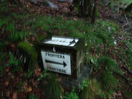 |
Submarker 4 |
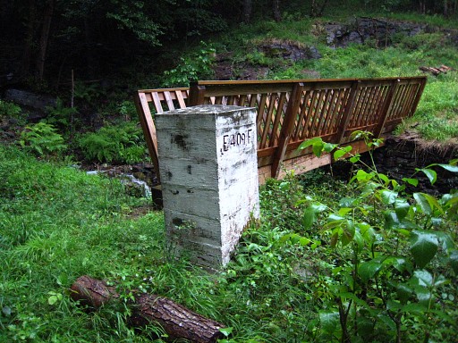 |
And I'm back at bm409. |
 |
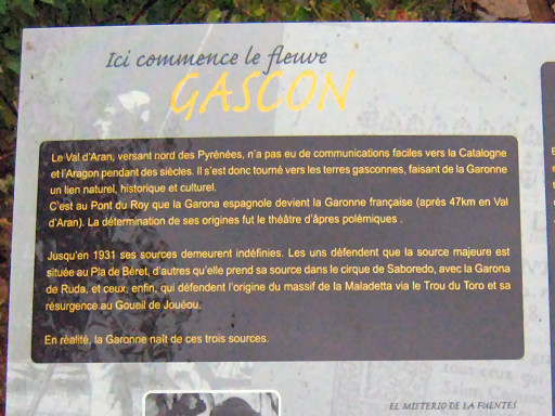
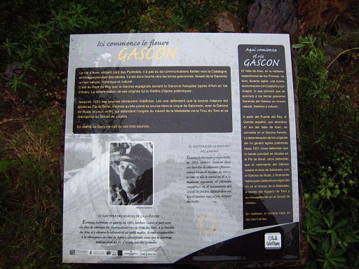
which stands at the south-side of the border-stream. At the other side of the bridge, is a information panel. It tell's about the search for the sources of the Garonne. One explorer simply poured fluorescent paint in one of the possible underground sources to see if the paint emerged in the Garonne (it did). |
|
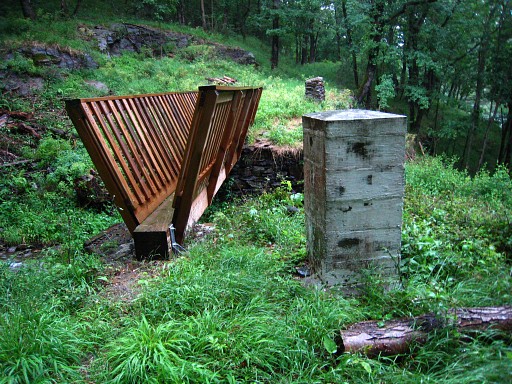
For us is more
interesting that it describes the Spanish Val d'Aran as being difficult
to reach in former centuries from Catalonia and Aragon. France
was easier to access. Val d'Aran is a special case in terms of
delimitation: it's on the French side of the watershed but it belongs to
Spain. Move the cursor over the picture to zoom in. Back at the barrage, I return on the country road to the new road in onstruction. Also nice & quiet and a better choice for the GRPdesBF then the nature-trail. Finally back at the camping, I'm soaked to the bone. |