|
The
bordermarkers of the Pyrenees : all my trips
 |
|
| -
8 september
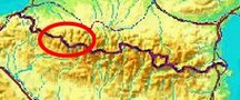
2009 - Bm310 high against a rockwall |
 |
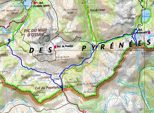 |
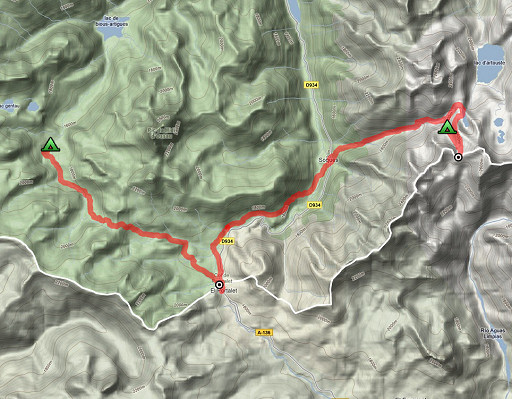
esfr-trip-track-20090908.kml (click to open in Google Earth or copy link to Google Maps; click right on this link to download gpx-version) Part of a 5-days trip from Col de Somport to Cauterets, exploring bm305 to bm314. Day 2: via Col du Pourtalet to Col de Sobe, 'doing' bm310 and 311. Weather: sunny, beautiful |
 |
For explanation of
the gps-coordinates and other cartographic backgrounds: see my cartography page Duration: 10.15-19.25, in total 9.10 hours, break 1 hour |
 |
According
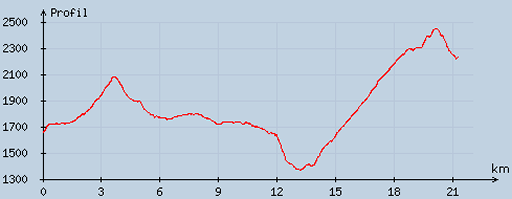
to visugpx - distance : 21.65 km - cum. elevation gain : 1567 m - cum. elevation loss : 1008 m - total elevation: 2575 - altitude maxi : 2450 m - altitude mini : 1368 m - altitude average : 1870 m |
|
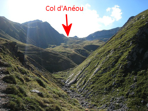
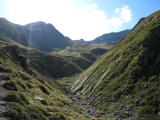
A late start after a long night of sleeping, the valley lit by a full mooon. I follow the dirtroad SE until the last cabane. Beyond the cabin I continue on the N-bank of the stream. When the bed of the stream becomes a small canyon, a clear path appears on that N-side. Beyond the canyon you have this clear view ahed of the Col d'Anéaou and the slopes leading to it. Actually you see two passes divided by a small summit in the middle. The left is Col d'Anéou. Move the cursor over the picture to see where the Col is. |
|
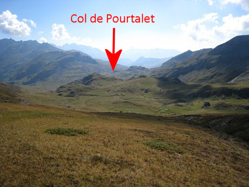
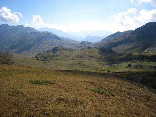
The trail disappears but the direction to Col d'Ainéou is obvious. Close to the Col, the trail reappears. On the Col this view ahead to Col de Pourtalet. Move the cursor over the picture to see where Col de Pourtalet is. |
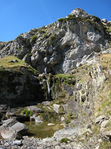 |
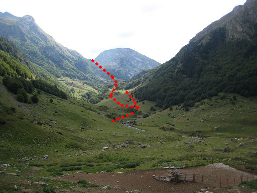
Then to Col de Pourtalet: here are no clear and connected paths but it's not difficult. My route: I descended to the little streams down below, following them until the stream disappears in the ground. Then traversing with a curve on the left side and descending on rocky surface and curving back to where the stream reappears. This picture: this is where the stream reappears. |
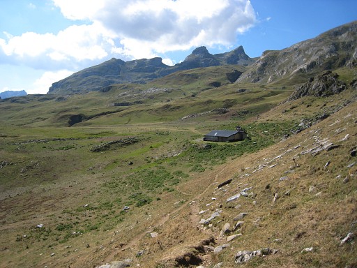 |
Then: on a trail you will reach this barn, from there continue on the dirtroad |
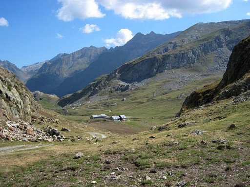 |
until it descends - left of a rocky outcrop - to other cabanes (this picture). At this point, I leave the dirtroad and go along the right side of the rocky outcrop in the direction of Col de Pourtalet. I cross a stream to remain at the same elevation as the Col. Close to the col I have to tackle a small rocky hill. |
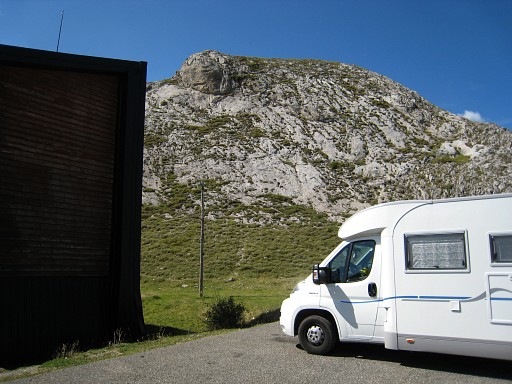 |
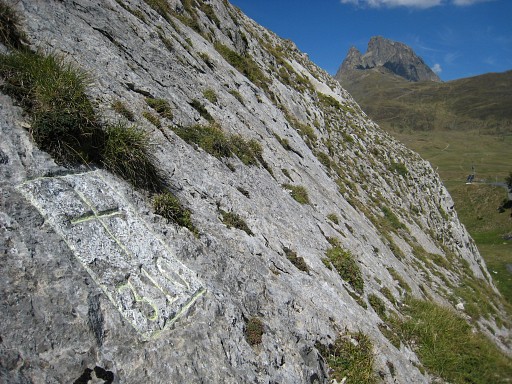
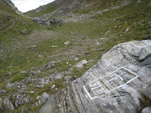
At the Col, I find easily (thanks to a picture of Robert Darrieumerlou) bm310 against a rockwall, west of the bordercrossing. |
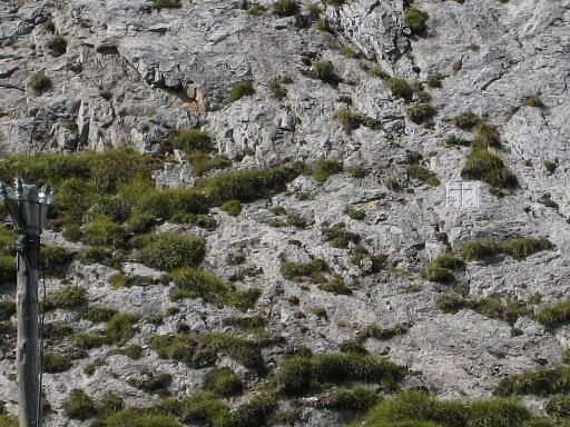 |
Zoom-in of the previous picture, bm310 is now visible. |
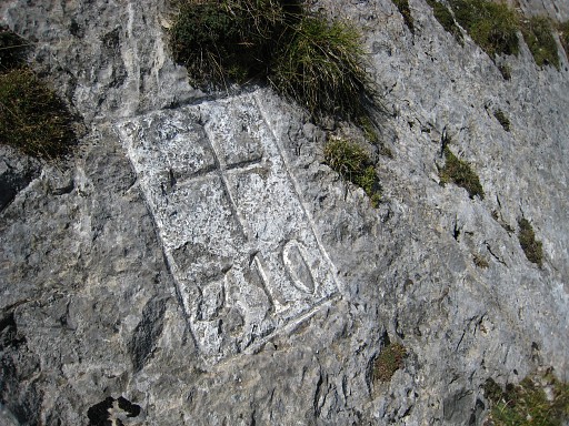 |
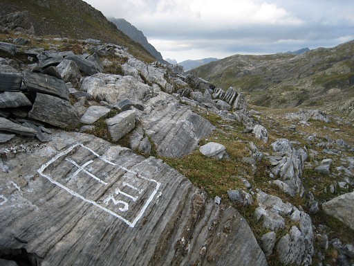
Bm310 |
 |
Bm310, the Pic du Midi d'Ossau visible in the background. |
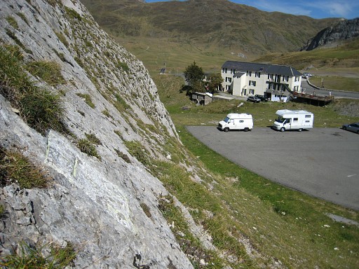 |
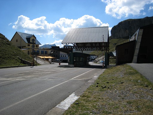
Bm310, looking into France. Then: a lunch in a Spanish restaurant 13.14 - 14.15. Col de Pourtalet is loaded with restaurants and shops on the Spanish side. |
 |
I go on and descend into France, taking this picture when looking back to the bordercrossing. Beyond the restaurant /hotel, I leave the road to the left and follow the slope, cross the bridge over the stream, then cross a second bridge and continue on clear paths/cattle tracks. Roughly at the same height as the road at the other side of the valley. As I enter the forest, the cattle trails fade away and I have to descend on the steep forest-hillside (loosing my precious altimeter-watch) to the more levelled gras-strip along the strean, |
|
Better is: if you have passed the
first part of the forest, descend quietly to the river and follow
the paths over the grass along the river. That's where the waymarked "Chemin de St. Jacques" should be, according to the French 25k 1546OT-map. On the map it continues to the south to the Col de Peyreluie, a borderpass. Move the cursor over the picture to see that trail (looking S). That could be an alternative for the GRPdesBF: Col de Pourtalet - Col de Peyreluie - descending and continuing to here. But probably longer and more difficult. |
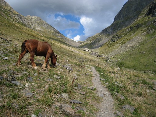 |
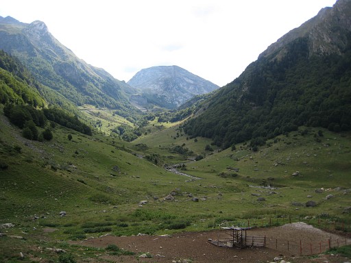
With Cabane du Caillou in sight, I cross a small bridge and climb to the road near the cabane. A little bit further, the trail to Col d'Arrioù starts. A sign says: 2½ hours, it took me 1.45 This picture: higher up in the valley, on my way to Col d'Arrioù. |
|
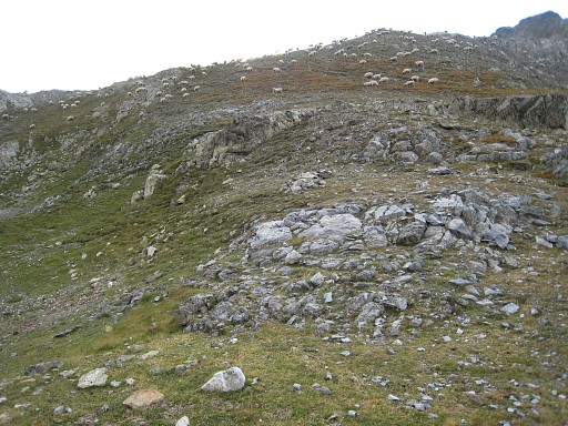
At the Col, I go to the right to Lac
d'Arriou. I follow a little part of its west-bank and when a flat part
appears I go to the right. A trail with many cairns brings me to Col de
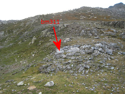
Sobe with Bm311 at the west-side of the Col Move the cursor over the picture to see the bordermarker. |
 |
Bm311. looking into Spain |
 |
Bm311, looking into France |
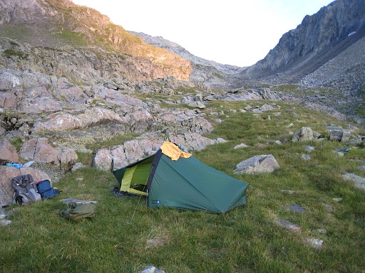 |
I go back, following the cairns but I
soon discover that I'm on a second access of Col de Sobe. It comes from
the west, out of the valley. I have to stop, it's almost 19.30 and at 21.00 it will be dark. A tiny stream is nearby. Bivouac: N42 50 35.2 W0 20 45.0 H2220m |