|
The
bordermarkers of the Pyrenees : all my trips
 |
|
| -
11 may
2010 - Bm001 revisited |
 |
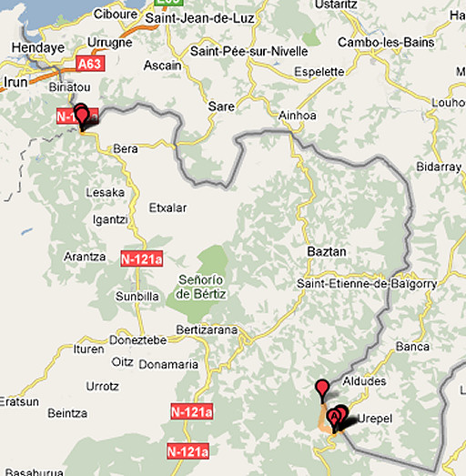 |
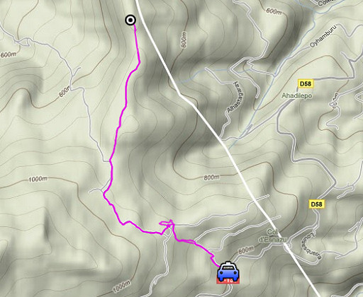
esfr-trip-track-20100511.kml (click to open in Google Earth or copy link to Google Maps; click right on this link to download gpx-version) Last night in our Gîte d Etappe in St-Étienne-de-Baïgorry. Today two targets: exploring a GRPdesBF-main-route-traject leading from bm130 to Col de Baztan and photographing bm001 from the other side of the Bidasoa-river. In between: some exploration near Venta Baztan. Weather: cloudy, in the afternoon some rain. |
 |
esfr-trip-track-20100511-trip1.kml (click to open in Google Earth or copy link to Google Maps; click right on this link to download gpx-version) Trip 1: exploring a GRPdesBF-main-route traject leading from bm130 to Col de Baztan We drive to Venta Baztan at the border and then a few hundred meters further where we spot (just beyond a house at the left) a narrow concrete road climbing into the forest at the right hand. That’s the one we saw on Google Earth. From there we find our way to bm130and back, combining different maps and a GR11-guidebook. |
 |
For explanation of
the gps-coordinates and other cartographic backgrounds: see my cartography page |
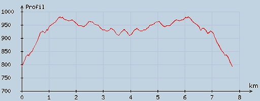 |
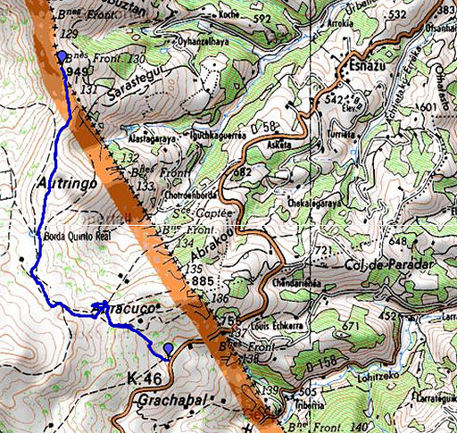
According
to visugpx - distance : 7.8 km - cum. elevation gain : 265 m - cum. elevation loss : 262 m - total elevation: 527 m - altitude maxi : 980 m - altitude mini : 793 m - altitude average : 927 m |
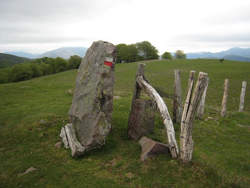 |
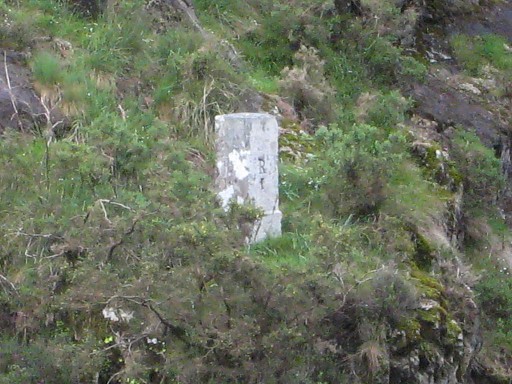
In between (and away from the esfr-border) we came across these peculiar stones. |
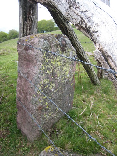 |
The little one contains some engravings which suggest that it is some kind of a bordermarker. Anyway, not an esfr-bordermarker. |
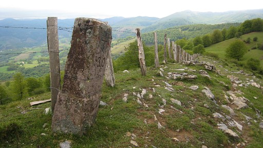 |
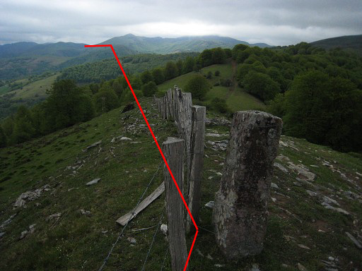
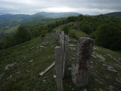
Bm130, the end of our reconnaissance-trip |
|
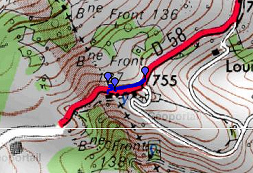
At Bm130 the border leaves the fence (and the watershed) and goes in a straight line to the hilltop of the Ichterbegui. See the curisosities-page for the item on Pays Quint. Move the mouse over the picture to see the approximate borderline. |
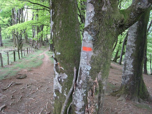 |
Description of our route from bm130 tot Venta Baztan: from bm130 follow the orange or
GR11-red/white-waymarks untill you reach a gate, |
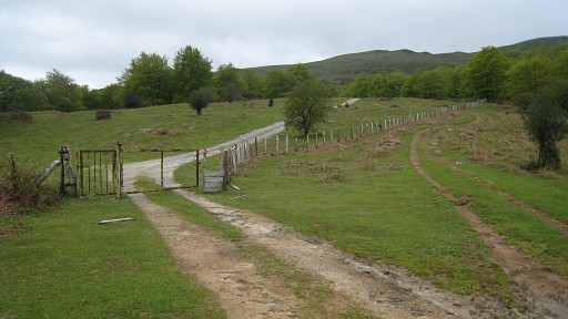 |
Go through the gate
and continue on the country road (quitting the GR11 which stays at
the other side of the fence). The country road becomes a concrete
road for a while and descends steeply later on. |
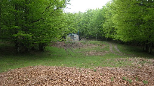 |
Then you arrive after a bend in the road at a
point where you can see to your left above a cabin in army-camouflage
colours. At the other side you see down below a meadow in the
forest. You need to go down along the fence of the meadow through the
forest untill you reach a narrow concrete road. Following that one
down brings you to the main road. A few hundred meters to the left
and you are at the venta Baztan. Takes about one hour walking (one
way). |
 |
esfr-trip-track-20100511-trip2.kml (click to open in Google Earth or copy link to Google Maps; click right on this link to download gpx-version) Trip 2: taking a break at Venta Baztan and doing some ad-hoc exploring around. |
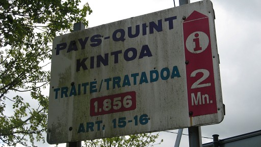 |
I make a picture of the roadsign before the venta saying there’s
information about Pays Quint at 2 minutes distance. We drive
several kilometers into Spain but don’t find anything of that kind. |
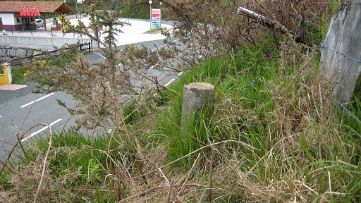 |
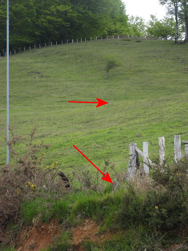
I spot another probable submarker in front of the Venta at
the edge of the meadow which ascends to the north. Needs a little
climb to reach it.No number or sign on this round little stone. |
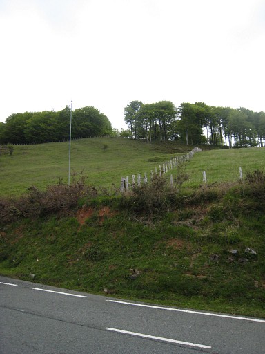 |
We're looking approximately in the direction of the borderline to bm136 which is located in the forest behind. |
|
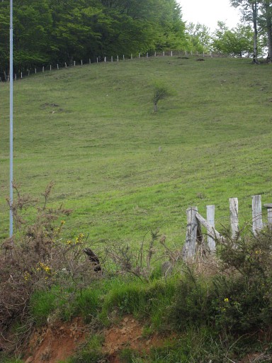
Like the other stone higher up in the
middle of the meadow, the round stone is approximately on a straight
line from bm136 to bm137. Move the mouse over the picture to see the two supposed bordermarkers. |
 |
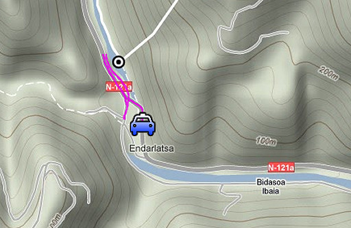
esfr-trip-track-20100511-trip3.kml (click to open in Google Earth or copy link to Google Maps; click right on this link to download gpx-version) Trip 3: photographing bm001 from the other side of the Bidasoa-river. Via Sare we drive to Endarlatsa, to the old bridge over the Bidasoa-river, close to bm001. |
 |
For explanation of
the gps-coordinates and other cartographic backgrounds: see my cartography page |
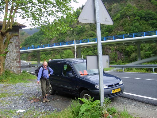 | Parking near the old bridge, the new bridge in the background. |
 |
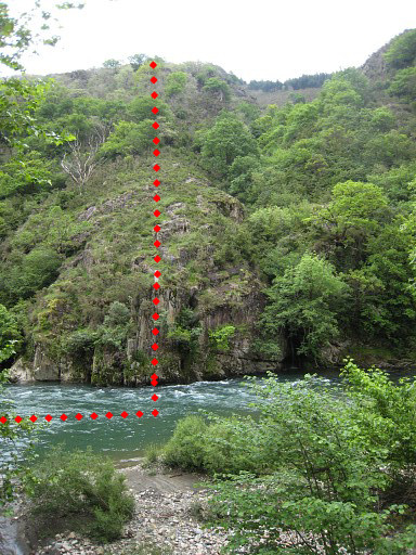
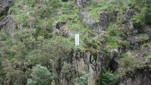
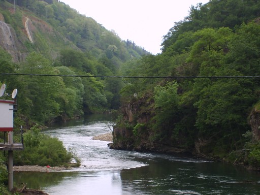
From the Spanish side I make a lot of pictures of bm001, |
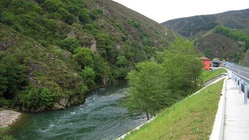 |
Taken from the new road, a bit lower
is the old road, converted into a bycicle-trail. Bm001 is well
visible at the left bank of the river. At the far end of this picture
both old and new bridge cross the river. However, there’s no trail leading from the bridges to bm001, it’s too steep there anyway |
 |
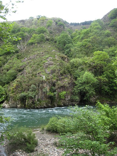
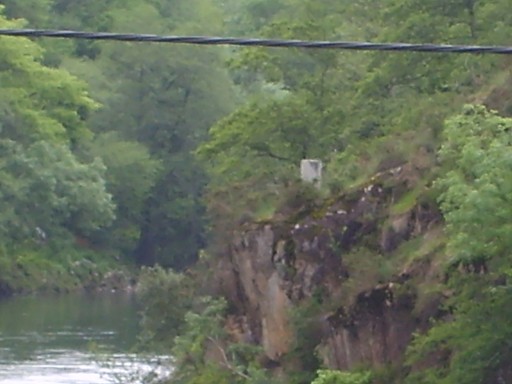
Another zoomin from bm001 |
|
But I can see that south of the steep
ridge of the bm there is a sort of cleft, large and well recognizable
if you come from that trail from the north. (see 20090402 ) If you reach that cleft, you have to go straight down on the ridge to find bm001. Other indications: on top of that cleft (which is Spanish) you can see conifers naaldbomen. On top of the ridge of the bm there’s a larger distinctive rock. And from above you should be able to see the new bridge and road as an orientation-points. This should be enough indication for the walker coming from the north on the variant-trail to see where he should descend for bm001. Move the mouse over the picture to see the borderline |
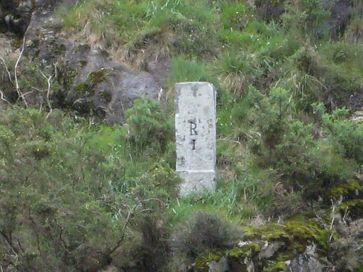 |
Zoom-in |
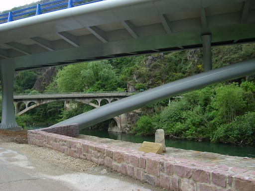 |
Under the new bridge, in the background the old bridge. Photo by Jan-Willem |
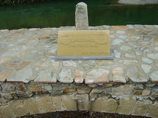 |
A monument, it looks like a mini-bordermarker but it seems to have no relation with the esfr-bordermarkers. Photo by Jan-Willem |
 |
Taken from the old bridge. Photo by Jan-Willem |
 |
Another zoom-in from bm001. Photo by Jan-Willem We had planned to stay our last night in Sare. But back at the car we decide spontaneously to drive back home to Holland immediately. End of a pleasant and productive journey to the Basque country. |