|
The
bordermarkers of the Pyrenees : all my trips
 |
|
| -
9 july
2010 - Without stick and pole |
 |
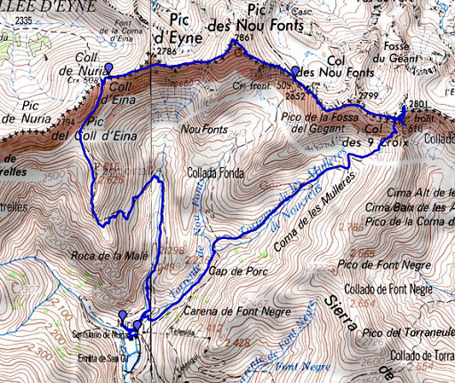 |
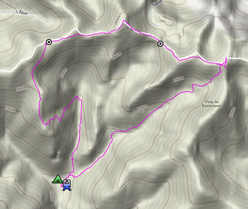
esfr-trip-track-20100709.kml (click to open in Google Earth or copy link to Google Maps; click right on this link to download gpx-version) A daytrip from the pilgrimage-site of Nuria, in search of bm508-510 |
 |
For explanation of
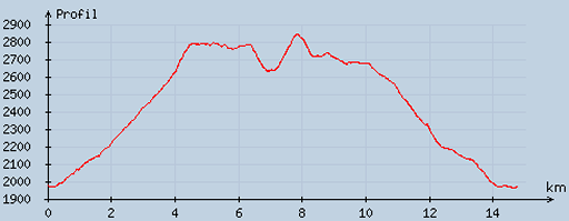
the gps-coordinates and other cartographic backgrounds: see my cartography page According to the gps-tripteller: Distance: 16km Duration: 7.27h (while moving 5.11, while standing still 2.16) Elevation up: 1327m Highest point: 2849m |
 |
According
to visugpx - distance : 15,1km - cum. elevation gain : 1075 - cum. elevation loss : 1085 - total elevation: 2160 - altitude maxi : 2841m - altitude mini : 1965m - altitude average : 2465m |
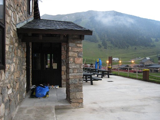 |
Starting about 7am
from Nuria. I slept the night under a porch because I forgot
the poles of my tent. Earlier that day my walking-stick was confiscated at the airport. |
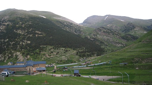 |
Leaving behind the Nuria-complex
with its church, museum and hotel |
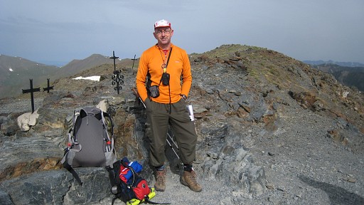 |
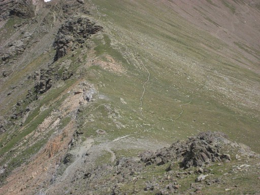
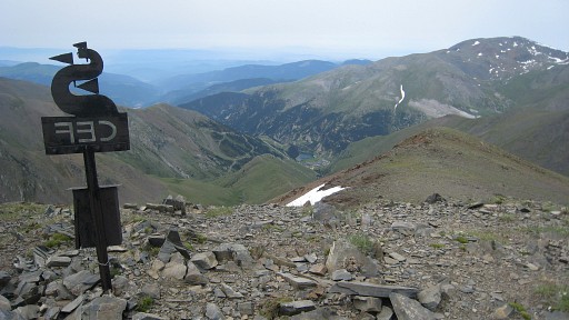
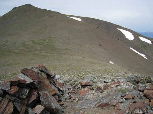
In approximately 2
hours to 'Col de Nou Creus" where bm510 - a bordercross - should be. I was here before on 13 july 2005 and couldn't find it at then. Behind me - posing on this picture - there are a few remembrance crosses at the western edge of the path that crosses the borderridge. Now I have the description of the Procès-Verbal with me but I still can't find bm510. |
 The original text: "510. On passe au pic de la Fosse-du-Géant pour aller au col des Tres-Créous,où l'on a gravé une croix sur une roche légèrement inclinée vers l'est, sur le bord occidental du chemin, et à 6 mètres de la ligne de faîte du côté de l'Espagne. 511. Après avoir passé au premier pic de la Vache, au col des lacs de Carença ou de las Arenas, ...." |
The description is
quite precise: "at the western edge of the
path at 6 meters from the watershed on the French side" in my own
translation. Writing this down, I realize that I mixed up the French and Spanish side of the watershed but I've searched all around at and close to the pass. On this picture we look from east to south on the very pass, the crosses just beyond the path |
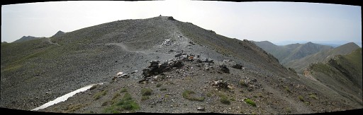 On this panorama, we see the pass now from the west, the actual pass just beyond the crosses. Coming from the right, the path continues to the left - on French soil - and crosses the next coll, entering again in Spain. |
I
considered also the possibility that the pass mentioned in the PV
"Col des Tres-Creous" might be the next one ("Col de Caranca") instead
of Coll de Nou Creus. But that doesn't make sense with "the western
edge" of the path. The 25K French map shows a localisation just to north of Col de Caranca. But I also searched there in vain. |
|
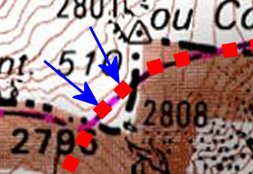
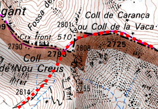
If we look closer
at the map and combine it with the picture above, we can draw (in red
dots) the path crossing the two colll's. Assuming this is the same
trail as back in 1866, we can establish the most likely spots according
to the description in the PV. Or did I make a misstake somewhere? Anyway: bm510 not foutnd. Move the cursor over the map to see those most likely spots. |
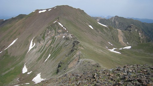 |
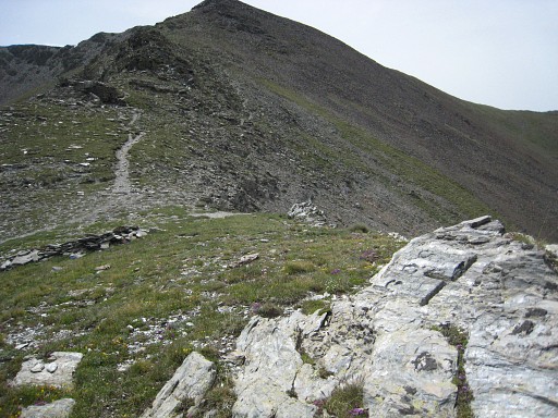
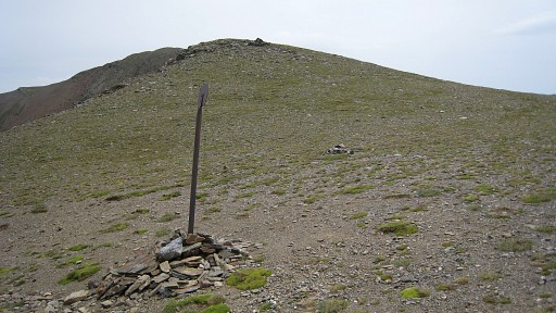
I
give up and continue westwards on the borderridge towards bm509, that's
± half an hour of walking. On this picture: Col des Nou Fonts - where bm509 is located - , seen from the east. |
|
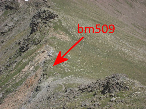
Thanks to the
pictures of Alain Laridon finding bm509 is easy. Its location fits
also exactly with the PV-description. Move the mouse over the picture to see where bm509 is. |
 |
Bm509 itself,
looking back at the pass |
 |
Bm509,
looking in the direction of Nuria. |
 |
Bm509 with some
chalk |
 |
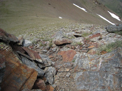
To bm508 takes more
time to reach but
but the path is well and follows the ridge. However: Pic d'Eina needs
not to be conquered, a path goes underneath on the Spanish side. On this picture - somewhere between bm509 and 510: looking at Nuria, far far away in the valley. |
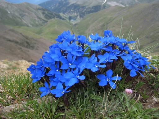 |
And there's more to
enjoy then bordermarkers alone. |
 |
At
(better: while approaching) Coll d'Eina, the Procès-Verbal description
becomes very useful:
approximately 100 meter from the coll itself to the east at the
watershed, I find a cross in a rocky outcrop. We see the pass with its metal pole further down. |
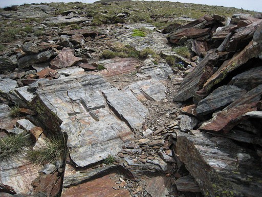 |
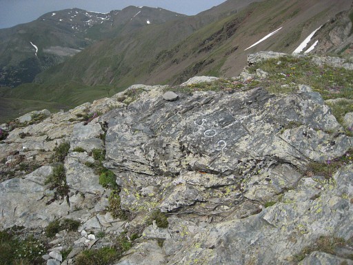
However, there's
no number, that part of the rock seems to be broken off. But the spot
fits perfectly with the PV and the size and style of carving resembles
that of bm509. My conclusion: this must be bm508. |
 |
Bm508, looking down
on the pass. |
 |
On the pass itself,
looking back at the rocky outcrop with bm508, on top of the 'hill'. Then: a long and fatiguing descent to Nuria. I continue by train to Puigcerda and take a hotel there. . |