|
The
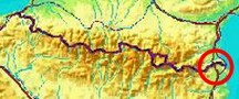
bordermarkers of the Pyrenees : all my trips
 |
|
| -
21 may
2011 - Sailing to bm602 |
 |
 |
Summary:
part of a 7-days trip to the Pyrénées Orientales with
Jan-Willem.
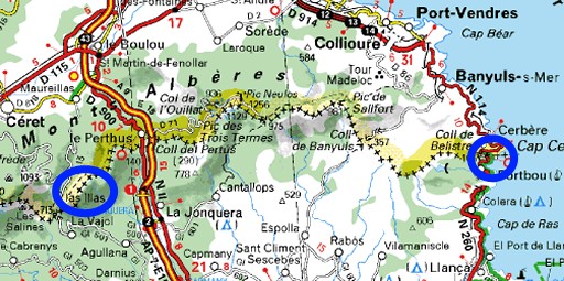
Mainly reconnaissances of routes. Supreme highlight: sailing to bm602 on day 1. Day 1: a small trip near Las Illas, then driving to Portbou for a boat-trip to bm602! Weather: sunny, warm |
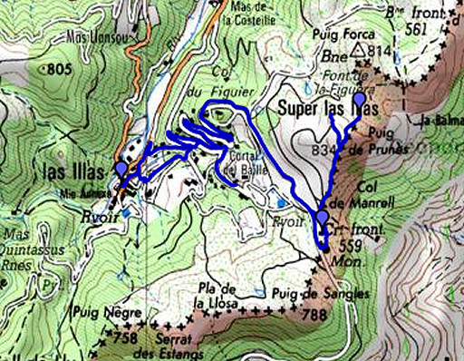 |
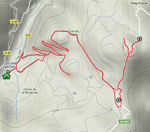
esfr-trip-track-20110521-trip1.kml (click to open this trip in Google Earth or copy link to Google Maps; click right on this link to download gpx-version) Trip 1: a reconnaissance from Las Illas of a direct route between bm559 (Col de Manrell) and bm560. |
 |
For
explanation of
the gps-coordinates and other cartographic backgrounds: see my cartography page Time en route: 3.15 (10 - 13.15) |
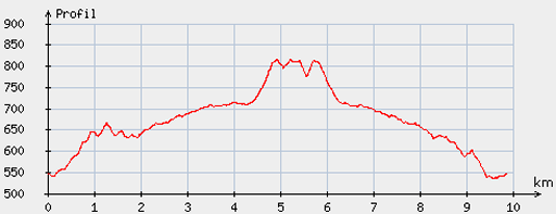 |
According
to visugpx - distance : 9.95 km - cum. elevation gain : 341 m - cum. elevation loss : 350 m - total elevation: 691 m - altitude maxi : 815 m - altitude mini : 535 m - altitude average : 694 m |
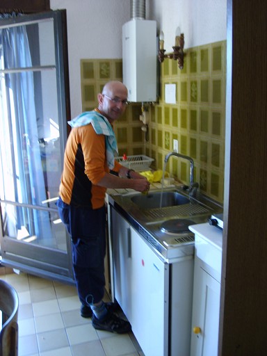 |
Someone has to do the dish-washing. The previous day we drove from Holland to Las Illas, arriving there around 9 pm. The landlady of the Gîte d'Étappe slept already and had to be persuaded to give us access to the Gîte. Later on she was very friendly and hospitable. The gîte is speckless. She wants to stop next year with the care-taking of the gîte and fears that the young people in the village are too lazy to take her job over. (photo by Jan-Willem) |
 |
In
Las Illas, we walk to the roundabout with the busstop and the monument,
climb uphill along the road, later on joining the GR10-trail. We try a shortcut to Col de Manrell but the tarmac road becomes a private road. That sign however, doesn't look very official. On Google Earth I saw later that it indeed seems to end at a private property. We return and take the winding detour, following the GR10. Good to know: a fountain at the beginning of the long straight dirtroad to Col de Manrel. We have just left the GR10. |
 |
At the Col with its monument,
the dirtroad becomes a perfect tarmac road on Spanish soil. Note that
there's a territorial dispute between France and Spain about the
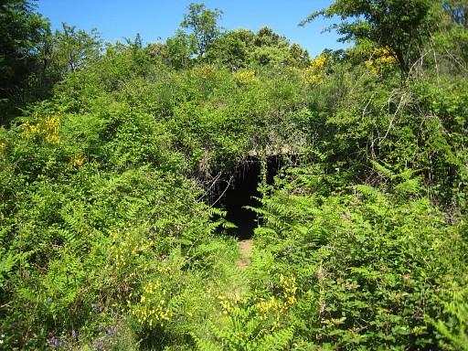
monument. Spain claims that it is on Spanish soil. At he Col before the monument, we take the path to the left. It leads you along this bunker-like dungeon at your left hand. A bit further (± 25 m.), just beyond a large stone, there's a trail going into the bush at your left. |
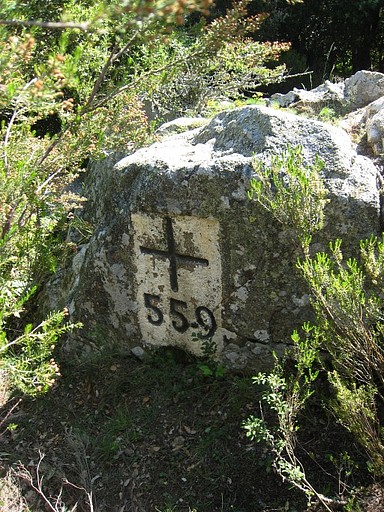 |
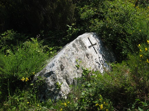
It will bring you after 25-30 m. at a rocky outcrop with - at its western side - bm559 |
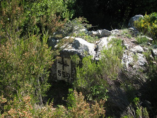 |
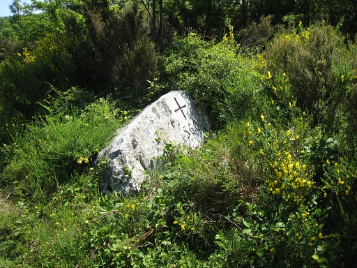
Bm559 |
 |
We
return to the path and continue untill it bends to the right. At that
point, there's a shortcut northwards through the forest to another
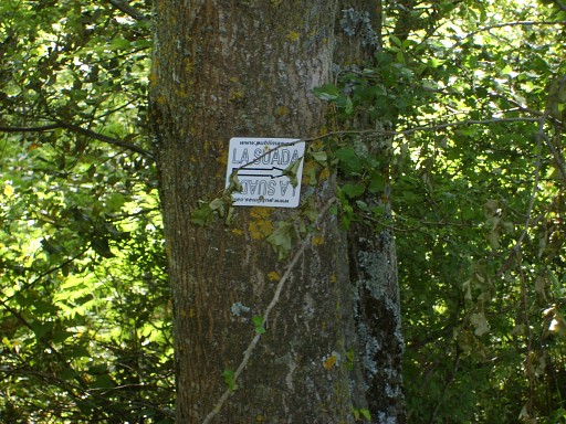
trail which has just started from the dirtroad. That's the one trail we're looking for: it follows roughly the borderline to bm560. We find back the blue waymarks which - I discovered on 25 march 2011 - guided me from bm560 to bm562. There's also another waymarking: "La Suada") and - after some googling - it turns out to be a trail-running parcours which partly follows our route of today. See this link (photo by Jan-Willem |
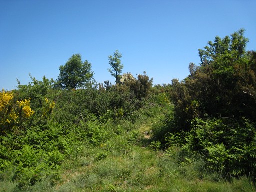 |
Following the blue waymarkings is easy
but at one point you may miss a bending and end up here with a large
rock formation in view. |
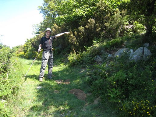 |
We return and find that point, JW is willingly showing where to go. |
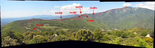 |
Then we pass
a terrific viewpoint (see next picture). The panorama shows
the border to the west. Click here to see an enlargement. |
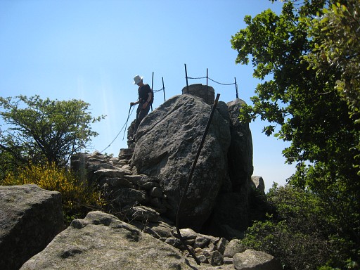 |
And this is that viewpoint, a large boulder equipped with stairs and protection. |
 |
We're
close to bm560, it needs some descending. |
 |
Bm560 |
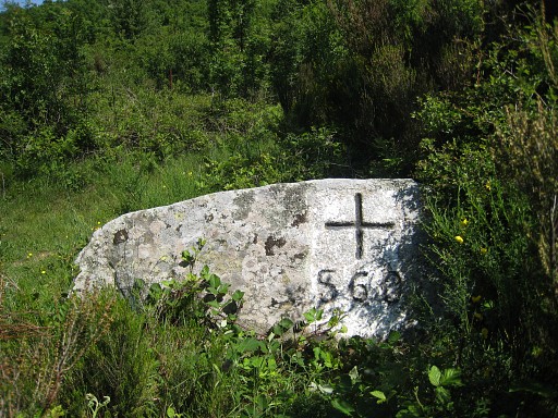 |
Bm560 |
 |
We return on the same trail, now
sticking to the GR10 once we join it. We don't loose our attention for nature's beauty as this picture proves. We heard a golden oriole sing. (photo by Jan-Willem) |
 |
Back at the Gîte d'Étappe and preparing for our second trip. We have to drive to Portbou. |
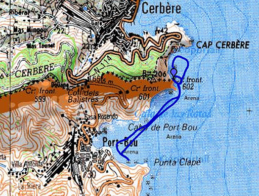 |
esfr-trip-track-20110521-trip2.kml (click to open this trip in Google Earth or copy link to Google Maps; click right on this link to download gpx-version) Trip 2: boattrip to bm602 |
 |
For
explanation of
the gps-coordinates and other cartographic backgrounds: see my cartography page Time en route: ± 15.45 - 16.45 According to Google Earth - distance : 4, 1 km |
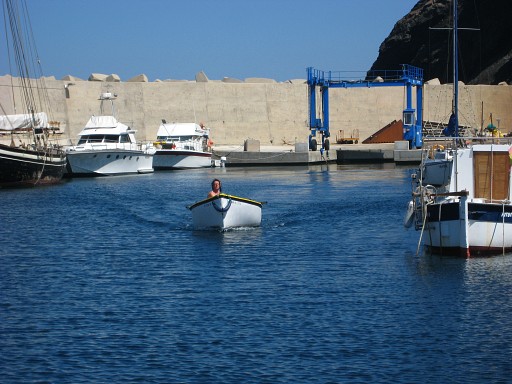 |
I have an appointment with Xarly Sol, he works in the harbour of Portbou. It wasn't easy to find someone to sail us to bm602. The two diving companies in Portbou and Cerbère didn't answer or had quit the business. The tourist information of Cerbère didn't respond. But we were very lucky that Teresa from the Portbou tourist information made an effort and came up with Xarly. Today, the weather is fine for sailing. |
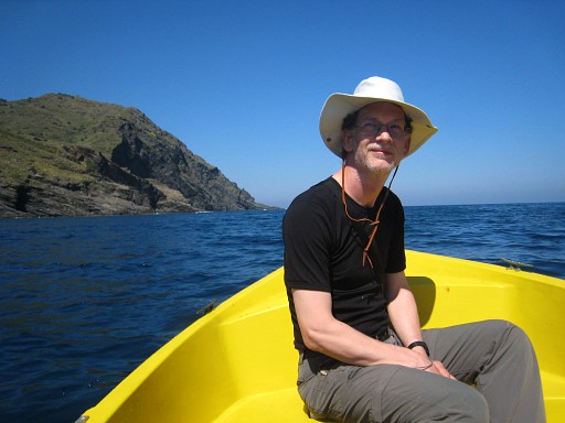 |
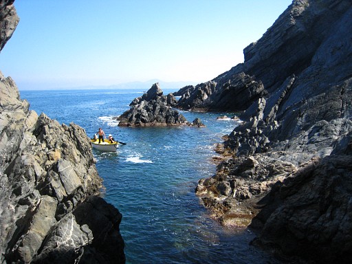
In the boat, Jan-Willem is silently awaiting the course of events. |
 |
But by now has taken his camera to record what will happen. (photo by Jan-Willem) |
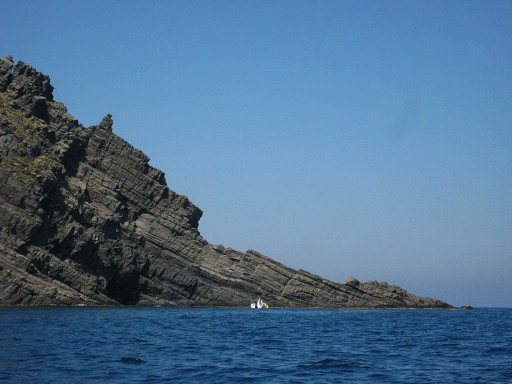 |
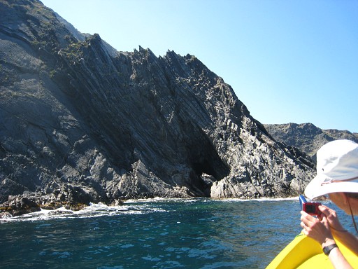
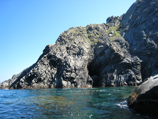
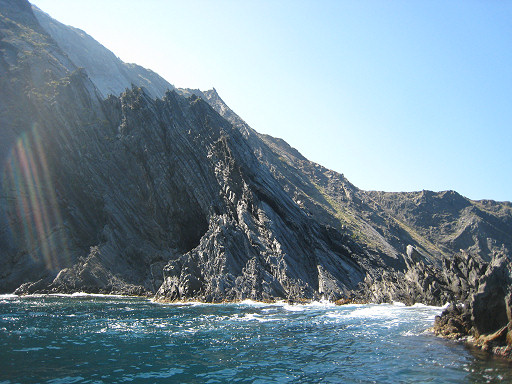
This is the cliff we have to sail around. According to Xarly resembling a praying figure. We recognize a face in silhouette. |
 |
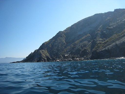
Going aroung that cliff |
 |
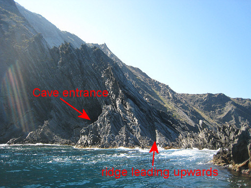
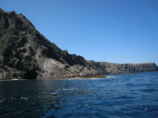
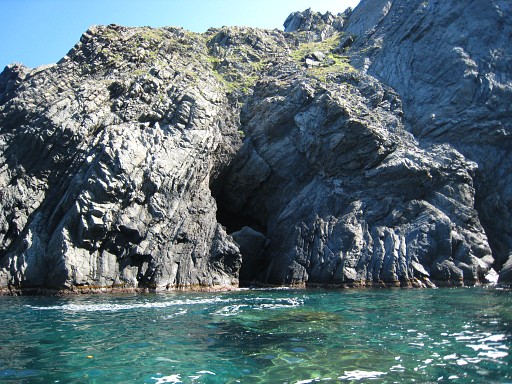
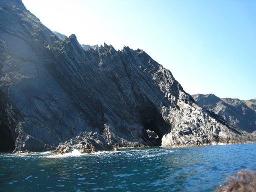
and the Cova Forada comes in sight. |
 |
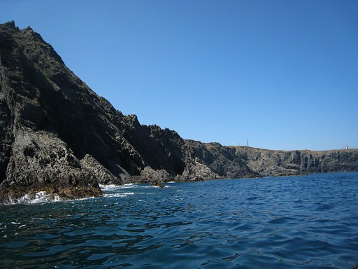
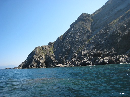
The tunnel-like aspect of the cave becomes visible. |
 |
And more visible. |
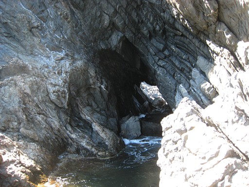 |
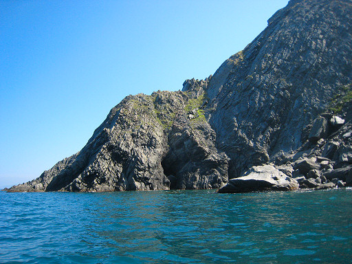
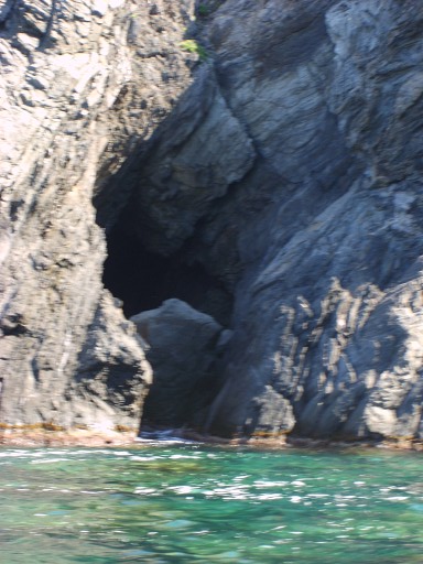
The waves are still to
strong - or the boat too deep? - to sail to the very entrance of the
cave, as seen on this picture. I wonder if you need a rubberboat anyway
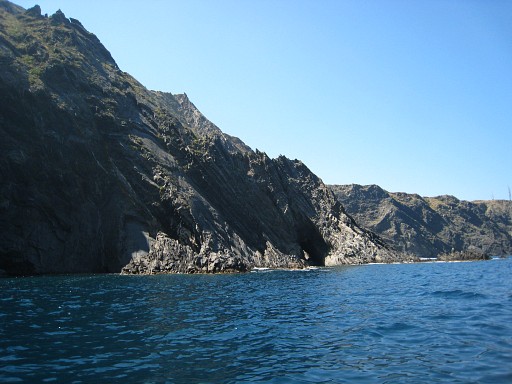
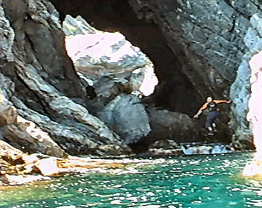
to reach that entrance. I have to disembark at the rocky side. At first sight, it seems to difficult to reach the cave along this rocky side. But it is possible with a little bit of rock-climbing. This picture: I'm on the the rocks by now, looking forward to the cave. |
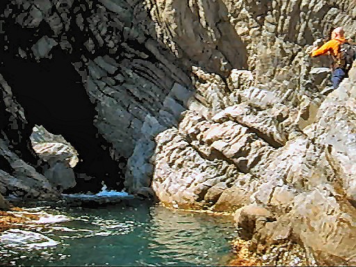 |
At approximately the same time, this is how Jan-Willem filmed me from the boat. (film-shot by Jan-Willem) |
 |
I'm closer now to the entrance. The tile on the left side of the cave is now visible (the shiny spot). |
 |
And getting into the cave. (film-shot by Jan-Willem) |
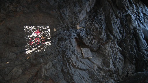 |
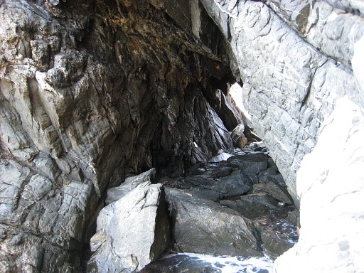
Bm602, both markers |
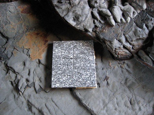 |
The newer tile |
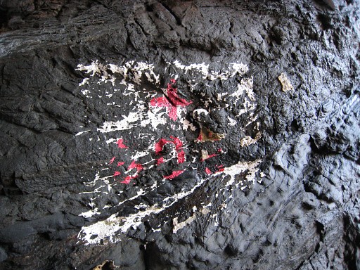 |
and a older and faded marker. |
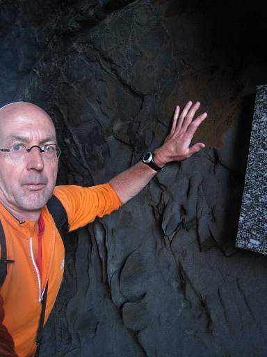 |
I try to make a selfportrait as a proof of my conquest but wasn't quite successfull. I should have looked happier anyway. |
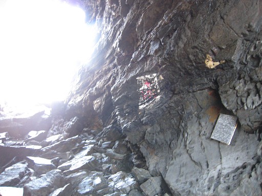 |
Bm602, looking to the southern entrance. |
 |
Looking out of the northern entrance. You might climb out of the cave here and possibly reach the coastline but it could also be too steep |
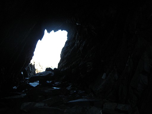 |
The north entrance. |
 |
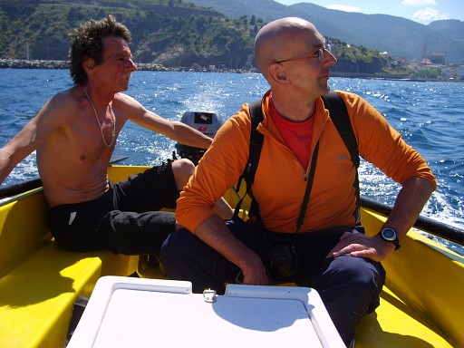
It's time to leave the cave. Xarly and Jan-Willem are waiting. |
 |
Once in the boat, we make a loop to the north to see the other side of the cave. Now w're approaching the cave from the northside. I'm curious if there's a route possible from above to the cave. |
|
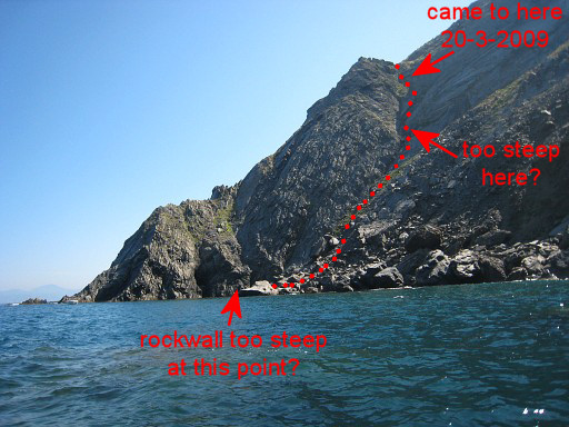
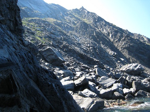
If you look at the slopes, descending
to the cave seems possible to descend. But views like this might be
deceptive, especially when the camera was zoomed in. Move the mouse over the picture to see a possible route downwards. |
|
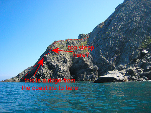
A bit closer, this picture shows better a rock-ridge which leads from the coast-line upwards. Move the mouse over the picture to see what I mean. |
|
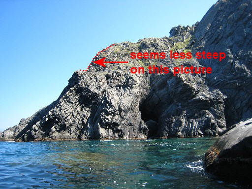
Close to the cave now, at its other side. Move the mouse over the picture to evaluate the steep part again. |
 |
Now you can spot the big rock which blocks the entrance at this side. And top-left: that steep part seems now manageable on this picture. Climbing along the coastline to this entrance seems too difficult. But to be honest: taking in account all pictures and video's, I think it's too steep to handle for a plain mountainwalker like me. However, it's should be a piece of cake for a rockclimber. |
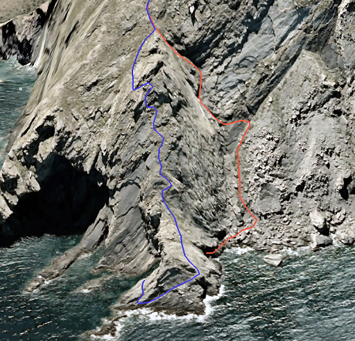 |
I suggest two possible
routes - drawn in Google Earth - from bm601bis to bm602. As said
before: you'll most likely need rockclimbing skills to do this safely. - the red one descending to the northern entrance - the blue one descending to the southern entrance In both cases (according to GE) an elevation of ±180 m. and an average slope of ± 50%. Check the routes for yourself on GE with this kml-file |
 |
Back to the cave, the nothern entrance in close-up. Xarly tells us that in former days, - ± 10 years ago - you could still sail through the cave. Smugglers loved that. Apparently, part of the ceiling has fallen down. (photo by Jan-Willem) |
|
Then returning to Portbou, sailing around the cliff. Move the mouse over the picture to see that ridge, mentioned above. |
 |
A last view of the Cova Forada. I'm very, very content. In Portbou we eat paella to celebrate this victory and drive back to Las Illas. Xarly Sol is willing to sail other people to bm602. A round-trip takes about one hour and we payed 50 euros. You'll probably need to do a little rockclimbing as I did. Sailing is always dependant on the weather. Xarly is on Facebook but is more accesible by telephone: +34 647 054 868 But there's another possibility: with a kayak! See this blog-post |
| And perhaps
you'll like the video, made by Jan-Willem. (or watch it on Youtube) |
|