|
The
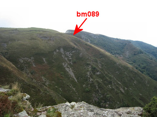
bordermarkers of the Pyrenees : all my trips
 |
|
| -
15 august
2011 - Bm087 found! |
 |
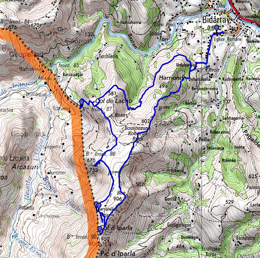 |
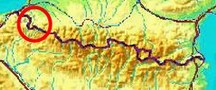
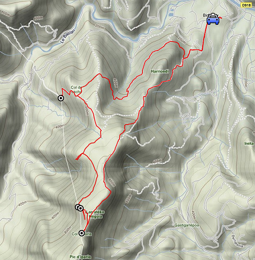
esfr-trip-track-20110815.kml (click to open this trip in Google Earth or copy link to Google Maps; click right on this link to download gpx-version) Summary: part of a 3-weeks trip to the Pyrénées to 'do' the ± 60 remaining bordermarkers. All done as daytrips from campings. Day 1: roundtrip from Bidarray, main target being bm089. Weather: warm, changing continuously up on the crête from open skies to cloudy. |
 |
For
explanation of
the gps-coordinates and other cartographic backgrounds: see my cartography page En route (±): 10.30 – 15.45 (5.15h) According to the gps-tripteller: Distance: 15,7 km Cum. elevation gain : 991m Total elevation: 1982 Maximum height: 947m Time: 5.22h |
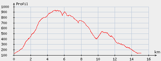 |
According
to visugpx - distance : 15,4km - cum. elevation gain : 1068m - cum. elevation loss : 1067m - total elevation: 2135m - altitude maxi : 935m - altitude mini : 135m - altitude average : 550m |
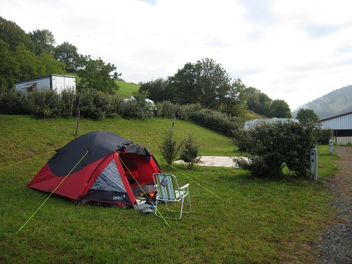 |
Yesterdag I drove from the Netherlands to St-Étienne-de-Baïgorry, to this camping. My first base-camp. |
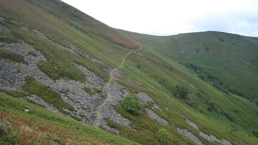 |
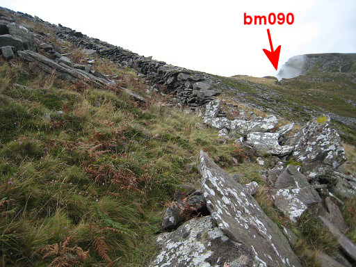
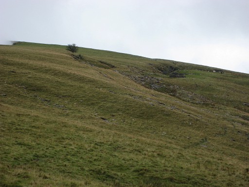
Driving to Bidarray, picking up the GR10-trail to bm090 (loosing the
trail in between and joining it back on the other side of a
hill-ridge). It seems that the GR10 has taken another track: more directly to the Iparla-ridge and then following it to bm090. I might be wrong. |
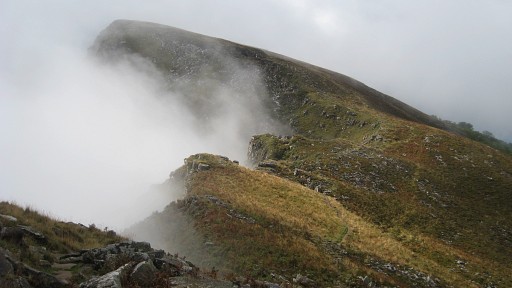 |
Clouds drifting in from the precipice on the French side. |
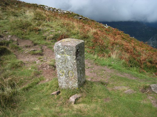 |
Bm090, with some chalk. |
 |
Bm090, looking NE. |
 |
Bm090, looking N in the direction of the borderline. |
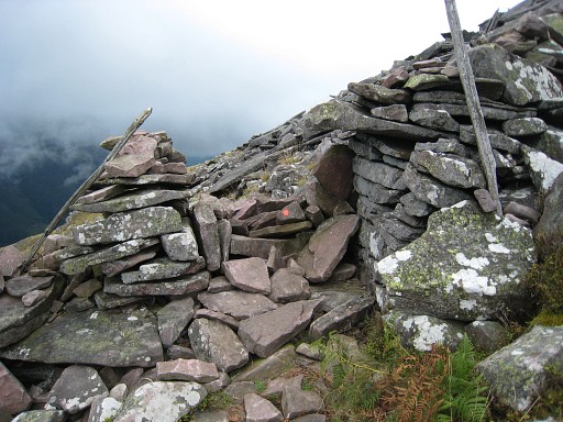 |
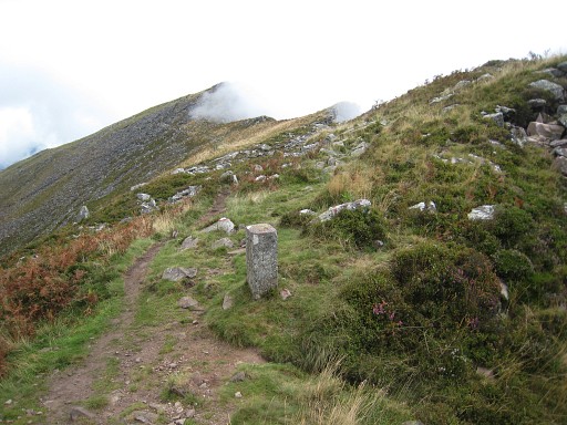
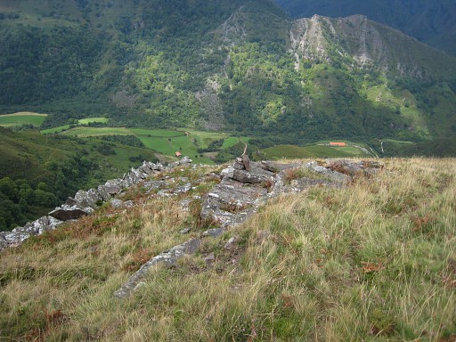
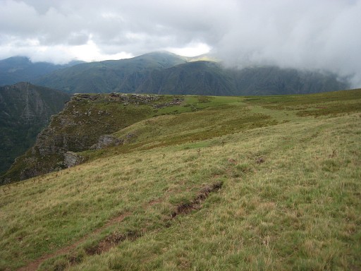
From bm090, I walk back on the GR10 until a bifurcation, taking
the ‘purple’ trail to the left. It soon passes through a 'gate' in a wall (this picture). To get directly to bm089, follow after the gate the wall on the left which descends rapidly and then changes in a wall made of vertical stone slabs. I wandered off too far to the E on the purple trail and had to return to that wall. |
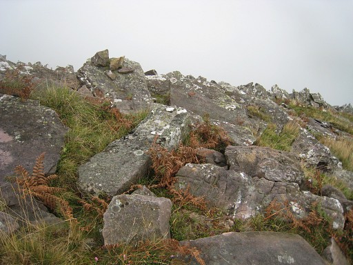 |
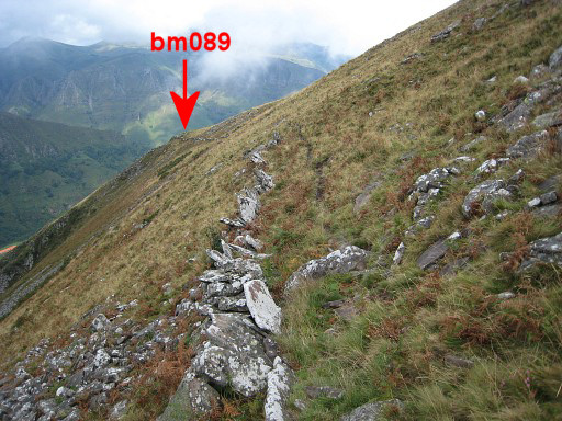
There's a cattle trail parallel to the stone slabs
wall. At a certain point it passes a sort of rim and then
- after ± 15 m -you’ll find bm089. Not at once because it lies unsuspiciously between a bunch of rock, say 5-10 from the stone slabs wall. Note the cairn. |
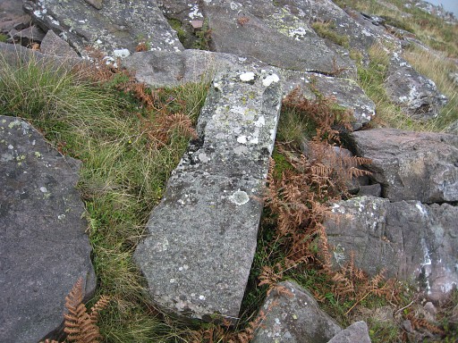 |
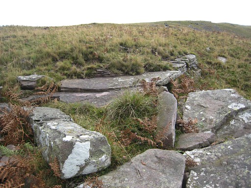
Bm089 |
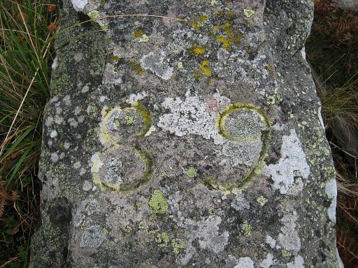 |
The shape and engraved number are convincing: this is THE bm089. On 6 may 2010 I found a different marker in the vicinity which I believed to be bm089. |
 |
Bm089
|
 |
Bm089, you can see the stone slabs wall in the background. |
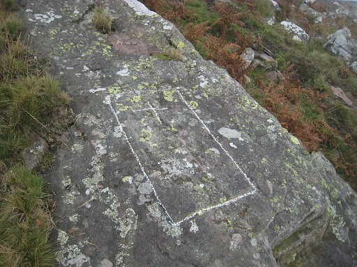 |
I also revisit the engraved cross in a rectangular frame about 50m uphill on a horizontal rock. As said before, on 6 may 2010 I thought it to be bm089. Cross and frame resemble other border-crosses, e.g. bm088. The number seems to be weathered away. I still believe that this cross-in-a-frame was meant to be (a replacement for) bm089. |
 |
I explore the route along the stone
slabs wall in the direction of bm090. This is the point where the stone
slabs wall changes in a normal wall. Here you might cross the wall and head straight to Col d'Iparla. |
 |
And here I'm looking back along the stone slabs wall in the direction of bm089. |
 |
The sky has cleared, making better pictures possible. Back at 'the cross', beyond the rim is bm089. |
 |
And after the rim, the cairn locating bm089 is now well visible. |
 |
Bm089 |
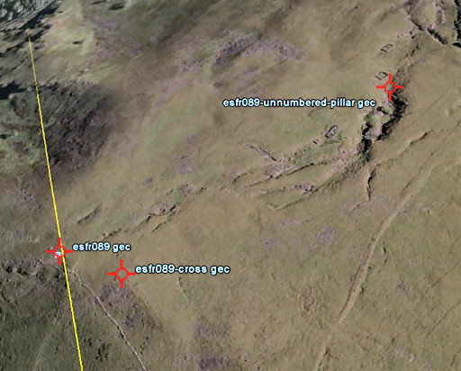 |
Note: nearby - about 250m - there’s a mysterious unnumbered marker lying flat. We found that one on 6 may 2010 |
 |
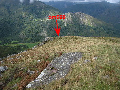
From bm089 I make - more or less remaining at the same level -
a semi-circle to the N. This picture: looking back with |
 |
this zoom-in to show the groove where you can find that mysterious unnumbered borderpillar, lying flat. |
 |
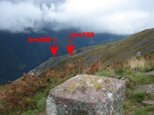
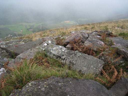
At the end of the semi-circle (on this picture: the cliff at the far end), I can see from above the spot of bm088. |
 |
At that cliff, looking back in the direction of Col d'Iparla with the approximate location of bm089. |
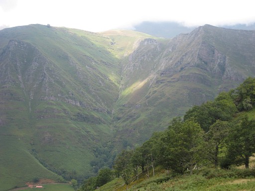 |
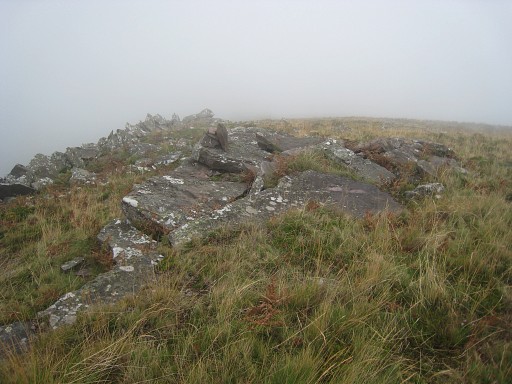
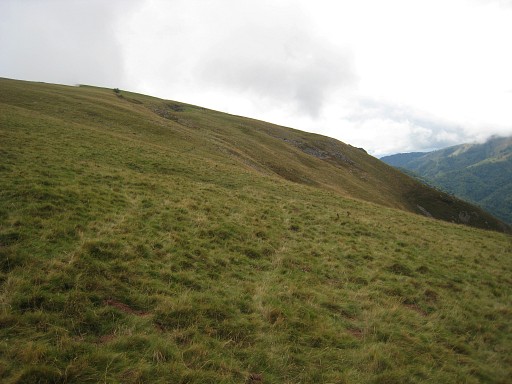
From that cliff, I make another semi-circle to the N, towards bm087. This picture, looking NW: a view of the ravine which is the borderline between bm084 and bm085 |
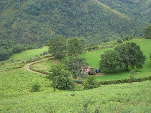 |
I want to have a view from above of the location of bm087 which has disappeared. However, I see two men working at the barn and go down to ask them about the fate of bm087. I |
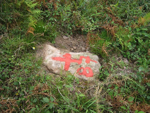 |
One of them tells me that it was destroyed by Basque nationalists but
that - apparently recently - a cross and number was painted at
the base stone of the destroyed marker. That marker was similar in shape to bm086. The damages on that last one is also caused by those vandals, he tells. And it’s true: at the opposite of the dirt-road, I find easily that stone at ground level! |
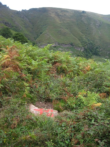 |
Bm087, looking SE |
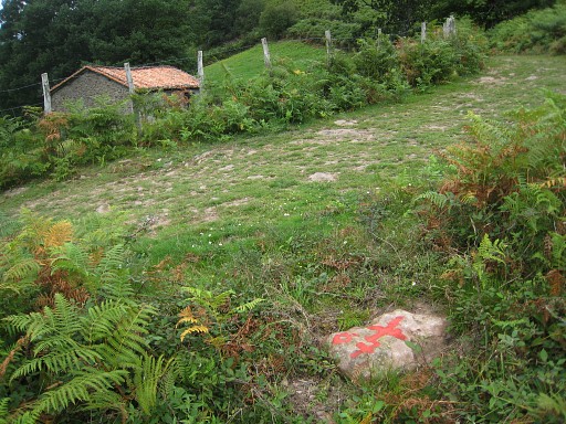 |
Bm087 with the barn. I’m happy with this discovery. But some questions remain: - is it really the original spot of the disappeared bm087? - and when did it disappear? |
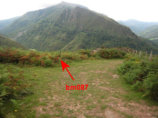 |
And a last picture of its location, my walking stick planted at that spot. |
 |
I climb back, pick up a yellow trail and return to Bidarray (changing yellow for purple when they bi-fork). |