|
The
bordermarkers of the Pyrenees : all my trips
 |
|
| -
17 may
2012 - Hot & oppressive |
 |
 |
Summary: part of a 6-days trip - accompanied by Jan-Willem Doomen- with
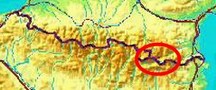
daytrip-targets in the Basque country, near Fos and around Puigcerda. Day 6: two targets: revisiting the Llivia-bordermarkers 18-20 and exploring a route from Palau-de-Cerdagne to bm496-497 Weather: it's a hot day, oppressive |
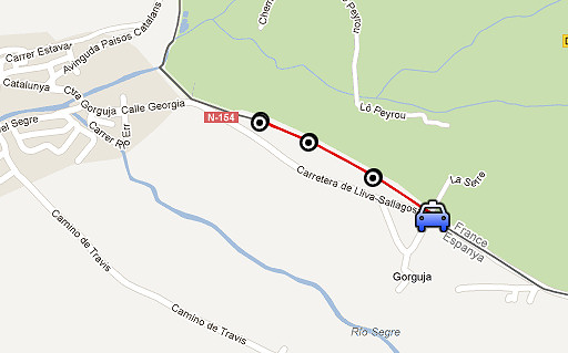 |
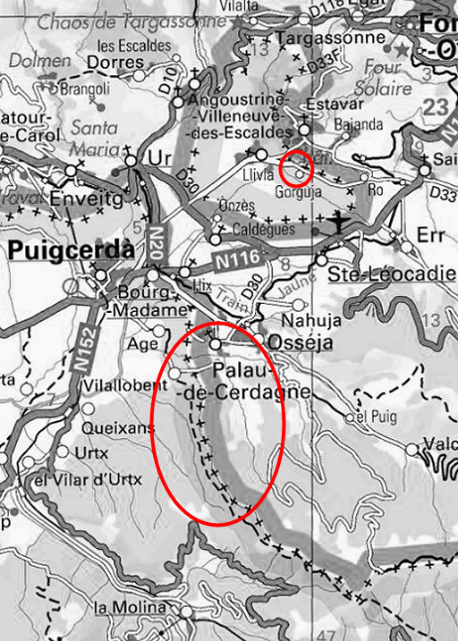
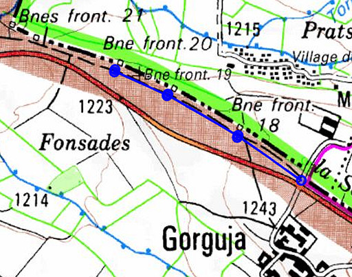
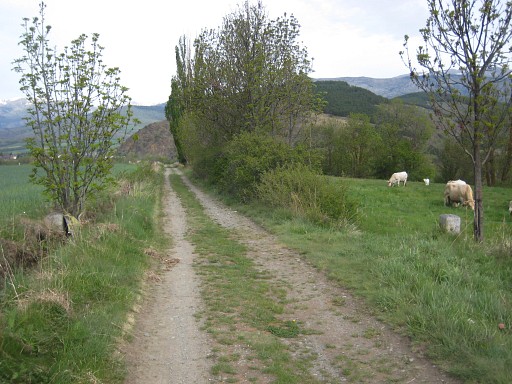
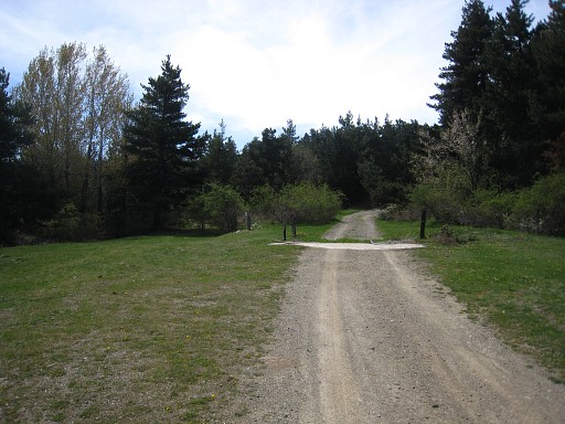
Trip 1 esfr-trip-track-20120517-trip1.kml (click to open this trip in Google Earth or copy link to Google Maps; click right on this link to download gpx-version) On our way to Palau-de-Cerdagne, we make a stop near Gorguja to redo the double Llivia-bordermarkers 18-20. Back on 20020828 I didn't photograph each one seperately. |
 |
For
explanation of
the gps-coordinates and other cartographic backgrounds: see my cartography page It's a short and easy stroll of about 1,3km on a dirtroad. |
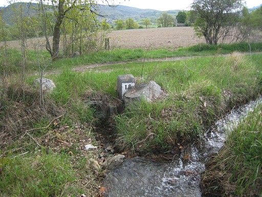 |
LL18fr, with a glimse of LL18ll on the other side of the dirtroad |
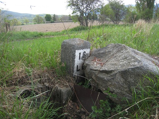 |
LL18fr |
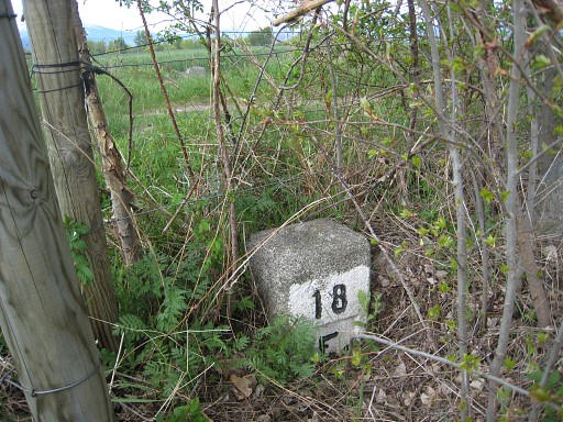 |
LL18ll |
 |
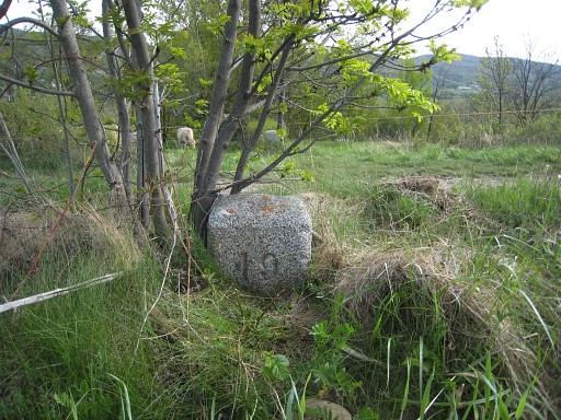
LL19, both markers (left Lliva, right France) |
 |
LL19ll, with LL19fr in the background |
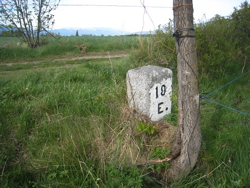 |
LL19fr, with a glimpse of LL19ll in the background |
 |
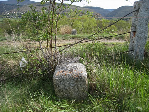
LL20fr with a glimpse of LL20ll on the other side of the road, just under the fence. |
 |
LL20ll with LL20fr in the background |
 |
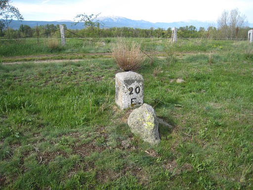
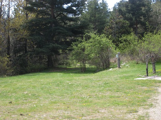
LL20, both markers (left Llivia, right France) |
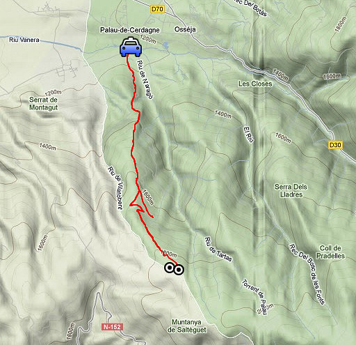 |
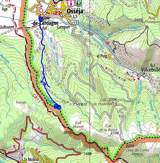
Trip 2 esfr-trip-track-20120517-trip2.kml (click to open this trip in Google Earth or copy link to Google Maps; click right on this link to download gpx-version) A survey of a route to bm496 from Palau-de-Cerdagne On 20050711 I took the GR11-trail on the Spanish side which brings you neatly to bm500 but forces you to descend back along the borderline to 'do' bm499 to 496. |
 |
For
explanation of
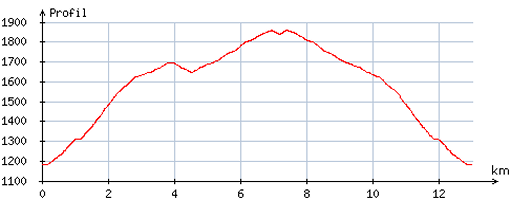
the gps-coordinates and other cartographic backgrounds: see my cartography page En route: 11.15 - 15.15 (4h) According to the gps-tripteller: Distance: 13,3 km Cum. elevation gain: 695m Total elevation: 1390m Maximum height: 1865m Time: 4.08h |
 |
According
to visugpx - distance: 13,1 km - cum. elevation gain: 724m - cum. elevation loss: 718m - total elevation: 1442m - altitude maxi: 1858m - altitude mini: 1183m - altitude average: 1578m |
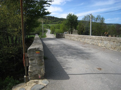 |
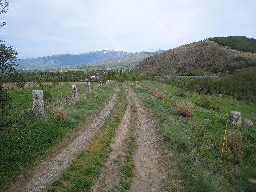
I explored this alternative route at forehand at maps and Google
Earth. We start at this bridge, at the south-edge of Palau-de-Cerdagne. |
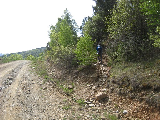 |
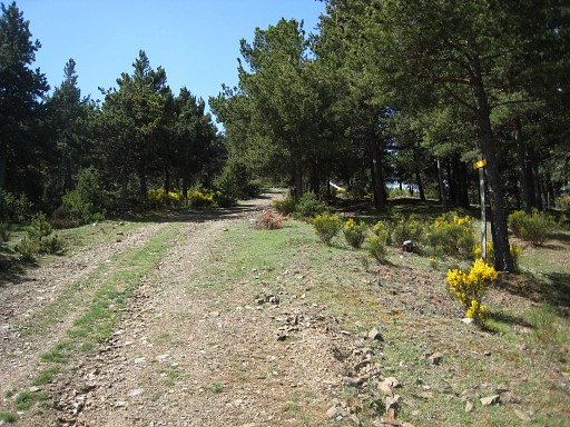
The route uphill to bm 496 ) is for a large part waymarked with yellow stripes (though not abundant).
It shortcuts the lacelets of the dirtroad, like here |
 |
and here. |
 |
Watch the yellow waymarks on the ground |
 |
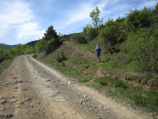
And here we go again (left) on a shortcut |
 |
bringing you to this cattle gate. Pass the gate, go right and continue uphill. |
 |
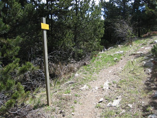
Further on we come along this yellow signbord, |
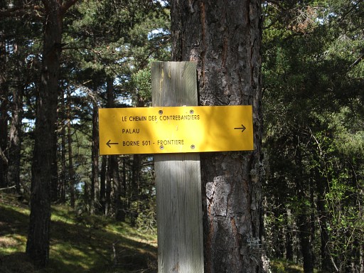 |
confirming we are on the right trail. |
 |
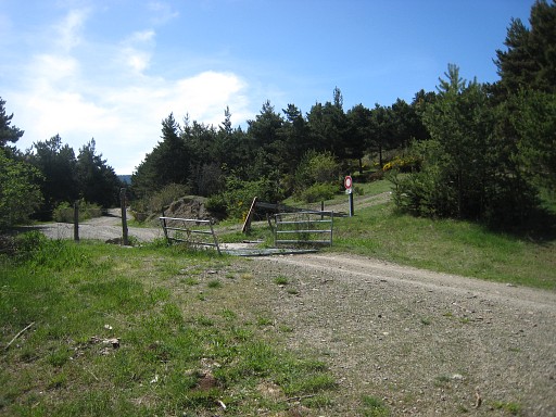
But then we reach a bifork. At this cattle gate, the yellow trail takes another course than our planned route. |
 |
It leaves the dirtroad and branches left of the cattle gate |
 |
and follows this path towards the cabin of Jaca de Palau and further to bm501. It took some time before I realized my mistake and we return to |
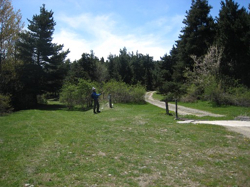 |
the cattlegate. Jan-Wilem shows where to go. So: at this point you have to forget the yellow trail and pass the cattle gate and continue on the dirtroad. |
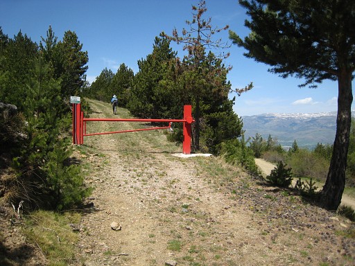 |
That dirtroad makes further on a sharp bend. A bit later you'll see a dirtroad sharply branching to the right, you can't miss it with its red gate. This last last dirtroad will - after a bend - approach the borderline. Then it will climb parallel to it (75m or more) and - after becoming a trail - arrive at bm499, 500 and 501. |
 |
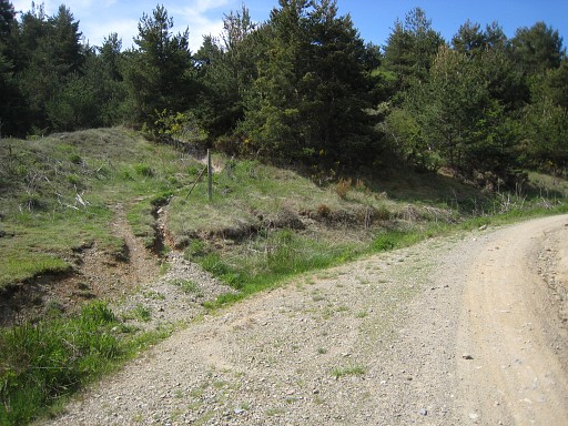
But we don't go that far. When the slope flattens, you'll spot at this point to the right |
 |
at approximately 75m |
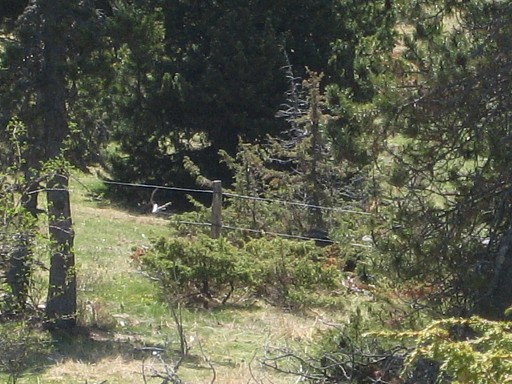 |
a fence. That's the borderfence. |
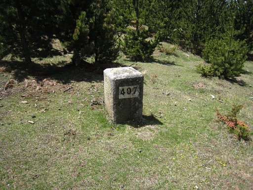 |
Bm397 is just behind it. |
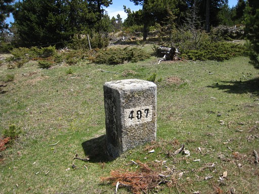 |
Bm497 From here, you can climb along the fence (=the border) to 498 and further to bm499, 500 and 501. |
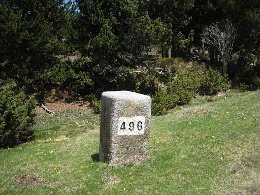 |
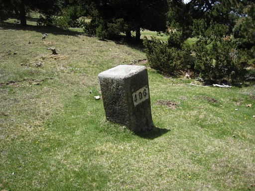
Bm496 takes a descent along the fence
of ± 175m and is standing a bit further away from the fence on the
Spanish side. |
 |
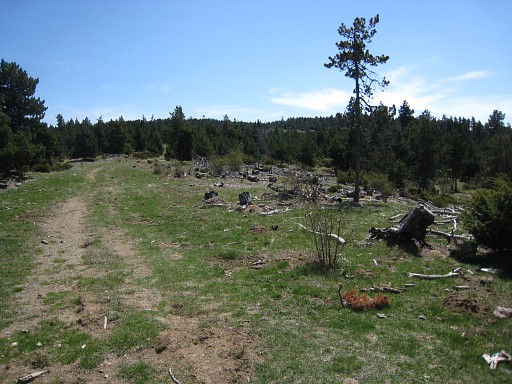
Bm496, looking N From here, it seems a gentle and open descent along the borderline. It makes me wonder it that 'valley' might be another access route to bm496. Later on - back home in Holland - I look again at Google Earth and the various maps. |
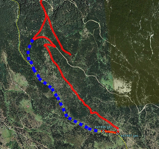 |
And now I think there's a nicer alternative to reach bm496: that's the blue dotted line. It gently climbs to the border-valley and then climbs through the open & green valley to bm496. So it seems on Google Earth. But now we walk back to the car along the same route. After a touristic visit to Puigcerda, we return to our camping in Targasonne. This is the end of our 6-days trip. The next day we'll drive back to Holland |
|
|
|