|
The
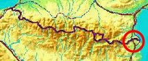
bordermarkers of the Pyrenees : all my trips
 |
|
| - 12 september
2012 - A fire helps |
 |
|
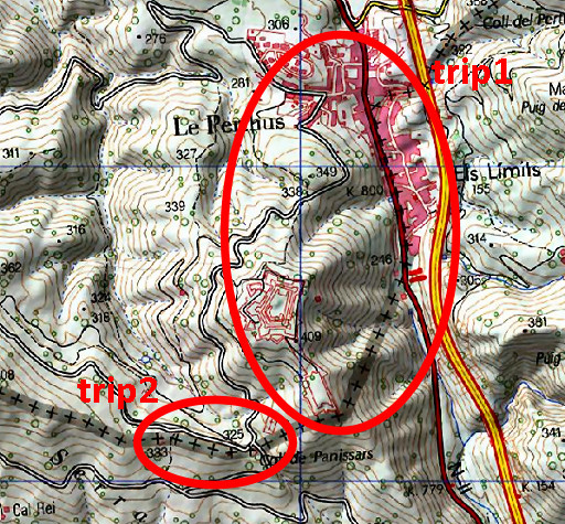
Summary: part of a 2½-weeks-trip to the Pyrenees with a lot of targets, most of them reconnaisances of routes for the GRPdesBF. Day 15: before visiting Fort de Bellegarde, I discover that the extensive forest fires of july 2012 have exposed the slopes of the hill, revealing a direct route from bm573 to 574. I do bm570-577, visit Fort de Bellegarde for the old bm569 and finish with redoing bm567-569. Weather: cloudy |
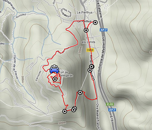 |
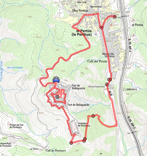
Trip 1 esfr-trip-track-20120912-trip1.kml (click to open this trip in Google Earth or copy link to Google Maps; click right on this link to download gpx-version) |
 |
For
explanation of
the gps-coordinates and other cartographic backgrounds: cartography page |
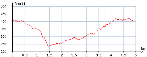 |
According
to visugpx - distance : 4,9 km - cum. elevation gain : 172m - cum. elevation loss : 170m - total elevation: 342m - altitude maxi : 421m - altitude mini : 234m - altitude average : 334m |
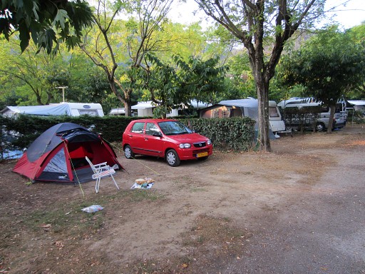 |
Yesterday
I drove from Fos (visiting in between the medieval town of St-Bertrand-de-Comminges) to
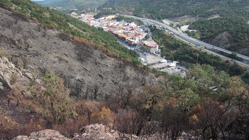
camping Le Vallespir near Arles-sur-Tech. Today will be the last day of my Pyrenees-trip. Main target: the old bm569 in the museum of Fort de Bellegarde. |
 |
I’m too early at Fort-de-Bellegarde and make a stroll to bm570. |
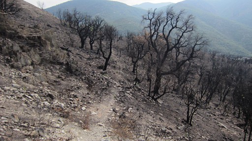 |
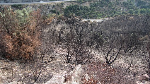
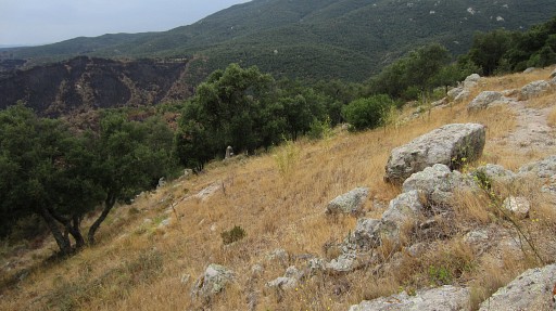
To my surprise, the enormous fires of spring 2012 in Catalogne have reached as far as the Fort and the borderline. That gives an unique opportunity: the maquis has burnt away leaving only blackened trees on the slopes. |
 |
This is a zoom-in of the previous picture showing bm571. I miss my walking shoes and walking stick but the access to bm571, 572 and especially 573 is now easy and straightforward. |
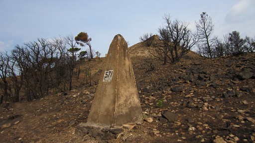 |
Bm571 |
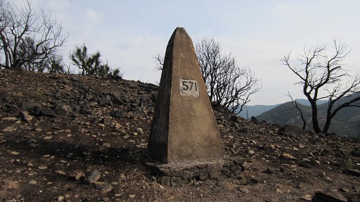 |
Bm571 |
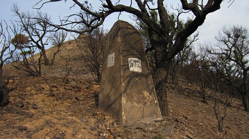 |
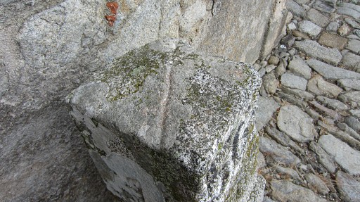
Bm572, which stands 20m to the NE |
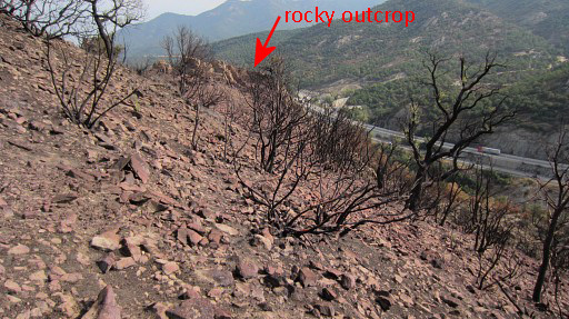 |
The
underground is loose and somewhat slippery. I'm heading to a rocky outcrop which is about 40m W of bm573 (and 25m higher). |
 |
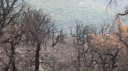
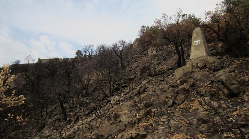
Something becomes clear on
this barren slope. There is a direct descent possible from bm573 to Le
Perthus! |
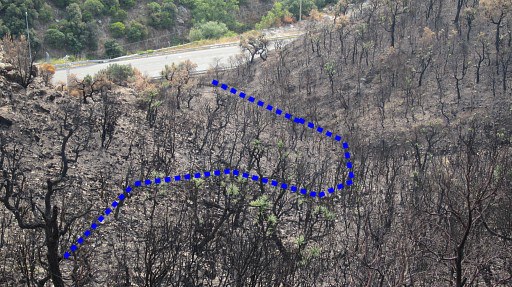 |
It looks not difficult when following a winding course down a sort of valley. |
 |
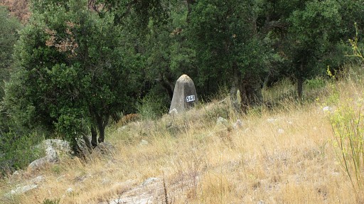
A view towards Le Perthus I have reached the rocky outcrop, I descend on its N-side to the E |
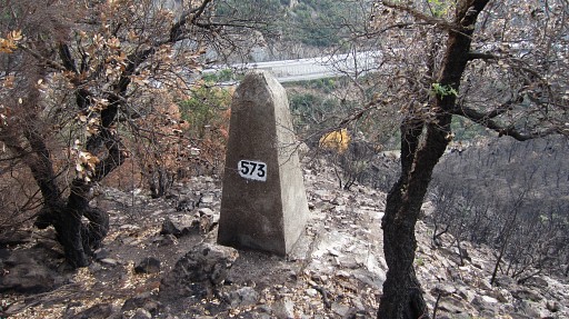 |
and soon reach - after 25m elevation loss and 40m walking - bm573. |
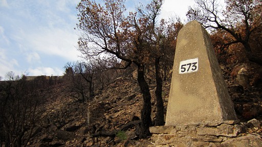 |
Bm573 |
 |
Bm573 I have descended a bit and then start to make the S-curve which brings me down to |
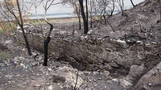 |
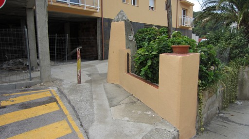
this wall, close to the road. It's some 10 meters up the slope from the road and is the spot where to reach the road (or start climbing to bm573). |
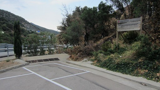 |
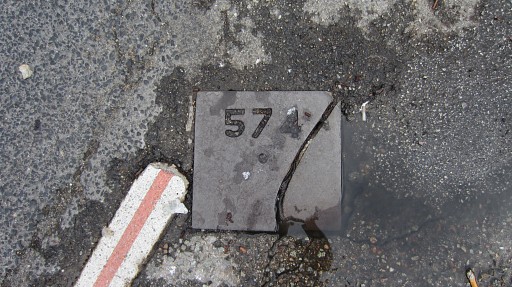
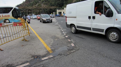
From there it's 40m N to this parking-lot on the westside of the road. In Le Perthus, I do of course bm574 to 577. |
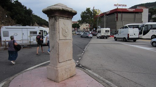 |
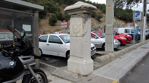
Bm574, looking to bm574bis (at the end of the dotted line). |
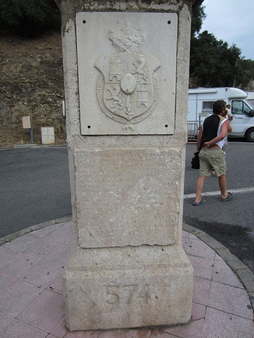 |
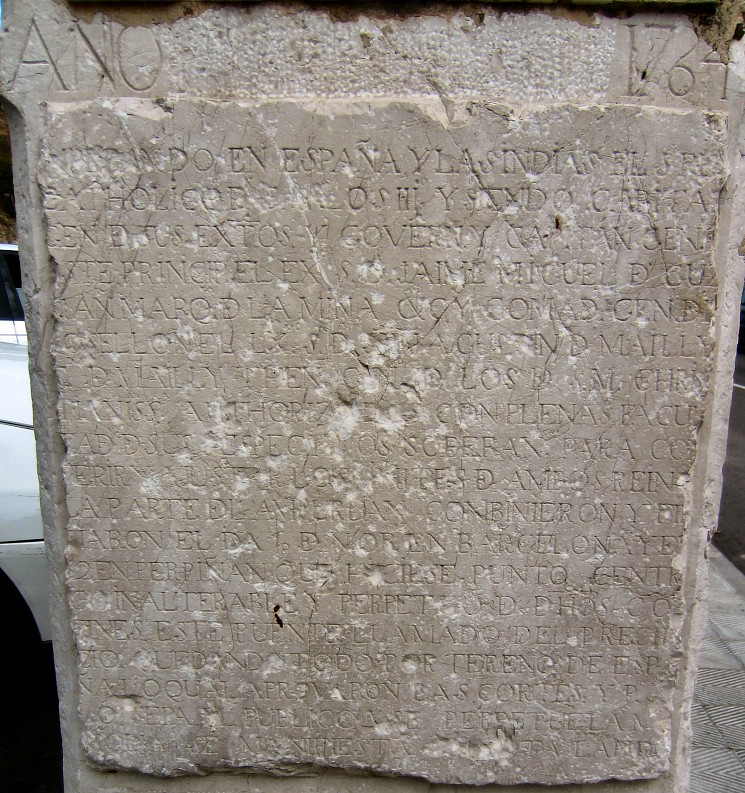
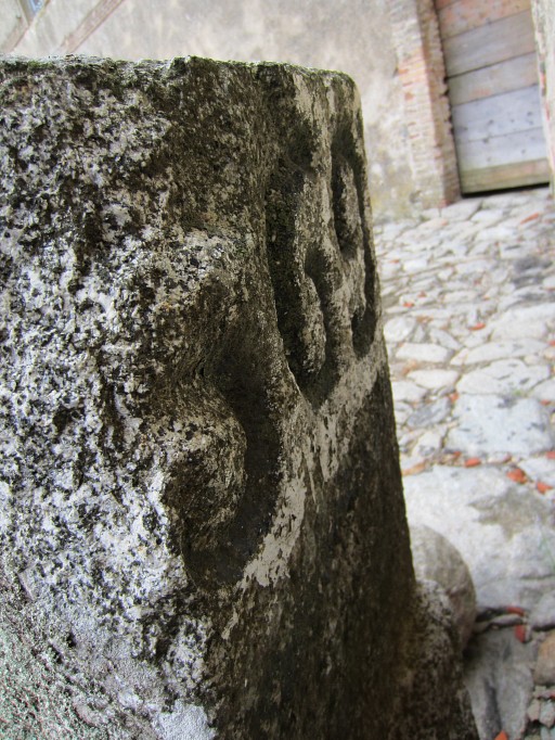
Bm574 You might be interested in the text on the tile. |
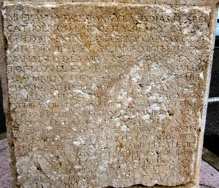 Well, I did some digital enhancing on this close-up. Still not large enough for you: open it fullsize |
|
 |
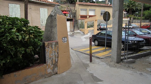
Bm574bis |
 |
Bm574bis, looking to bm574 |
 |
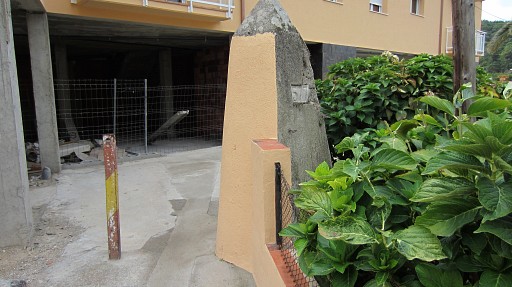
Bm575 |
 |
Bm575, looking to bm574bis |
 This text also digital enhanced. Still not large enough for you: open it fullsize |
|
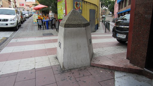 |
Further N in the street: bm576 The borderline takes the street to the right and brings me to |
 |
bm577. |
 |
Bm577 |
 |
Bm577 Lunch-break in a cafe. Then back to Fort de Bellegarde. |
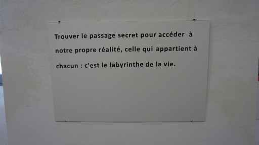 |
I visit the - once glorious but now poorly maintained - premises. Some of the halls have become art galleries. I liked this text: "Finding the secret passage which gives access to our own reality, the one which belongs to everyone: that's the labyrinth of life" Mysterious, philosophical or meaningless? Make your pick. |
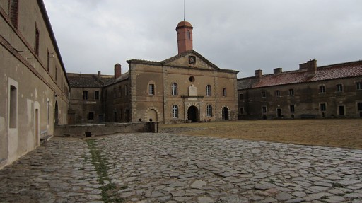 |
This is the large inner court of the Fort. |
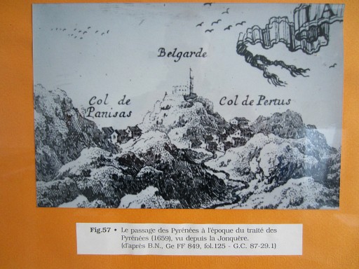 |
A few rooms are dedicated to the local history. This drawing shows both cols, seen from Spain. |
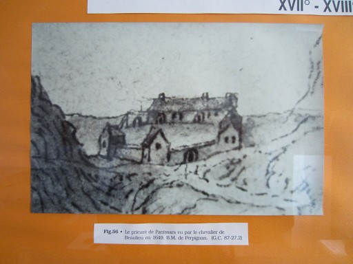 |
And this drawing shows the monastery of Panissars in 1649, now gone |
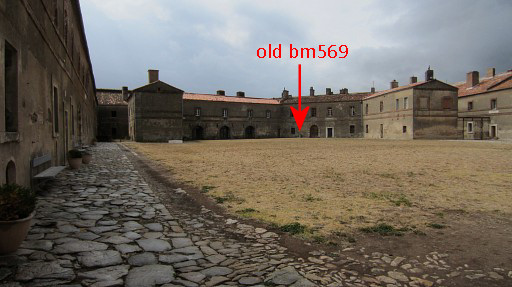 |
Another view of the inner court, now looking to the other side. The old bm569 stand at the far end. |
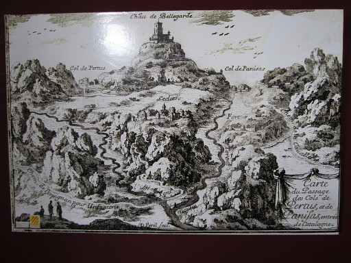 |
In another room, I find this drawing: the Col de Pertus and Col de Panissar seen from France. They seem equally important. |
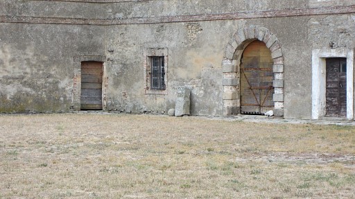 |
Bm569 - the former one - is standing along a wall of the inner courtyard with no explanation whatsoever. |
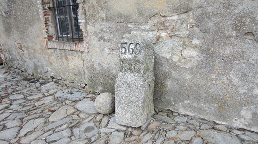 |
It’s larger than I thought and in good shape. |
 |
Bm569 - former one |
 |
Bm569 - former one. On its top the bend of the borderline engraved. |
 |
Bm569 - former one - backside. |
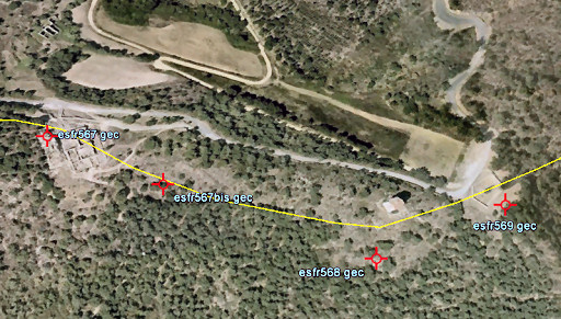 |
After the museum-visit, I drive to the ruins of Panissars to complete this Le Perthus series with bm568, 567bis and 567. |
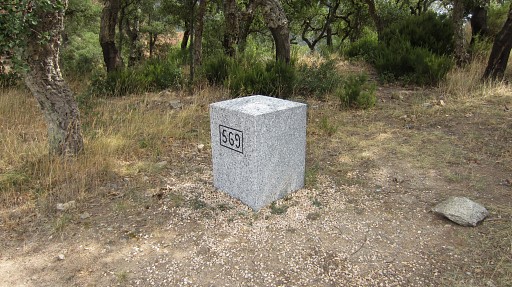 |
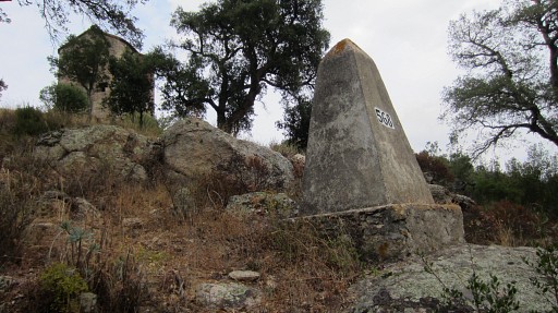
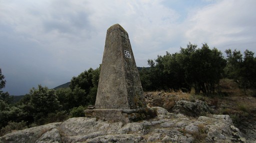
Bm569 |
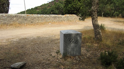 |
Bm569 |
 |
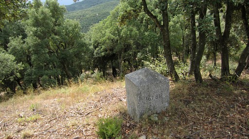
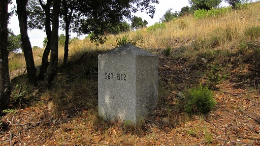
B568, seen from far |
 |
Bm568 |
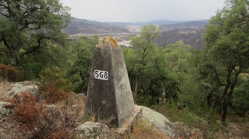 |
Bm568 |
 |
Bm568 |
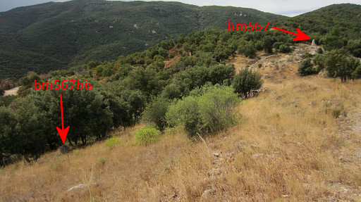 |
Bm567bis, seen from far. Bm567 to the right. |
 |
Bm567bis |
 |
Bm567bis |
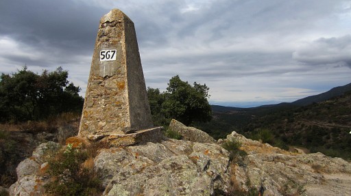 |
Bm567 |
 |
Bm567 |
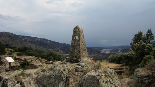 |
Bm567 This is the last picture of my 2½-weeks-trip. I drive back to Holland in one go, arriving there next morning very early. |