|
The
bordermarkers of the Pyrenees : all my trips
 |
|
| - sunday 2 june
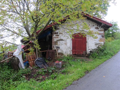
2013 - Bm139: cornerstone of a cabin |
 |
 |
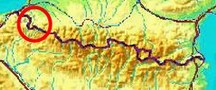
Summary: a seven-days trip with Jan-Willem with a lot of targets in the Basque country and around Llivia. Day 3: two trips (exploring a route between bm139 and 138 and visiting again bm196) and a transfer to a camping near Isaba. Weather: cloudy/foggy |
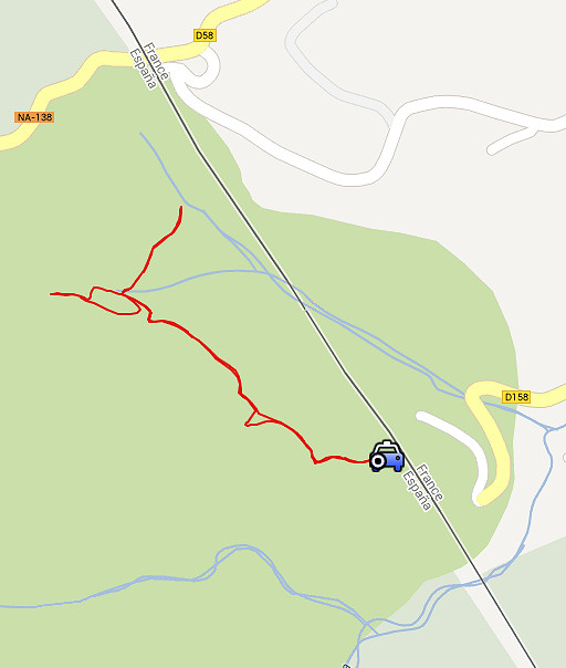 |
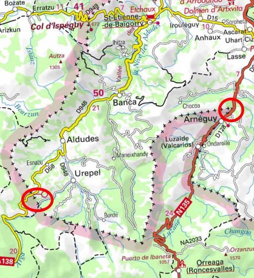
Trip 1 A small trip to explore a direct route between bm138 and 139. |
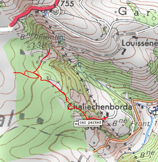 |
esfr-trip-track-20130602-trip1.kml (click to open this trip in Google Earth or copy link to Google Maps; click right on this link to download gpx-version) For explanation of the gps-coordinates and other cartographic backgrounds: cartography page |
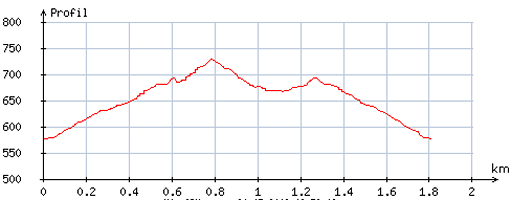 |
According
to visugpx - distance : 1,9 km - cum. elevation gain : 170 m - cum. elevation loss : 163 m - total elevation: 333 m - altitude maxi : 728 m - altitude mini : 576 m - altitude average : 653 m |
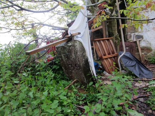 |
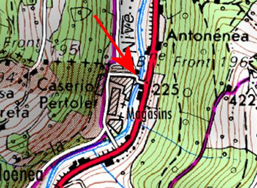
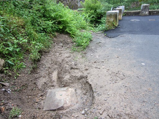
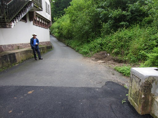
We first drive to bm139. The kid of the farmhouse has built a messy cabin against the bordermarker, using it as a cornerstone. We forgive him. |
 |
Bm139 |
 |
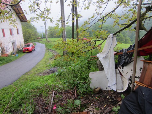
Bm139 The farmer's wife gives us some directions and together with our gps, we can easily find a route to bm138. I'm content. |
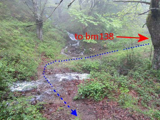 |
It results in the following directions from bm138 towards 139: - from bm138 go a bit to the W until the end of the dirtroad in a final bend of the road. At this point two streams come together continuing SE - cross the 1st stream, the dirtroad becomes a path - cross the second stream |
 |
- and climb to a semi-open place in the forest - the trail seems to vanish SW in the direction of 3 large trees |
 |
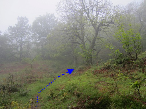
- but after the last of those trees, the trail reappears -and after ± 100m crosses a third stream - then go left on the trail |
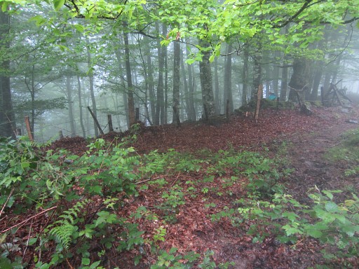 |
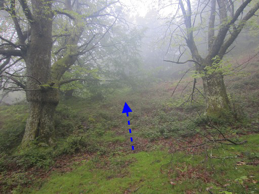
- the trail climbs gently SE and arrives at a fence - cross the fence - descend SE in the forest with keeping the fence/rockwall at your left in sight - after ± 200m you'll get to a tiny stream and beyond it another fence - cross that fence and continue descending SE for ± 150m in the forest until you reach the tarmac road - go left for ± 100m until a farmhouse left - bm139 is at the opposite site of the road, in front of a small barn. |
We can now merge the two explorations (from yesterday and today) in one map (derived from the Aragon Sitna-website): how to descend from bm137 to 139.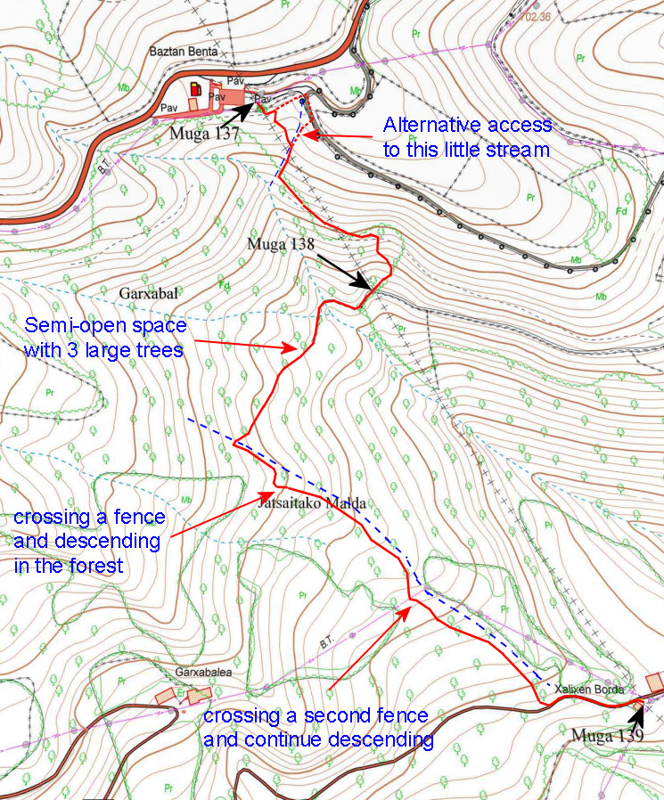 |
|
 |
Trip 2 We return to Saint-Étienne-de-Baïgorry, pack our tent and drive to Isaba to the Asolaze-camping. We make a stop at bm196 to make some other pictures. We discovered this long sought borderstone two days earlier on 20130531 |
 |
Bm196 |
 |
Bm196 |
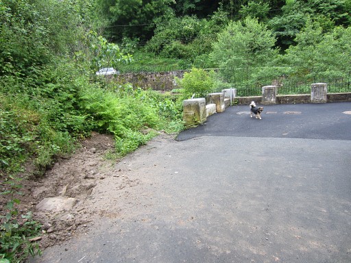 |
Bm196 |
And the distances between bm196 and the balustrade and the legs of the disapeared billboard: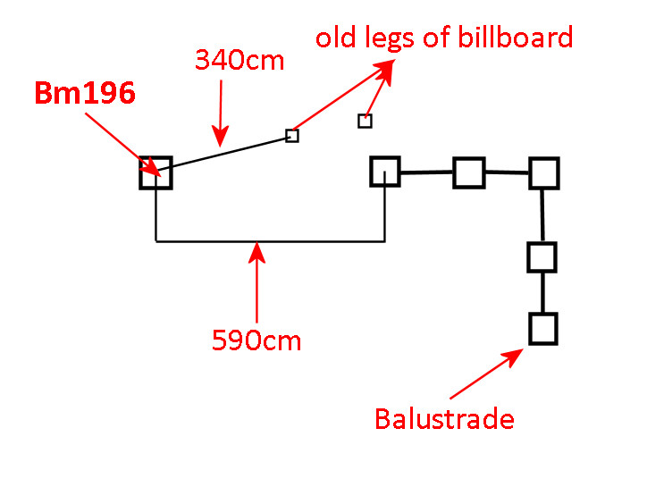 |
|
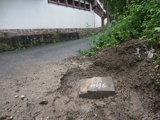 |
Bm196 I'm very convinced that this is bm196 but finding a number would have been 100% evidence. But after digging a few hours on , we gave up for that last proof. |
But
2 months later - on july 31th - I received pictures of Anne-Marie Bats and
Bernadette. They have continued where Jan-Willem and I had to stop and
delivered the ultimate evidence: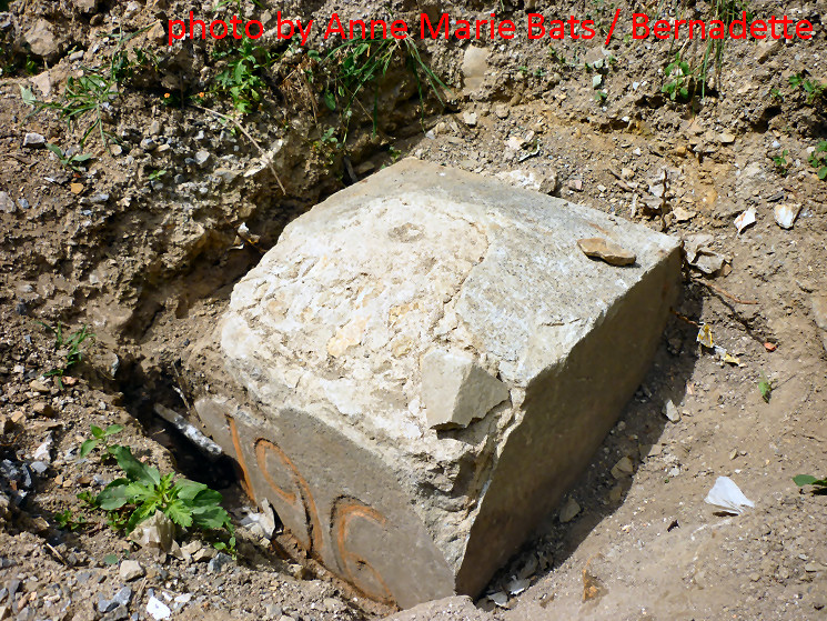 |
|
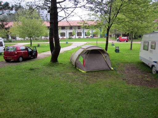 |
Camping Asolaze is ± 20km from the
borderpass of Col de la Pierre St-Martin. A short reconnaissance-drive up the mountains, tells us that there is still too much snow for our scheduled trip to the bm251-cross. We have to change our plans. That's what we decide in the evening, the camping has a nice communal room & kitchen. There's also wifi, something which has become a conditio sine qua non for us. We're getting spoilt. |