|
The
bordermarkers of the Pyrenees : all my trips
 |
|
| - saturday 31 august
2013 - Easy walk |
 |
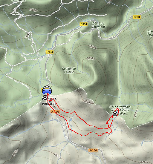 |
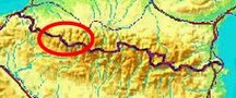
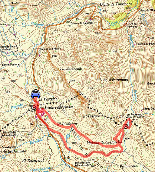
esfr-trip-track-20130831.kml (click to open this trip in Google Earth or copy link to Google Maps; click right on this link to download gpx-version) Summary: part of a 12-days trip to the Pyrenees with a lot of targets from the Ariège mountains to the Basque country Day 9: an easy walk from Col du Pourtalet to Col de Peyrelue to bm310bis Weather: blue skies |
 |
For
explanation of
the gps-coordinates and other cartographic backgrounds: see the cartography-page |
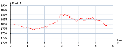 |
According
to visugpx - distance : 5,9 km - cum. elevation gain : 96m - cum. elevation loss : 90m - total elevation: 186m - altitude maxi : 1851m - altitude mini : 1770m - altitude average : 1806m |
 |
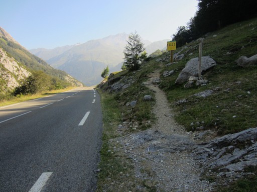
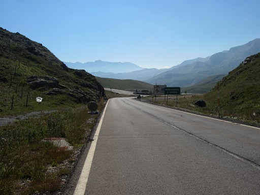
From Lourdes - where I spent a day of rest - I drive to Col du Pourtalet. |
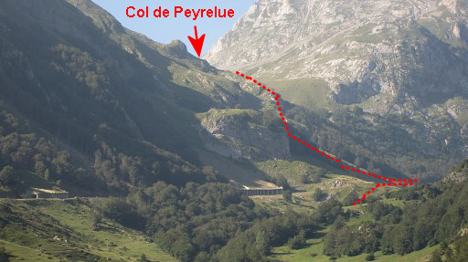 |
Zoom-in of previous picture. About 4km before the col, I check if the “chemin de Saint Jacques de Compostelle”-trail - as shown on the maps - really exists in its course of descending from the Col de Peyrelue and crossing the road and descending to the river. |
 |
Well it exists and is waymarked. This picture: the trail coming from the Col, meets the road. |
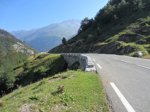 |
and continues along the road NE and immediately after this bridge |
 |
descends to the river. I know enough and drive on to Col du Pourtalet |
 |
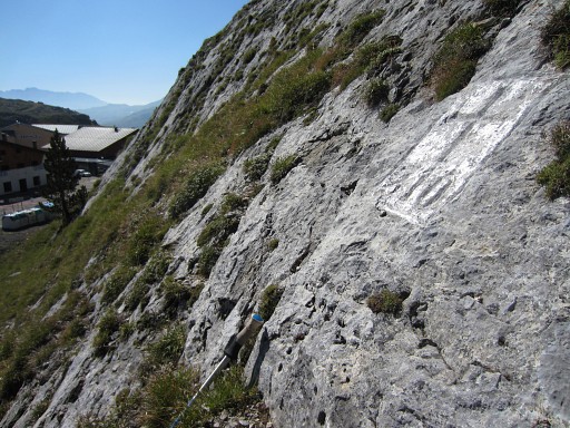
At col de Pourtalet, I ‘do’ once again bm310 |
 |
Bm310, looking towards the Spanish venta's. |
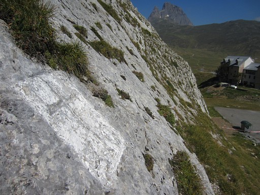 |
Bm310, the Pic du Midi d'Ossau in the background |
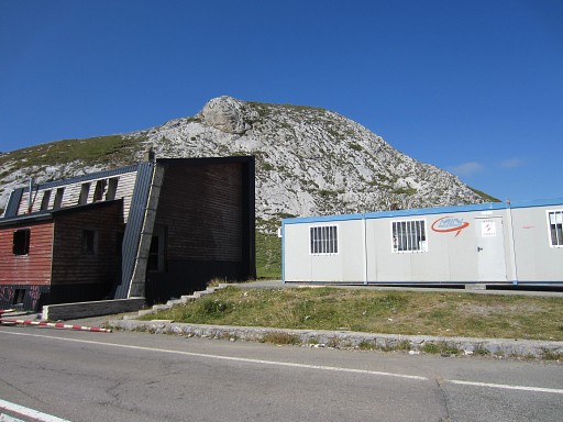 |
Bm310 is on the rockwall behind these buildings |
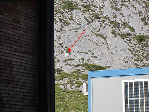 |
Bm310
|
 |
Then I walk to Col de Peyrelue. That’s an easy and more or less horizontal stroll. I first descend ± 500m into Spain along the road until a roundabout. |
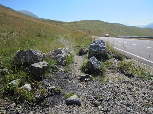 |
Then - 100m beyond the roundabout - a dirtroad starts at the
left side, blocked with some rocks. |
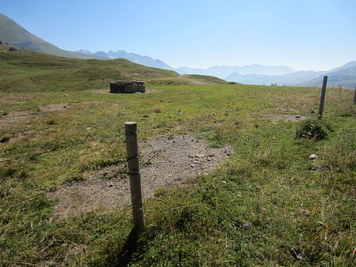 |
Further on, it becomes a trail and
brings you to a fence which you can follow at its right side. When you see a concrete cattle watering device at the other side of the fence, you can creep through or under the fence |
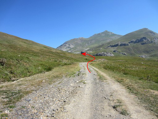 |
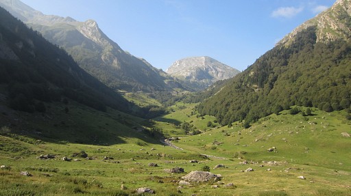
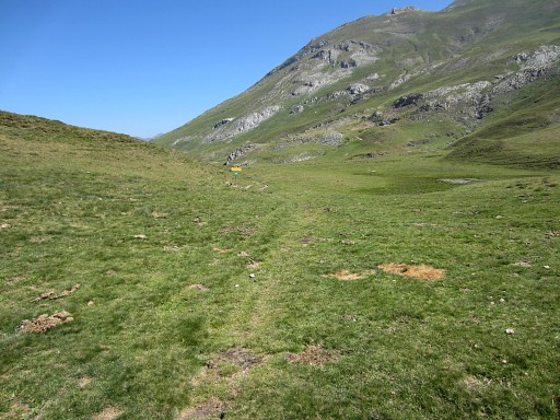
and continue on a dirtroad. After ± 1km on the winding dirtroad, you’re at the S-side of a large grassy valley which leads to the Port de Peyrelue. It’s very obvious as such. |
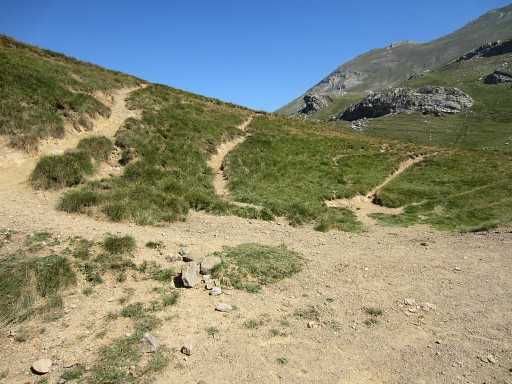 |
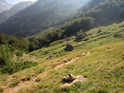
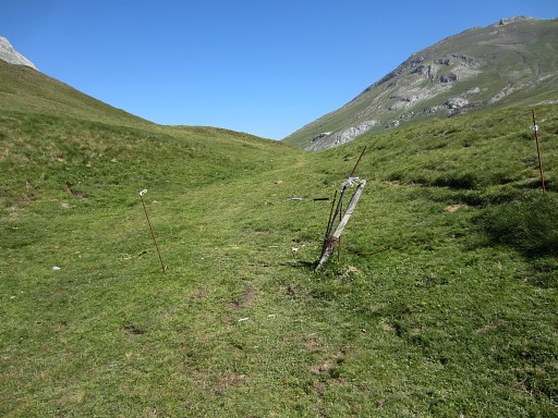
I leave the dirtroad and follow a trail throught the grass (there are various trails, all leading towards Col de Peyrelue) |
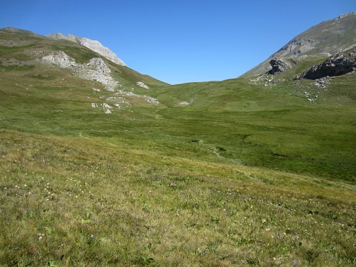 |
The Col de Peyrelue comes is sight. |
 |
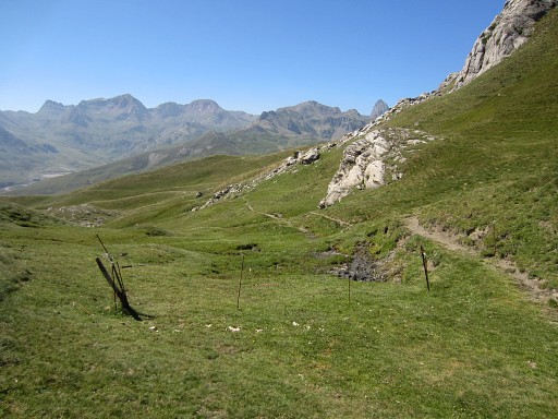
The trail brings me to this fence. The fence is the border and bm310bis is 40m to the right at the small hill. |
 |
At the other side of that small hill is
the Compostella-trail and that trail you should follow onwards to
the N (if you follow my GRPdesBF-trail). |
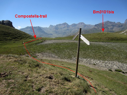 |
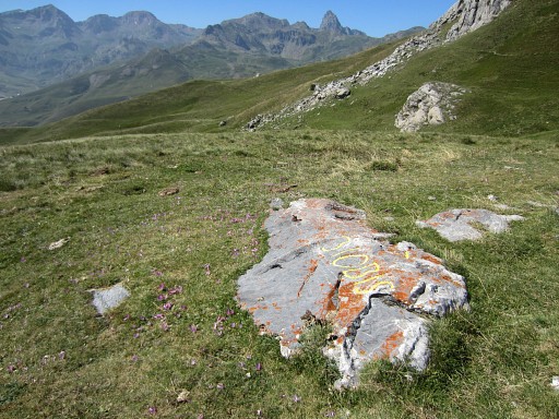
But I don't know yet that bm310bis is at that small hill. I continue, realize that I'm too far and return on the Compostella-trail. This picture: looking S to the Col with its small hill in the middle of the broad pass. |
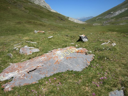 |
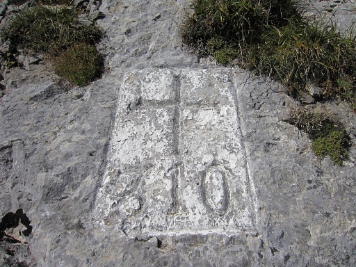
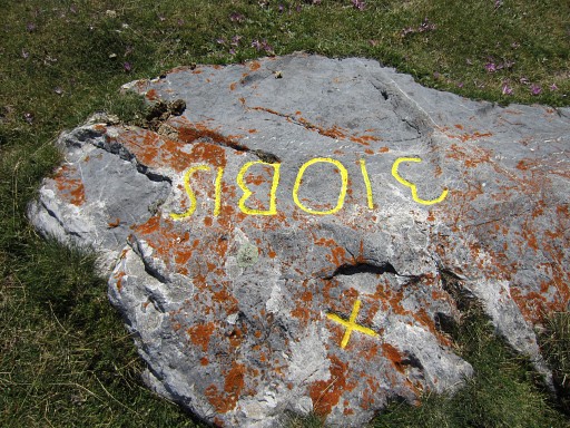
Bm310bis |
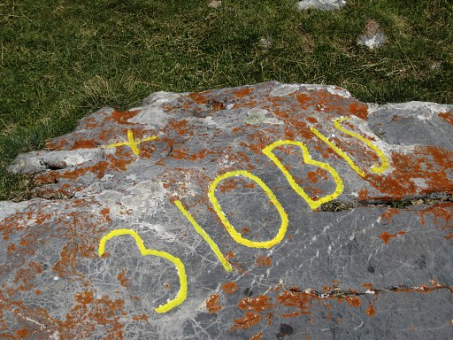 |
Bm310bis This bordermarker is not mentioned in the official treaties of Bayonne. We have no information on when this cross and number were engraved and how official or unofficial they are. The cross itself may well be a shepherd's cross, engraved by shepherds as a delimitation of their territories. Around Col du Pourtalet there are many more of such crosses. See this blog-post |
 |
Bm310bis, looking into Spain |
 |
Bm310bis |
 |
I return to Pol de Pourtalet, following another trail that’s more up and down and becomes a dirtroad and |
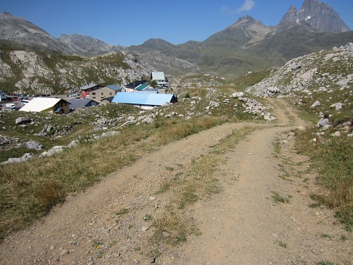 |
arrives at the backside of the venta’s of Col du Pourtalet. This route seems to have no advantage in distance and wayfinding. |
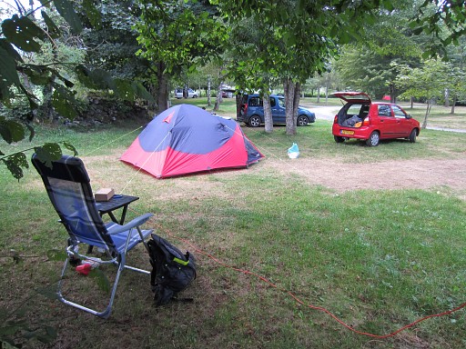 |
Then I drive to the camping of Lescun. I hope that tomorrow will be a perfect day for a new visit to Col d’Anaye. The camping itself is a haven of space and peace. |
| previous
trip next
trip |
|