|
The
bordermarkers of the Pyrenees : all my trips
 |
|
| - saturday 6 september
2014 - Shortcut to bm418 |
 |
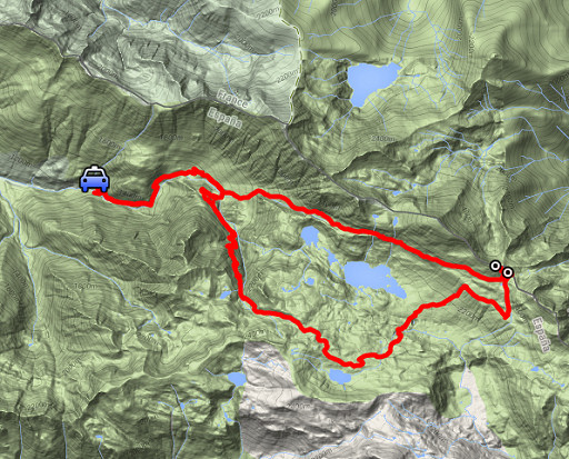 |
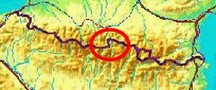
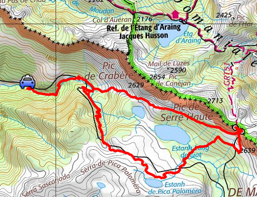
esfr-trip-track-20140906.kml (click to open this trip in Google Earth or copy link to Google Maps; click right on this link to download gpx-version) Summary: part of a 2-weeks trip along the entire Pyrenees, focussing on high altitude reconnaissance of parts of my GRPdesBF-trail. Today: trying a shortcut to bm418. Basecamp is a camping in Bagnères-de-Luchon. Weather: nice weather, slightly covered |
 |
For
explanation of
the gps-coordinates and other cartographic backgrounds: see the cartography-page Start: 10h, finish: 18.30, net walking time: 7.30h According to the gps-tripteller: Distance: 23,4 km Total ascent: 1262m Total denivellation: 2524m Maximum height: 2436m Total time: 8.32h |
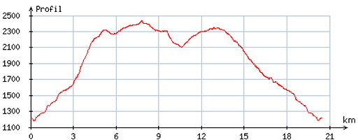 |
According
to visugpx - distance : 21,0 km - cum. elevation gain : 1582m - cum. elevation loss : 1587m - total elevation: 3069m - altitude maxi : 2435m - altitude mini : 1182m - altitude average : 1988m |
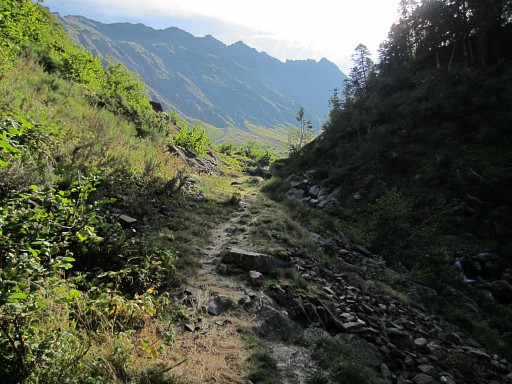 |
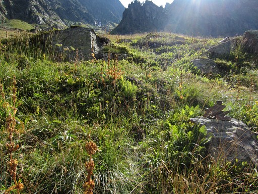
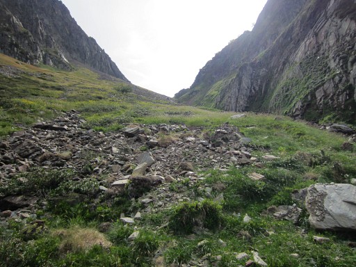
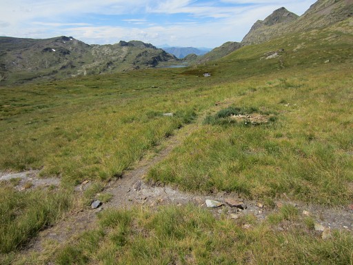
I start from the dirtroad's end beyond Refugi dera Honeria. The trail traverses the forest and has reached open terrain on this picture. |
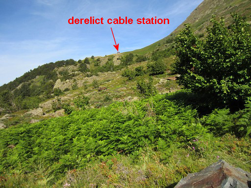 |
This picture: looking back to a derelict building of a derelict cable line which was once connected to the Mines de Liat. From that building the variant of the GRPdesBF in this part (covering bm511-517) descends to the trail where I am now. |
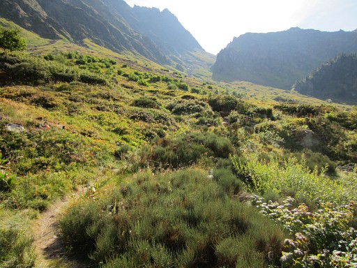 |
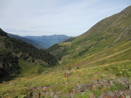
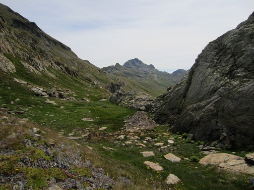
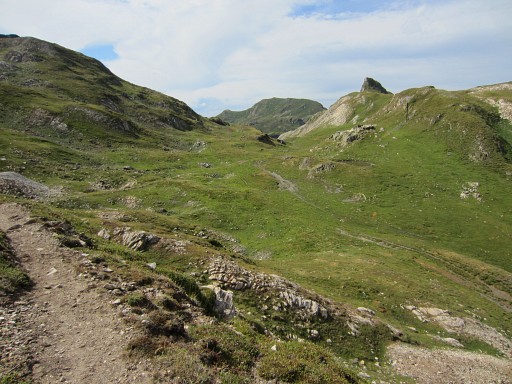
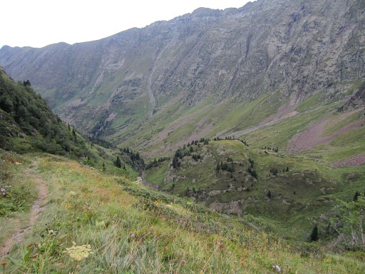
A bit further, the pass in sight which is my target today. But where to leave the main trail and start climbing towards it? |
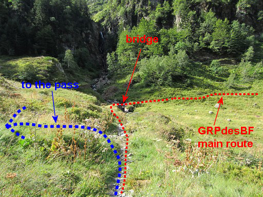 |
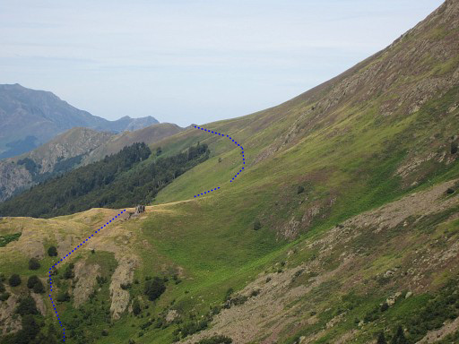
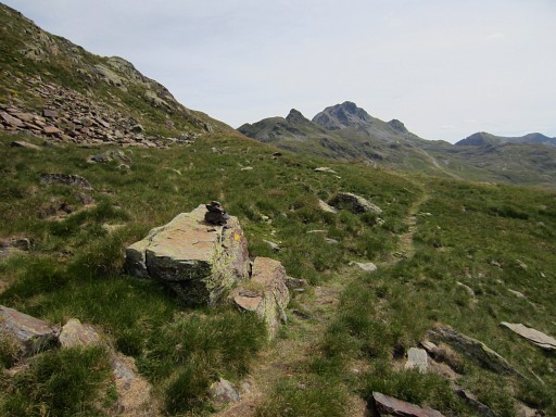
Well, about here: when you spot the footbridge, go left and start climbing, |
 |
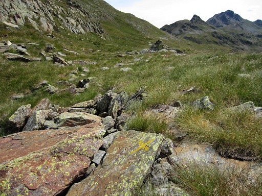
following a sort of streambed. I catch up with a faint trail with cairns, loosing it (or it vanishing) higher up. |
 |
While climbing, a look back with |
 |
this zoom-in with the approximate route of the GRPdesBF-variant 511-517 along the derelict cable station. |
 |
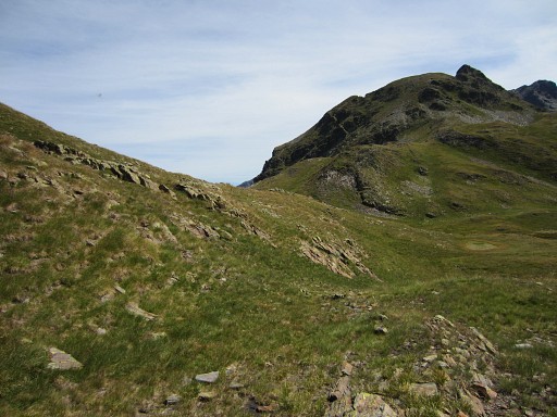
The climb to what seems the pass is just the beginning |
 |
of a prolonged pass with various subpasses. |
 |
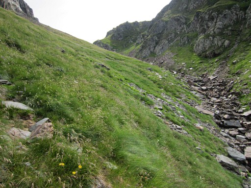
There is one in the beginning of that
series with a rockslide to the left (=N) of the streambed, which is
unstable and therefore risky. Try to avoid it by going past it at the right side of the streambed or to the left climbing over the grass. |
 |
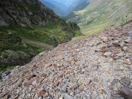
Further on, still climbing. |
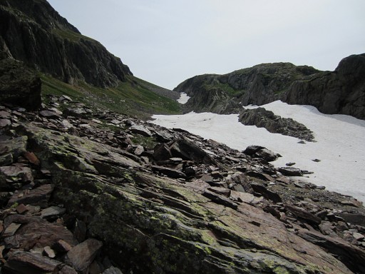 |
In the end, some snowfields can be easily passed on the left side. This picture: the final (green) pass in sight. |
 |
From there, it looks that you can easily proceed to Port de Hourquette. And that proves to be right. |
 |
A zoom-in from previous picture and my approximate route ahead. |
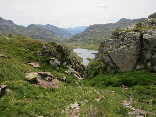 |
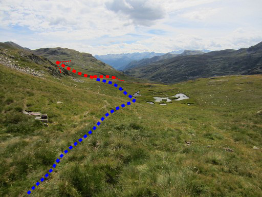
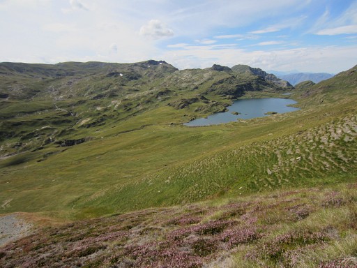
To the right the lake of Estanh Long de Liat. |
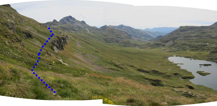 Panorama with my approximate route. The grassy slope is easy to walk on. |
|
 |
For a short while, there's a more
distinctive trail when a yellow route (apparently from Portillon d'Albe to Montgarri)
joins my route to Port de Hourquette. |
 |
But where that yellow route descends towards the lake, I continue towards Port de Hourquette |
 |
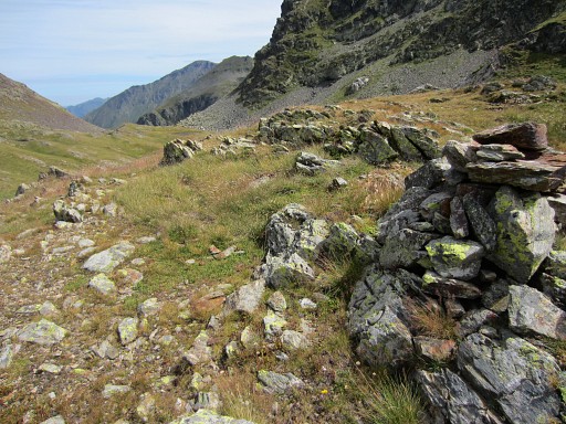
which comes nearer. This seems the very pass but is only the access (when you go left) |
 to the final climb to Port de Hourquette (bm418). The trails here are vaguer and waymarking worse than I remember from last year (2130821) |
|
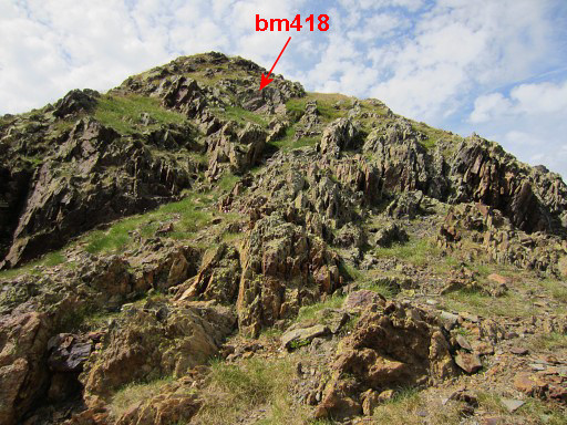 |
At 14h I'm at Port de Hourquette. From the Port |
 |
it's a short climb to |
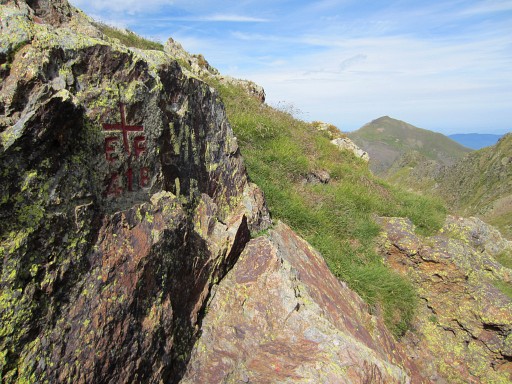 |
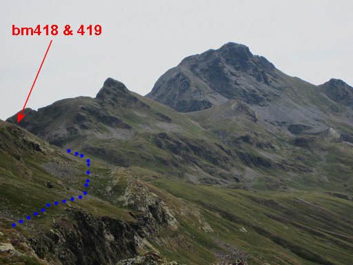
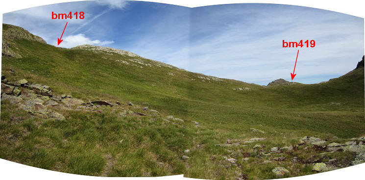
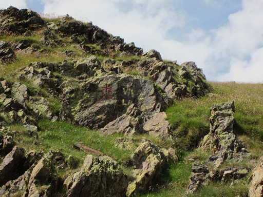
bm418. |
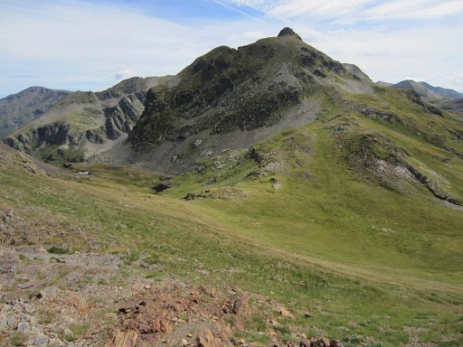
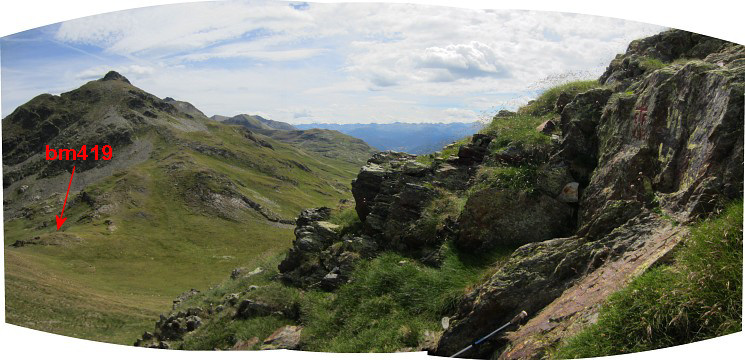 A panorama with bm418 to the right and bm419 down below. |
|
|
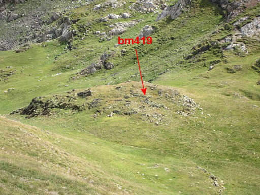
Towards bm419 which is on a lower col. |
|
Zoom-in |
|
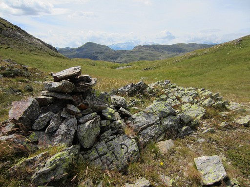
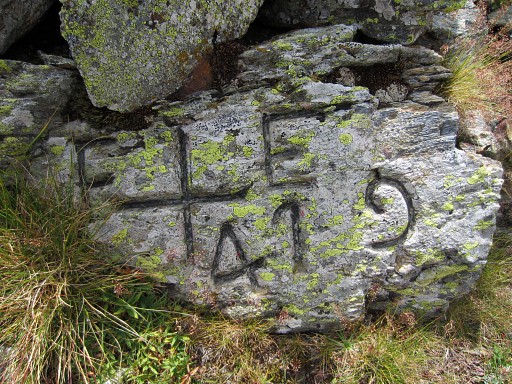
At 14.15h at bm419. |
|
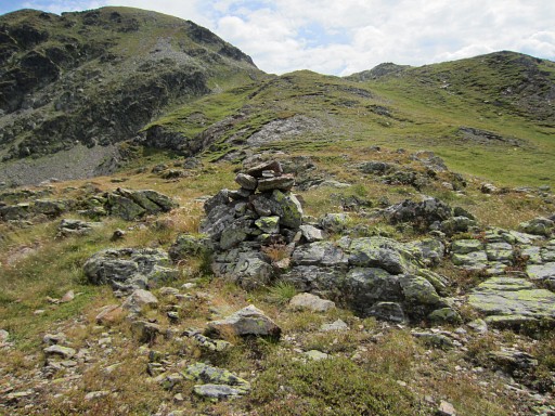
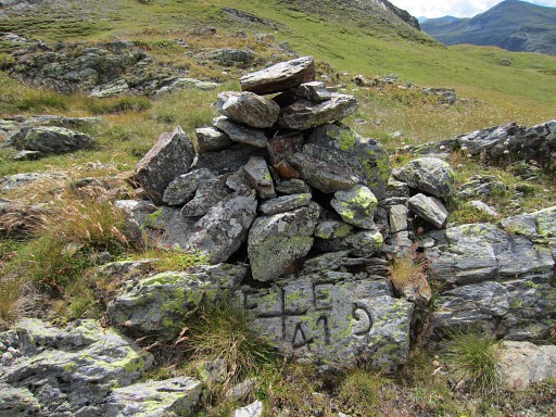
Bm419 |
|
Bm419 |
|
Bm419 |
|
Bm419 |
|
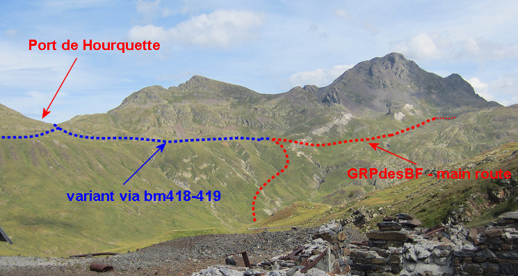
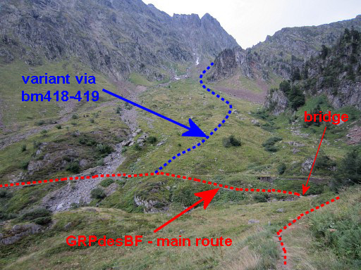
This picture shows where to go when you want to continue on the GRPdesBF. The blue variant -doing bm418-419 - merges with the red main rute which comes from Mines de Liat. |
|
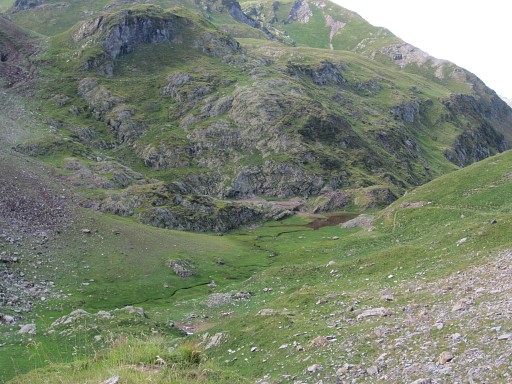
But I return, first towards the lake of Estanh Long de Liat which you can see in the far distance. |
|
But there's no obvious trail to the lake and so I descend straight in its direction. Then towards Mines de Liat. |
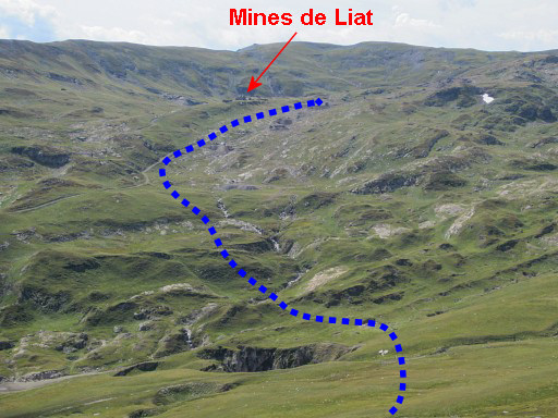 |
Zoom-in of previous picture. My target is the 'Mines de Liat', a complex of ruines. The blue line: my approximate route. It's a considerable denivellation, more than expected. |
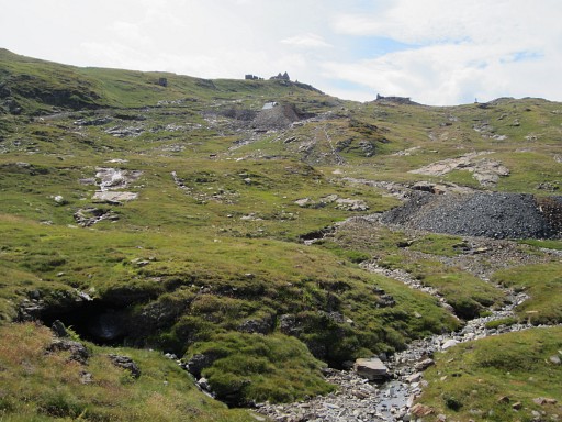 |
Getting closer to the Mines de Liat and the dirtroad leading to it. |
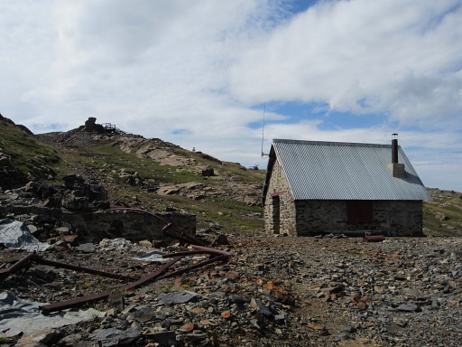 |
There's a cabin (Refugi de Liat) 5om NW of the dirtroad with a stream at 125m to the E) |
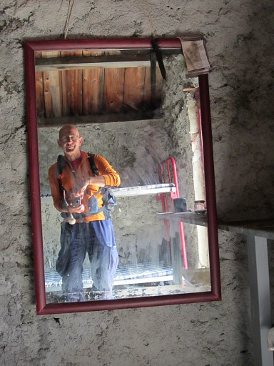 |
A kind of selfie. |
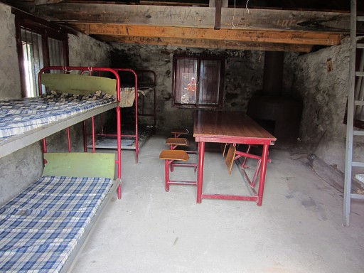 |
The cabin is tidy and comfortable. |
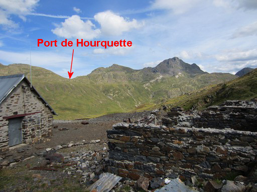 |
A view towards Port de Hourquette. Let's zoom in and show the GRPdesBF-routes. |
 |
|
 |
From the Refuge, picking up the red/white trail W-NW towards |
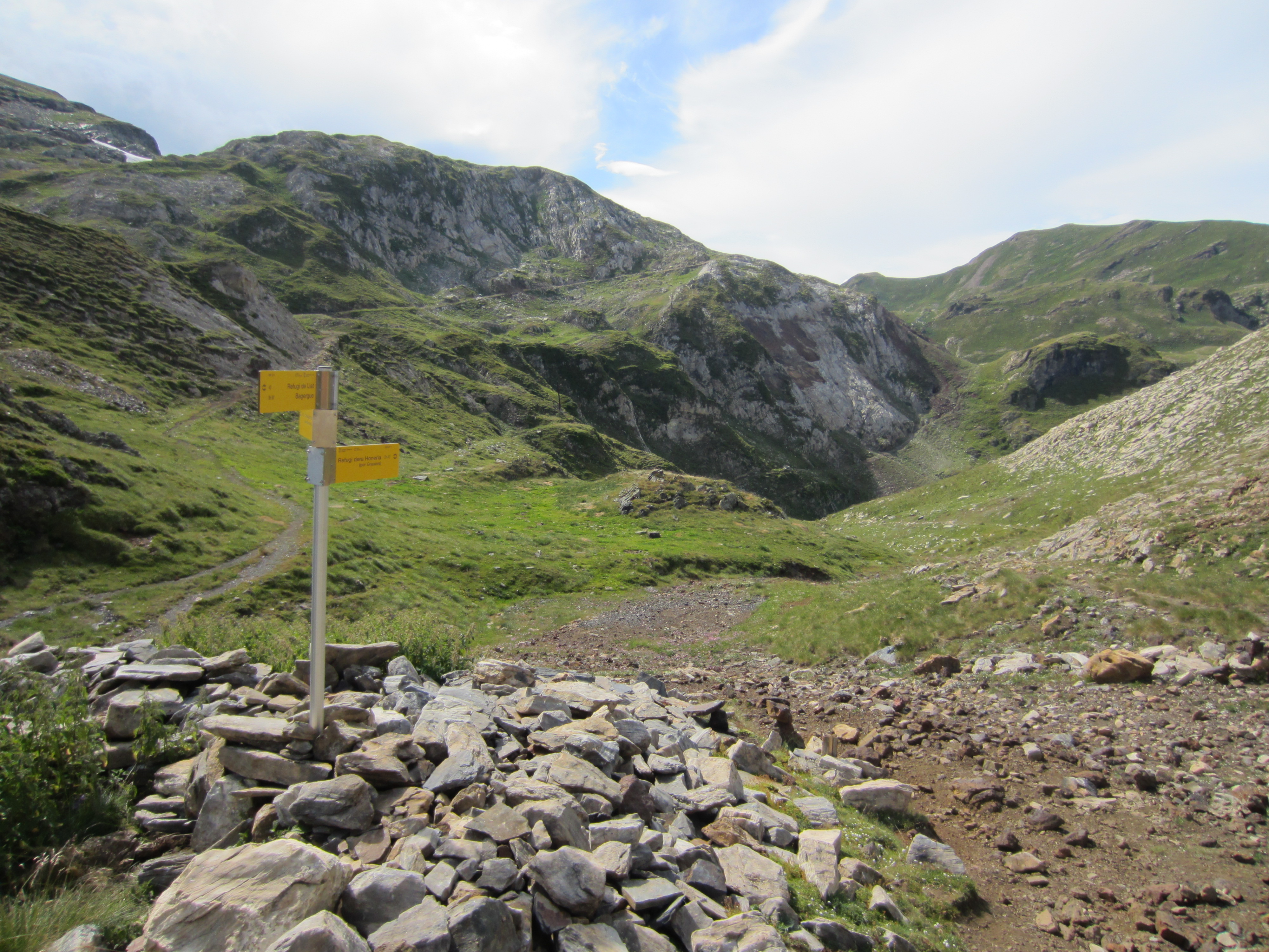 |
this waysign. There are apparently two waymarked routes back to Refugi dera Honeria. I take the right one which |
 |
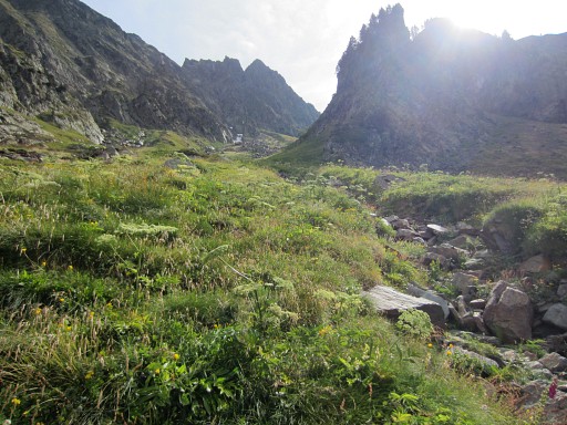
descends to this valley with nice bivouac-possibilities. |
 |
Then there's a long, long descent to the valley. At times very silent. |
 |
I'm almost at the bridge and now we have another view of the route to the pass which I tried today. |
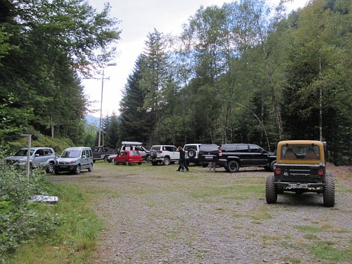 |
Back at the parking. My little red car between giant 4x4 vehicles having their contest in tackling incredible steep hillsides. Returning to Bagnères-de-Luchon. |