|
The
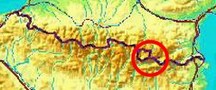
bordermarkers of the Pyrenees : the GRPdesBF
 |
||||||||||||||||||||||||||||||||||||||||
| - stage 43 - The Llivia-circuit (bm01-45) |
 |
|||||||||||||||||||||||||||||||||||||||
 |
||||||||||||||||||||||||||||||||||||||||
| Only
the bordermarkers on this stage are shown (and some adjoining ones).
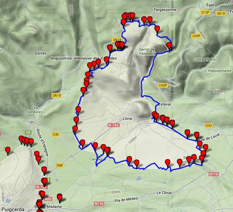
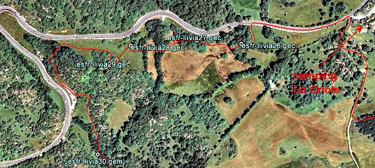
The main route is red, the variants have other colors. Click here for an fullscreen interactive map. In short A circular walk around Llivia, visiting all bordermarkers. This stage is - as a whole - is a variant and not part of the main route. You can do it in one day but probably it will be a long day. Taking two days will be more pleasant, the area offering a lovely scenery to walk through. The starting point (and thus finish) of the circuit is bm01 but could be any point along the route. The shortest acces from the main esfr-borderline is 1,7 km along the busy D68 to bm01. NB: The stage is scheduled after the Puigcerda-stage (bm444-495) but it's more logical and convenient to do this while you're still in Puigcerdag/Bourg-Madame. You might consider breaking up the Puigcerdà-stage in two parts. For example: - day 1: doing bm44-477 in the Puigcerdà-stage, walk to the Llivia-border along the D68 and continue with the first half of the Llivia-circuit - day 2: doing the second half of the Llivia-circuit, walk back to the main border and continue with bm478-495 As said, this entire circuit should be considered as a variant on the GRPdesBF considering the .... considerations: Considerations - the Llivia-border runs mainly straight through fields. The best time to walk (or run?) the circuit might be in autumn after the harvest or in early spring. Then you can cross the fields easier and that shortens this circular walk a bit. The circuit itself avoids crossing through fields but seeks their edges to protect crops and not to disturb cattle. - wayfinding is not always easy: use detailed maps, a compass and if available a gps loaded with the bordermarker-waypoints - the circuit crosses some streams - for example between bm12 and 13. Be prepared to get wet feet or take 'watershoes' with you. A walking stick might give you support for these crossings. At times, large parts can be wet/muddy. - there's one Llivia-bordermarker still not found (or disappeared): bm16north - there are a lot of streams and plenty spots for a bivouac but often close to villages, roads or houses. There are several campings in the villages around but there's only one along the circuit: camping La Griole near Targasonne. That could be a perfect stopover when doing the circuit in two days. Factsheet
Gps-files needed
Useful You might check the relevant webpages in the 'All markers'-section and 'All my trips'-section. They provide pictures of the bordermarkers and additional information. Version 01 August 2013. If you have any correction, suggestion etcetera -> please email me: eefberns@grenspalen.nl MAPS AND DIRECTIONS August 2013. Maps and directions yet to be worked out in more detail. You might check the relevant webpages in the 'All markers'-section and 'All my trips'-section for pictures of the bordermarkers and wayfinding-issues. Print your own maps It's easy to print your own - custom made - maps with the GRPdesBF-route and the bordermarkers on them. See: Print your own maps |
||||||||||||||||||||||||||||||||||||||||
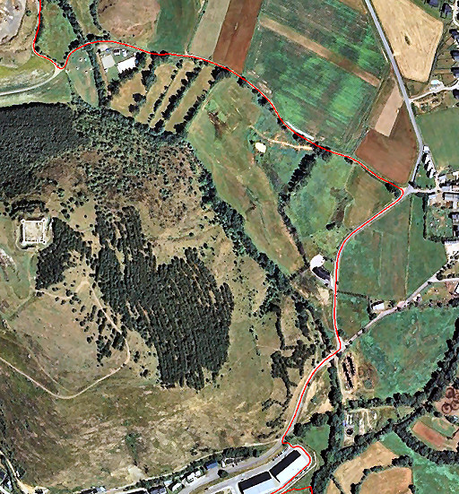
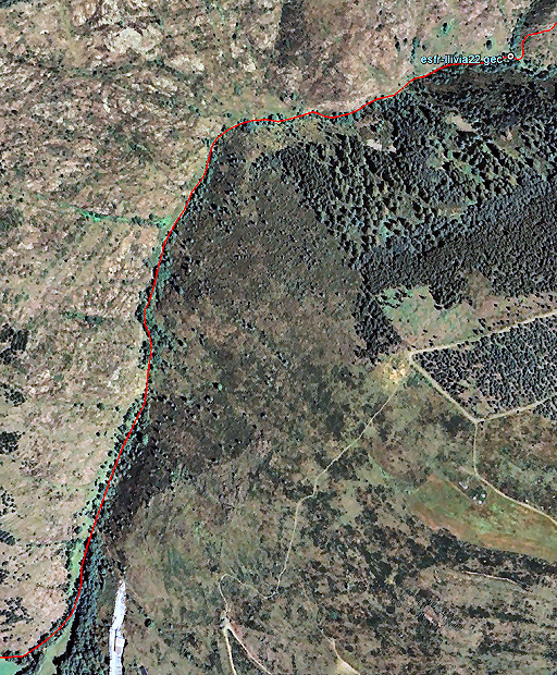
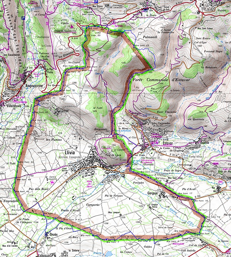 The circuit on a French IGN-map. For a full-scale image: click here 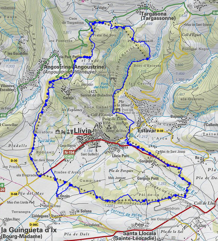 The circuit on a map of the ICC (Catalonia topographic service) |
||||||||||||||||||||||||||||||||||||||||
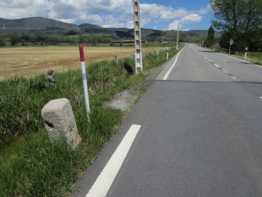 |
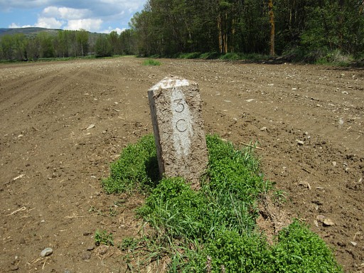
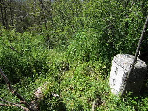
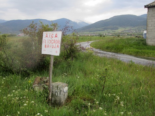
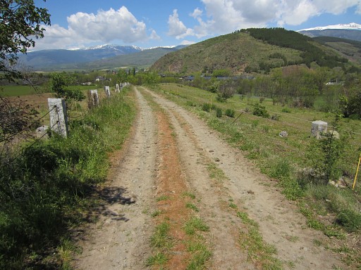
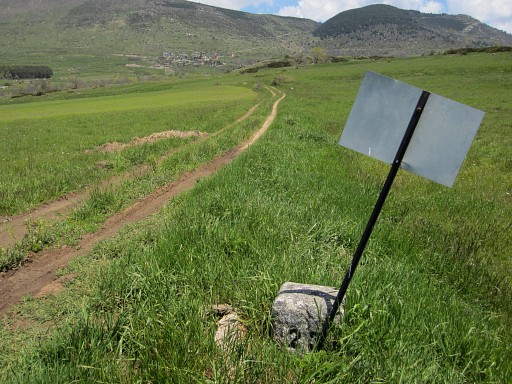
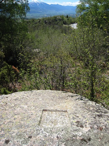
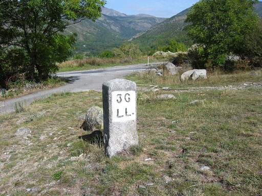
LL01, the starting point of the Llivia-circuit. But - being a circuit - you could start at any point along the circuit. |
|||||||||||||||||||||||||||||||||||||||
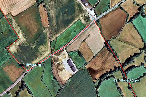 |
Walk towards Llivia-town for 400m and take the first dirtroad to the right. Watch this map to see where LL02 is located. The field hedges and edges help a lot in seeing where you are. |
|||||||||||||||||||||||||||||||||||||||
 |
LL02, at the right side of the the dirtroad. It might be hidden behind some debris. |
|||||||||||||||||||||||||||||||||||||||
 |
Then - further on - you have to enter a field going hence & forth to cover LL03. |
|||||||||||||||||||||||||||||||||||||||
 |
LL03 The river El Segre blocks a direct course to bm04. |
|||||||||||||||||||||||||||||||||||||||
 |
So you have to return to the dirtroad which brings you to this trail along the river. You can pass the river on the footbridge and the trail brings you to the quiet hamlet of Onzès. |
|||||||||||||||||||||||||||||||||||||||
 |
In the village at the crossroad, keep left and leave the village at a dirtroad. |
|||||||||||||||||||||||||||||||||||||||
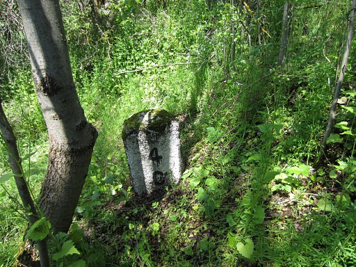 |
After 400m from the village, LL04 is located left of the dirtroad. It's standing a bit lower and not (well) visible from that dirtroad. |
|||||||||||||||||||||||||||||||||||||||
 |
LL05 is 10-15 meters further on the dirtroad but now to the right. It's up a small hill and not visible from the dirtroad. This picture: looking towards the dirtroad. |
|||||||||||||||||||||||||||||||||||||||
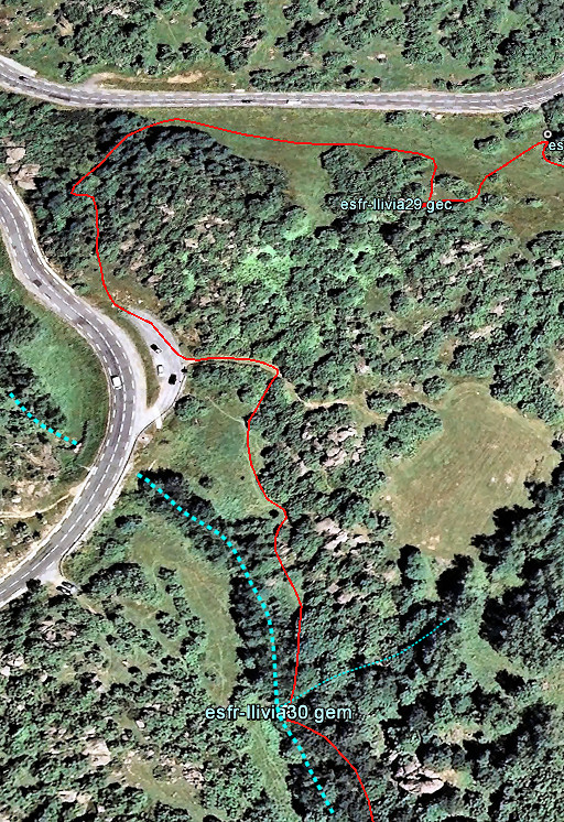
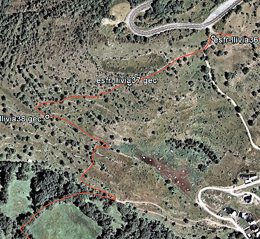
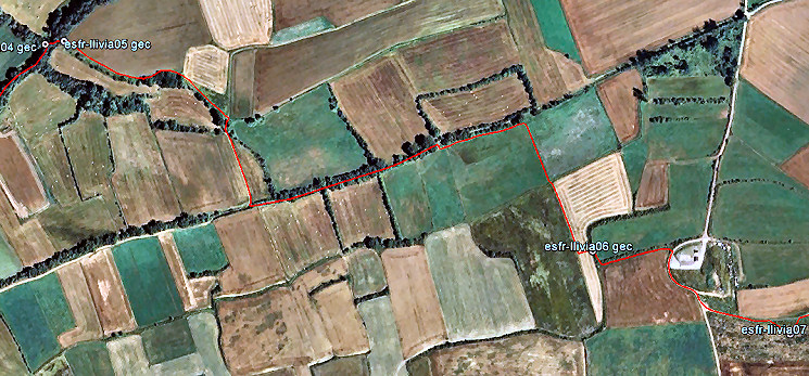 Now - from LL05 - you have to traverse for 1,1 km through and along the fields as shown on this map to get to LL06 |
||||||||||||||||||||||||||||||||||||||||
 |
LL06 |
|||||||||||||||||||||||||||||||||||||||
 |
With the map above, it's easy to find LL07 |
|||||||||||||||||||||||||||||||||||||||
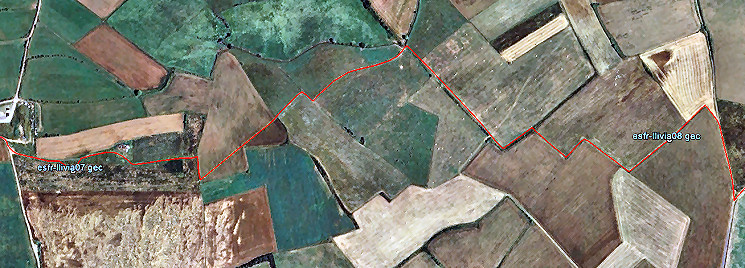 Then another long stretch (1,5km) through the fields to get to LL08. As said before: the route follows the edges of the fields but when there are no crops or cattle, you might as well cross them in a straight line. |
||||||||||||||||||||||||||||||||||||||||
 |
LL08 |
|||||||||||||||||||||||||||||||||||||||
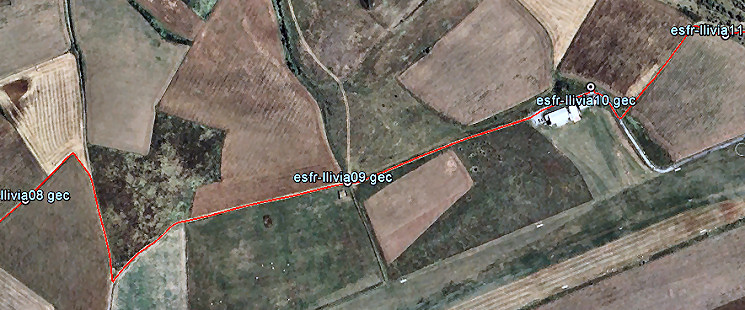 Between LL08 and LL11 you are back on dirtroads and the bordermarkers easy finds. |
||||||||||||||||||||||||||||||||||||||||
 |
LL09 |
|||||||||||||||||||||||||||||||||||||||
 |
LL10, left of the road. Just beyond the bend in the dirtroad (on this picture), go left on a dirtroad going NE. |
|||||||||||||||||||||||||||||||||||||||
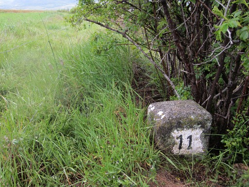 |
After 150m that dirtroad bends to the right and descends. From that bend, LL11 is 35m to the right at the edge of the field. Descend directly - from LL11 - to the dirtroad. |
|||||||||||||||||||||||||||||||||||||||
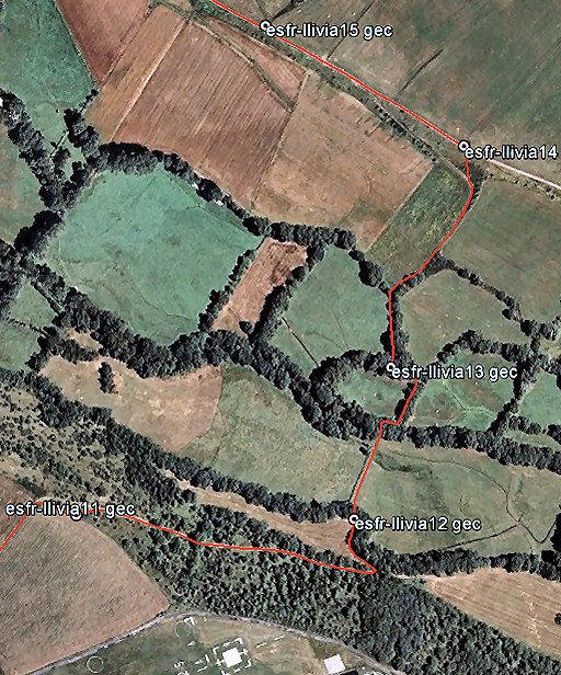 |
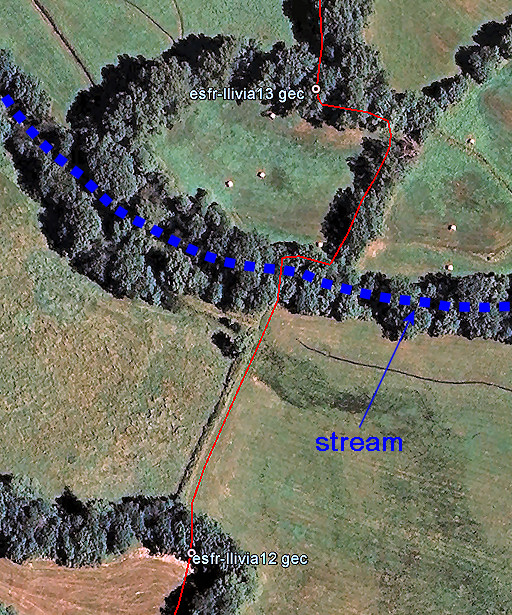
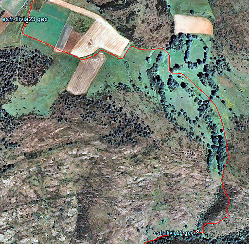
The dirtroad descends further to a meadow. Go left and localize LL12 using this map. From LL12, you could go straight to LL13 but you have to cross a stream. Proceeding on to LL14 and LL15 is easy, using this map. |
|||||||||||||||||||||||||||||||||||||||
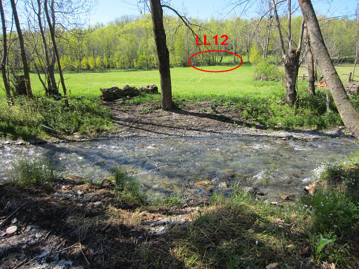
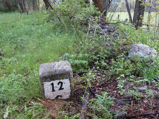 |
LL12 From here, you could go straight to LL13 but you need to cross a stream. Bm13 is then only 100m on the other side of the river. |
|||||||||||||||||||||||||||||||||||||||
 |
Let's show it in more detail. |
|||||||||||||||||||||||||||||||||||||||
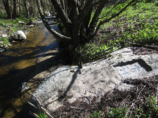
 |
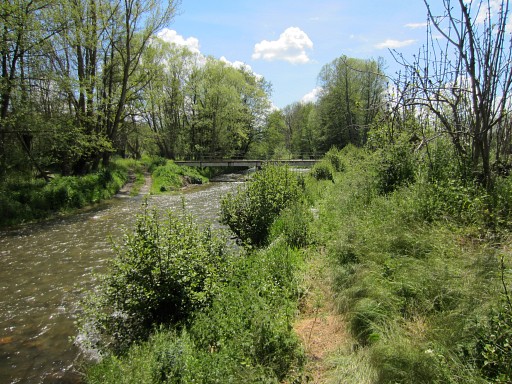
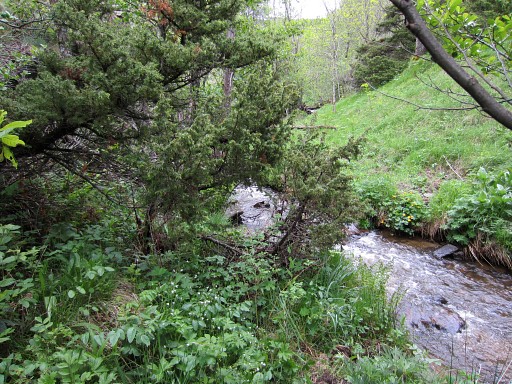
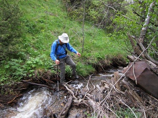
This is the spot where have to cross the stream (looking backwards = towards LL12. This picture is made in june, the stream is not very impressing and can be waded through easily. When crossing the river: using 'watershoes' and a walking stick could help you. |
|||||||||||||||||||||||||||||||||||||||
 |
LL13 only 100m from the river. Use the map above to navigate towards LL14. |
|||||||||||||||||||||||||||||||||||||||
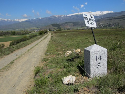 |
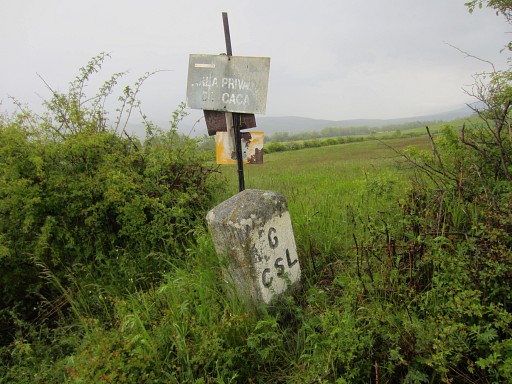
LL14 The "area privada de caça"-signs (hunting restricted) - also seen as black/white shields without a text - are helpful because they mark the esfr-border. Go straight ahead for 250m to |
|||||||||||||||||||||||||||||||||||||||
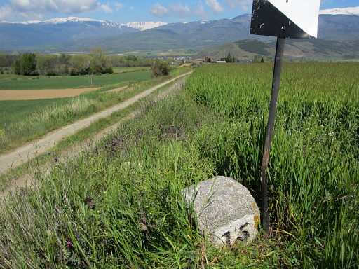 |
LL15 |
|||||||||||||||||||||||||||||||||||||||
 |
After 150m you have to go right to traverse through the fields towards LL16 along the road. |
|||||||||||||||||||||||||||||||||||||||
 |
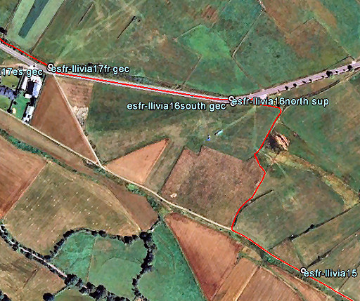
LL16south |
|||||||||||||||||||||||||||||||||||||||
 |
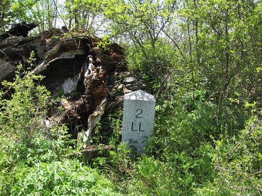
LL16north Once there was a second LL16 at the other side of the road or its more narrow predecessor. The treaty of 1868 (see this webpage) explicitly states double bm's for the range 16-20. It has disappeared or is still there underground. |
|||||||||||||||||||||||||||||||||||||||
 |
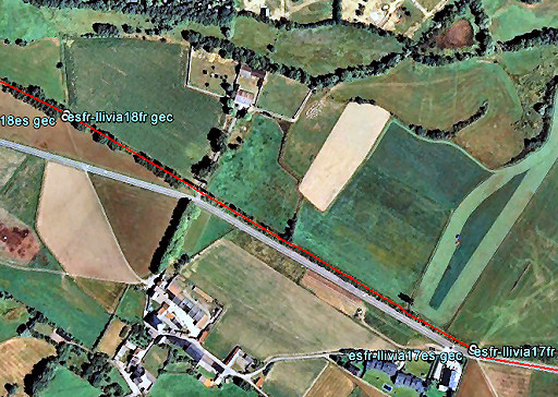
After 350m towards LLivia-town, a dirtroad branches off on the right side and continues parallel of the tarmac road. There you will find LL17: double markers. |
|||||||||||||||||||||||||||||||||||||||
 |
Continue on the dirtroad. After 650m |
|||||||||||||||||||||||||||||||||||||||
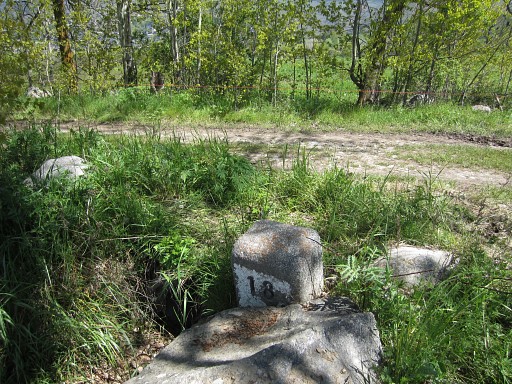 |
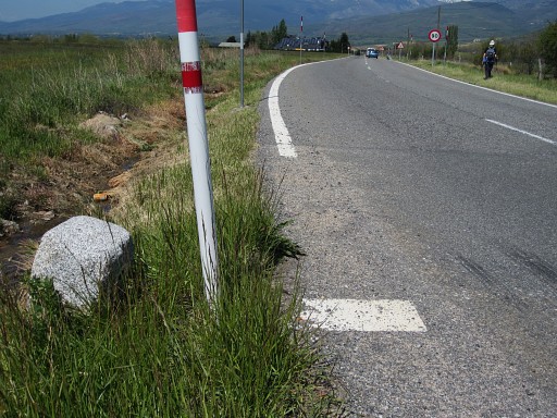
the next couple of bordermarkers: LL18 This one is at the left side of the the road, you can spot the other one on the opposite side. |
|||||||||||||||||||||||||||||||||||||||
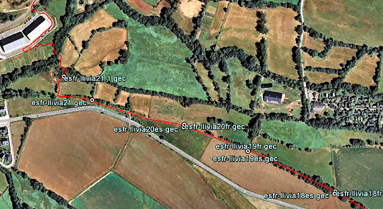 Navigation is easy now: just continue on the dirtroad until 100m beyond LL21. |
||||||||||||||||||||||||||||||||||||||||
 |
After 225m: LL19 - double markers |
|||||||||||||||||||||||||||||||||||||||
 |
Then - after 175m - LL20 (the last double markers in this range). |
|||||||||||||||||||||||||||||||||||||||
| After 250m: LL21 The borderline now leaves the dirtroad and goes straight through the meadow to LL21.1. |
||||||||||||||||||||||||||||||||||||||||
 |
Zoom-in from previous picture: LL21.1 seen from far. First proceed on the dirtroad for 100m, then enter the field to the right and climb the small hill with |
|||||||||||||||||||||||||||||||||||||||
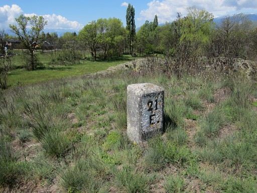 |
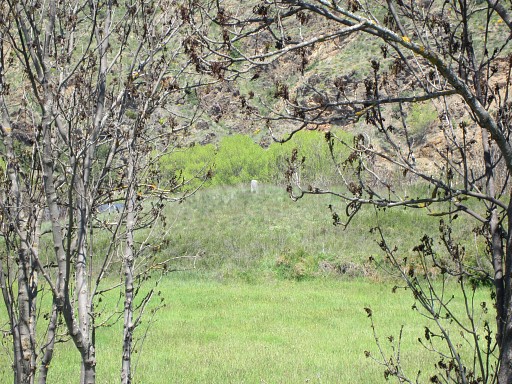
LL21.1 (we see only "21" but it is named 21.1 in the delimitation act) | |||||||||||||||||||||||||||||||||||||||
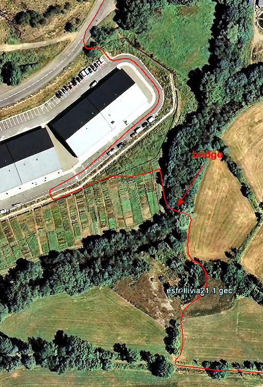 |
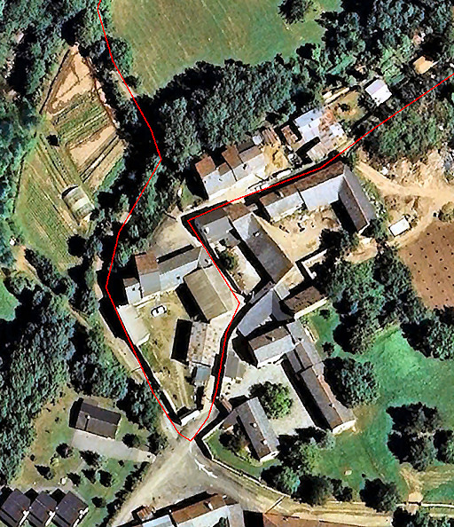
Navigating from LL21.1 to the road onwards is easy with this map. Descend on the other side of the small hill of LL21.1 and cross the bridge to a complex of small vegetable gardens (allotments). |
|||||||||||||||||||||||||||||||||||||||
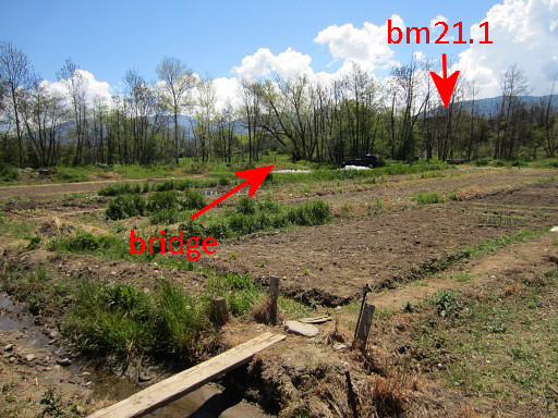 |
This picture: taken from the N-side of the allotments. | |||||||||||||||||||||||||||||||||||||||
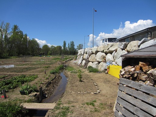 |
Through the complex of gardens, you will reach an artificial made rockwall | |||||||||||||||||||||||||||||||||||||||
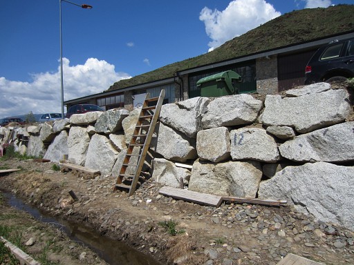 |
with this ladder to climb to a complex of industrial buildings. Then go right around the buildings and climb to the road. |
|||||||||||||||||||||||||||||||||||||||
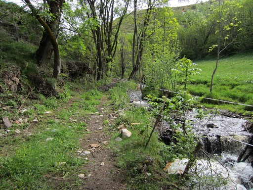
 |
Then it's a long way to LL22. This is the first part. |
|||||||||||||||||||||||||||||||||||||||
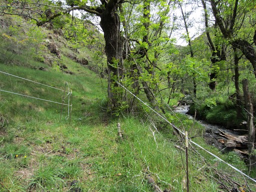
 |
This is the second part which needs some extra directions. |
|||||||||||||||||||||||||||||||||||||||
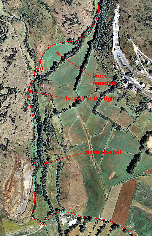
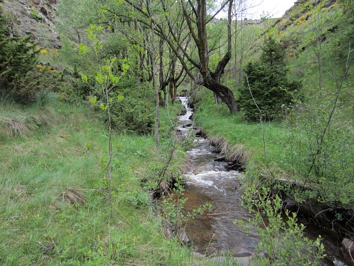
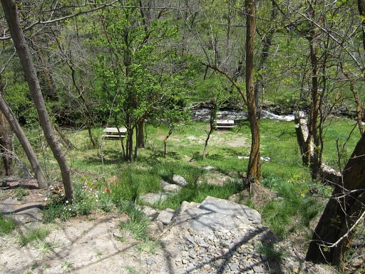 |
A small picknick-spot to the right. A trail crosses the stream on a footbridge. You could bivouac here though flat space is limited and the water of the stream seems not safe enough to drink. The bridge over the stream could be useful to reach LL22 on the E-side of the stream as an alternative access. See hereunder. |
|||||||||||||||||||||||||||||||||||||||
 |
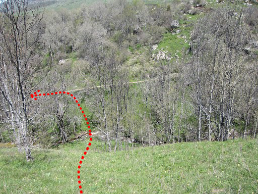
Further on, leave the main dirtroad and descend on a branch to the right. It brings you to the stream which can be crossed on a bridge. From there it's simple: just follow the borderriver upstream. |
|||||||||||||||||||||||||||||||||||||||
 |
But
there's one
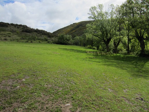
problem: at the beginning there's this horse-meadow. When occupied and
if you don't want to disturb the horses or farmer, it's an obstacle. Then there are two options: 1. Go left around the horse meadow (as the route does) and descend further on to the stream 2. Earlier on the route, there's that picknick-spot near the stream. You could go back and cross the stram there on the footbridge. At the E-bank you can then walk upstream until the fence of the horse-meadow at the other side ends. Then cross the stream to the W-bank |
|||||||||||||||||||||||||||||||||||||||
 |
At the end of the horse- meadow, a kind of dirtroad appears which becomes a trail leading you | |||||||||||||||||||||||||||||||||||||||
 |
to the end of the fence. | |||||||||||||||||||||||||||||||||||||||
 |
Now continu upstream along the stream. |
|||||||||||||||||||||||||||||||||||||||
 |
The trail goes on, gets vaguer but is still easy to follow until LL22. It's ± 1.15h from the bridge just before the horse-meadow until LL22. |
|||||||||||||||||||||||||||||||||||||||
 |
At one point you have to cross the stream because a rockwall blocks progress on the W-bank. |
|||||||||||||||||||||||||||||||||||||||
 |
After ± 20m you can easily cross back. You could also continue on the E-bank and cross it later but it seems easier to switch to the W-bank because of the trail on the W-bank. |
|||||||||||||||||||||||||||||||||||||||
 |
And then LL22 is not far away: where a small stream coming from the N merges with the borderriver. |
|||||||||||||||||||||||||||||||||||||||
 |
Now you have to leave the stream-valley and climb N-NW-W to LL23. That can be best done by climbing the rocky hillside NE of the confluence and not uphill along the stream. Your first goal is the lowest part of the meadows. There are some cattle trails on that rocky hillside to help you. |
|||||||||||||||||||||||||||||||||||||||
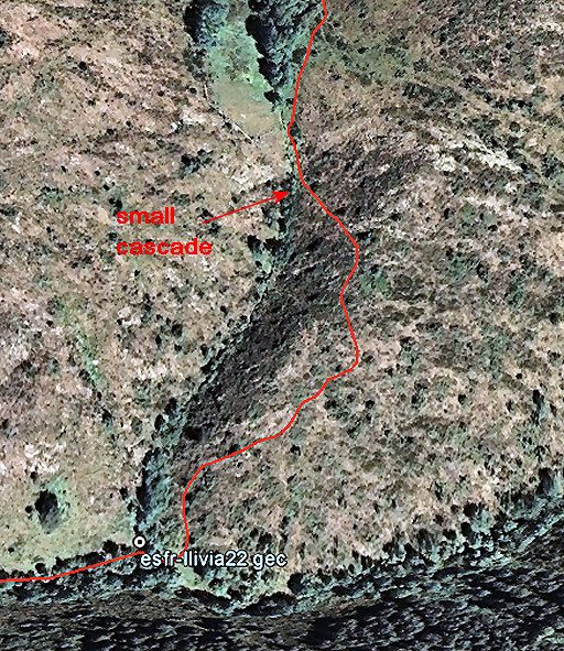 |
Let's show that first part in more detail. By the way: climbing uphill along the stream is also possible but more difficult. |
|||||||||||||||||||||||||||||||||||||||
| Approaching the (lowest part of the) meadows. There's a small cascade just underneath it. From the cascade, climb uphill throught the various meadows (see the map above). After a while a kind of dirtroad emerges which brings you finally on a plateau to a T-junction with another dirtroad. |
||||||||||||||||||||||||||||||||||||||||
 |
From that junction, go right (=N). LL23 is 35m further along the dirtroad. |
|||||||||||||||||||||||||||||||||||||||
 |
Now you have to do another crossing of fields and a stream to proceed to LL24. This map shows how to navigate. A direct course from LL23 to LL24 gets too steep and rocky. But when going first N from bm23 along the dirtroad for 200m, you can do a more gentle and non-rocky NW-descent to the stream. |
|||||||||||||||||||||||||||||||||||||||
 |
The last part of the descent to the stream. You can spot the stream. You have to cross the stream to reach the dirtroad which brings you to a sewage-installation, 100m to the left. |
|||||||||||||||||||||||||||||||||||||||
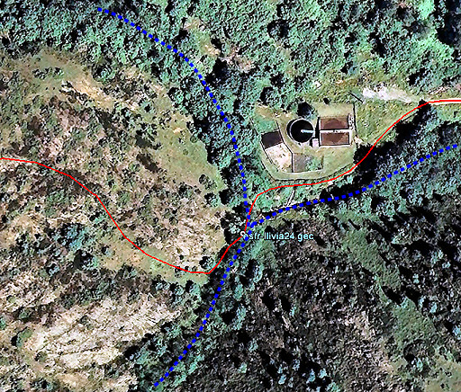 |
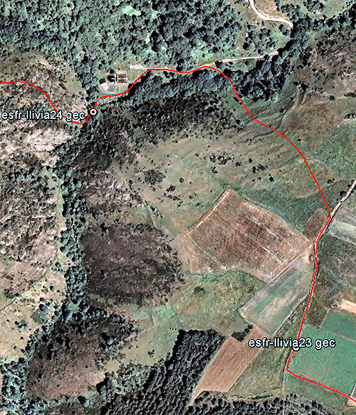
This map shows the sewage-installation and the two streams which join together S of it. LL24 is ± 30m SW of the installation, just S of that confluence at the W-side of the stream. |
|||||||||||||||||||||||||||||||||||||||
 |
LL24 Now continue ± 25m S along the stream and then climb NW uphill. |
|||||||||||||||||||||||||||||||||||||||
 |
This map (looking W) shows your course better. So: after the first steep climb NW, the climbing continues W but more gentle. LL25 is more or less on the hilltop, standing a few meters from the forest edge. |
|||||||||||||||||||||||||||||||||||||||
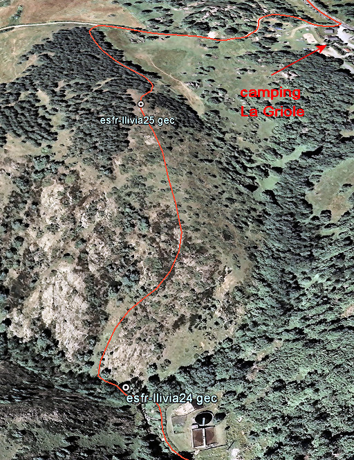
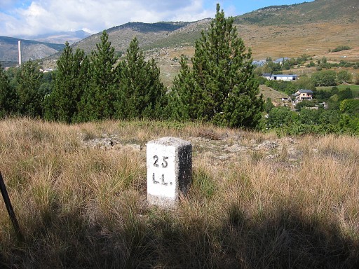 |
LL25 Now proceed W - through or along the forest - until a dirtroad. Then go right and walk to the tarmac road (D618). Just before the D618: camping La Griole which might provide a perfect stopover on this Llivia-circuit. |
|||||||||||||||||||||||||||||||||||||||
 This is an overall view of the route - mainly trough the fields to LL30. |
||||||||||||||||||||||||||||||||||||||||
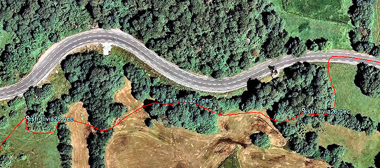 Now the first part in more detail. |
||||||||||||||||||||||||||||||||||||||||
 |
LL26: along the side of a meadow surrounded by an iron cable. Not difficult to find with the maps above. |
|||||||||||||||||||||||||||||||||||||||
 |
LL26 |
|||||||||||||||||||||||||||||||||||||||
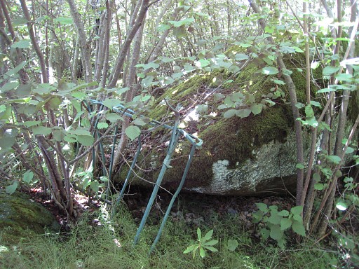 |
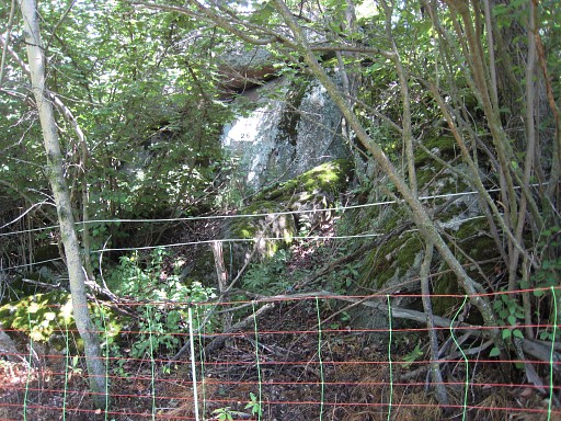
The next one - LL27
- is more
difficult to find in a bunch of boulders, all covered with moss and
hidden by bush. These boulders are situated next to the road and the one with the bm is more close to it. The luggage rack may be still there, lying against the boulder with on its top: |
|||||||||||||||||||||||||||||||||||||||
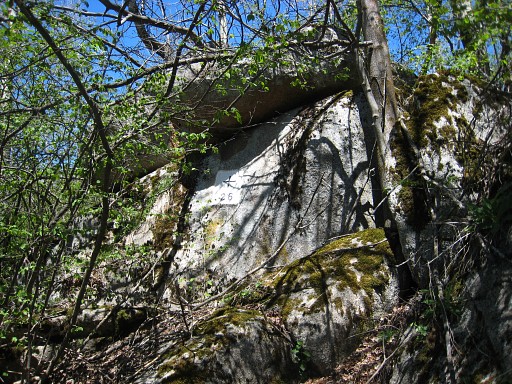
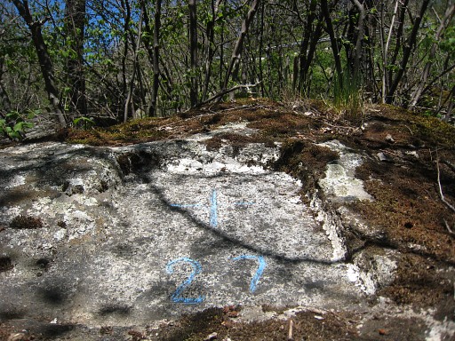 |
LL27 |
|||||||||||||||||||||||||||||||||||||||
 |
The map above will help you to navigate to LL28 and how to proceed in 75m |
|||||||||||||||||||||||||||||||||||||||
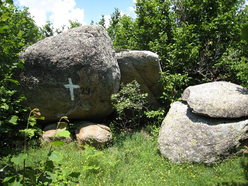 |
to LL29, this boulder, |
|||||||||||||||||||||||||||||||||||||||
 |
with on top the 'real' LL29. You can climb to it from the backside. |
|||||||||||||||||||||||||||||||||||||||
 |
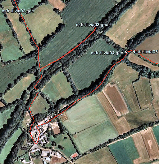
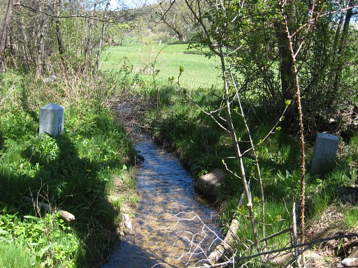
The route from LL29 to LL30 in more detail. A more straight course is obstructed by steep and rugged terrain. LL30 is not an easy find. It's on the E-side of a stream where a smaller stream or streambed coming from NE merges with the larger stream. |
|||||||||||||||||||||||||||||||||||||||
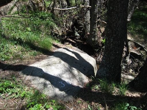 |
LL30 |
|||||||||||||||||||||||||||||||||||||||
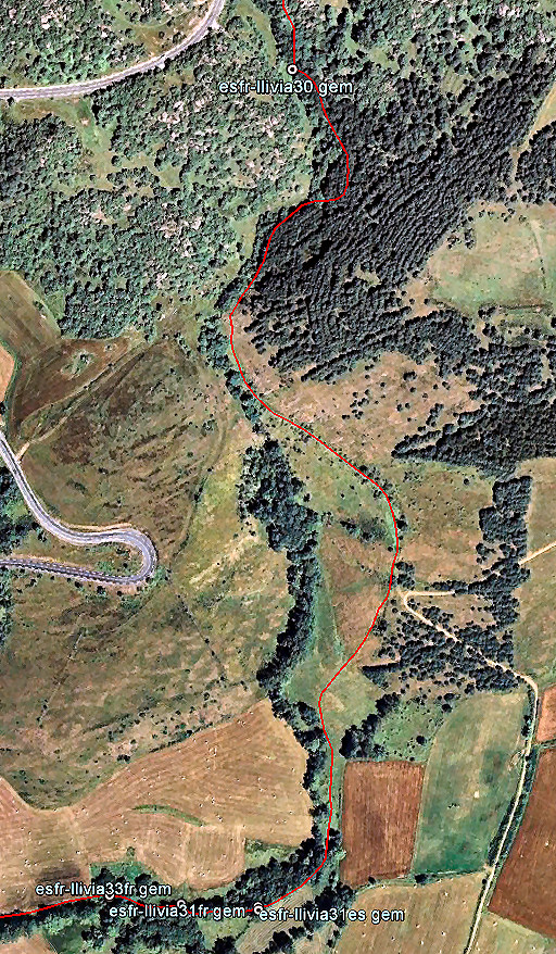 |
Then navigating to the next bordermarkers is more easy. Continue S along the stream on a trail as shown on this map. The trail will then leave the stream and climb uphill. But just before you reach a dirtroad, you have to leave the trail and descend through the fields SE back to the stream. Then follow it's course bending to the W. You now get to a second range of double bordermarkers. |
|||||||||||||||||||||||||||||||||||||||
 |
The first ones: LL31 - both markers |
|||||||||||||||||||||||||||||||||||||||
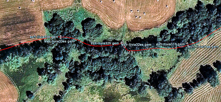 Navigating is now very easy: just follow the stream downstream. |
||||||||||||||||||||||||||||||||||||||||
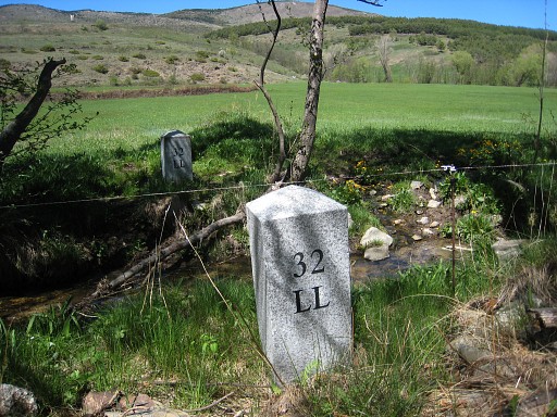 |
LL32: both markers after 75m. Now switch to the other side of the stream (=N), that's easier to proceed. |
|||||||||||||||||||||||||||||||||||||||
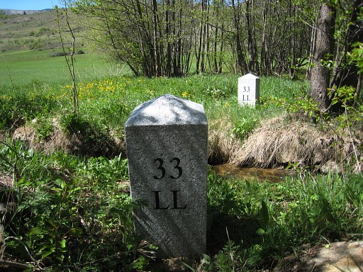 |
After another 75m the double markers LL33. |
|||||||||||||||||||||||||||||||||||||||
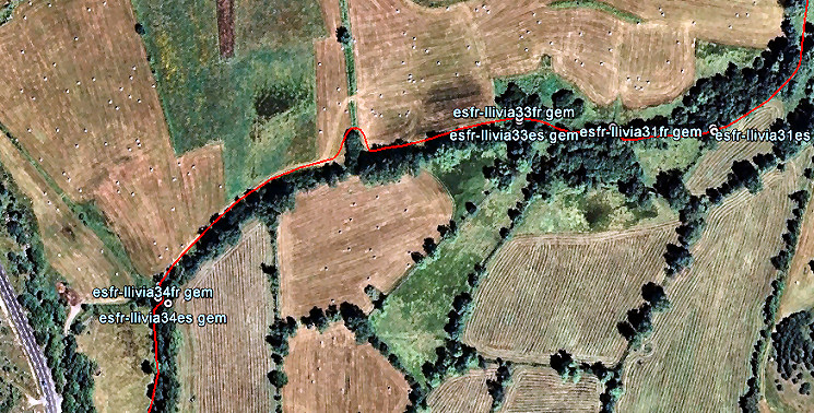 You can see on this map that LL34 is a bit further but still easy to navigate to. |
||||||||||||||||||||||||||||||||||||||||
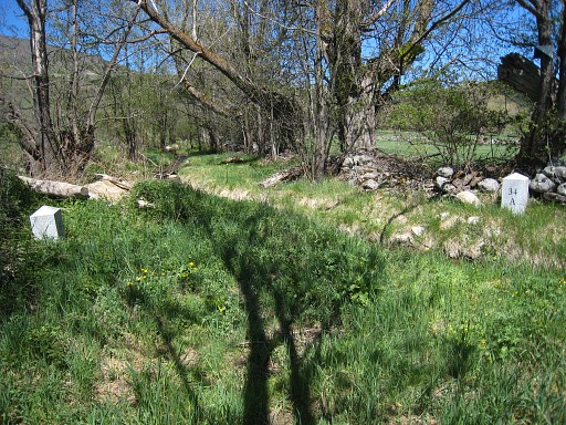 |
LL34 - both markers |
|||||||||||||||||||||||||||||||||||||||
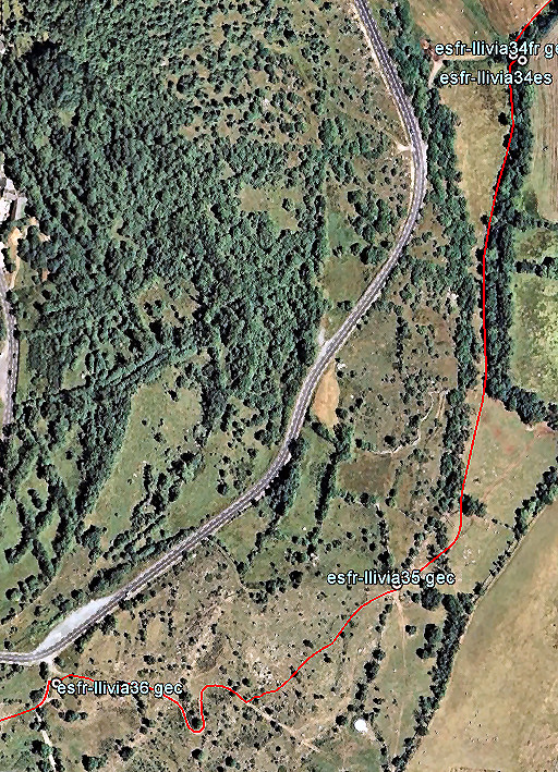 |
From LL34 onwards, navigating through the fields is easy when using this map. |
|||||||||||||||||||||||||||||||||||||||
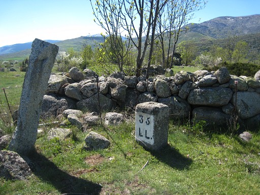 |
LL35, then SW through the field to a dirtroad. That dirtroad bring you to |
|||||||||||||||||||||||||||||||||||||||
 |
LL36 |
|||||||||||||||||||||||||||||||||||||||
 |
Another crossing of fields. Beyond LL37, the terrain descends in terrace-shape. |
|||||||||||||||||||||||||||||||||||||||
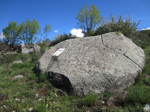 |
LL37, not difficult to find as a remarkable border. |
|||||||||||||||||||||||||||||||||||||||
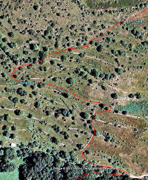 |
But then navigating becomes more difficult. This map will help you to navigate along the terraces with its walls until you have to bend to the left to find |
|||||||||||||||||||||||||||||||||||||||
 |
LL38 Go straight ahead on this terrace until its end, then descend as the map above show to a dirtroad. |
|||||||||||||||||||||||||||||||||||||||
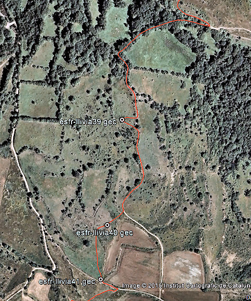 |
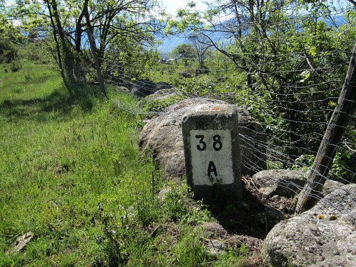
Continue on the dirtroad to the E which bends to the S. From the dirtroad, both LL39 and LL40 are easily accesible. |
|||||||||||||||||||||||||||||||||||||||
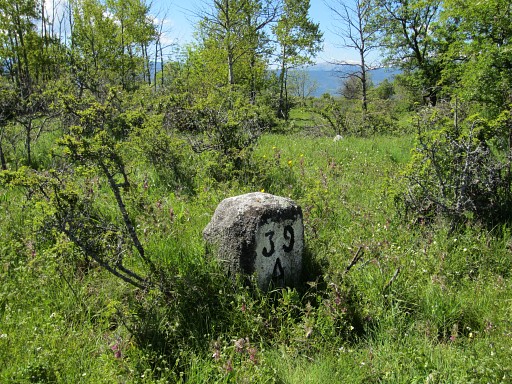 |
LL39, in a field |
|||||||||||||||||||||||||||||||||||||||
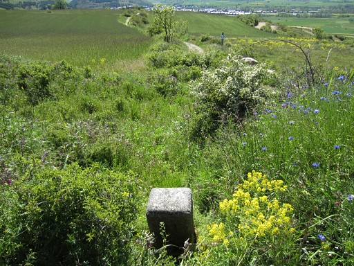
 |
LL40 From LL40, continue through the field - as shown on the map - to LL41. |
|||||||||||||||||||||||||||||||||||||||
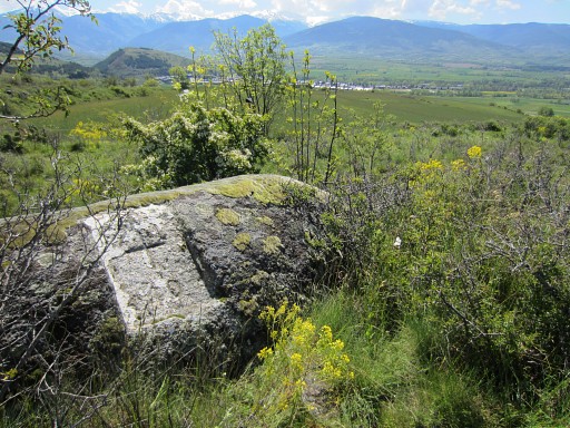
 |
LL41 is on the edge of a field. This picture looking E. Descend to the dirtroad. |
|||||||||||||||||||||||||||||||||||||||
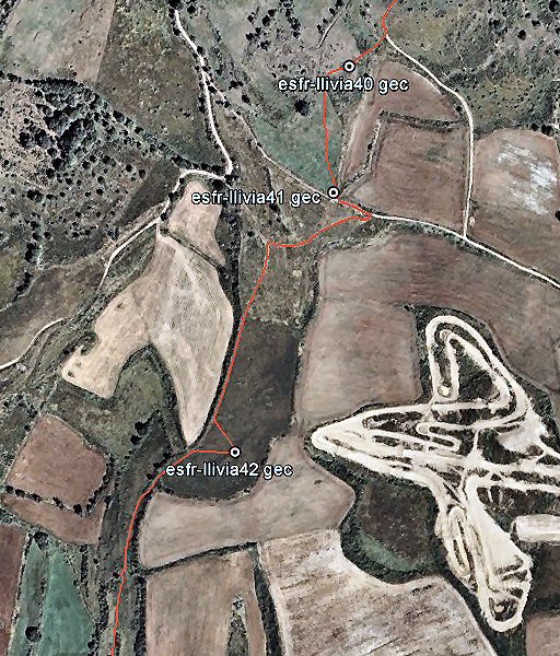 |
Follow the dirtroad 35m E , then turn sharp right on another dirtroad going SW-S. You can see, where to leave the dirtroad to cover LL42 in the middle of a field, going hence & forth. |
|||||||||||||||||||||||||||||||||||||||
 |
LL42 |
|||||||||||||||||||||||||||||||||||||||
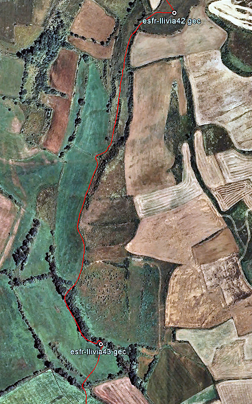 |
The dirtroad ends now and you have to continue S through the fields as this map shows. The field hedges help you to navigate and to localize yourself. In this way you will approach LL43 from its S-side. |
|||||||||||||||||||||||||||||||||||||||
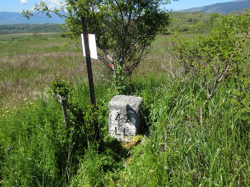
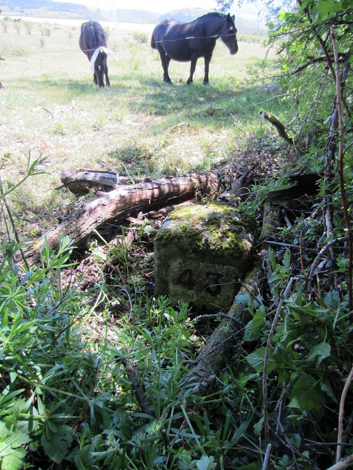 |
It's standing at the other side of the fence/hedge in a horse meadow. LL43 |
|||||||||||||||||||||||||||||||||||||||
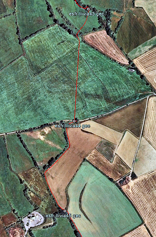 |
Then straight S through the fields/meadows to LL44. From there continue along the edge of a field to its most southern point where LL45 is hidden in a bush. |
|||||||||||||||||||||||||||||||||||||||
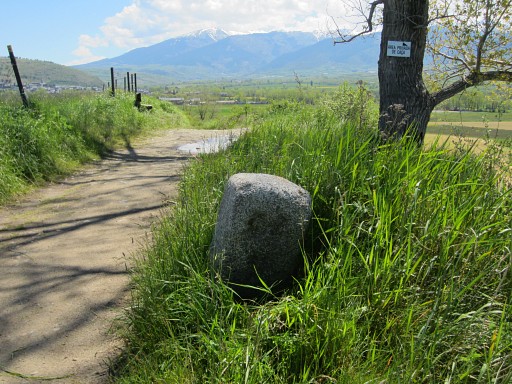 |
LL44 |
|||||||||||||||||||||||||||||||||||||||
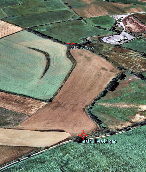 |
From LL44 the location of LL45 is already visible: it's at the far end of the field that stretches SSW. | |||||||||||||||||||||||||||||||||||||||
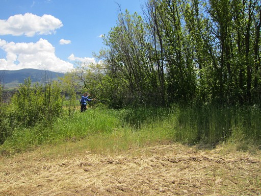 |
And at that far end, it's a few meters further. Jan-Willem is pointing to it. | |||||||||||||||||||||||||||||||||||||||
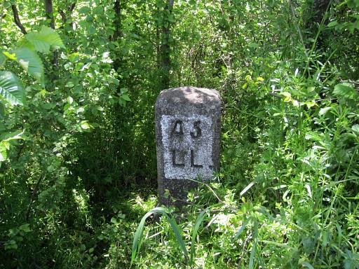 |
LL45 |
|||||||||||||||||||||||||||||||||||||||
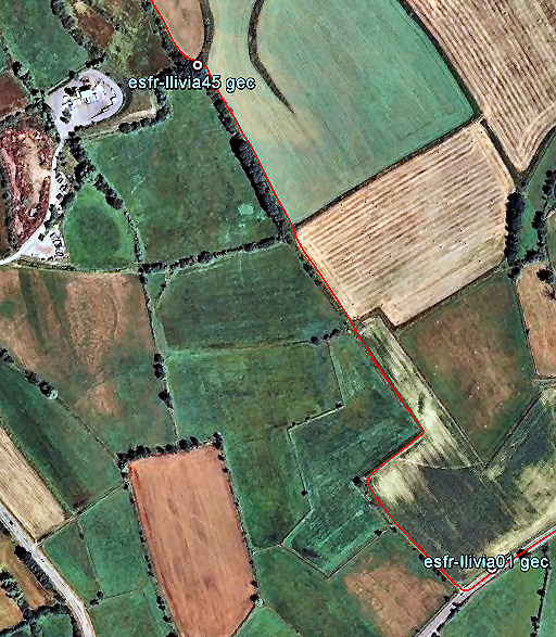 |
The last part back to LL01 is easy if you use this map. |
|||||||||||||||||||||||||||||||||||||||