The bordermarkers of the Pyrenees : all my trips  | |
| - 24 august
2007 - Forgotten passes |
 |
 |
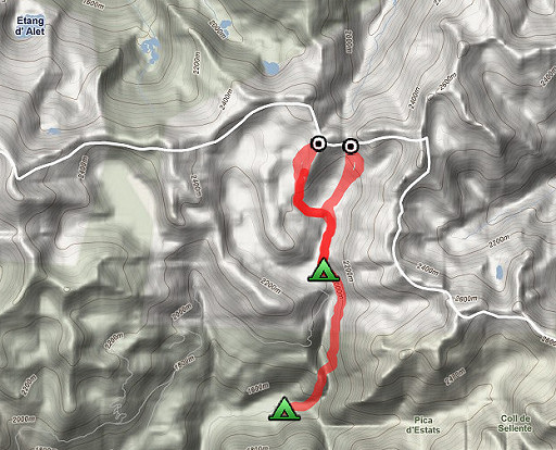
Trip-summary. Kml (opens in Google Earth: esfr-trip-track-20070824.kml Part of 3 days "bm-backpacking" (out of 6) NE of Andorra, covering bm423-426. Day 2: exploring the two remote passes with bm424 and bm425 and descending to Pla de Boavi. The previous day I walked from Noarra past Refugio de Certascan to the lake of Laguna Romeda de Baix (or Estang de Romeda Baix) where I camped for the night. |
 |
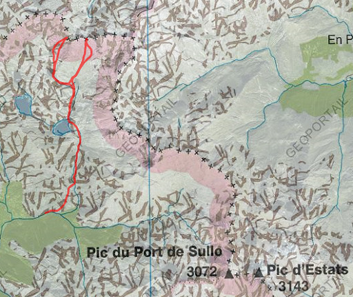
Both bordercrosses are not shown on the IGN 50k and 25k maps. Their locations had to be derived from comparing the names of the passes mentioned in the Procès Verbal with the passes shown on the current maps. In this case, that wasn't a 1-to-1 match. Names may change or linked to other passes or pics than in the 19th century. And there can be a difference between French and Spanish maps Bm417 is a similar case: according to the Procès-Verbal the Cap de la Pique and Pic de Huradic are the same summit. On present-day maps they are different pics. |
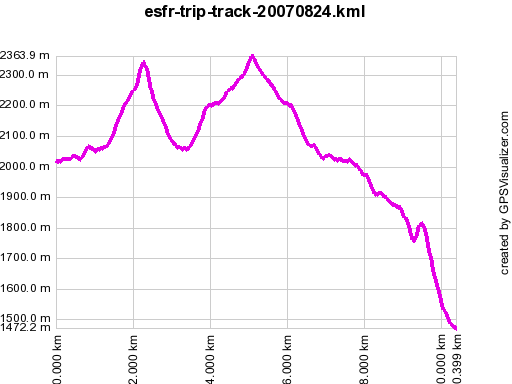 |
According to gpx-view: Distance : 10.381 km Altitudes : Maxi 2364 m Mini 1472 m Denivellation : +636 m -1152 m |
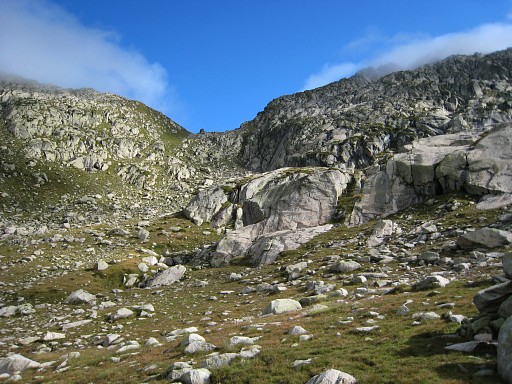 |
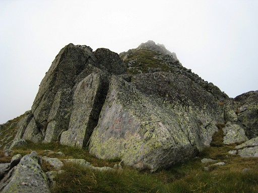
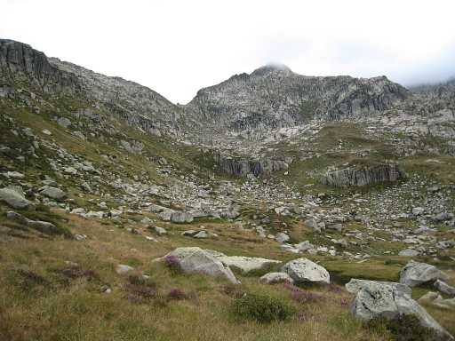
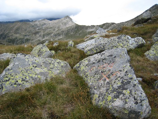
It took me about 2 hours to reach Port d'Aulús, passing two small lakes along their west-side. When the clouds disappear, the Port becomes very clear. We can spot - on this picture - the boulder in the middle of the pass. On that boulder, bm425 is engraved. There's no trail but the climb to the Port gives no problems. |
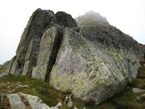 |
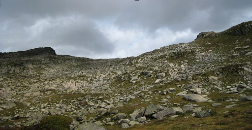
This is the boulder in the middle of the pass. Bm425 is at its east-side, facing Spain. Coordinates: N42 43 08.1 E1 20 36.3 H2339m (on my watch 2324m) |
 |
From the Port looking back into Spain where I came from. |
 |
Bm425 |
 |
Finding bm425 on this pass confirmed my interpretation of the Procès-Verbal and the maps. Now I know that bm424 must be at Port de Guiló (Spanish maps) or Port de Sounou (French maps). |
 |
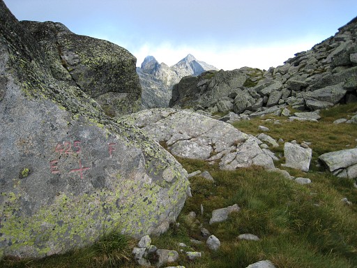
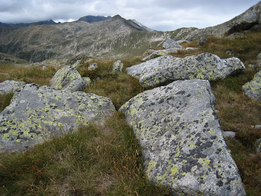
There is a sort of trail descending into France but looking very steep. I decide to make a loop via Spain to bm424. This picture: looking back at the Port d'Aulús in the distance. |
 |
Later I regretted my decision because
it took me 2 hours to descend and climb to the plateau with Estanys de
Guilé and climb further along two other lakes to the pass. I walked via the second lake to the pass but you might as well go directly from the NE-corner of the first lake in NNE direction. This picture: looking forward to the Port which is very broad-shouldered. The actual pass is in the middle with a metal pole which you can see from far. |
 |
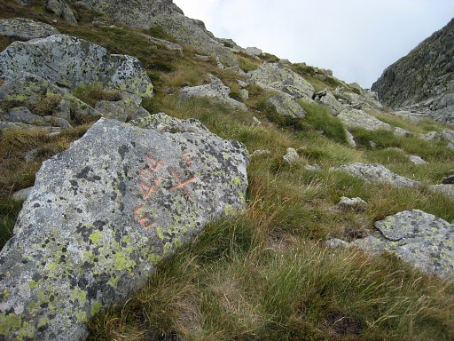
Bm224 was difficult to find. It is located more or less along the path with its side tilted to the path. Coordinates: N42 43 09.5 E1 20 13.8 H2376m |
 |
Bm424 It's obvious that this borderpass is hardly used. That is evenmore the case with bm425 with no or hardly traces of waymarks / trails. But once - in the 19th century - these passes must have been considered important enough to receive a bordermarker. |
 |
Also at this pass - like the previous one - the descent into France is steep. But a loop via France must be a lot faster than my route. |
So
I didn't try the loop via France from bm425 to bm425 or viceversa. I
was happy to receive in 2013 the following picture and information from
Jacques Koleck concerning these 2 borderpasses.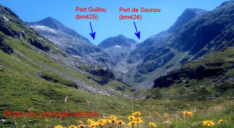 Jacques Koleck: for me there is no doubt that the port Guillou is left on this photo taken from the French side, the Port de Sounou to the right. In his book 'les PYRÉNÉES' Adolphe Joanne wrote (in 1879) : "The Port de Guillou (which leads to Tabascan) is divided into two passages separated by a small summit. The east passage, 2342m high, opens below a peak called Ventefarine, the other, the Port de Sounou, 2402m high, passes along Pic de Turgulla (2495m) and is only used by the flocks after snowmelt. They are both only practicables during 2 to 3 months of the year. To the NE is the Pic de Puntussan (2715m) " |
|
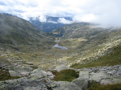
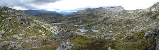 | This panorama: from the pass looking back at the plateau with the various lakes I passed. |
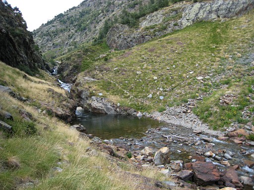 | In ± 1.15 hours I'm back at Estang de Romeda Baix where I started this morning. The whole trip to the two passes took me in this way± 6 hours . With a loop via France ± 5 hours? Then I descend in 2 hours along a stream (this picture) to |
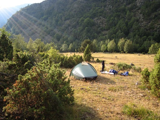 | Pla de Boavi to pitch my tent. The next day I will continue to Pla de Boet. |
|
| |