|
The
bordermarkers of the Pyrenees : all my trips
 |
|
| -
6 may
2010 - Bm089 in duofold |
 |
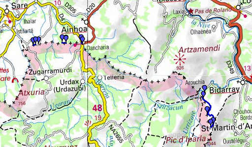 |
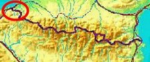
esfr-trip-track-20100506.kml (click to open in Google Earth or copy link to Google Maps; click right on this link to download gpx-version) A search together with Jan-Willem on 4 different places for a few missing bordermarkers, not found last year. Overall dry weather, heavily clouded in the morning and spell’s of sun in the afternoon. |
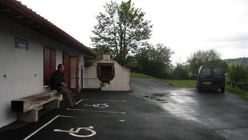 |
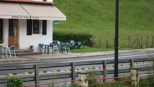
Starting from this gîte d étappe in Ainhoa. The previous day we drove from Holland to Ainhoa. |
 |
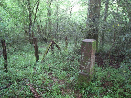
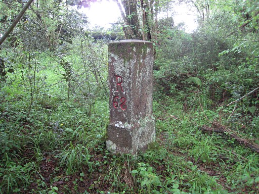
esfr-trip-track-20100506-trip1.kml (click to open in Google Earth or copy link to Google Maps; click right on this link to download gpx-version) First driving to close to bm062 and simply walking down a country road along a fence to it. |
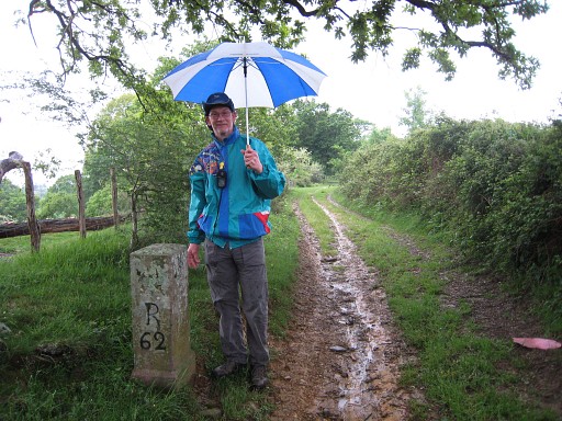 |
Bm062 with Jan-Willem |
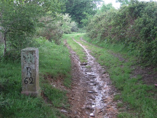 |
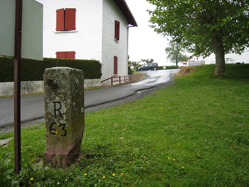
Bm062 |
 |
Bm062, looking back |
 |
Also pictures of
bm063 nearby |
 |
|
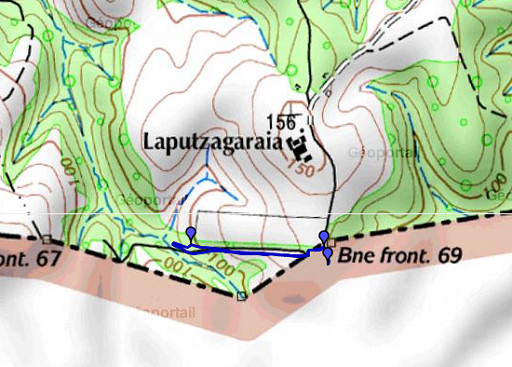 |
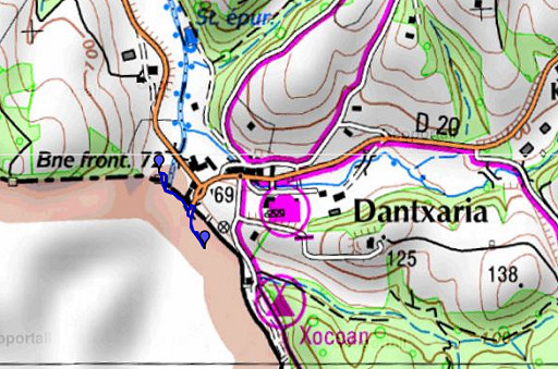
esfr-trip-track-20100506-trip2.kml (click to open in Google Earth or copy link to Google Maps; click right on this link to download gpx-version) Driving past bm063 to Zugarramurdi in Spain and in the direction of Dantxaria. Taking a narrow road, later country road to bm 069. |
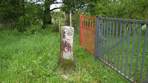 |
Bm069 |
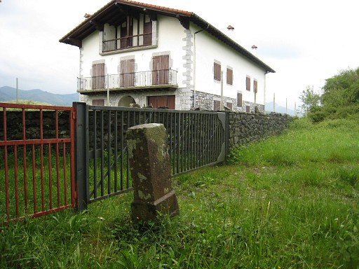 |
Bm069 with that intriguing empty apartment-building. Tackling the walls around that building and walking along on the spanish side of the fence. First over the meadow and further in the forest on a sort of cattle track or country road. |
 |
Right along the
fence there’s a narrow track and from there we spot bm068 on the French
side of the fence. |
 |
Bm068 |
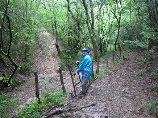 |
The cattle track leads to a gate, passes a stream and continues We walked that part last year on our search for bm067. |
 |
esfr-trip-track-20100506-trip3.kml (click to open in Google Earth or copy link to Google Maps; click right on this link to download gpx-version) Back to the car and to the main road and to Dantxaria and walking to the spot where bm072 was removed temporarily last year. |
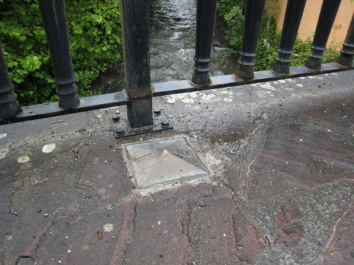 |
On the old bridge over the 'border-river' this bordersign on one side |
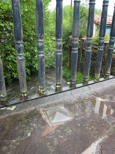 |
and this one on the other side. |
 |
The bridge as a whole. |
 |
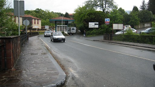
In front of the
venta there’s a new road leading to a new bridge over the river. |
 |
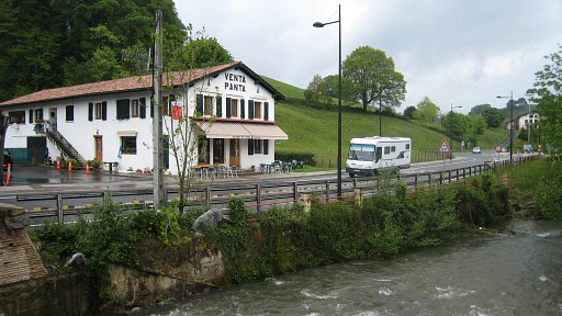
Bm072 is back
besides the venta but seems to have got another place: besides and not
in front. I have to check that on older pictures from other people. |
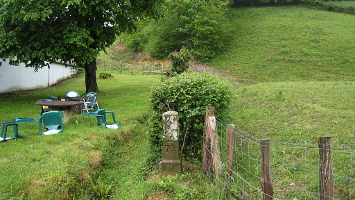 |
Also: the number is
facing back in stead of looking forward in the direction of
the borderline and the next bm as is usual. This seems a misstake. |
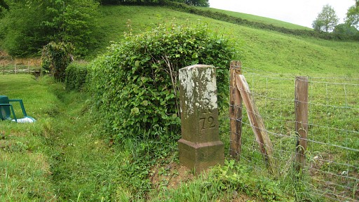 |
Bm072 |
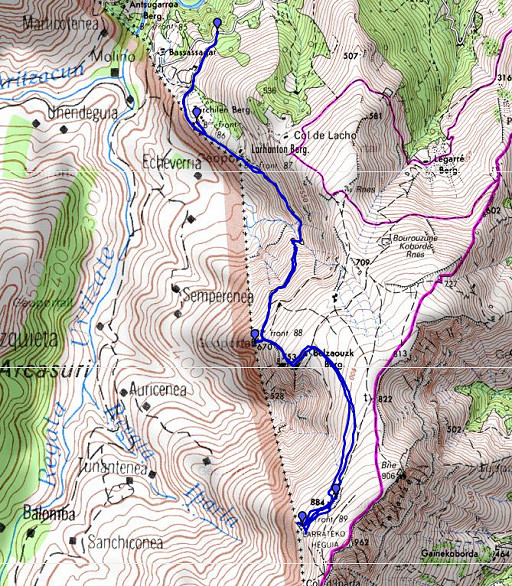 |
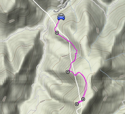
esfr-trip-track-20100506-trip4.kml (click to open in Google Earth or copy link to Google Maps; click right on this link to download gpx-version) Driving to Bidarray and on a narrow windy road up to where the country road starts its way to bm 086 and the lost bm087. We start walking on 13.45 and are back 18.45. |
 |
For explanation of
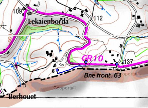
the gps-coordinates and other cartographic backgrounds: see my cartography page |
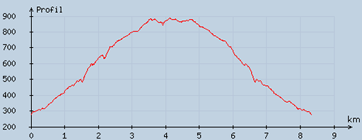 |
According
to visugpx - distance : 8.57 km - cum. elevation gain : 696 m - cum. elevation loss : 696 m - total elevation: 1392 - altitude maxi : 888 m - altitude mini : 277 m - altitude average : 597 m |
 |
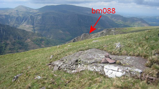
We take the track
from (the place of) bm087 up to bm088. Sometimes a vague track but
overall clear enough. |
|
Bm088 Move the mouse over the picture to see the next bordermarkers |
 |
Bm088 |
 |
Bm088 with Jan-Willem |
|
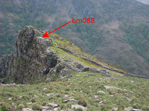
We have entered that triangular enclosure - with bm088 at one of its corners - through a a wide gap in the wall. Move the mouse over the picture to see the trail leading to bm088 |
 |
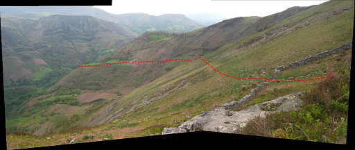
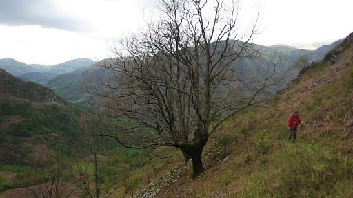
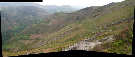
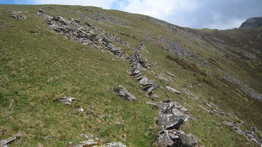
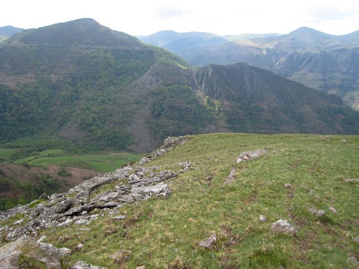
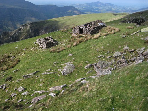
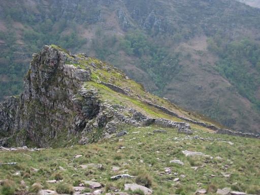
Continuing our climb along the crête
until a sort of summit, to the left and passing a ruined barn on the
right hand, then making a semicirle - still climbing but more gentle
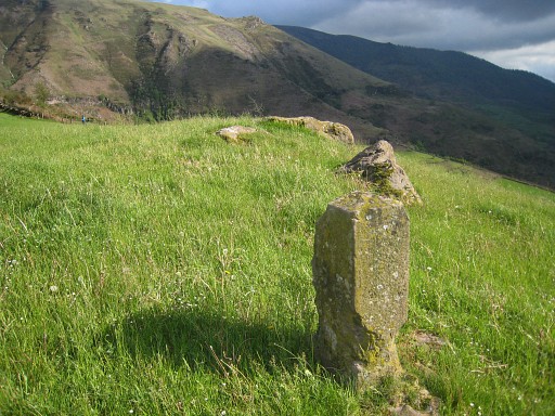
now - to a series of 3 ruined barns. Robert’s picture of bm089 is of a
stone lying in front of one of them. The last one is the closest to the
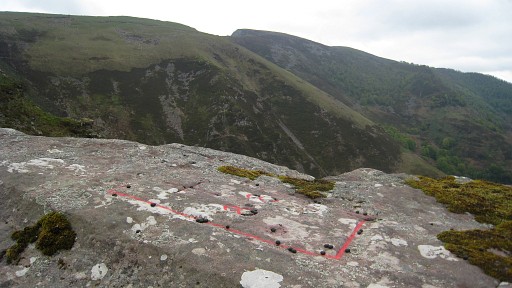
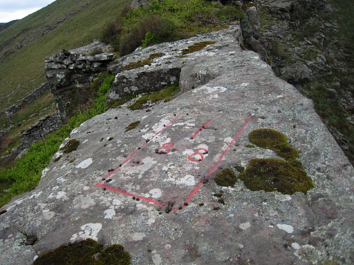
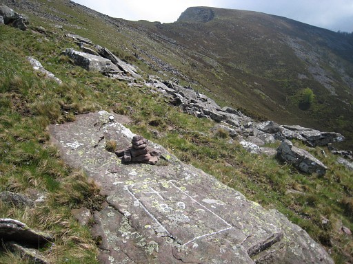
border but there we can’t find his stone. Then first with the gps to the assumed place according to the25k-map. We stumble upon a cairn and see a rectangular shape on a horizontal rock. I'm doing some brushing. |
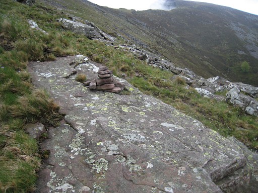 |
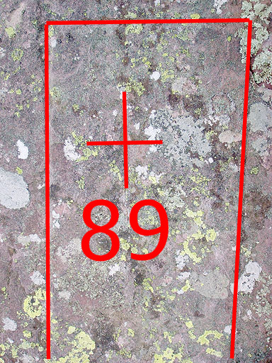
Notice the rectangular shape. |
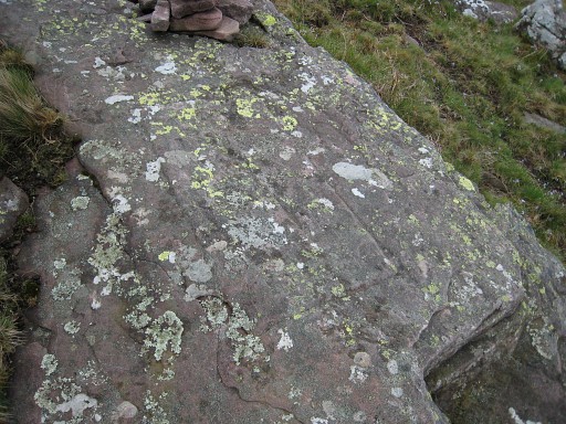 |
The rectangular engraving is very similar in shape and size to earlier crosses. |
|
The numbers and cross are almost
completely weathered away but we can distinguish still the form of
a cross and of the 9. The 8 however is hardly recognizable. Move the mouse over the picture to see cross and number imposed on the weathered engravings Photo by Jan-Willem |
 |
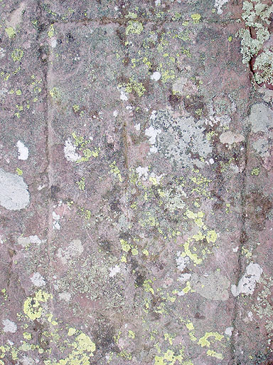
(With the rectangle chalked.) |
|
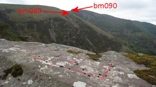
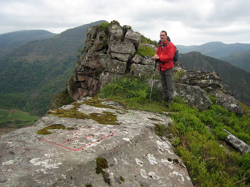
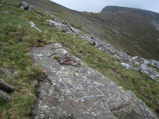
And the very spot - on one line more or less between bm088 and Col d Iparla - fits also. This must be bm089! Move the mouse over the picture to see where bm090 is located. |
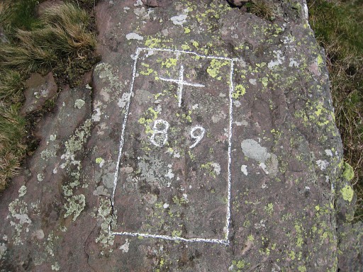 |
But still some doubts remain because of the difficulty of recognizing the numbers. |
|
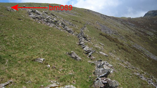
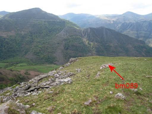
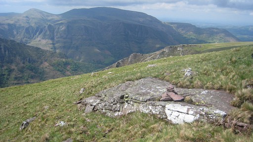
Bm089 looking northwards Move the mouse over the picture to see where bm088 is located. |
|
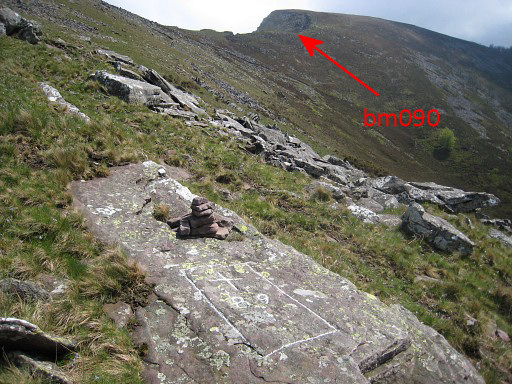
Bm089 from far Move the mouse over the picture to see where bm089 is located. |
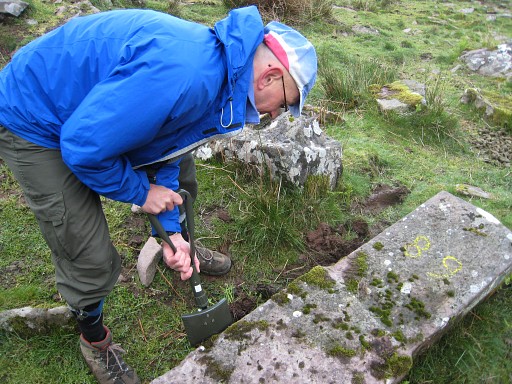 |
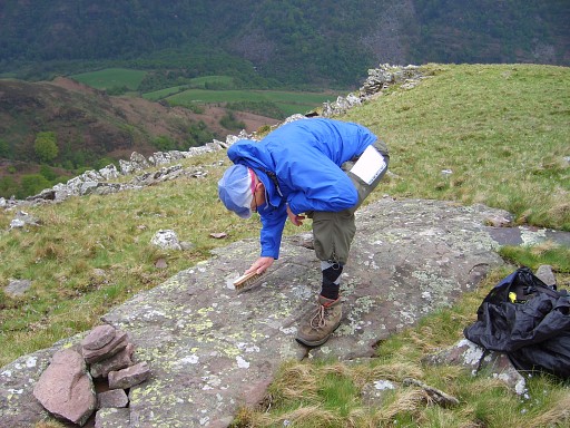
Back but checking the ruined barns to find Robert’s borderstone. Near the second one Jan-Willem finds that bordermarker lying in the grass. Definitely a typical bordermarker of this region but we don’t see a number engraved on the 3 visible sides, only one painted in yellow of which we suspect Robert. With the help of my foldable spade, |
 |
I clear the ground |
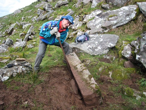 |
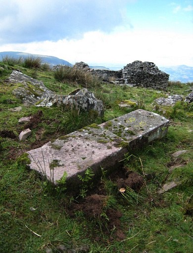
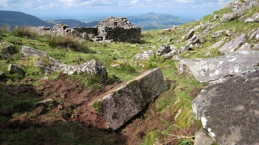
and with iron poles we manage to turn the massive stone. But still no number whatsoever to see.. A mystery: definitely the make of a borderstone but approximately 250 meters away from the border and having no number. Apparently meant to replace an older borderstone 089 or to assist the bordercross 089 but never been able to make his way to its location and destination. |
 |
|
|
I return to the spot of bm089 because Jan-Willem remembered having seen another cairn but I can't find it. Move the mouse over the picture to see where bm089 is located. |
 |
And back to the borderstone, passing again this ruin, the first of the 3 ruined barns. |
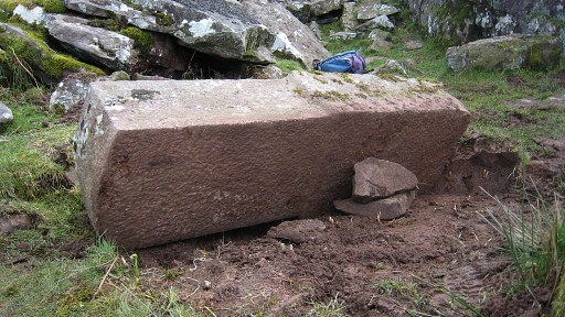 |
And this picture proves that there's no number engraved. |
|
We return on the same tracks to the car. Move the mouse over the picture to see where bm088 is located. |
 |
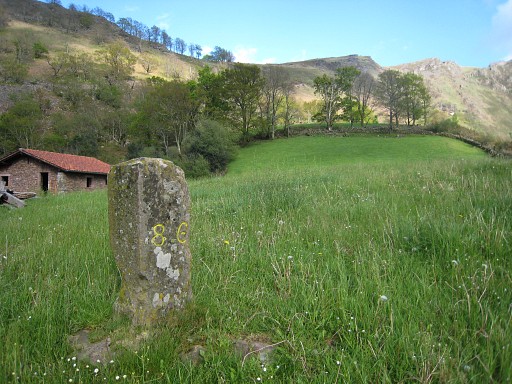
Pictures of bm086, |
|
on one side the engraved number is now painted yellow (one year ago not). We drive back to Bidarray and sleep in the Gîte d Etappe. |