|
The
bordermarkers of the Pyrenees : all my trips
 |
|
| -
6 september
2010 - Robert's menhir |
 |
 |
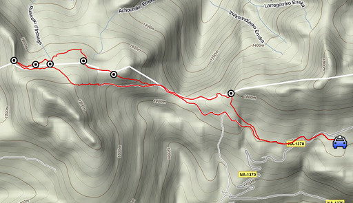
esfr-trip-track-20100906.kml (click to open in Google Earth or copy link to Google Maps; click right on this link to download gpx-version) Summary: part of a 3-days exploring trip around Arette La Pierre St-Martin. First day: a roundtrip from the Refuge Belagua in search of bm251, 252 and 255, not found last year. Weather: on the ridge very strong winds |
 |
For explanation of
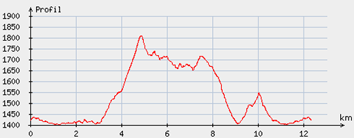
the gps-coordinates and other cartographic backgrounds: see my cartography page Start: 12, break: no, finish: 17, net walking time: 5 hours According to the gp-tripteller: Distance: 13,6 km Time moved: 3.59h Time standing still: 1.06h In total: 5.05h Total ascent: 965m Maximum height: 1799m |
 |
According
to visugpx - distance : 12.53 km - cum. elevation gain : 672 m - cum. elevation loss : 663 m - total elevation: 1335 - altitude maxi : 1810 m - altitude mini : 1401 m - altitude average : 1566 m |
 |
In
the morning, I drive from Lourdes to the (abandoned) Refuge Belagua. I follow the GR12-red/white waymarks, they bring me finally to Port de Belhay with bm250. The GR12 (a regional trail in the Basque country) is only useful for the GRPdesBF from the Port d’Ourdayté to Refuge Belagua. Searching for bm251 and 252 is made more easy by the pictures of Robert Darrieumerlou on this webpage |
|
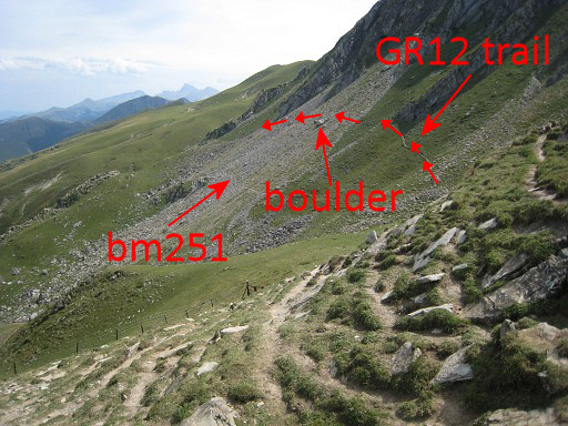
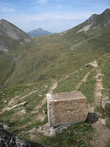
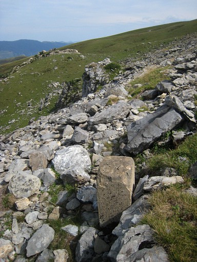
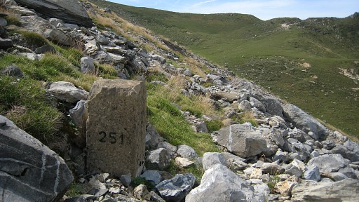
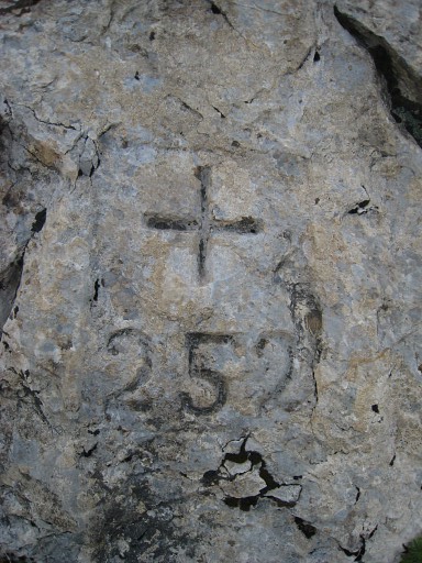
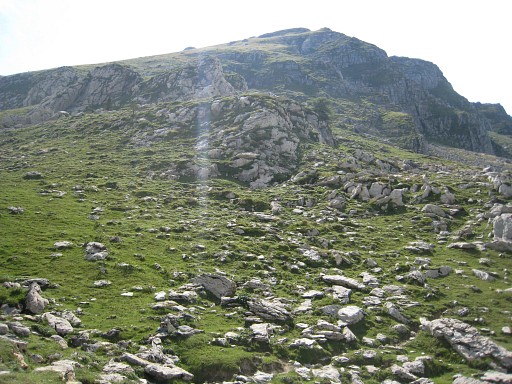
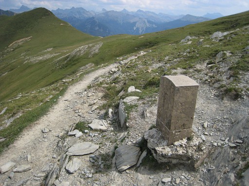
Bm251 must be
somewhere in the
middle of the rockslide on the hillside. The Gr12-trail is too
high. By trial and error, I find the borderstone. It’s about 100-200 meters under a distinctive boulder higher up and along a sort of trail (but there are more), leading horizontally through this rocky hillside. Move the mouse over the picture to see where bm251 approximately is. |
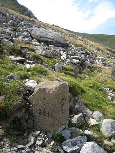 |
Bm251 |
 |
Bm251, looking to
the east |
 |
Bm251, looking up,
you can spot that distinctive boulder, straight up but a bit to the
right. |
 |
Bm251, looking to the west and the Port de Belhay in sight. |
 |
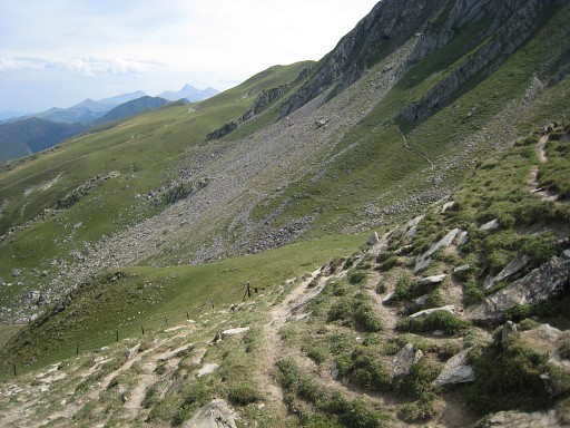
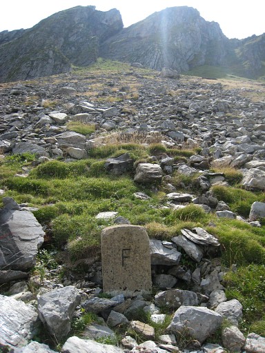
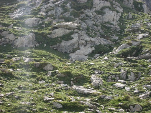
There’s is no
obvious route to bm252: after the
rockslide, there’s a sort of grassy hill-ridge to overcome. On the rocky east-side of it, there is bm252 somewhere along that hill-side ridge. |
 |
Bm252 |
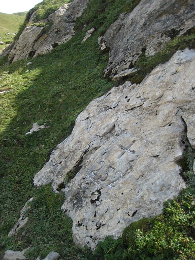 |
Bm252 |
 |
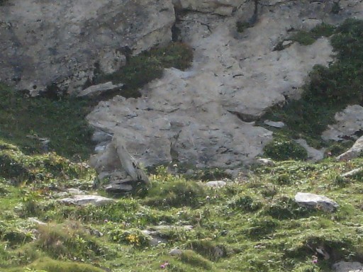
A clue: there’s a
clear path making a bend NE below the bm. This picture is taken from the spot of bm252, looking to the east. |
 |
Bm252 |
 |
This picture is
taken from quite a distance SW to visualize the location of bm252 in
the landscape. |
 |
Zoom-in |
 |
2x zoom-in. Bm252
becomes visible. |
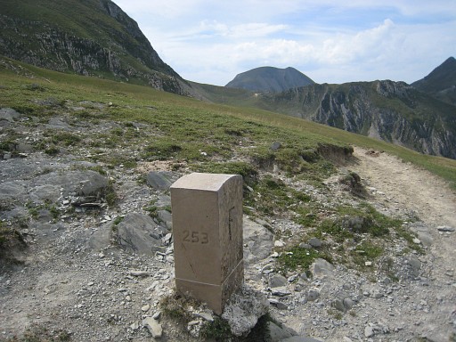 |
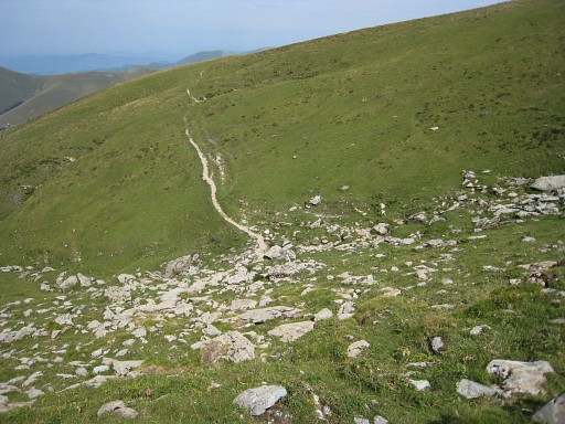
To
get go bm253, you need to climb in eastern direction, de bm is at the
north-side of a hilltop. At this picture you are looking back in western direction, the Port de Belhay visible in the distance. |
 |
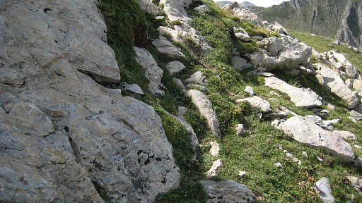
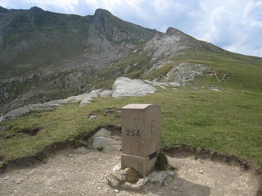
Bm253,
the hilltop being higher than Port de
Bimbaleta (in the distance on this picture) where bm254 is. I needed my gps to find bm253 back. |
 |
From Port de Bimbaleta with bm254, it’s gradually descending to Port d’Ourdayté by changing cattle trails again and again. |
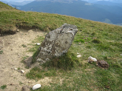 |
At Port d’Ourdayté
still no sign
of bm255. But I keep following the borderridge to find Robert’s
menhir-like rock which he assumes to act as bm255. See this page . Actually that ‘menhir’ is beyond Port de Cortaplana and has no engravings or painting. I don’t understand Robert’s reasoning. Both Procès-Verbal and maps situate bm255 at Port d’Ourdayté. Descending to my car. Up on the ridge there were very strong winds. Driving to La-Pierre-St. Marin and sleeping in the Refuge Jeandel. |