|
The
bordermarkers of the Pyrenees : all my trips
 |
|
| -
17 august
2011 - Trailrunning the GR10 |
 |
 |
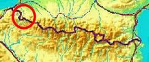
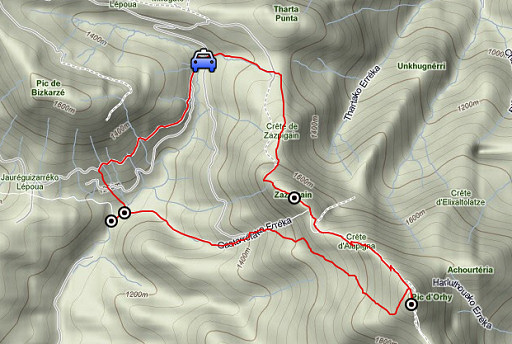
esfr-trip-track-20110817.kml (click to open this trip in Google Earth or copy link to Google Maps; click right on this link to download gpx-version) Summary: part of a 3-weeks trip to the Pyrénées to 'do' the ± 60 remaining bordermarkers. All done as daytrips from campings. Day 3: a trip to Pic d'Orhy, main target is bm235. Weather: in the morning full sun and a strong breeze in the mountains, in the afternoon clouds drifting in. |
 |
For
explanation of
the gps-coordinates and other cartographic backgrounds: see my cartography page En route (±): 10.45- 16.00 (5.15h) According to the gps-tripteller: Distance: 10,6 km Cum. elevation gain : 987m Total elevation: 1974 Maximum height: 2014 m Time: 5.16h |
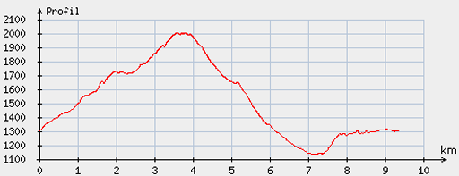 |
According
to visugpx - distance : 9,7 km - cum. elevation gain : 893m - cum. elevation loss :899 m - total elevation: 1792m - altitude maxi : 2002m - altitude mini : 1135m - altitude average : 1649m |
 |
It takes me almost
2 hours to drive from my basecamp in St-Étienne-de-Baïgorry via remote mountain roads to Iraty and to my
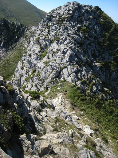
starting point near Cayolar d’Ibarondous. I climb the ridge as I did on 1 june 2009, higher up there’s a trail leading to the Pic of Zazpigain. |
 |
A view to the west. |
 |
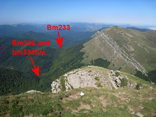
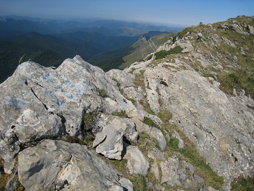
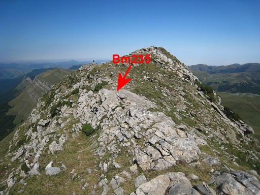
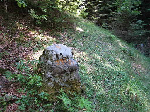
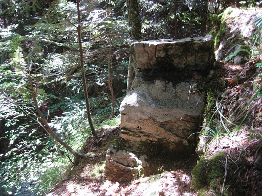
Finding bm235 is not
difficult with Charles Darrieu’s waypoint. View SE to Pic d'Orhy. |
 |
Zoom-in of the previous picture, the bm hidden by the cairn. |
 |
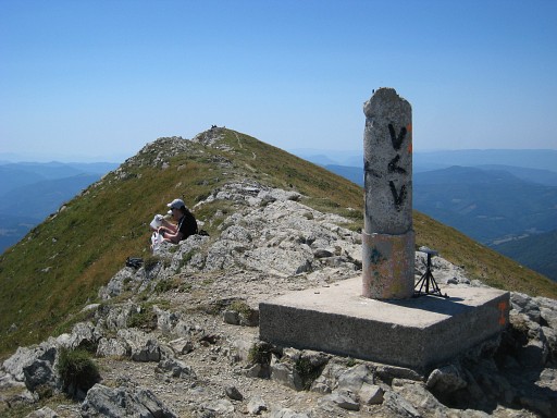
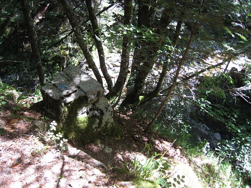
Bm235 |
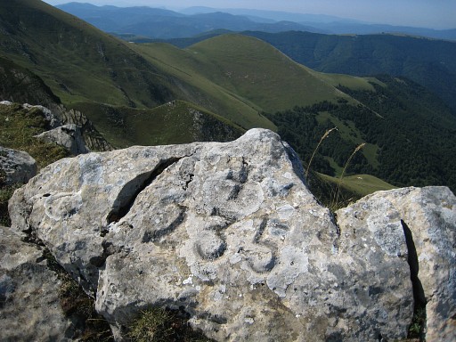 |
Bm235 |
 |
Bm235, now with some chalking. |
 |
Bm235, seen from its back and looking to the summit of Zazpagian. |
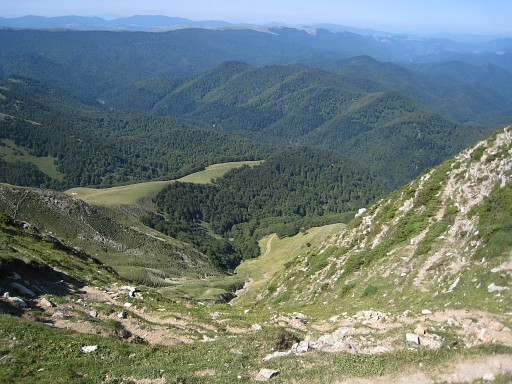 |
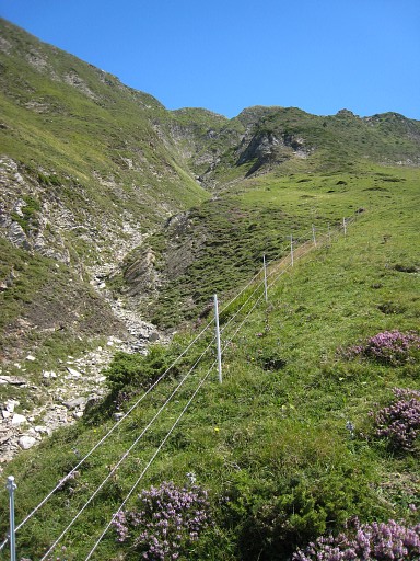
Then this view down the ravine/stream which is the borderline leading to bm234bis. |
 |
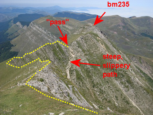
And - looking S - this is a sort op
pass, where the ravine begins. One would expect bm235 at this point - the IGN-map says it's here - and
that 's where I did an intensive search in 2009. |
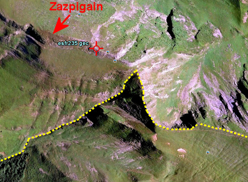 |
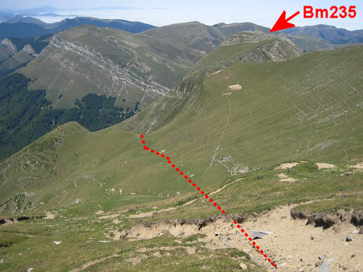
But - as you can see on this Google Earth-image - bm235 is in fact ± 150m to the NW and off the (yellow) borderline. |
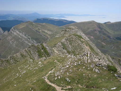 |
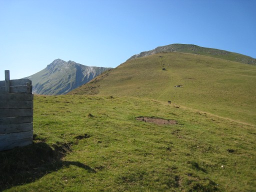
Then climbing further to Pic d’Orhy to make some pictures in this clear sky
and for a second - halfheartedly - search for bm236. I know
that the Darrieu’s and Robert Darrieumerlou have searched the ridge
thoroughly but in vain. This picture: looking back at the ridge |
 |
This is a zoom-in |
 |
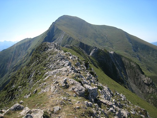
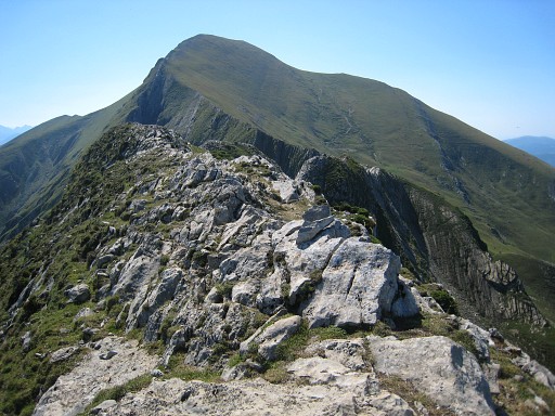
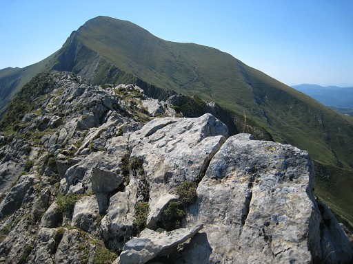
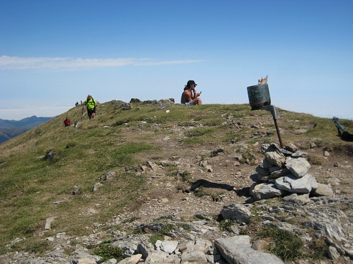
On the ridge of Pic d'Orhy, it’s busy with walkers on this fine and clear summerday. The Pic d’Orhy is more or less a horizontal ridge with 3 mini-pics on it as this picture show. On the nothern one stands this geodetic pillar, |
 |
on
the southern one this metal pole. The IGN-maps locate the - disappeared - bm between the middle pic and the southern one. There’s a slight height difference between the 3 pics (according to my gps).: from N to S: 2010m - 2011m - 2012m. So the southern one should be considered as the real Pic d’Orhy. |
 |
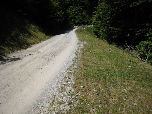
I return via a more direct descent in NW-direction |
 |
to the ravine/stream (the borderline) until the point where the
French dirtroad - coming from the N - ends. This picture: looking up the ravine. Here I meet a French trailrunner who tells with passion about her dream: trailrunning the GR10 in „semi-autonome“ style.  She - Marie Carty - is a vedette in this
region. I read somewhere on the internet: "En féminines, la spécialiste basque Marie Carty est intouchable". She's unbeatable. She - Marie Carty - is a vedette in this
region. I read somewhere on the internet: "En féminines, la spécialiste basque Marie Carty est intouchable". She's unbeatable. |
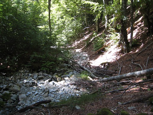 |
Then I descend along the stream (largely dry now), changing from the bed to the left or right bank,whatever suits best, |
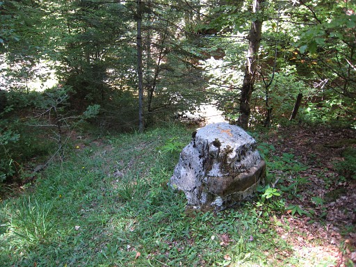 |
until bm234bis at the N-bank, close to where the stream merges with a river. That’s about 1.2 km downwards from the French dirt road and easier to walk then I thought. |
 |
Bm234bis |
 |
Then following the river to the left
for about 125m to where a stream (dry now) at your right,
descends from above and merges with the river. Bm234 is high above this confluence at its NA-angle. Climbing to it can be best done via the dry bed of the stream. |
 |
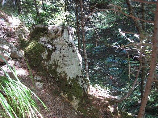
Bm234 |
 |
Bm234, looking down to the river. |
 |
I go back to bm234bis. From the
junction of the stream and river, I go a bit upstream the river until the N-slope
becomes less steep. Then climbing the hillside in NE-direction - crossing one or two forestroads - until you reach this distinct dirtroad which brings you to Cayolar d’Ibarondous where I started. |
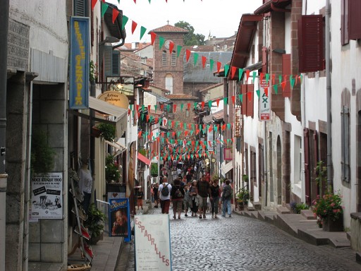 |
On my way home to the camping in St-Étienne-de-Baïgorry, I visit Saint-Jean-Pied-de-Port. |
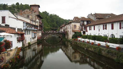 |
Once - in 1997 - my starting point for a pilgrimage to Santiago-de-Compostella. |