|
The
bordermarkers of the Pyrenees : all my trips
 |
|
| - 2 september
2011 - Disguised as a cairn |
 |
 |
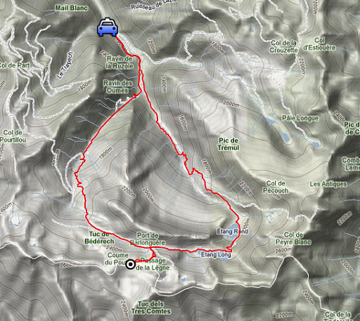
esfr-trip-track-20110902.kml (click to open this trip in Google Earth or copy link to Google Maps; click right on this link to download gpx-version) Summary: part of a 3-weeks trip to the Pyrénées to 'do' the ± 60 remaining bordermarkers. All done as daytrips from campings. Day 17: roundtrip to 420bis. Weather: sunny, pleasant |
 |
For
explanation of
the gps-coordinates and other cartographic backgrounds: see my cartography page En route: 10 - 18.30 (8.30h) According to the gps-tripteller: Distance: 24.6km Cum. elevation gain : 1491m Total elevation: 2982m Maximum height: 2508m Time: 8.34h |
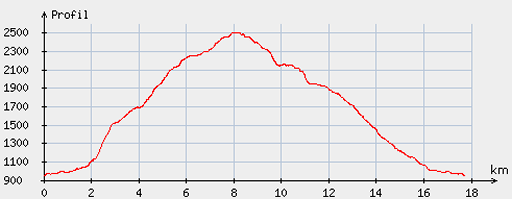 |
According
to visugpx - distance : 18,3km - cum. elevation gain : 1596m - cum. elevation loss : 1594m - total elevation: 3190m - altitude maxi : 2507m - altitude mini : 948m - altitude average : 1762m |
 |
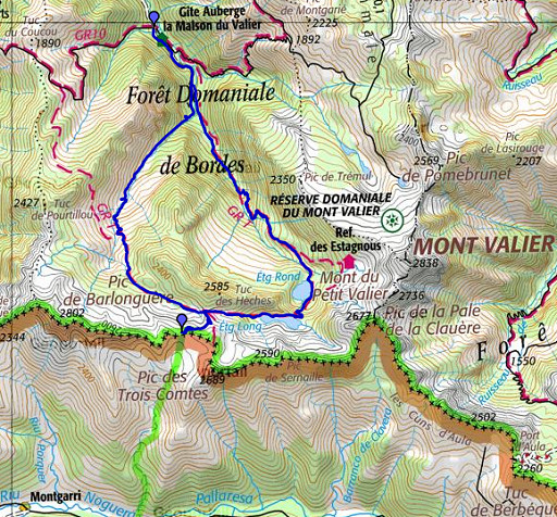
A trip to bm420bis from the Riberot-parking, south of
Castillon-en-Couseran. In the morning I drove from Fos to this parking. It took 4 hours to climb to it via the west-side. That is: climbing to Port de Barlongère and then follow the red/white 'route transfrontalière'. |
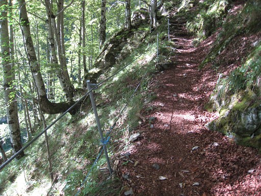 |
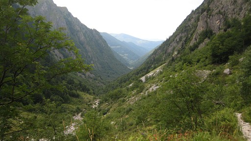
First, a steep climb through a forest |
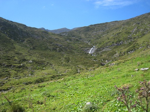 |
up to this mountain valley. |
 |
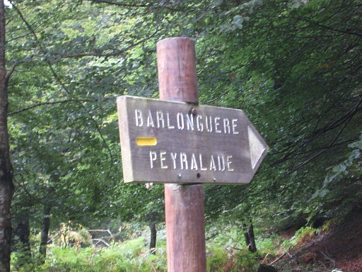
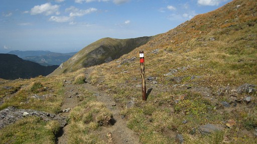
There's enough waymarking |
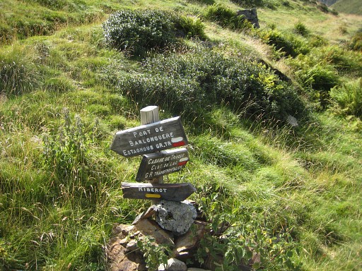
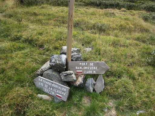
 Beyond a (private) cabin the Port Barlongère is not far anymore. |
|
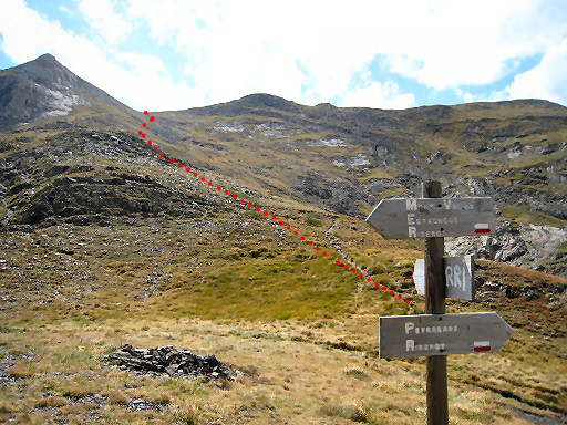 |
At the Port, one of the signs point to the hamlet of Montgarri (RRI) in Spain. On this picture: the approximate route to the border. It's a 'route transfrontalière' with red/white waymarks which were not always easy fo find. |
 |
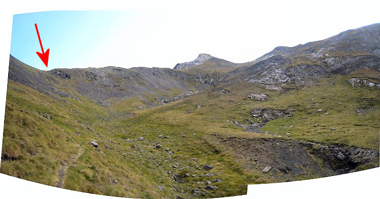
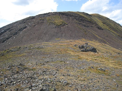
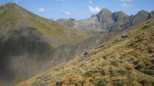
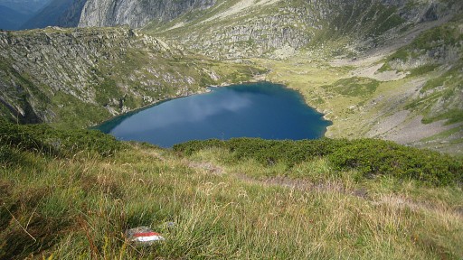
The trail crosses the border - so I learn -
at the Passage de Lègne. That's at the bottom of this picture, we're looking W. I spot something which |
 |
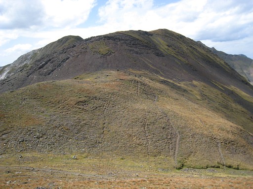
(zoom-in) must be bm420bis, standing higher on the the ridge to
the west. But it looks strange. When I get closer, I discover that |
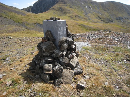 |
this bm420bis is almost completely covered by stones in a sort of attempt to
conceal it! From distance, it looked like a cairn. |
 |
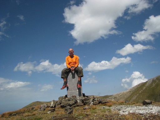
But sorry guys, I
don’t think bordermarkers should be disguised. I remove the stones and see that this bm - placed in 1997 - still looks brand new. For the story of bm420bis: see the curiosities-page |
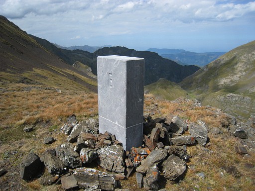 |
bm420bis |
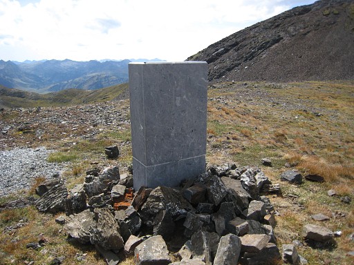 |
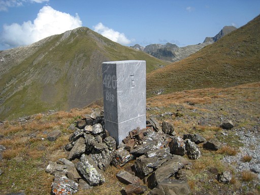
Bm420bis |
 |
From bm420bis looking back to the Passage de Lègne. |
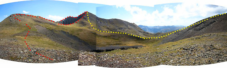 And this panorama, taken from bm420bis, shows the bassin of Renadge d'en Haut. Red is the current and correct borderline (on the watershed). Yellow is the borderline as being drawn on the maps until 1997. |
|
 |
A self-portrait, |
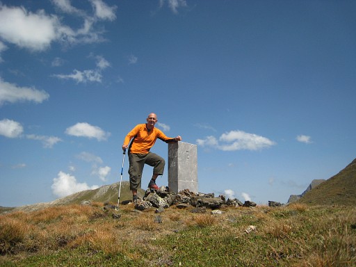 |
why not? |
 |
As said before, this cross-border route is waymarked and should bring you to Montgarri in Spain. |
 |
From the Passage de Lègne looking to the Port Barlongère where I came from. |
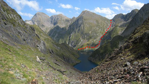 |
Then descending (also 4 hours) via two lakes on tiring rocky paths. This picture: looking down at the first lake. At the other end of the first lake, I will see where a branch of the red/white trail (the red line) leads to the Col de Clauère and eastwards into France. |
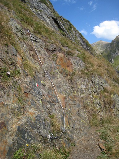 |
Along the first lake, some cables help on tricky parts. |
 |
There's enough waymarking. |
 |
After the first lake, descending to the second one and from there |
 |
descending further, back to my car and to Castillon-en-Couseran, my basecamp for the next two days. |