|
The
bordermarkers of the Pyrenees : all my trips
 |
|
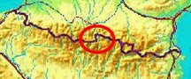
| - 6 september
2012 - On my way to Port de Clarabide |
 |
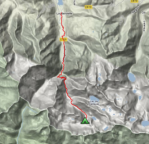 |
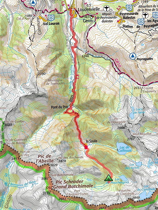
esfr-trip-track-20120906.kml (click to open this trip in Google Earth or copy link to Google Maps; click right on this link to download gpx-version) Summary: part of a 2½-weeks-trip to the Pyrenees with a lot of targets, most of them reconnaisances of routes for the GRPdesBF. Day 11: from Loudenville via Refuge de la Soula to the cabin of Prat Caseneuve Weather: sunny & warm, cloudy in the evening |
 |
For
explanation of
the gps-coordinates and other cartographic backgrounds: cartography page Start: 13.00, no break, finish: 17.15 , net walking time: 4.15 According to the gps-tripteller: Distance: 18,0 km En route: 4.21h Total ascent: 713m Maximum height: 1828m |
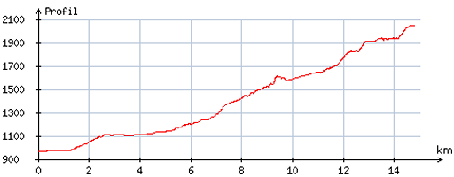 |
According
to visugpx - distance : 15,0 km - cum. elevation gain : 1130m - cum. elevation loss : 50m - total elevation: 1180m - altitude maxi : 2047m - altitude mini : 964m - altitude average : 1463m |
 |
I
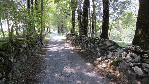
parked my car in Lannemezan and came by bus to Loudenville. The long walk from the village to Pont du Prat was eased by some hitchhiking, otherwise it would have taken me 1 hour extra. |
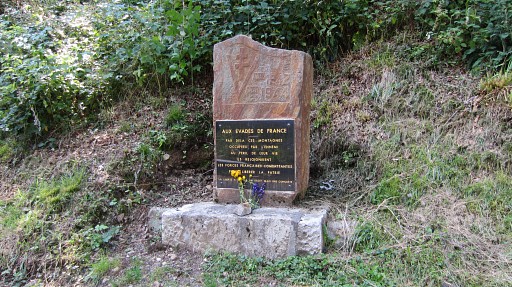 |
At Pont de Prat, this monument for the French refugees to Spain during WOII. |
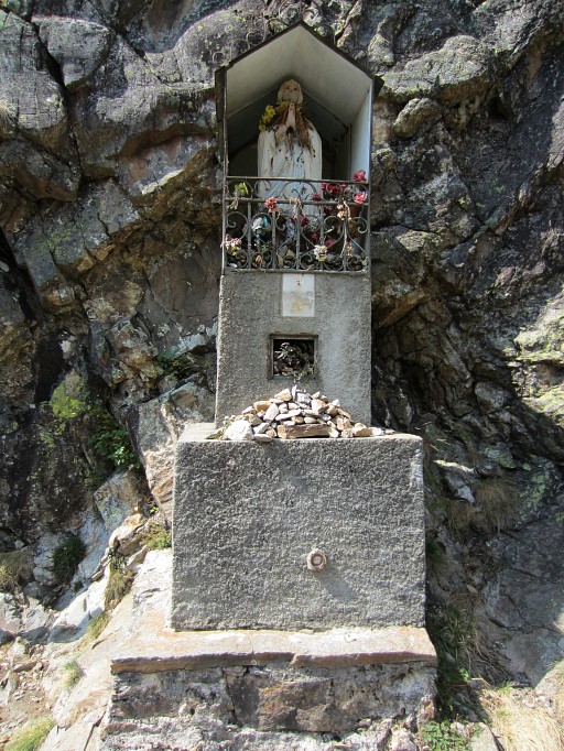 |
Then climbing to Refuge de Soula, passing this chapel |
 |
Towards refuge de Soula. |
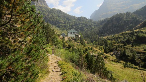 |
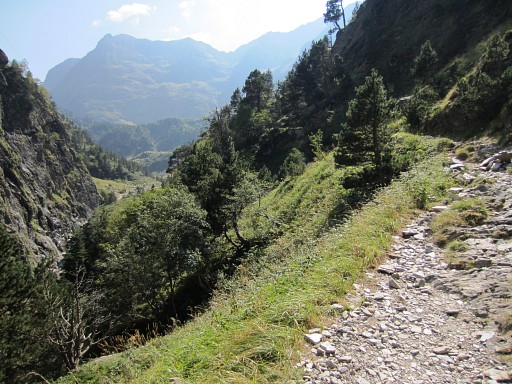
I'm close to refuge de Soula. Beyond the refuge I continue to the cabin of Prat Casaneuve. One hint: when arriving at refuge de Soula, go in between the refuge and the large building and pass over the footbridge. Don’t pass the second one. Instead go straight ahead and cairns will appear |
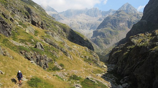 |
and guide you via various subclimbs to increasing levels up the valley |
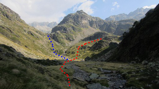 |
Be attentive and don’t climb to the lake of Lac de Pouchergues (the blue branch), that's where the dominant trail goes |
 This is a panorama stitched together from 2 pictures from Jacques Koleck which I received in 2013. The pictures were taken from the high trail which leads from Lac de Caillouas to Lac de Pouchergues. Note the red arrow pointing to Port d'Aygues Tortes. Weeks later I will learn that that Port is the original location of bm330. See the next trip (tomorrow). |
|
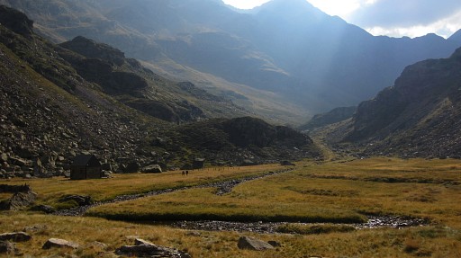 |
After the last climb I get to the last level and finally to the cabin of Prat Caseneuve. |
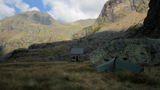 |
But I prefer the privacy of my tent. |