|
The
bordermarkers of the Pyrenees : all my trips
 |
|
| - 10 september
2012 - I've had enough |
 |
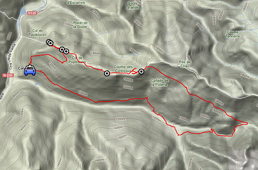 |
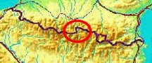
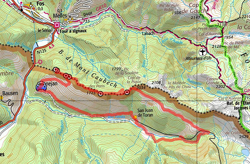
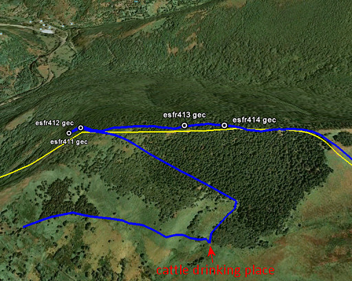
esfr-trip-track-20120910.kml (click to open this trip in Google Earth or copy link to Google Maps; click right on this link to download gpx-version) Summary: part of a 2½-weeks-trip to the Pyrenees with a lot of targets, most of them reconnaisances of routes for the GRPdesBF. Day 14: a roundtrip from Canejan, meant as a 2-days trip but my feet and mind stopped me: it's been enough. Weather: overcast & sunny |
 |
For
explanation of
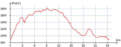
the gps-coordinates and other cartographic backgrounds: cartography-page Start: 10.30, no break, finish: 20.00, net walking time: 9.30h According to the gp-tripteller: Distance: 25,6 km En route: 9.38h Total ascent: 1417m Maximum height: 1830m |
 |
According
to visugpx - distance : 24,9 km - cum. elevation gain : 1445m - cum. elevation loss : 1444m - total elevation: 2889m - altitude maxi : 1822m - altitude mini : 886m - altitude average : 1392m |
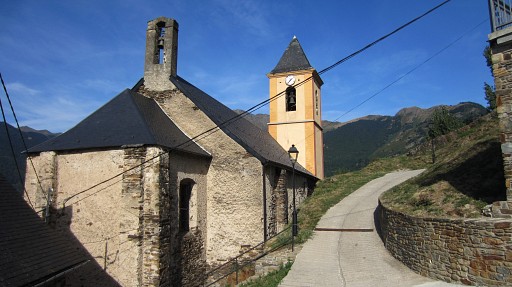 |
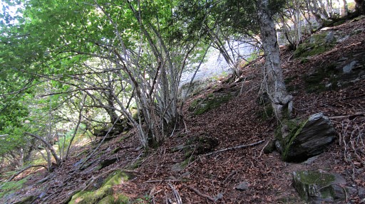
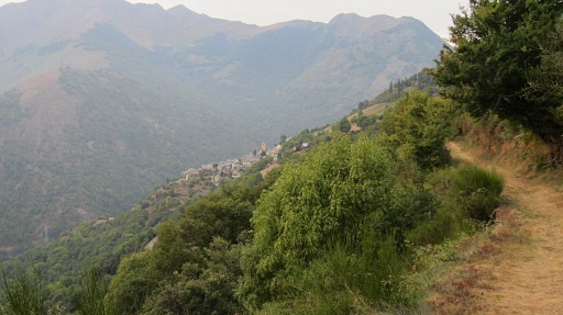
From Canejan I take the steep and winding path that starts behind the church. |
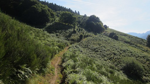 |
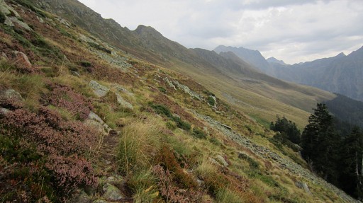
Later on, the path gets less steep. |
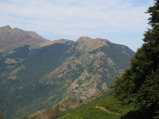 |
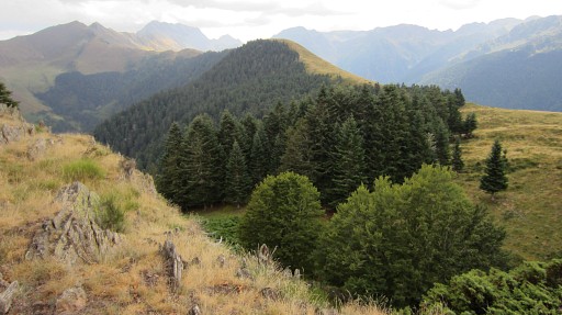
This is a view backwards to the E. The mountainridge you see is de borderridge. |
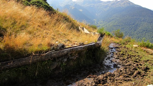 |
It brings me to a cattle drinking place. I want to try the route to bm411 which I proposed on 20100913. |
 |
And this was my proposal. |
 |
So - from the drinking place - I climb
first NE along the edge of the beach forest until I get into the pine
trees. Then bending to the left and gently climbing NW, the fern slope
still visible down to the left. |
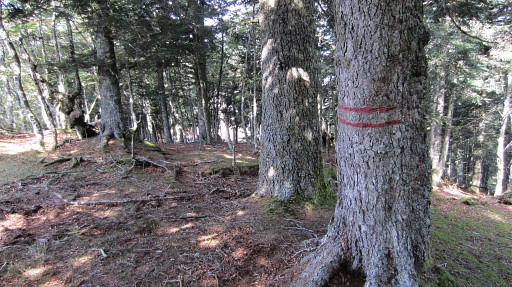 |
At one point, you’ll
reach the ridge which is the borderridge between bm412 and bm413. The
ridge here is a distinct ridge and you might spot double red stripes on
the trees, bordermarkers used by foresters. I proceed along the
ridge, descending towards bm412 and 411. But downhill the ridge isn’t that obvious anymore and the double red stripes disappear. Use your compass or gps or you might do the wrong descent as I did (descending W instead of NW). One hint: the borderridge has a rocky aspect in places. |
 |
Without a gps, bm412 and 411 might be difficult to find. Bm411 is at the edge of a precipice, that’s another hint. |
 |
Bm411 |
 |
Bm411 |
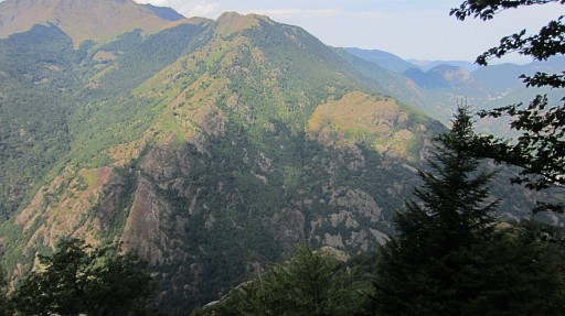 |
From here another view of the mountainridge on the other side of the Garonne |
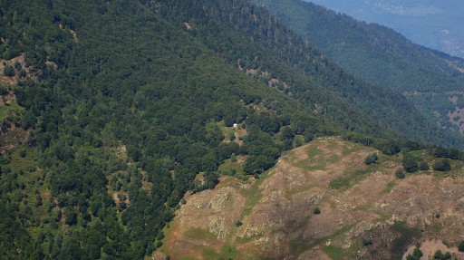 |
with this zoom-in to the Cabane de Hérechet. |
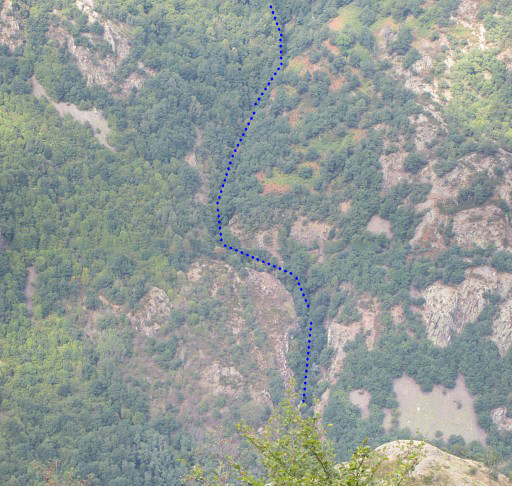 |
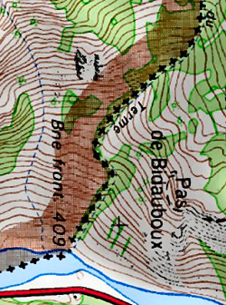 And a zoom-in to the borderstream 'ruisseau du Terme' between bm408 and bm409 |
 |
From bm411 I climb to bm412. |
 |
Bm412 |
 |
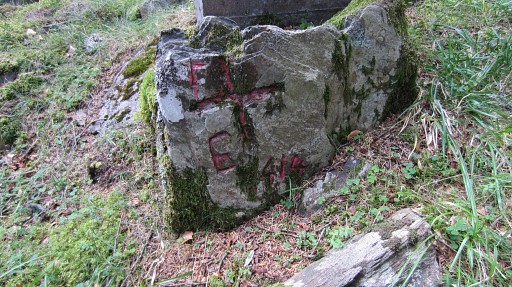
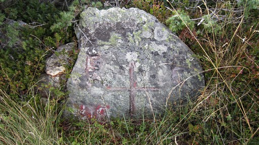
Bm413 |
 |
Bm413 |
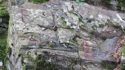 |
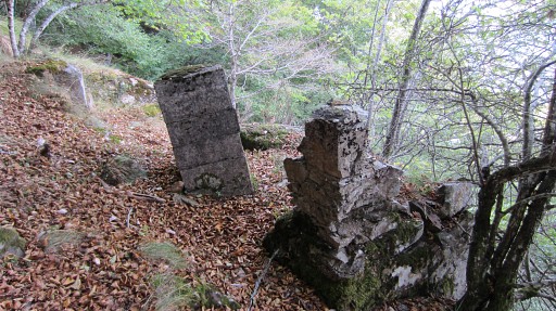
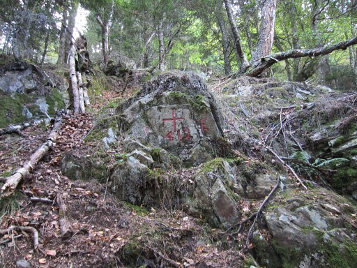
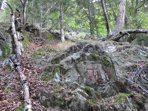
Bm413, the original cross |
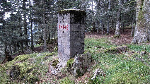 |
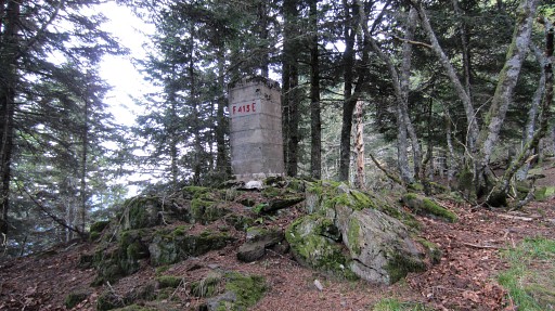
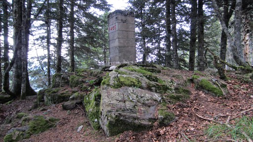
Further to bm414 along the borderridge. |
 |
Bm414
|
 |
After bm414 you’ll have to do a short & steep but not difficult descent and continue on the ridge |
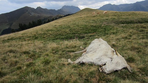 |
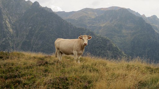
A trail soon appears and I pass this cow and bm415. I took pictures of bm415 but they failed somehow. Further on, the trail goes left of a hilltop and just above a pine forest. |
 |
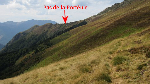
However, you won’t get
straightforward to bm416 and Pas de la Portéule. The main trail descends in the end into the valley. So after the passing of the trail just above a pine forest, you have to continue on a vaguer trail to the right. This means climbing to the E which is in fact straight on and not continuing NE on the same level on the main trail. |
 |
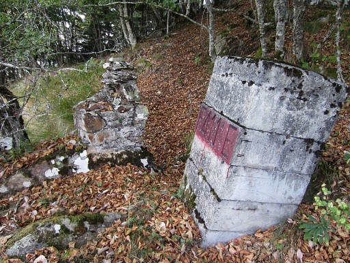
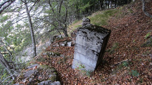
You will pass bm416 with |
 |
the older bordercross 416 just behind the pillar |
 |
and - after some ruins - reach the Pas
de la Portéule. It doesn't look much like a typical pass, it's where
you can descend along the slope ahead. |
 |
From that pass, there is a kind of trail to Cabane la Trauès - visible on this zoom-in - but |
 |
it’s often vague. Some cairns help. This picture: looking back to Pas de la Portéule in the far distance. |
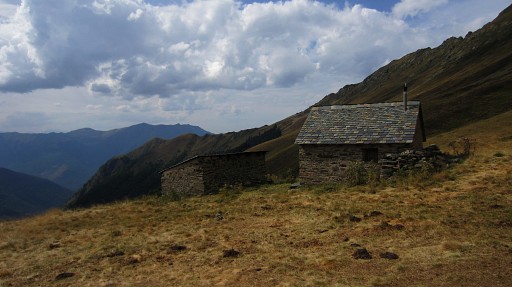 |
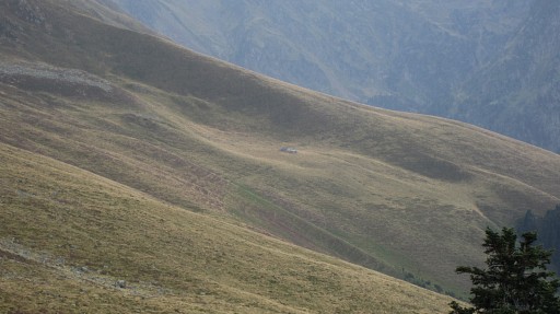
The cabane seems abandoned, the source / drinking place dry. I camped here at 20060828 and was invited by the shepherd for dinner, a nice memory. |
 |
Beyond the cabane the trail gets more distinct thanks to the cattle. When you get close to Cabane le Plan it gets vaguer again. S of the old funicular-building (150m NE of the cabane, the waterbassin nearby is dry), |
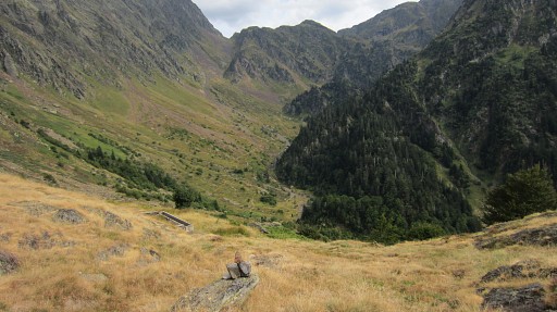 |
the descent starts in a sort of valley. It brings you - guided by
cairns - to a trail down below which is the trail leading to Mines de
Liat. I’m in doubt what to do: continue to Mines de Liat or return to Canejan. I’m tired of the tough & slow plodding until now, my right foot hurts and there’s a rain forecast for tomorrow. But most of all: it seems I’ve had enough of all that struggling through rough terrain during the last two weeks. |
 |
I long for a relaxt & touristic ending
of my holiday. Is there a lesson for next trips: take it more easy, take more time to
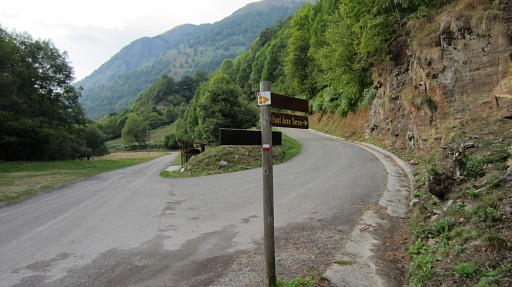
enjoy, shorten the trips. One worrying question: am I getting old? Anyway: I descend back along the red/white GR211-trail. Beyond Refugio de Era Honeria, I climb along the GR211 to the hamlet of San Juan de Toran |
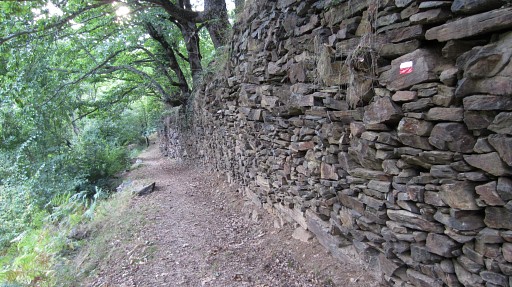 |
and further along an ancient and lovely path |
 |
to Canejan, my feet hurting. That GR211-trail is an excellent choice for the main GRPdesBF-route. From Canejan I drive quickly to Fos to the camping municipal to pitch my tent. It's almost dark. |