|
The
bordermarkers of the Pyrenees : all markers
 |
|
| Bordermarkers 360-365 |
 |
| Notice The pages of the day-trips may give additional information on coordinates, localisation, surroundings and access. They also show (additional) maps. Click on the date-links in the right column. |
|
 |
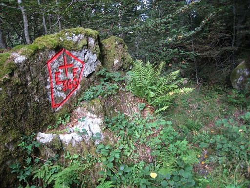
Bm360 Photographed on 20090610 (more pictures at that page) |
 | Bm360 Photographed on 20100913 (more pictures at that page) |
|
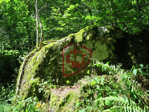
Bm36o Photographed on 20150707 (more pictures at that page) |
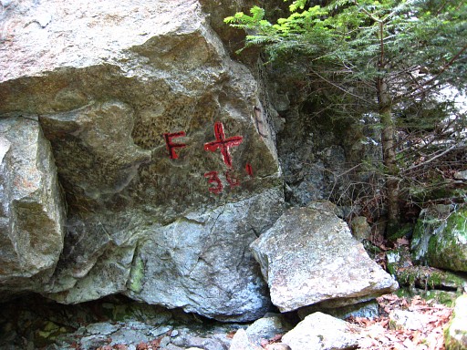 |
Bm361 Photographed on 20090610 (more pictures at that page) |
 |
Bm361 Photographed on 20100913 (more pictures at that page) |
|
Bm361 Photographed on 20150707 (more pictures at that page) |
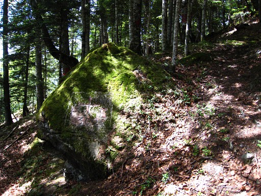 |
Bm362 Photographed on 20090610 (more pictures at that page) |
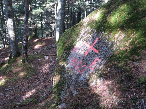 |
Bm362 Photographed on 20100913 (more pictures at that page) |
|
Bm362 Photographed on 20150707 (more pictures at that page) |
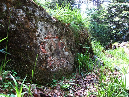 |
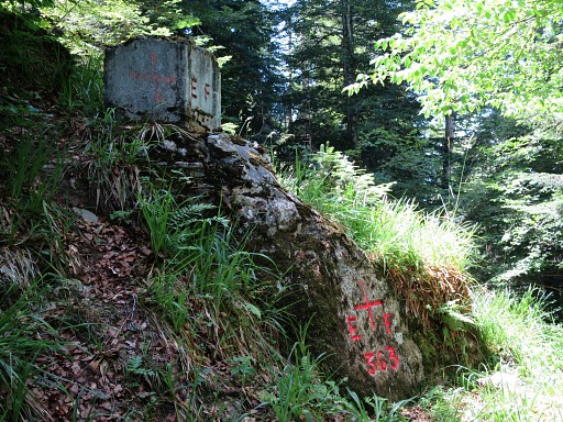
Bm363 Photographed on 20090610 (more pictures at that page) |
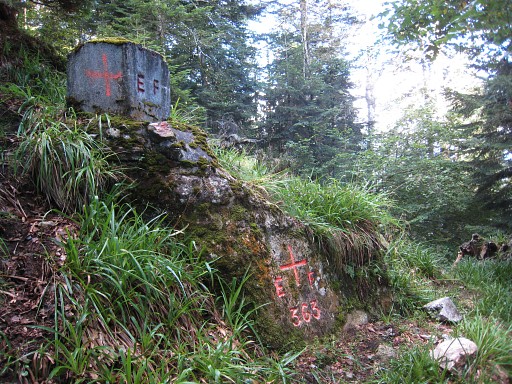 |
Bm363 Photographed on 20100913 (more pictures at that page) |
|
Bm363 Photographed on 20150707 (more pictures at that page) |
 |
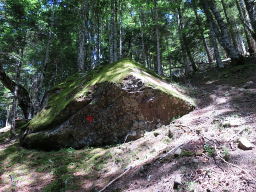
Bm364, not found Searched on 20090610 and 20100913 and 20110901 and 20150707 and 20230412 This bm wasn't found neither by Robert Darrieumerlou nor by Charles & Josette Darrieu and Paco Nudels and Jaques Koleck and Corinne Gourgeonnet. |
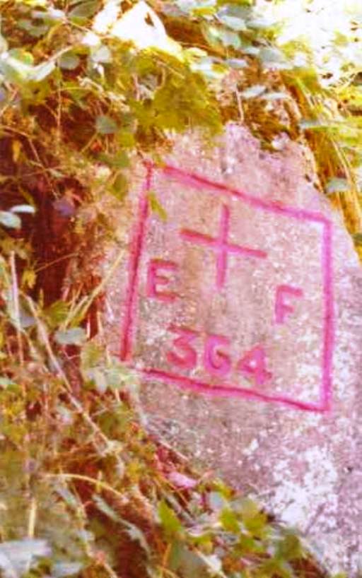 |
However, Paco Nudels does show a picture of the cross on this page. In
january 2011, Charles & Josette Darrieu informed me that Paco's
got his picture from the "Archives de La Guardia Civil". Paco supposes that
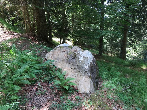
the rock has tumbled down when the forest road underneath was dug. And Jaques Koleck added in 2013: "With a decameter I measured exactly the 143 meters which, according to the Treaty, separate cross 365 from 364. I arrived at a rock at groundlevel, at the right roadside. This rock - 1m x 1,5m x 0,8m - had a moss covered face looking to the West and that could be used to support the cross photographed by the Guardia Civil. But I found no trace of paint in 2010. The mystery remains." In january 214 he returned and did the measuring again, adding a measurement of the 243m distance from bm363. That gives a rather precise zone where bm364 must have been located. |
|
Bm364 - possible original location with the rock as described by Jacques Koleck above. Photographed on 20150707 (more pictures at that page) |
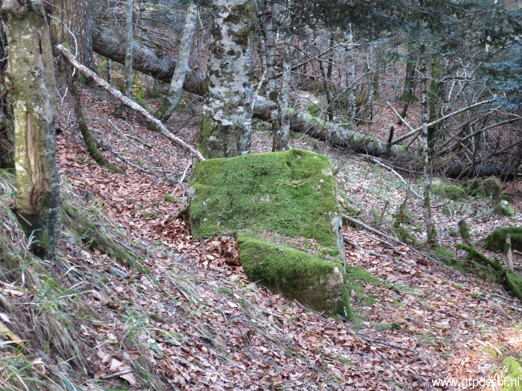 |
Same rock, Photographed on 20230412 (more pictures at that page) (click photo to enlarge) |
 |
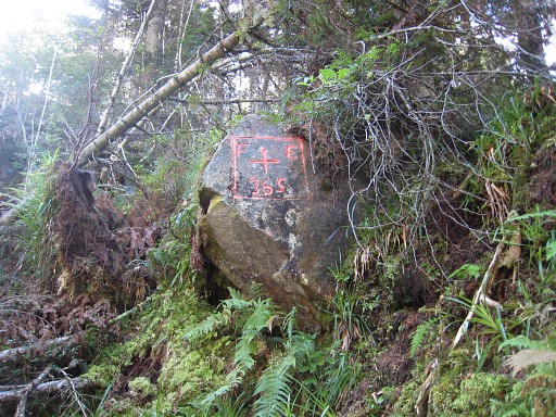
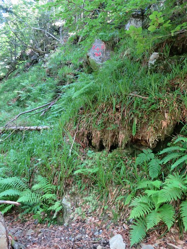
Bm365 Photographed on 20090610 (more pictures at that page) |
 | Bm365 Photographed on 20100913 (more pictures at that page) |
 |
Bm365 Photographed on 20110901 (more pictures at that page) |
|
Bm365 Photographed on 20150707 (more pictures at that page) |
 |
Bm365 Photographed on 20230412 (more pictures at that page) (click photo to enlarge) |
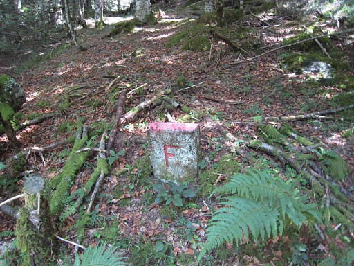 |
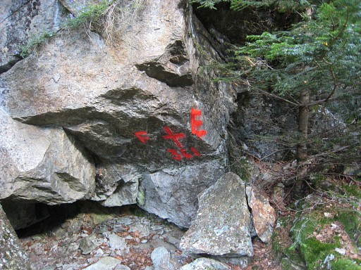
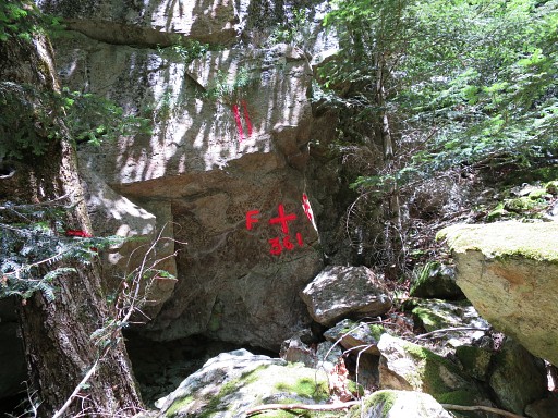
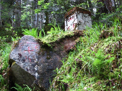
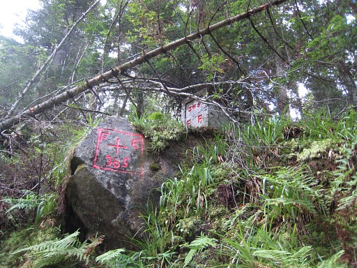
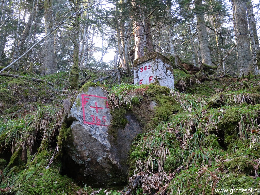
Between bm365 and 366
there are several of these intermediate bordermarkers left with an F on
one side and an E on the other side. On 20110901 I counted 4 of them and probably some others didn't survive the Xynthia-storm of february 26th, 2010. I remember spotting more than 4 markers on previous visits. But Jacques Koleck reports having found 9 markers and I guess that happened in 2010 when he searched for bm364. On 20150707 I found 8 of them, see that page for pictures and their gps-locations. |
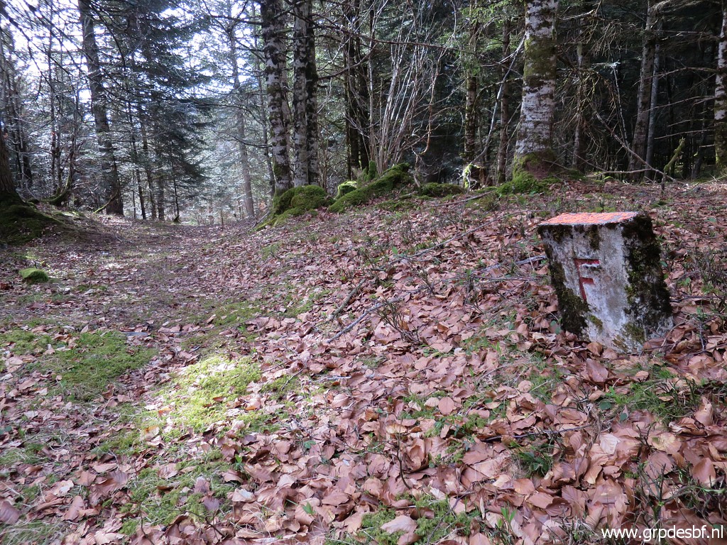 |
But on 20230412 I did a new search and found 10 of them. There is also a brick-built triangle shaped column and a square shaped column which serve as bordermarkers between bm365 and 366. They all lack any alpha-numerical indication, fitting in the numbering of the 602 bordermarkers. See the 20230412 -page to see them all. (click photo to enlarge) |