|
The
bordermarkers of the Pyrenees : all my trips
 |
|
| - 28 august
2011 - Bm271 found |
 |
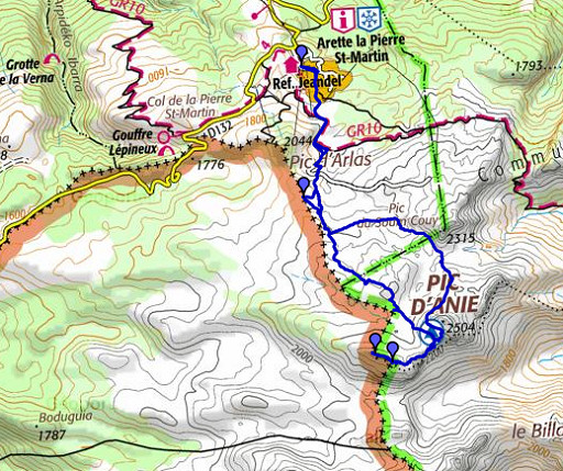 |
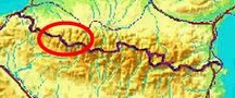
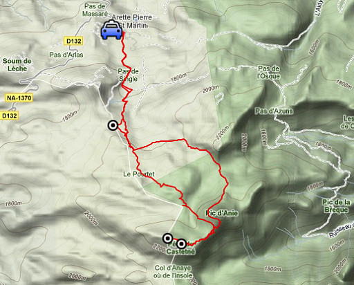
esfr-trip-track-20110828.kml (click to open this trip in Google Earth or copy link to Google Maps; click right on this link to download gpx-version) Summary: part of a 3-weeks trip to the Pyrénées to 'do' the ± 60 remaining bordermarkers. All done as daytrips from campings. Day 13: roundtrip to bm271 from Arette la Pierre St-Martin. Weather: sunny, chilly breeze |
 |
For
explanation of
the gps-coordinates and other cartographic backgrounds: see my cartography page En route (±): 8.30 - 16.30 (8h) According to the gps-tripteller: Distance: 18,2km Cum. elevation gain : 1264m Total elevation: 2528 Maximum height: 2407m Time: 8.14h |
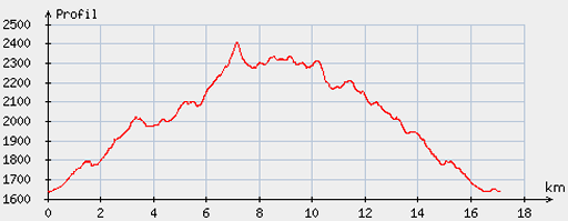 |
According
to visugpx - distance : 17,4km - cum. elevation gain : 1013m - cum. elevation loss : 1010m - total elevation: 2023m - altitude maxi : 2405m - altitude mini : 1635m - altitude average : 2037m |
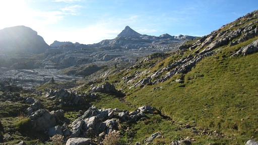 |
Early drive from my basecamp in Urdos to Arette la Pierre St-Martin. Approach of Pic d’Anie on the ‚normal’ double-yellow-stripe-trail. |
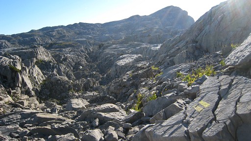 |
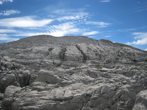
Through the crevasses to |
 |
the foot of Pic du Soum Couy where a trail along the slope (visible on this picture) brings you to Col des Anies. |
 |
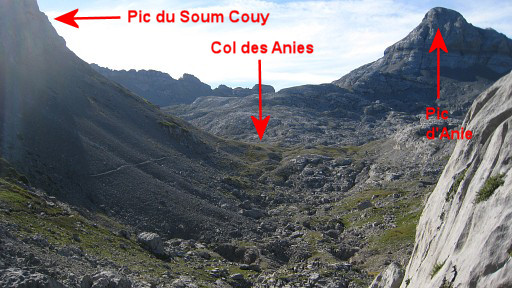
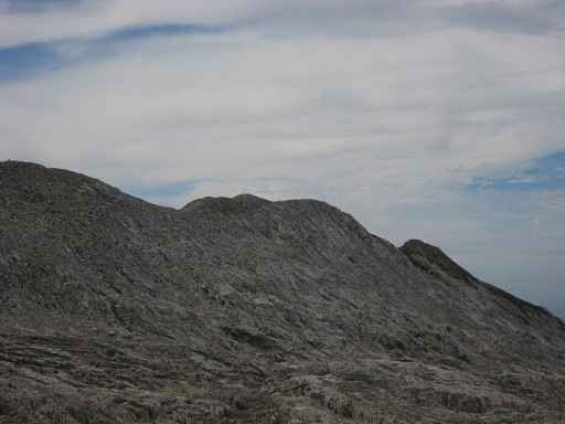
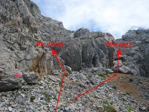
After Col des Anies, further climbing to Pic d'Anie. Before the final climb of the Pic, I leave the trail and find my way to that 'little pass' between Pic d’Anie and the up & down crête that goes SW. |
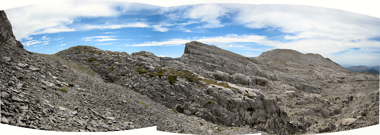
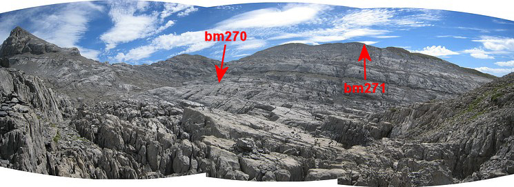
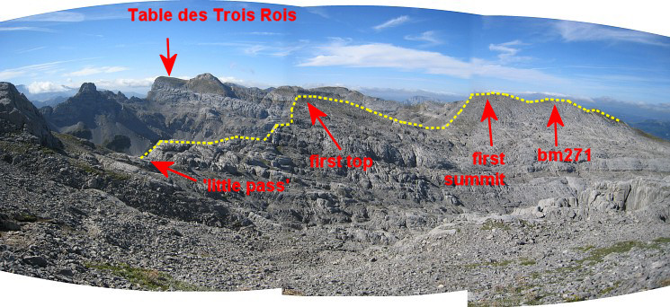 On that crête should be bm271. Two walkers give me some directions and point where bm271 is: a large cairn far away on the crête. In fact - so I will learn - the bm is further on. This panorama: taken just before arriving at the 'little pass' |
|
 |
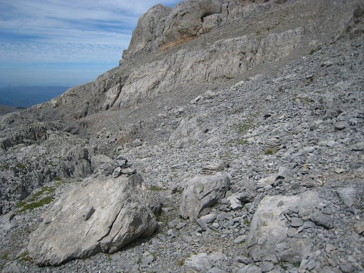
Before you get to the ridge with the two summits, you need to traverse
underneath a first top. A few cairns help you but it isn’t easy.
Perhaps it’s better to climb that top straight away, then there are no
crevasses to cross, so it seems. Either way, you’ll get to a sort of
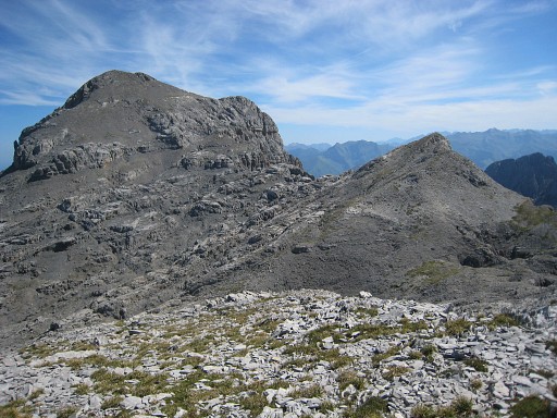
pass between that first top and the rest of the crete. This picture: I started climbing the rest of the crête and look back at that first top and Pic d'Anie. |
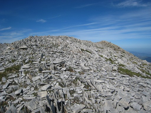 |
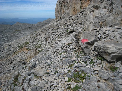
Climbing to the 'rest of the crête' is easy on this sort of terrain. I pass where 271bis must have been once. I do a little searching but of course I find nothing. It’s reported on the IGN-map as being destroyed. Renowned bm-searchers like the Darrieu-couple and Robert Darrieumerlou didn’t find it either. |
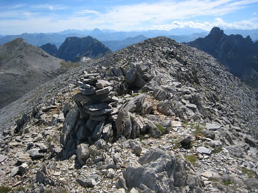 |
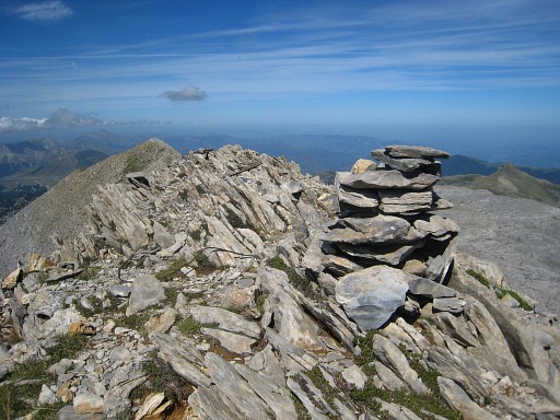
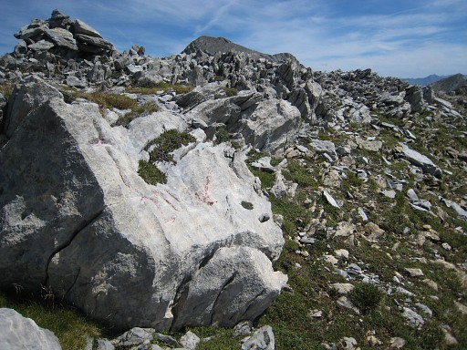
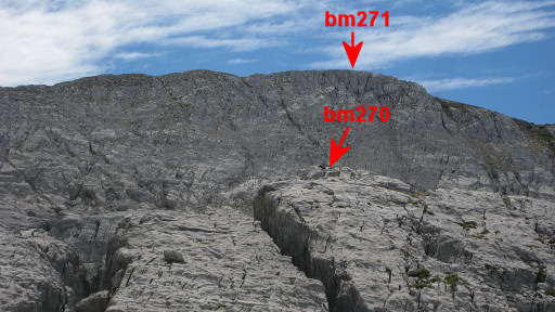
A bit further is that large cairn I saw from far. But bm271 is ± 175m further on the next summit with a less impressive cairn. |
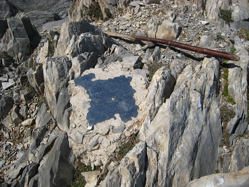 |
Close to the cairn this base which resembles the base of the miniature castle at Pic des Trois Rois, seen on 20 august 2011 As if something has been removed or vandalized. |
 |
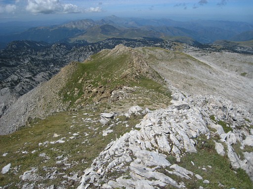
From that first cairn looking NWW to the next summit with the next cairn. |
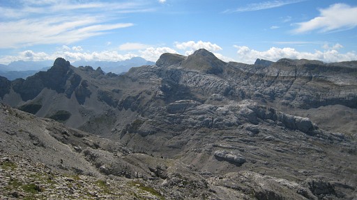 |
A view to the Pic and Table des Trois Rois
|
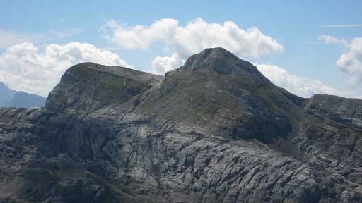 |
with this zoom-in. |
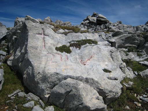 |
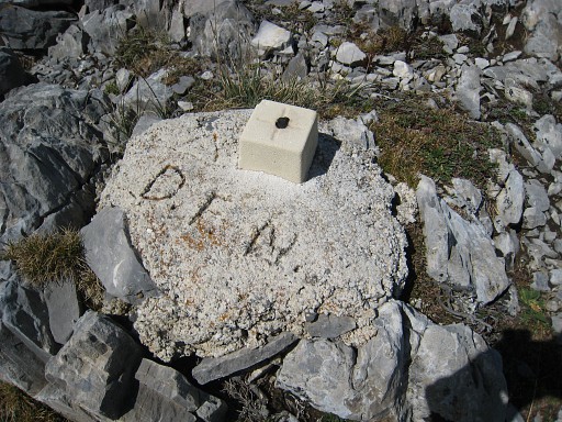
Underneath the second cairn, at the southern slope of the ridge, bm271 is easy to find. |
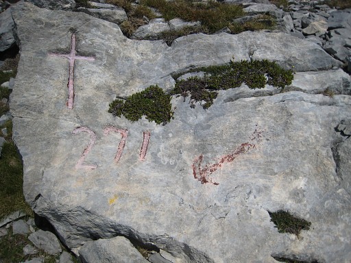 |
Bm271 |
 |
Bm271 |
 |
Bm271 |
 |
A bit further on the ridge, this geodetic marker |
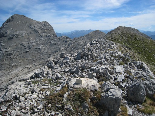 |
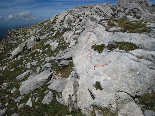
Looking back: Pic d'Anie, 'little pass', first top and first summit are well visible. |
 |
A bit further, the crête descends and becomes green. There is however no time to investigate a link to bm272. |
 . .Back where I came from and again this view of the 'little pass', first top and the two-headed ridge far away |
|
 |
with this zoom-in on the summit with bm271. |
 |
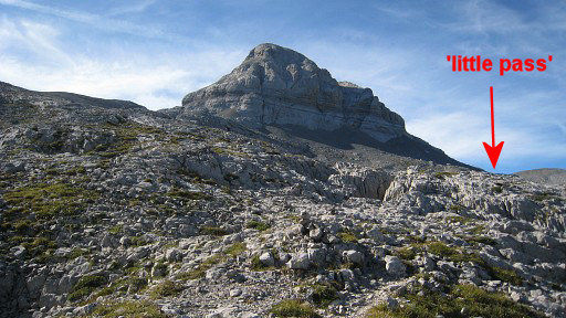
At the little pass I find a vague path along the Pic
d’Anie’s slope that joins later |
 |
the red path I did one week ago. But now on top of a steep climb - a sort of chimney - while I stopped at the bottom of it, one week ago. |
 |
So - recapitulating - coming from bm270, the red trail traverses the
crevasses and starts to climb along the slope of Pic d’Anie. Then it climbs steeply through a sort of ‚chimney’. Shortly after that chimney, the red trail bends to the left (this picture). At that point, go straight ahead to that little pass and so on. |
 |
I return on the red trail through the crevasses, passing near bm270. This picture: taken somewhere in the crevasses, looking in the direction of bm270 and 271. |
 |
Zoom-in |
 And a last panorama, taken from the point where you emerge from or dive into the crevasses. Back to the car, finishing with a beer in the ski-resort. Tiring trip. |
|