|
The
bordermarkers of the Pyrenees : all my trips
 |
|
| - 5 september
2012 - Not that dreadful |
 |
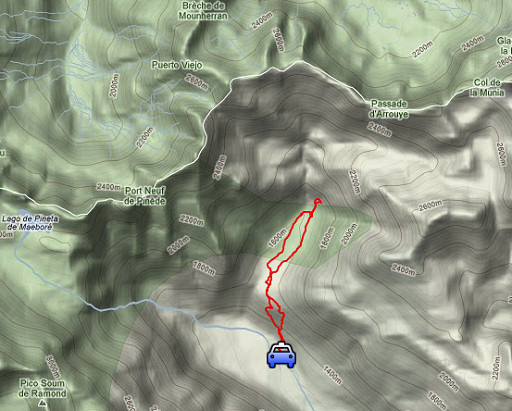 |
esfr-trip-track-20120905.kml (click to open this trip in Google Earth or copy link to Google Maps; click right on this link to download gpx-version) Summary: part of a 2½-weeks-trip to the Pyrenees with a lot of targets, most of them reconnaisances of routes for the GRPdesBF. Day 10: a short reconnaissance in the valley of Llanos de Larry to see if there's another trail to bm321 Weather: splendid, a first glimpse of autumn-light |
 |
For
explanation of
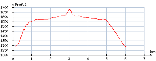
the gps-coordinates and other cartographic backgrounds: cartography page Start: 11.15, no break, finish: 14.15, net walking time: 3h According to the gps-tripteller: Distance: 6,8 km En route: 2.55h Total ascent: 389m Maximum height: 1642m |
 |
According
to visugpx - distance : 6,3 km - cum. elevation gain : 401m - cum. elevation loss : 400m - total elevation: 801m - altitude maxi : 1679m - altitude mini : 1283m - altitude average : 1561m |
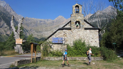 |
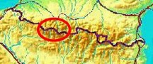
In
the morning I drove from Lourdes via the tunnel of Bielsa to Bielsa and
up the valley of Pineta. From the chapel of Notra Señorita de Pineta I
loose within minutes the trail uphill (unbelievable afterwards) and
climb right through the forest to |
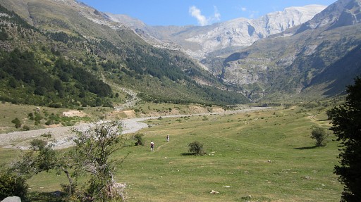 |
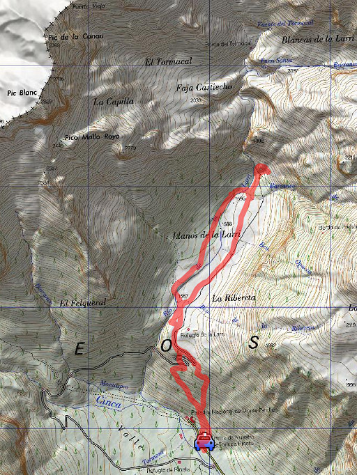
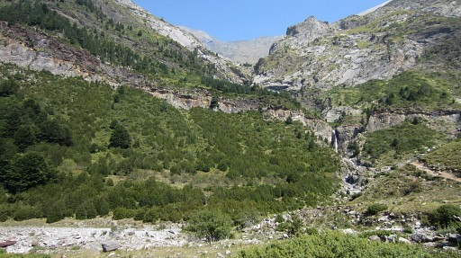
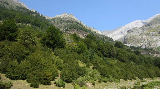
the wide green valley of Llanos de Larry. I was here before on 20100828 |
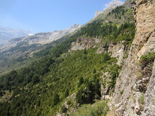
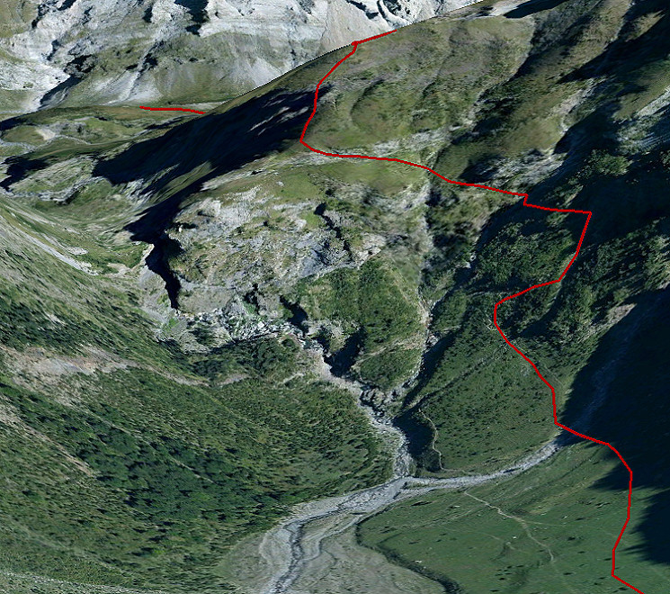 And this is the route (waycairned) which I followed on that day. It's a trail to the lake of Lago de la Munia. After this steep and vertiginous climb (as shown here), I left the trail and descended N to the valley to camp. Next day - on my way up to Port de la Canau (bm321) I found white waymarks. I don't know where that trail came from. Perhaps there's another (white) trail from the plain of Llanos de Larry to my camping spot. Perhaps to the left of the cascade. That's why I'm here, to find out. |
|
 |
My first target is the cascade at the end of the valley. |
 |
Getting closer. At the left of the
cascade you see a steep hillside with in the middle a horizontal rock
ledge. It seems not possible to walk/climb along this side to a higher
level. |
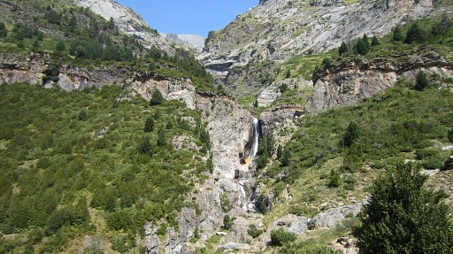 |
Near the cascade at
the end of the valley I can’t find (at the right side of the cascade) any trail climbing to the spot where
I camped on 28 august 2010. |
 |
Now, from the cascade, looking back.
As far as I can see, it’s too steep higher up on the N-side of the stream or along the cascade. Moreover, the steep & vertiginous & long climb on the hillside to the right of the cascade doesn’t look so gruelsome as I remembered it. Conclusion: as part of a variant of the GRPdesBF that climb will do and is probably the only route to the foot of Port de la Canau (bm321). |
 |
I return, |
 |
partly along the W-bank of the river, |
 |
to my car. After a lunch in Bielsa I drive into France to the camping municipal of Saint-Lary-Soulan. |
| previous
trip next
trip |
|