|
The
bordermarkers of the Pyrenees : all my trips
 |
|
| -
monday 10 april
2023 - Search for Croix de Malafrenor & Bidaubus-cross D with Corinne |
 |
 |
Summary:
part of a series of 5 daytrips and one 3-days backpacking trip in april
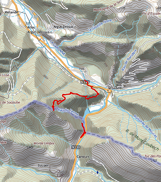
2023. This is day 1. Today: together with Corinne Gourgeonnet a last search (in vain) for the Croix de Malafrenor, idem for the Bidaubus-cross D. Weather: fine Basecamp: camping Pradelongue near Bagnères-de-Luchon FRLU-underground-bordercrossings |
 |
My basecamp near Bagnères-de-Luchon: camping Pradelongue . I arrived here yesterday and met Corinne Gourgeonnet in Luchon to discuss our plans. |
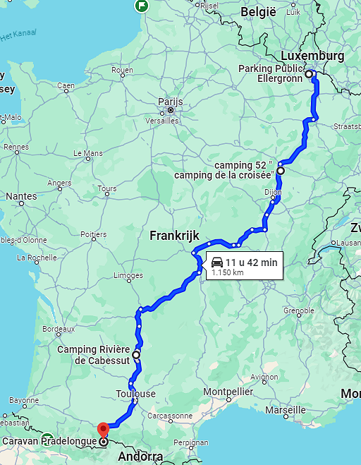 |
It took me several days to arrive here. Starting point was Luxembourg where I spent 2 days with Jannis Deeleman and Marc van der Steen exploring the frlu-border (see this website) 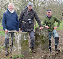 Then with 2 overnight stops at campings, the second one in beautiful Cahors, to this camping. |
TRIP 1 |
|
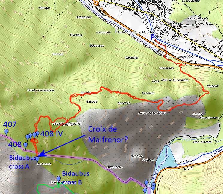 track-20230410-trip1.gpx This gpx-track has not been manually corrected which explains the inaccuracy and misalignment at some points. The original elevation recording has been replaced by more accurate DEM-data with Gpsvisualizer.com. For cartographic backgrounds: see the cartography-page Gps-waypoints of all bordermarkers (most recent version): kml: esfr-bordermarkers-all-waypoints.kml gpx: esfr-bordermarkers-all-waypoints.gpx (with reliable elevation data added by gpsvisualizer.com) |
|
 |
According to Garmin
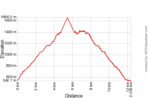
Basecamp (uncorrected track with elevation added by Gpsvisualizer.com): Distance: 10,2 km Max-height: 1427m Min-height: 543m Elevation: +971m -982m Total elevation: 1973m Start 8:43 Finish 15:40 Total time: 6:57 |
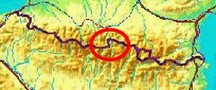
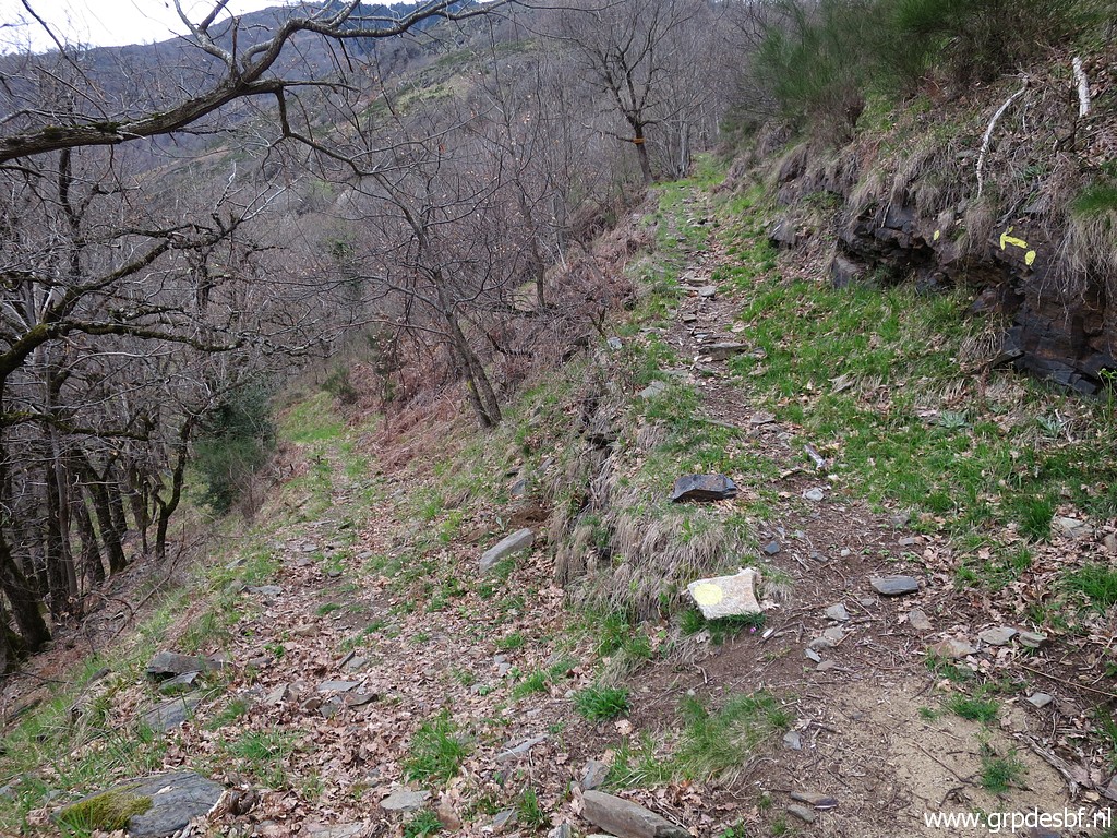
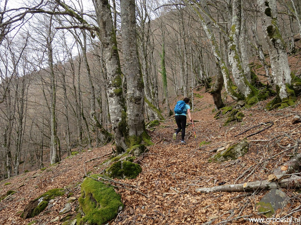
 | Corinne and I met in Fos. This is the start of the climb to Cabane d'Herechet. The waymarking has improved in recent years. (click photo to enlarge) |
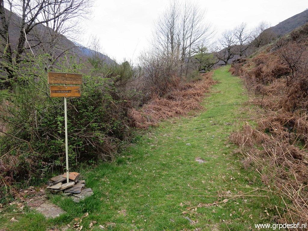
 | Just beyond the Col Carrech, there is this diversion. The left trail descends and ends at Source des Réchides, we take the right track. (click photo to enlarge) |
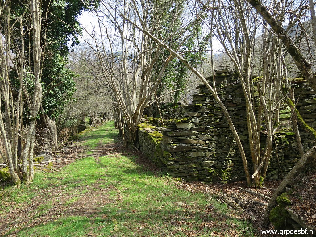
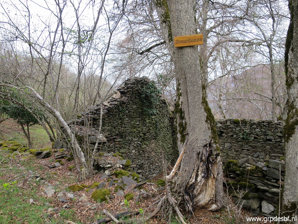 | Continuing along ruins, (click photo to enlarge) |
 | climbing through the forest (click photo to enlarge) |
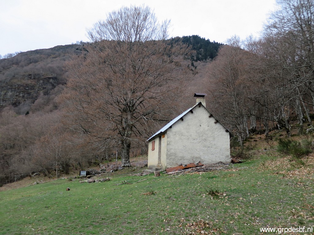 | to cabane d'Herechet, a well kept cabane with a watersupply next to it. I slept there once: 21 june 2020 (click photo to enlarge) |
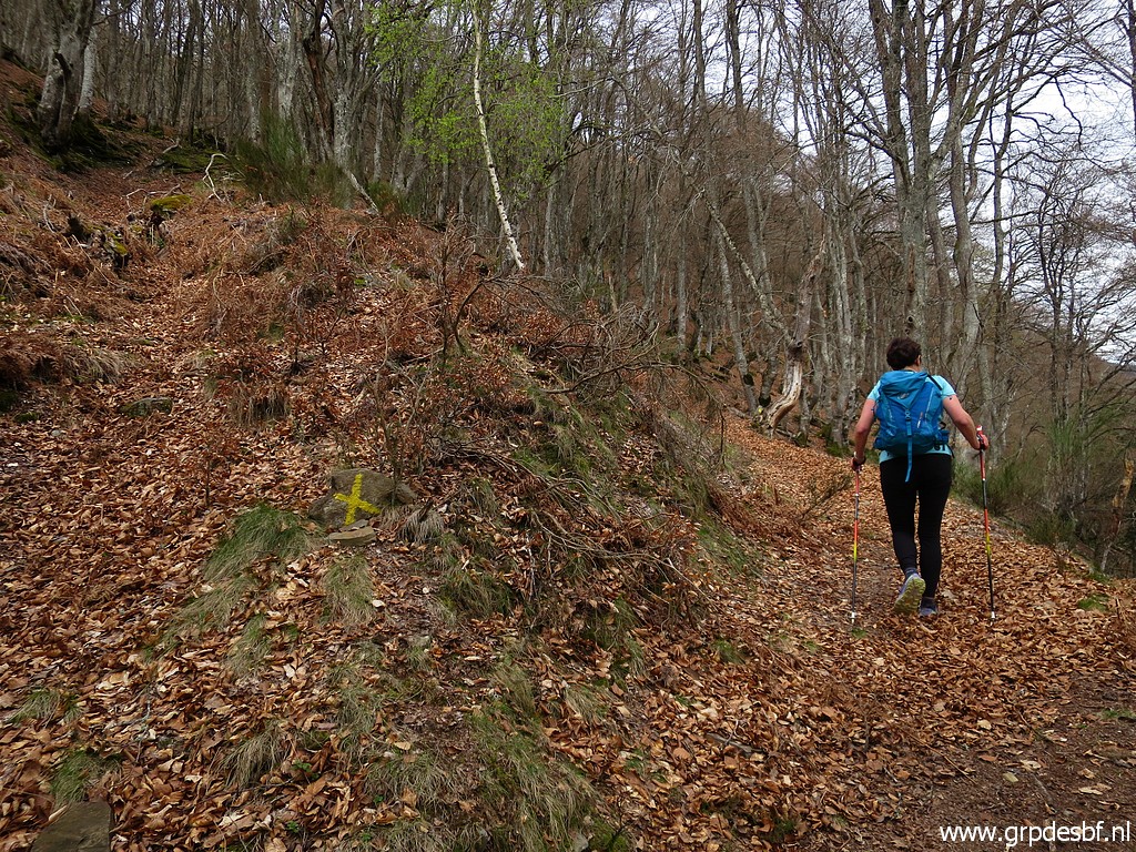
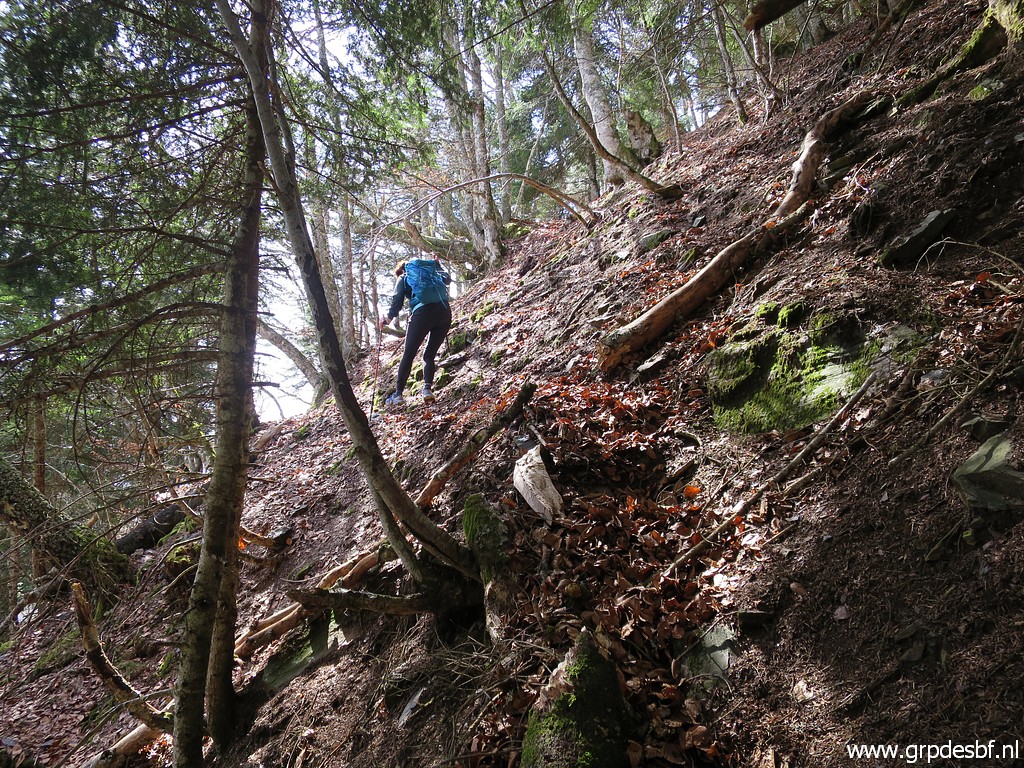
 | Then the climbing gets tougher, (click photo to enlarge) |
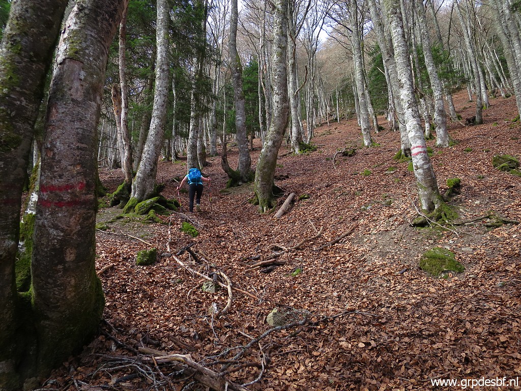 | especially when we turn left (indicated by red stripes on 2 trees) for the last part. It seems that we are the first on this trail this year, we even lose the trail sometimes. (click photo to enlarge) |
 | But finally we arrive at the foot of the steep stream (now almost dry) where the submarkers bm408-II and III are located. A little climbing and we can spot bm408-II from some distance. (click photo to enlarge) |
 | Bm408-II, the number is at the backside. (click photo to enlarge) |
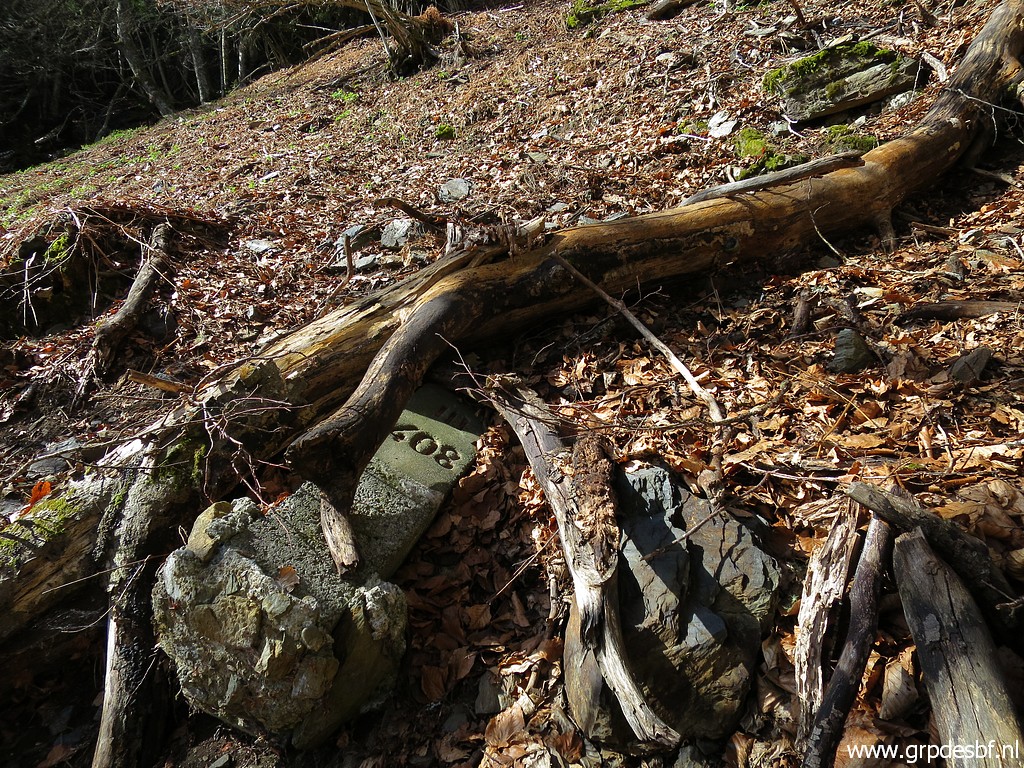 | Bm408-III is lying a bit off the streambed. Originally placed along the streambed, it has sled away somewhere in time. Read all about the bm408-submarkers on this page. (click photo to enlarge) |
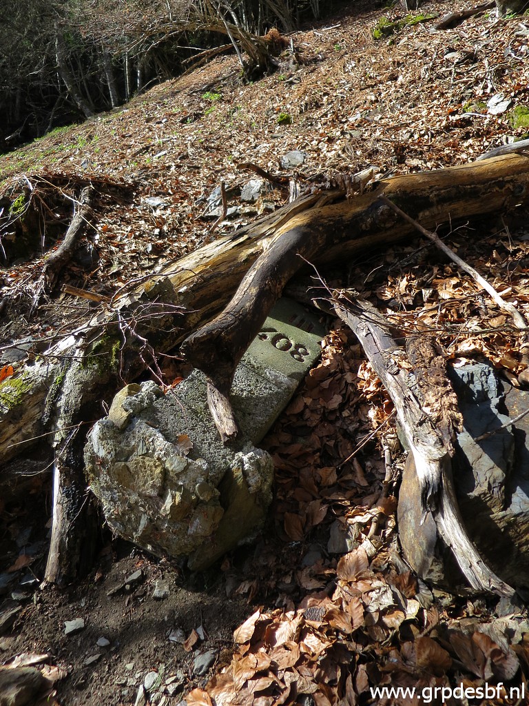 | Bm4080-III (click photo to enlarge) But these submarkers are not our goal. We want to find the Croix de Malafrenor. |
But what is the Croix de Malafrenor?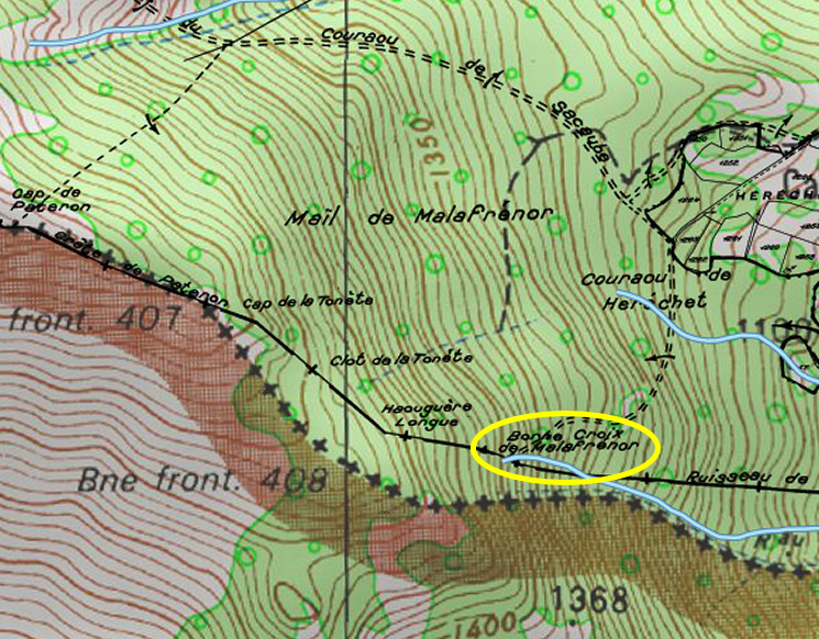 The Croix de Malafrenor is shown on an older cadastral map (however: not longer available at Géoportail.gouv.fr). Although the alignment of the cadastral maplayer with the IGN-topographic-layer (and hydrographical layer) is not perfect, one can clearly see that this cross was located at the beginning of the Ruisseau du Terme. This Ruisseau is in the treaty mentioned as the borderline until its merging with the Garonne. But remember: this cross is not mentioned in the original text in the (additional) treaty of 1863 describing the borderline. |
|
But
it is depicted as a double branched cross on this (rough and inaccurate
regarding the A to D-crosses) sketch of Jean Sermet of ± 1960.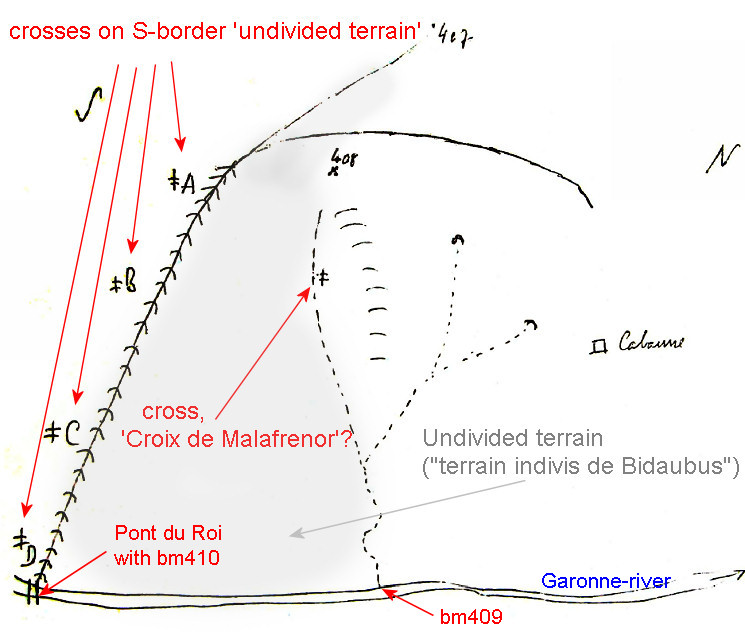 The cross was probably shown to Sermet in 1959 by the French forest ranger Amédée Boussac in a field survey. Boussac considered the cross as a delimitation of the esfr-border. Sermet describes it as a double branched cross. However, he thought it was a cross delimitating some unknown and forgotten communal border. All this is connected to what I call the 'Bidaubus-dispute' about the correct borderline between bm407 and 409. It led in the 1960-ies to a shift of the borderline to the N with the 408-submarkers installed. An elaborate explanation can be found on this page. In recent years there has been an new inflammation of this discussion which resulted in a new proposed borderline which - to my opinion and that of Michel Molia and Joël Molinier - violates the treaty of 1863. See this blog-post with all my reasoning and this video which explains it in a few minutes. Finding the Croix de Malafrenor should not be overemphasized in this discussion but would provide some additional evidence. But most of all it's a challenge for Corinne and me and a good excuse to climb once again this intriguing mountainside. |
|
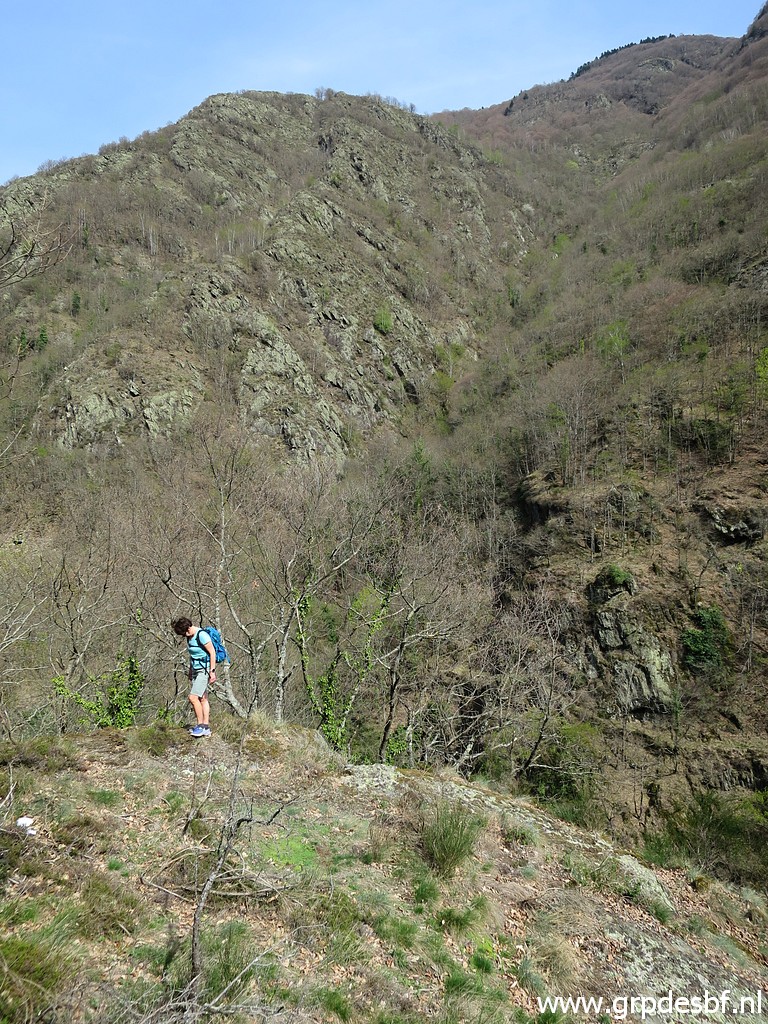
 | From the streambed, we follow a faint and climbing trail south to the edge of the forest. (click photo to enlarge) |
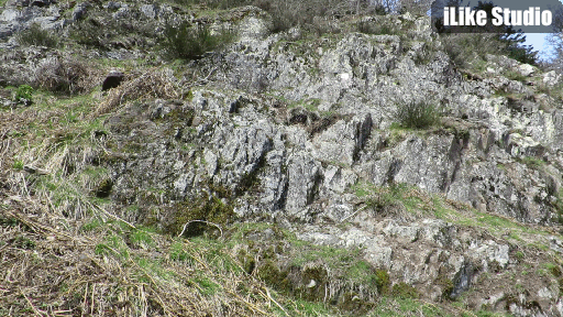
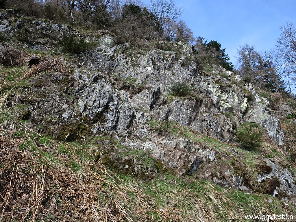
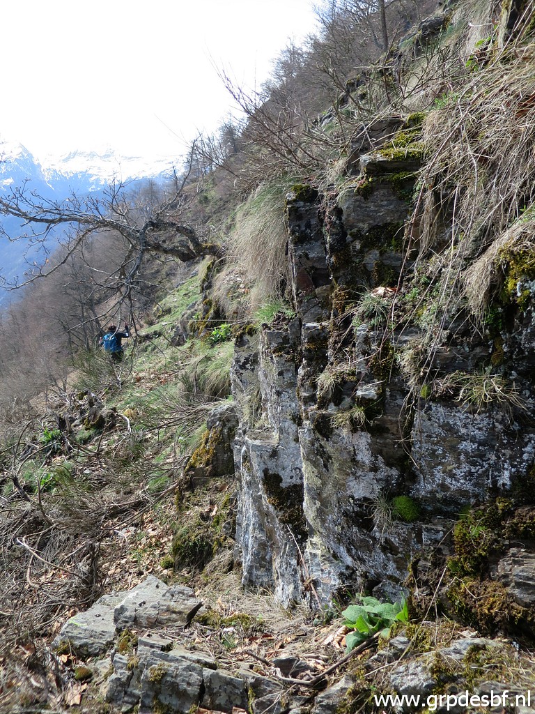 | Then we arrive at steep and open terrain. Somewhere on a rock, the Croix de Malfrenor must have been engraved. But where? We soon pass this remarkable rockface. (click photo to enlarge) |
 | Same rockface, seen from the south. The faint trail is probably a wildlife track. (click photo to enlarge) |
 |
This is a video converted to an animated gif-picture. We can well see how this rock-formation is at the top of a steep versant, gradually becoming the beginning of a ravine. In my opinion, this is the 'origin of the Ruisseau de Terme' as mentioned in the treaty. BUT: while making this webpage, I discover that we didn't look at the right place. See hereunder. |
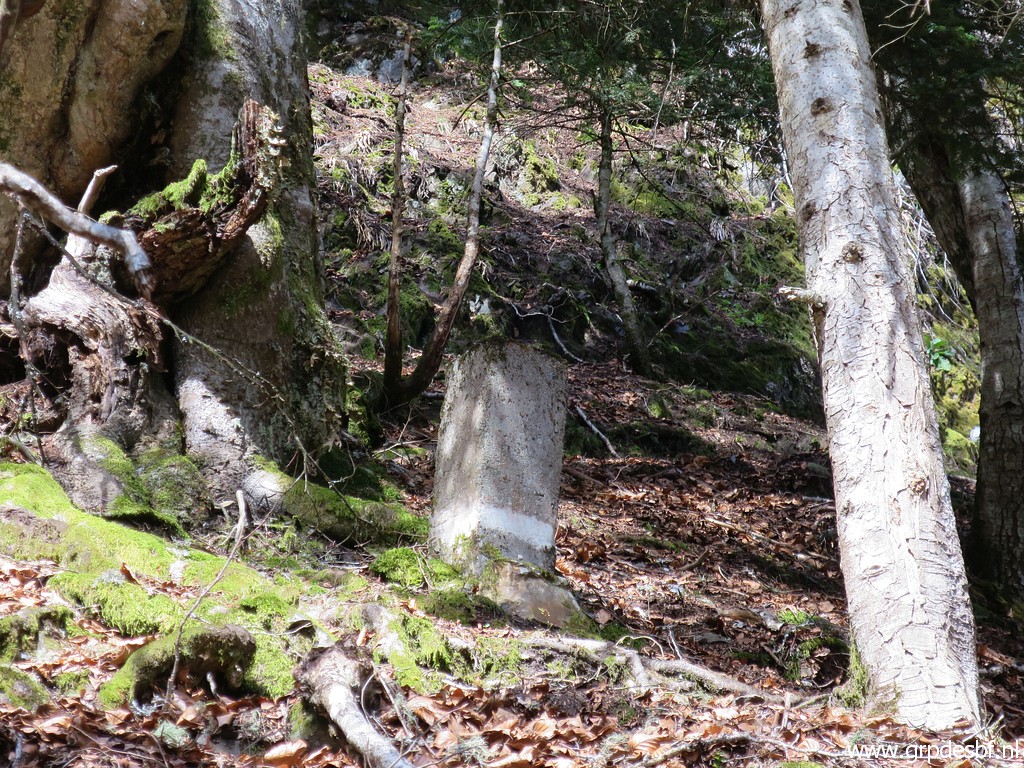
 | I
inspect these rocks well and find nothing. But remember that in ± 60 years, the rocks have got overgrown in places and whithered by the weather. (click photo to enlarge) |
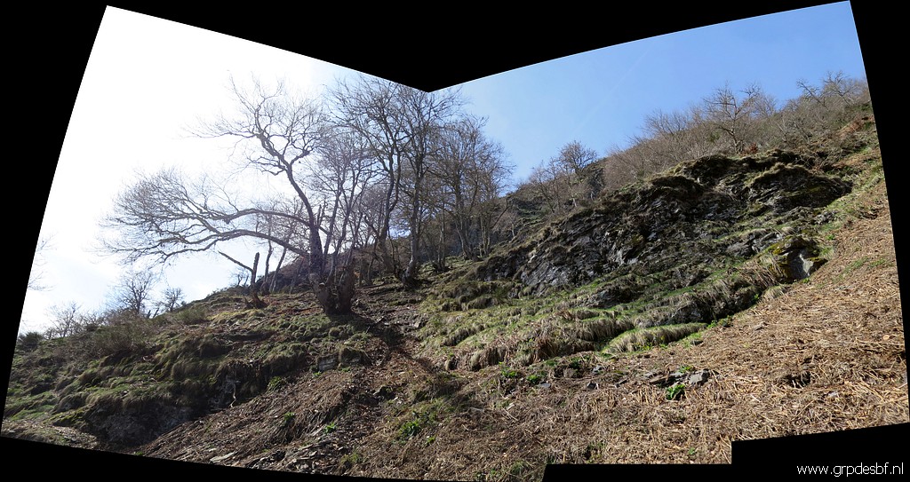
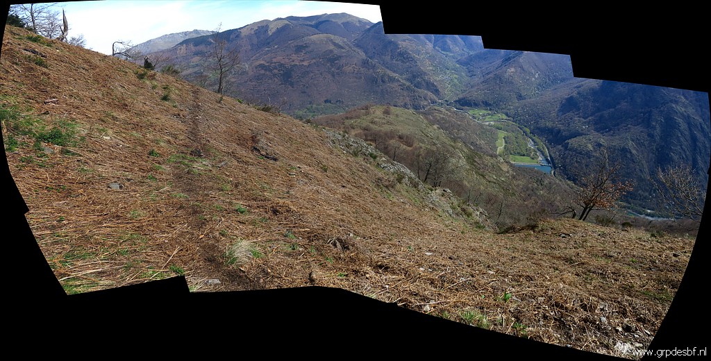 | Panorama-picture looking down. (click photo to enlarge) One can see how the versant folds as it were in a ravine down below. BUT: while making this webpage, I discover that that 'ravine' we see, is not the beginning of the Ruisseau du Terme. See hereunder. |
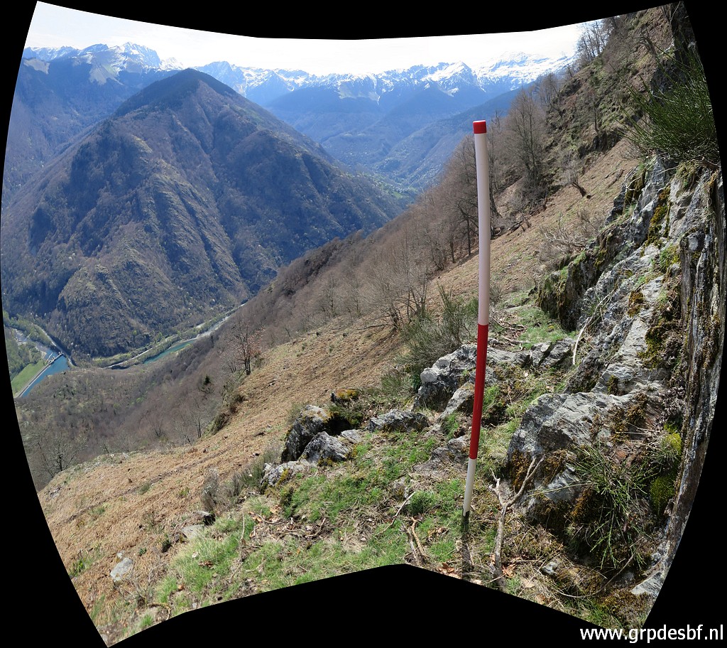 | My geodetical stick (also a perfect walking stick with its length) at the foot of the rockface. (click photo to enlarge) Thus indicating the assumed spot of the Croix de Malafrenor. BUT: while making this webpage, I discover that we didn't look at the right place. See hereunder. |
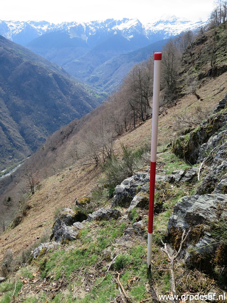 | Same position (click photo to enlarge) |
 | Meanwhile 'daring devil' Corinne has descended the versant (click photo to enlarge) |
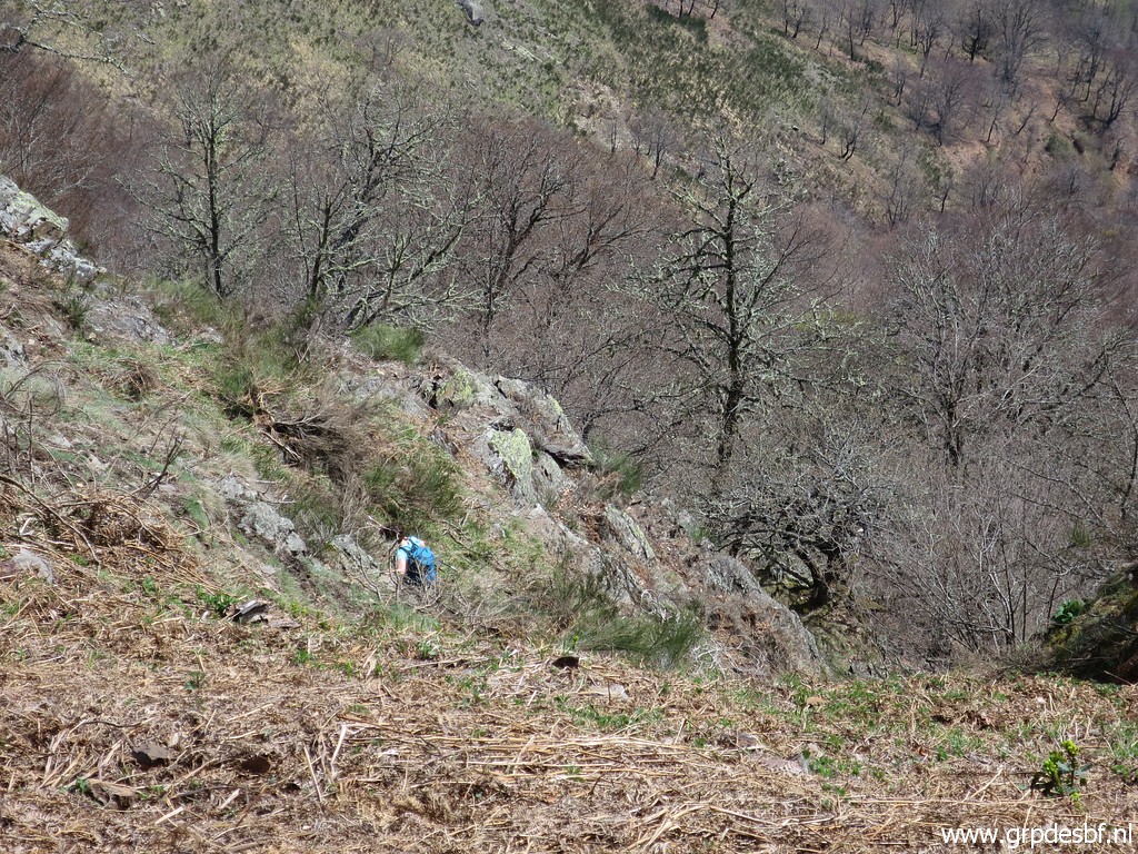 | to search for the cross at lower altitudes, also in vain. (click photo to enlarge) |
 | Then a last picture of the rockface but from below. (click photo to enlarge) |
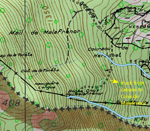 |
But did we search at the
right place? The old cadastral map shows a track which winds from
Cabane d'Herechet to the borderline and the Croix de Malafrenor. In all our visits we haven't found a trace from this old trail. But it led apperently to the Croix de Malafrenor. |
Let's draw that track on the very detailed map of the Catalonian ICC including other data.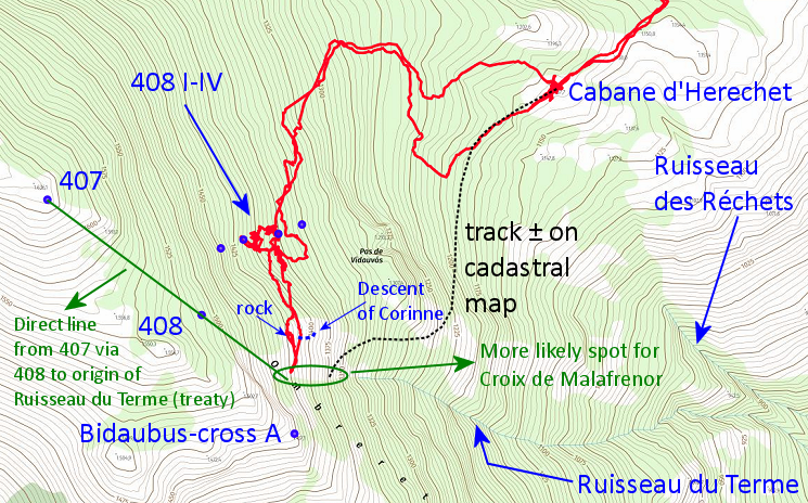 The conclusion is disappointing, we should have searched more to the south. That where the real origin of the Ruisseau de Terme is supposed to be. |
|
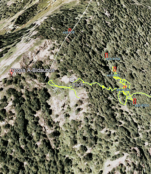 |
And if we show Corinne's gps-track on Google Earth, it becomes even more obvious. |
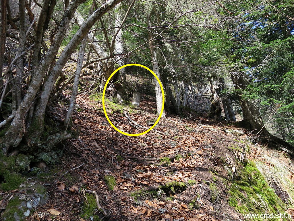
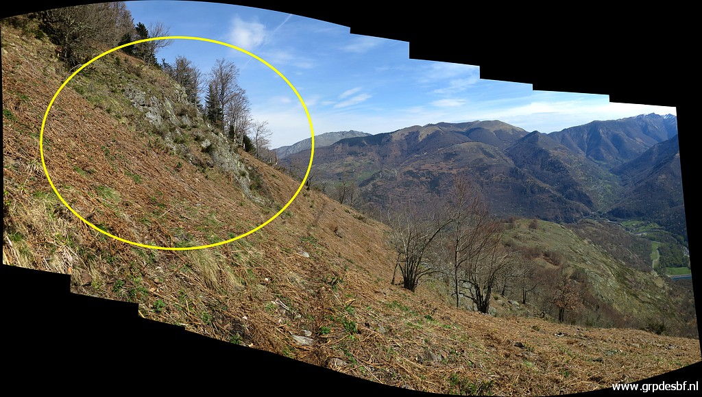
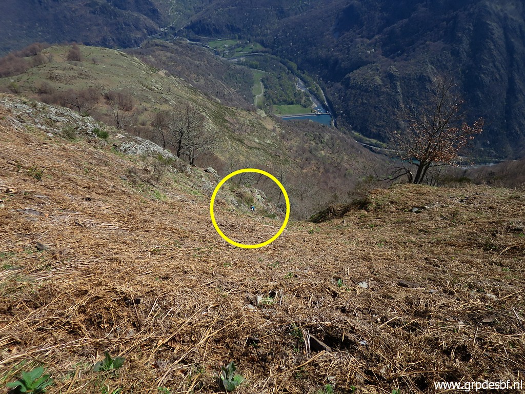
If
I look back at the pictures, I can see where we should have searched.
The yellow circle indicates the groove which is the real origin of the
Ruisseau du Terme.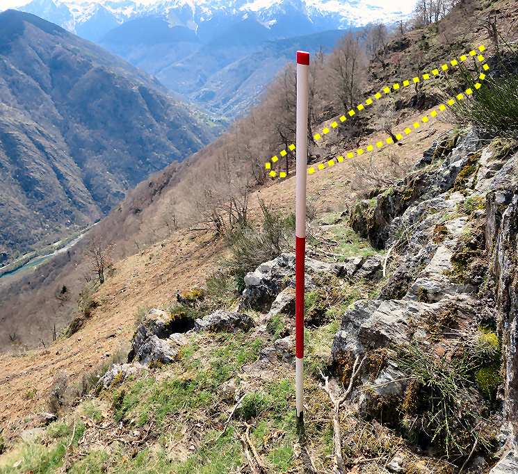 Well, let's say: we have a new reason to return. |
|
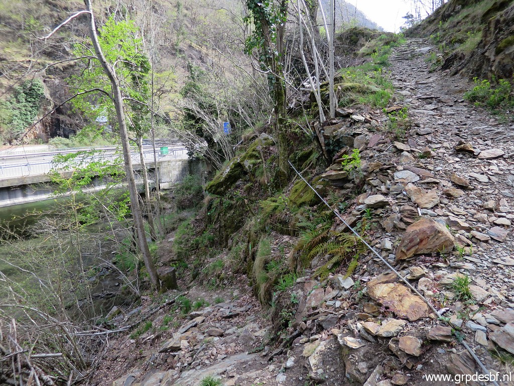
 | Enough searching done and we give up. After a lunch at bm408-III we descend back (click photo to enlarge) |
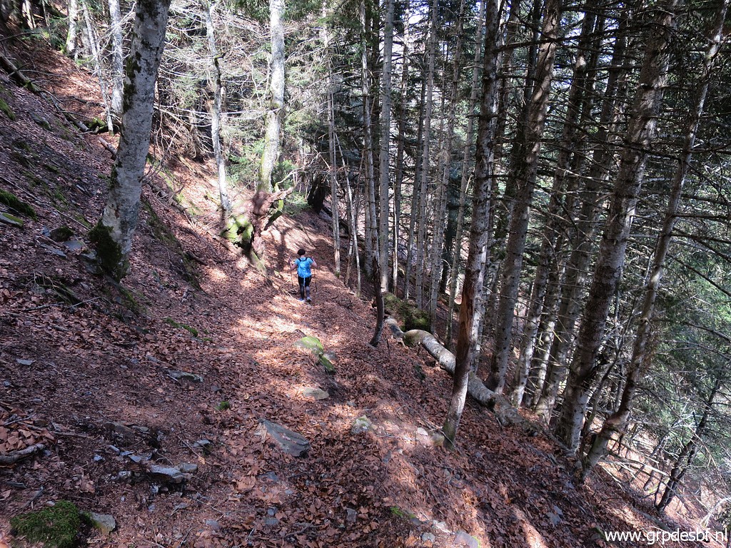
 | along the beautiful trail to Fos. (click photo to enlarge) |
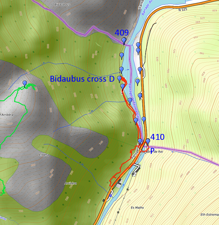
TRIP 2
|
|
 track-20230410-trip2.gpx This gpx-track has not been manually corrected which explains the inaccuracy and misalignment at some points. The original elevation recording has been replaced by more accurate DEM-data with Gpsvisualizer.com. For cartographic backgrounds: see the cartography-page Gps-waypoints of all bordermarkers (most recent version): kml: esfr-bordermarkers-all-waypoints.kml gpx: esfr-bordermarkers-all-waypoints.gpx (with reliable elevation data added by gpsvisualizer.com) |
|
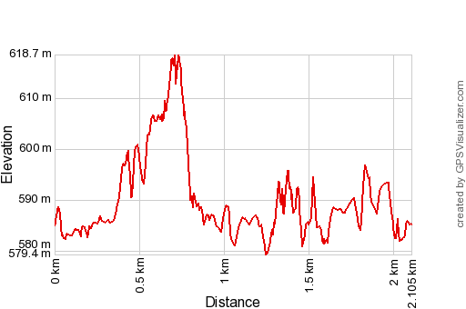 |
According to Garmin
Basecamp (uncorrected track with elevation added by Gpsvisualizer.com): Distance: 2.1 km Max-height: 619m Min-height: 579m Elevation: +104m -104m Total elevation: 208m Start 15:57 Finish 17:00 Total time: 1:03 |
|
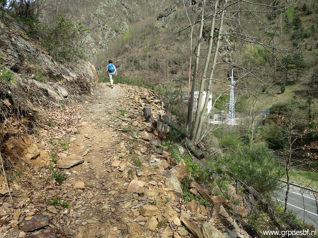
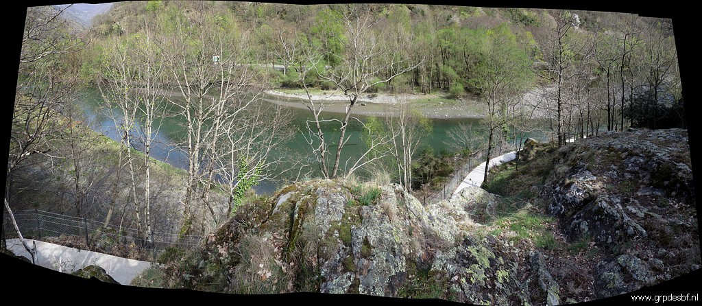
Our second trip is a short one from Pont du Roi. (click photo to enlarge) Our destination is the rocky outcrop above the Garonne which is the assumed spot of the Bidaubus-cross D. In the 19th century four of these double branched crosses were engraved (with the letters A to D) to delimitate the southern border of the 'terrain indivis de Bidaoubous'. |
That was a terrain on Spanish
territory south of the borderline between bm408 and 409. In the treaty
of 1863 it is described as common ground for the communities of Fos
(F) and Bausen (E).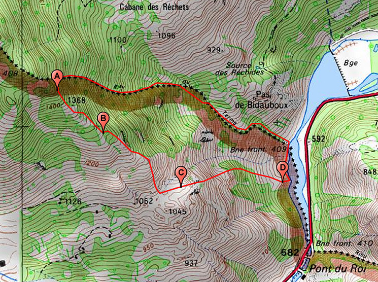 However, the exact spots of these crosses are not known. The treaty mentions toponyms which cannot be found on maps. The localisation on the map above is based on various clues, all explained on this page. But they remain hypothetical until found 'in situ'. |
|
 |
About this picture: at Corinne's request we first do an inspection above approximately Pont du Roi. (click photo to enlarge) |
| And
why does she wants to search here for the Bidaubus-cross D here? That
is because of a sketch of Jean Sermet (± 1960) in which he draws a
different borderline from A to D than I can conclude on the various
clues as explained on this page. But we find nothing and continue N along the trail above the Garonne. |
|
|
This picture: we see the (new) Pont de Roi and some work in progress. A cycle trail is being built along the Garonne and I suspect that it will lead from this point along the rockside toward Pont du Roi. (click photo to enlarge) |
|
We have arrived at the rocky outcrop which is the assumed spot of Bidaubus-cross D (to my opinion). (click photo to enlarge) We both have searched here several times before. And again we find nothing. A bit of consolation with a beer in Pontaut. |